


Bishopbriggs, United Kingdom
Bishopbriggs is a town of 23,680 people in Scotland, United Kingdom.
Why visit Bishopbriggs
Townapedia lists 32 museums and landmarks, 13 parks and trails, 31 places to eat and 7 attractions in and around town.
Highlights include Glasgow Empire Theatre, Kelvinbridge, Centre for Contemporary Arts and Glasgow Cenotaph.
Weather in Bishopbriggs
Forecast from MET Norway (CC BY 4.0). Full forecast
About Bishopbriggs
Bishopbriggs (Scots: The Briggs; Scottish Gaelic: Achadh an Easbaig) is a town in East Dunbartonshire, Scotland. It lies on the northern fringe of Greater Glasgow, approximately 4 miles (6 km) from the city centre. Historically in Lanarkshire, the area was once part of the historic parish of Cadder - originally lands granted by King William the Lion to the Bishop of Glasgow, Jocelin, in 1180. It was later part of the county of Lanarkshire, and then an independent burgh from 1964 to 1975.
From the Wikipedia article Bishopbriggs (this version), under CC BY-SA 4.0.
Things to do7

Glasgow Empire Theatre
Cinema and theater · 3.2 mi
Former theatre in Glasgow, Scotland, UK


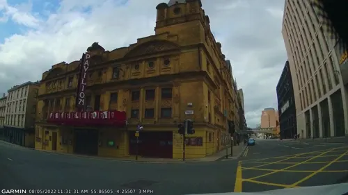
Pavilion Theatre
Cinema and theater · 3.2 mi
Theatre in Glasgow, Scotland, UK
Royalty Theatre, Glasgow
Cinema and theater · 3.2 mi
Former theatre in Glasgow, Scotland, UK

Theatre Royal
Cinema and theater · 3.2 mi
Theatre in Glasgow, Scotland, UK


Museums and landmarks32

Centre for Contemporary Arts
Museum · 3.3 mi
Arts centre in Glasgow, Scotland, UK

Glasgow Cenotaph
Monument and historic site · 3.4 mi
War memorial in Glasgow, Scotland, UK

National Piping Centre
Museum · 3.1 mi
Museum in Glasgow City, Scotland, UK

Provand's Lordship
Museum · 3.1 mi
Historic house museum in Glasgow, Scotland, United Kingdom

Scott Monument
Monument and historic site · 3.4 mi
Monument to Walter Scott in Glasgow, Scotland, UK
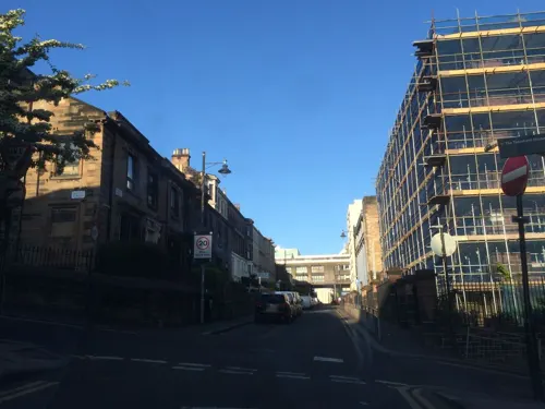
Scottish Jewish Archives Centre
Museum · 3.3 mi
Repository of Jewish migration to Scotland

St Mungo Museum of Religious Life and Art
Museum · 3.1 mi
Museum in Glasgow, Scotland, United Kingdom


Western Necropolis
Monument and historic site · 2.5 mi
Cemetery in the north of Glasgow, Scotland, UK

Heatherbank Museum of Social Work
Museum · 3.0 mi
Former stand alone museum now part of Glasgow Caledonian University
Springburn Museum
Museum · 1.8 mi
Virtual museum in Glasgow City, Scotland, UK

20 more on the map.
Parks, trails and playgrounds13


Alexandra Park, Glasgow
Park · 2.9 mi
Urban park in Glasgow, Scotland, UK

Lenzie Moss
Park · 2.3 mi
Nature reserve in East Dunbartonshire, Scotland, UK


Cawder Golf Club
Golf course · 1.5 mi
18 hole Par 70 Cawder course + 18 hole Par 68 Keir course
Cadder Road, Bishopbriggs

1 more on the map.
Restaurants and cafes31

Costa
Cafe · Coffee Shop · 1.1 mi
Crosshill Road, Bishopbriggs
Mo-Fr 07:30-19:00; Sa-Su 08:00-17:00


19 more on the map.
History
Bishopbriggs' history stretches at least to Roman times, as Cadder was a Roman fort on the Antonine Wall, the furthest and most northerly boundary of the Roman Empire.
As early as 1568, reference is made to a path northwards from Glasgow as the 'common passage to Bischopis Briggis'. Bishopbriggs was first documented in the Cadder Parish records of 1655, and was recorded to have had only eleven residents in the mid-18th century. Even more than a century later, after substantial growth, the village was still being referred to in the terms of the larger settlement of Cadder.
By 1793, the introduction of new farming techniques had improved yields. While crops such as oats, barley, potatoes and flax flourished, Cadder's population fared less well; a decrease of around 600 from the mid-1760s was attributed to new agricultural methods which combined smaller farms or Run rigs and swept away independent tenants, known as the Lowland Clearances. By 1836 there were 'almost no cotters' with the largest farms employing no more than ten people, and some of those only as maid servants. Land reclamation (through drainage) changed the landscape so that crops could grow, where once there was only marshland. Dairy farming was relied upon to cover ground rents.
Read more of the history
With the completion of the Forth and Clyde Canal in 1790, the area began to attract ironstone and coal mining industry. The Carron Company, became the area's main employer, building the mining villages of Mavis Valley and Jellyhill to accommodate its workers. From there, the Forth and Clyde Canal formed a convenient and direct transport link with their famous ironworks near Falkirk. There were also freestone quarries established at Coltpark (Colston), Crowhill, Huntershill and Kenmure.
Development during the 19th century was slow compared to the industrially-driven expansion of other nearby areas, such as Springburn. In 1836 Bishopbriggs' population stood at 175, compared to neighbouring Auchinairn Village's 284. Bishopbriggs railway station on the Edinburgh and Glasgow Railway, opened in 1842 however, underlining its status as the emerging focus of the local area, although expansion remained slow throughout the latter half of the 19th century. The population of Bishopbriggs was recorded as 658 in 1861 and 782 in 1871. At the time, the village had also been known as 'Bishopbridges' and was so described thus or similarly in published maps up to the mid-1850s. The arrival of the railway heralded a change, although the first printed tickets called the station Bishopbridges, platform signage showed Bishopbriggs and it has remained so ever since. Groome, in 1882, described it as being "inhabited chiefly by poor Irish families".
Cadder Yard (2 km north of the Cross) became a major facility for the routing of freight and minerals on the line. Short spurs were constructed to link the various quarries (initially with the Forth & Clyde Canal) for transportation of minerals. An underpass for the line which crosses under the A803 Kirkintilloch Road (at Hilton Road) was converted to a pedestrian subway and is still visible. Also at Cadder Yard was a short spur that connected with Bishopbriggs Oil Terminal, used as a distribution point for West of Scotland deliveries before it ultimately closed in 1982. The area continued to be a major centre for freestone quarrying during the 19th century, supplying many major municipal building projects in Glasgow, such as Sir George Gilbert Scott's new Glasgow University main building (the second largest Gothic Revival building in Britain). The blonde coloured Bishopbriggs Sandstone is from the Upper Limestone Formation of the Lower Carboniferous age. It was one of the most important Glasgow building stones, and was a major supplier of stone for Victorian Glasgow along with stone from quarries in other local areas such as Giffnock. Increasing demand for building stone and the emergence of the railways allowed for the additional transportation of red sandstone to Glasgow from quarries in Locharbriggs from the late 19th century onwards. The blonde sandstone however was still considered to be of such value that in the 1850s when the depth of overburden became too great for opencast quarrying, it was mined using the traditional pillar and stall technique. Quarrying ceased in 1907 however after a fall at Huntershill killed several men.
With the expansion of Glasgow in the 20th century, some 2,000 acres (810 ha) of the wider parish of Cadder were eventually absorbed by Glasgow Corporation in 1926, which would be used to construct the Milton peripheral housing scheme from the late 1940s. The Glasgow tramway network was extended north from Springburn to Bishopbriggs in 1903, with a terminus at Kirkintilloch Road close to traffic lights at what is now the Triangle Shopping Centre. As all trams were required to switch tracks (and direction) at a central crossover this proved dangerous as the levels of traffic on the main road increased. The tracks were eventually relocated and a new crossover created in a short spur which required all trams to turn left and terminate at Kenmure Avenue, where they changed direction and returned southwards to Glasgow. The tram service ceased across Glasgow in 1962.
From the History section of Bishopbriggs on Wikipedia, under CC BY-SA 4.0.
More about Bishopbriggs
Arts and culture
Located near Bishopbriggs Cross are the former playing fields of Glasgow-based Allan Glen's School, which opened in 1923 and continue to be used by Allan Glen's RFC, who play in the National League Division 3. The club has teams covering all age groups, from Primary 1 all the way up to the senior 1st XV team. Former Scotland and Glasgow Warriors captain Alastair Kellock started his rugby days at Allan Glens. Among the youth and junior football teams that play in the town are Rossvale, Westpark, and East Dunbartonshire F.C.
The town has three golf courses. The oldest, Bishopbriggs Golf Club, was founded in 1906 and is situated in parkland which was once part of Kenmure House (built 1806 by David Hamilton, demolished 1955), formerly family seat of the Stirling-Maxwell Baronets. Cadder House, built in 1654, was also a Stirling family residence. It is now the clubhouse of Cawder Golf Club, which was established in 1933. Both original courses were designed by James Braid. The town has two bowling clubs; Bishopbriggs Bowling Club and Auchinairn Bowling Club.
The town has a curling club, Cadder Curling Club, which originally met in Cawder Estate but now meets at Braehead. The town has 3 Boys Brigades (182 Glasgow, 212 Glasgow and 268 Glasgow), a Scout group (175th Glasgow), a Girls Guides and a Girls Brigade. There is also numerous, much smaller groups often linked to local churches.
Education
The area is served by six Primary schools; Balmuildy, Meadowburn, St Helen's, St Matthew's, Thomas Muir and Wester Cleddens. Meadowburn Primary School hosts a Gaelic Medium Unit. There are also two Secondary schools, both of which have been rebuilt as the result of a Public-Private Partnership investment into education infrastructure, first launched in 2006 by East Dunbartonshire Council.
Bishopbriggs has two secondary schools; Bishopbriggs Academy (Non-denominational) at Woodhill and Turnbull High School (Roman Catholic) at Kenmure. Both schools rank as some of the best in Scotland, with Bishopbriggs being named Scottish State School of the year in both 2014 and 2017. Both schools have had new-build campuses built, which were completed in August 2009.
From the Wikipedia article Bishopbriggs, under CC BY-SA 4.0.
Notable people from Bishopbriggs
 Amy MacdonaldScottish singer-songwriterPhoto: Sven Mandel, CC BY-SA 4.0
 Jack BruceBritish musician (1943–2014)Photo: F. van Geelen, Omroepvereniging VARA, CC BY-SA 3.0
 Stuart BanniganScottish footballer (born 1992)Photo: Andrew Hendo, CC BY-SA 4.0
- Steve ValentineScottish actor
- Jackie HendersonScottish footballer (1932-2005)
- Marcus FraserScottish footballer (born 1994)
- Nieve JenningsBritish model
- Alastair StorieScottish cricketer
- Sandy McDonaldScottish minister
- Paul MulrooneyScottish footballer (born 1990)
- Gerry McLauchlanScottish footballer (born 1989)
- Frances Mayli McCannScottish actress
Born in Bishopbriggs, according to Wikidata (CC0). Each name links to its Wikipedia article.
Churches and places of worship32
Adelaide Place Baptist Church, 188 Pitt Street, Glasgow
Church · 3.4 mi
Kelvinside Free Church, 731 Great Western Road, Glasgow
Church · 3.4 mi
Shopping10
Gas and EV charging3
Schools, colleges and libraries25
Healthcare8
Map of Bishopbriggs
161 places. The map loads OpenStreetMap tiles when you open it.
Getting there and nearby towns
Glasgow Airport (GLA) is the nearest airport with scheduled flights listed in OpenStreetMap, 9 miles away.
- Glasgow 3 mi southwest, about 5 min by car
- Kirkintilloch 3 mi northeast, about 5 min by car
- Milngavie 5 mi northwest, about 8 min by car
- Rutherglen 5 mi south, about 9 min by car
- Cambuslang 7 mi south, about 11 min by car
- Renfrew 7 mi west, about 12 min by car
- Clydebank 7 mi west, about 12 min by car
- Coatbridge 8 mi east, about 13 min by car
- Giffnock 8 mi southwest, about 12 min by car
- Cumbernauld 9 mi east, about 15 min by car
Drive times are estimates from straight-line distance, not routes.
Towns near Bishopbriggs


Keep exploring
Local news
Headlines from INDB.
Reviews, tips and questions
Loading what members have shared...
Sources and licences
- GeoNames (CC BY 4.0): population, coordinates, regions and time zone
- Mapillary (see each image): photos
- OpenStreetMap contributors (ODbL 1.0): places, airports, map data
- Wikidata (CC0 1.0): elevation, founding date, time zone, website, landmarks and historic places
- Wikimedia Commons (see each image): photos
- Wikipedia (CC BY-SA 4.0): overview and history text
Photo credits
- Glasgow Empire Theatre Sauchiehall Street about 1930, Hwyndham, CC BY-SA 4.0
- Great Western Bridge in Glasgow, Tbatb, CC BY-SA 4.0
- Pavilion Theatre, Stinglehammer, CC BY-SA 4.0
- Theatre Royal, Glasgow, Kilnburn ( talk ) 22:16, 30 March 2009 (UTC), Attribution
- Centre for Contemporary Arts, Glasgow (34986043461), Sam Saunders from Bristol, CC BY-SA 2.0
- Glasgow Cenotaph, MrsEllacott, CC BY-SA 4.0
- Provand's Lordship 2026, TSP, CC BY 4.0
- The Scott Monument, Glasgow, Reading Tom, CC BY 2.0
- Tenementhouse, No machine-readable author provided. Twid assumed (based on copyright claims)., CC BY-SA 3.0
- View of Western Necropolis, Glasgow looking south, AlistairMcMillan, CC BY-SA 4.0
- Lenzie Moss - boardwalk, Rosser1954, CC BY-SA 4.0
- BaronyHallPhoto, Cs104g13, CC BY-SA 4.0
- 2018 07 19 Schottland (33), Bewahrerderwerte, CC BY-SA 4.0
- Queens Cross Church07a, dave souza, CC BY-SA 4.0
- Ruchill Parish Church, Glasgow, 2, LornaMCampbell, CC BY-SA 4.0
- St Aloysius Church, Glasgow 01, Stinglehammer, CC BY-SA 4.0
- GCU Campus View, Knwwsss, CC BY-SA 3.0
- Glasgow School of Art - September 2017, Stinglehammer, CC BY-SA 4.0
- Royal College Strathclyde, Self., CC BY-SA 3.0
- University of Strathclyde Campus, Flickr User StrathclydeGuy, CC BY 2.0
- Turnbull High aerial, Ldopa, CC BY-SA 3.0
- AlexandraPark2024 05, Horep, CC0
- Ruchill Park hillock, Thrissel, CC BY-SA 3.0
- The National Piping Centre DSCN1883, AlasdairW, CC BY-SA 4.0
- From St. Mungo Museum of Religious Life & Art, Glasgow (6832490174), dun_deagh, CC BY-SA 2.0
- Winter Gardens, Springburn Park, Davidw82, CC BY-SA 3.0
- Street-level photo, gmc, CC BY-SA 4.0
- Street-level photo, mr_hunter, CC BY-SA 4.0
- Street-level photo, mr_hunter, CC BY-SA 4.0
- Street-level photo, pbb, CC BY-SA 4.0
- Street-level photo, mr_hunter, CC BY-SA 4.0
- Street-level photo, pbb, CC BY-SA 4.0
- Street-level photo, mr_hunter, CC BY-SA 4.0
- Street-level photo, gmc, CC BY-SA 4.0
- Street-level photo, gmc, CC BY-SA 4.0
- Street-level photo, gmc, CC BY-SA 4.0
- Street-level photo, gmc, CC BY-SA 4.0
- Street-level photo, gmc, CC BY-SA 4.0
- Street-level photo, gmc, CC BY-SA 4.0
- Street-level photo, gmc, CC BY-SA 4.0
- Street-level photo, gmc, CC BY-SA 4.0
- Street-level photo, zeno_kugy, CC BY-SA 4.0
- Street-level photo, gmc, CC BY-SA 4.0
- Street-level photo, gmc, CC BY-SA 4.0
- Street-level photo, mr_hunter, CC BY-SA 4.0


Page built November 10, 2026. Spotted a mistake? Tell us or suggest a place.