



Derry, United Kingdom
Derry is a town of 83,652 people in Northern Ireland, United Kingdom.
Why visit Derry
Townapedia lists 74 museums and landmarks, 37 parks and trails, 149 places to eat, 33 places to stay and 27 attractions in and around town.
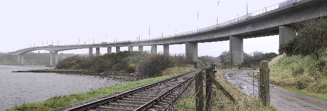
Highlights include Craigavon Bridge, Foyle Bridge, Diamond War Memorial and Free Derry Corner.
Weather in Derry
Forecast from MET Norway (CC BY 4.0). Full forecast
About Derry
Derry, officially Londonderry, is a cathedral city in Northern Ireland. Located in County Londonderry, the city now covers both banks of the River Foyle. Cityside and the old walled city are on the west bank and Waterside is on the east, with two road bridges and one footbridge crossing the river in between.
From the Wikipedia article Derry (this version), under CC BY-SA 4.0.
Travel tips from other travellers: Derry on Wikivoyage (CC BY-SA 4.0).
Photos of Derry


Things to do27

Craigavon Bridge
Bridge · 0.6 mi
Bridge in Derry, County Londonderry, Northern Ireland


Millennium Forum
Cinema and theater · 0.4 mi
Theatre and conference centre in Derry, Northern Ireland





15 more on the map.
Museums and landmarks74

Diamond War Memorial
Monument and historic site · 0.5 mi
War memorial in Derry, Northern Ireland

Free Derry Corner
Monument and historic site · 0.7 mi
Irish historical landmark

Museum of Free Derry
Museum · 0.7 mi
Museum in Northern Ireland
55 Glenfada Park, Derry
Mo-Sa 10:00-16:00; PH 10:00-16:00
Void Derry
Museum · 0.5 mi
Contemporary art gallery in Northern Ireland



Tower Museum
Museum · 0.5 mi
Local history museum in Northern Ireland, United Kingdom
Union Hall Place
Mo-Su 09:00-17:30
The Nerve Centre
Museum · 0.5 mi
A youth self-help organisation establish in 1990 in Derry. A multimedia arts centre along Derry’s walls with arts and live entertainment...
7-8 Magazine Street, Derry

62 more on the map.
Parks, trails and playgrounds37

Brandywell Stadium
Sports field and stadium · 1.2 mi
Lone Moor Road, Derry



Oakfire Adventures
Sports field and stadium · 5.2 mi
227 Glenshane Road
Su-Tu, Th 10:00-18:00; We, Fr-Sa 09:30-18:00

25 more on the map.
Restaurants and cafes149
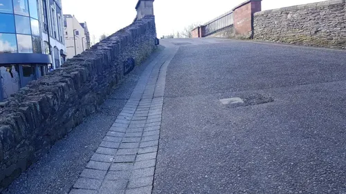
Grain & Grill Restaurant
Restaurant · Regional, Pizza, Burger, Seasonal, Irish, Steak, Pasta · 0.5 mi
Butcher Street, Derry
Mo-Su 17:00-22:00
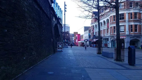
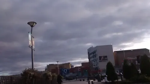


The Sandwich Co
Cafe · Coffee Shop · 0.6 mi
6 Bishop Street Within, Derry / Londonderry
Mo 08:30-16:00, Tu-Sa 08:00-17:00,Su 10:00-16:00

Granny Annies
Bar and pub · 0.6 mi
23 The Diamond, Derry
Mo 21:00-01:30; We-Th 12:00-23:00; Fr-Sa 12:00-02:00; Su 12:00-23:00
137 more on the map.
History
Derry is one of the oldest continuously inhabited places in Ireland. The earliest historical references date to the 6th century when a monastery was founded there by St Columba or Colmcille, a famous saint from what is now County Donegal, but for thousands of years before that people had been living in the vicinity.
Before leaving Ireland to spread Christianity elsewhere, Colmcille founded a monastery at Derry (which was then called Doire Calgach), on the west bank of the Foyle. According to oral and documented history, the site was granted to Colmcille by a local king. The monastery then remained in the hands of the federation of Columban churches who regarded Colmcille as their spiritual mentor. The year 546 is often referred to as the date that the original settlement was founded. However, it is now accepted by historians that this was an erroneous date assigned by medieval chroniclers. It is accepted that between the 6th century and the 11th century, Derry was known primarily as a monastic settlement.
Read more of the history
The town became strategically more significant during the Tudor conquest of Ireland and came under frequent attack. During O'Doherty's Rebellion in 1608 it was attacked by Sir Cahir O'Doherty, Irish chieftain of Inishowen, who burnt much of the town and killed the governor George Paulet. The soldier and statesman Sir Henry Docwra made vigorous efforts to develop the town, earning the reputation of being "the founder of Derry"; but he was accused of failing to prevent the O'Doherty attack and returned to England.
What became the City of Derry was part of the relatively new County Donegal up until 1610. In that year, the west bank of the future city was transferred by the English Crown to The Honourable The Irish Society and was combined with County Coleraine, part of County Antrim and a large portion of County Tyrone to form County Londonderry. Planters organised by London livery companies through The Honourable The Irish Society arrived in the 17th century as part of the Plantation of Ulster and rebuilt the town with high walls to defend it from Irish insurgents who opposed the plantation. The aim was to settle Ulster with a population supportive of the Crown. It was then renamed "Londonderry".
This city was the first planned city in Ireland: it was begun in 1613, with the walls being completed in 1619, at a cost of £10,757. The central diamond within a walled city with four gates was thought to be a good design for defence. The grid pattern chosen was subsequently much copied in the colonies of British North America. The charter initially defined the city as extending three Irish miles (about 6.1 km) from the centre.
The modern city preserves the 17th-century layout of four main streets radiating from a central Diamond to four gateways – Bishop's Gate, Ferryquay Gate, Shipquay Gate and Butcher's Gate. The city's oldest surviving building was also constructed at this time: the 1633 Plantation Gothic cathedral of St Columb. In the porch of the cathedral is a stone that records completion with the inscription: "If stones could speake, then London's prayse should sound, Who built this church and cittie from the grounde."
During the 1640s, the city suffered in the Wars of the Three Kingdoms, which began with the Irish Rebellion of 1641, when the Gaelic Irish insurgents made a failed attack on the city. In 1649 the city and its garrison, which supported the republican Parliament in London, were besieged by Scottish Presbyterian forces loyal to King Charles I. The Parliamentarians besieged in Derry were relieved by a strange alliance of Roundhead troops under George Monck and the Irish Catholic general Owen Roe O'Neill. These temporary allies were soon fighting each other again however, after the landing in Ireland of the New Model Army in 1649. The war in Ulster was finally brought to an end when the Parliamentarians crushed the Irish Catholic Ulster army at the Battle of Scarrifholis, near Letterkenny in nearby County Donegal, in 1650.
During the Glorious Revolution, only Derry and nearby Enniskillen had a Protestant garrison by November 1688. An army of around 1,200 men, mostly "Redshanks" (Highlanders), under Alexander MacDonnell, 3rd Earl of Antrim, was slowly organised (they set out on the week William of Orange landed in England). When they arrived on 7 December 1688 the gates were closed against them and the Siege of Derry began. In April 1689, King James came to the city and summoned it to surrender. The King was rebuffed and the siege lasted until the end of July with the arrival of a relief ship.
The city was rebuilt in the 18th century with many of its fine Georgian style houses still surviving. The city's first bridge across the River Foyle was built in 1790. During the 18th and 19th centuries, the port became an important embarkation point for Irish emigrants setting out for North America.
Also during the 19th century, it became a destination for migrants fleeing areas more severely affected by the Great Famine. One of the most notable shipping lines was the McCorkell Line operated by Wm. McCorkell & Co. Ltd. from 1778. The McCorkell's most famous ship was the Minnehaha, which was known as the "Green Yacht from Derry".
During World War I, the city contributed over 5,000 men to the British Army from both Catholic and Protestant families.
During the Irish War of Independence, the area was rocked by sectarian violence, partly prompted by the guerilla war raging between the Irish Republican Army and British forces, but also influenced by economic and social pressures. By mid-1920 there was severe sectarian rioting in the city. Many people died and in addition, many Catholics and Protestants were expelled from their homes during this communal unrest. After a week's violence, a truce was negotiated by local politicians on both unionist and republican sides. (See: The Troubles in Ulster (1920–1922)).
From the History section of Derry on Wikipedia, under CC BY-SA 4.0.
More about Derry
Geography
Derry is characterised by its distinctively hilly topography. The River Foyle forms a deep valley as it flows through the city, giving it a steep topography. The original walled city of Londonderry lies on a hill on the west bank of the River Foyle. In the past, the river branched and enclosed this hill as an island; over the centuries, however, the western branch of the river dried up and became a low-lying and boggy district that is now called the Bogside.
Today, modern Derry extends considerably north and west of the city walls and east of the river. The half of the city on the west of the Foyle is known as the Cityside and the area east is called the Waterside. The Cityside and Waterside are connected by the Craigavon Bridge and Foyle Bridge and by a footbridge in the centre of the city called Peace Bridge. The district also extends into rural areas to the southeast of the city.
Economy
The economy of the district was based significantly on the textile industry until relatively recently. For many years women were commonly the sole wage earners working in the shirt factories while the men in comparison had high levels of unemployment. This led to significant male emigration. Shirt-making in the city dates back to 1831, and is said to have been begun by William Scott and his family who first exported shirts to Glasgow. Within 50 years shirt-making in the city was the most prolific in the UK, and garments were exported all over the world. It was known so well that the industry received a mention in Das Kapital by Karl Marx, when discussing the factory system:
The shirt factory of Messrs. Tille at Londonderry, which employs 1,000 operatives in the factory itself, and 9,000 people spread up and down the country and working in their own houses.
The industry reached its peak in the 1920s employing around 18,000 people. In modern times, however, the textile industry declined due largely to lower Asian wages.
Arts and culture
Artists and writers associated with the city and surrounding countryside include the Nobel Prize-winning poet Seamus Heaney, poet Seamus Deane, playwright Brian Friel, writer and music critic Nik Cohn, artist Willie Doherty, socio-political commentator and activist Eamonn McCann and bands such as the Undertones. The large political gable-wall murals of Bogside Artists, Free Derry Corner, the Foyle Film Festival, the Derry Walls, St Eugene's and St Columb's Cathedrals and the annual Halloween street carnival are popular tourist attractions. In 2010, Derry was named the UK's tenth 'most musical' city by PRS for Music.
In May 2013 a perpetual Peace Flame Monument was unveiled by Martin Luther King III and Presbyterian minister Rev. David Latimer. The flame was lit by children from both traditions in the city and is one of only 15 such flames across the world.
The local newspapers, the Derry Journal (known as the Londonderry Journal until 1880) and the Londonderry Sentinel, reflect the divided history of the city: the Journal was founded in 1772 and is Ireland's second oldest newspaper; the Sentinel newspaper was formed in 1829 when new owners of the Journal embraced Catholic emancipation and the editor left the paper to set up the Sentinel.
There are numerous radio stations receivable: the largest stations based in the city are BBC Radio Foyle and the commercial station Q102.9.
Education
Derry is home to the Magee Campus of Ulster University, formerly Magee College. However, Lockwood's 1960s decision to locate Northern Ireland's second university in Coleraine rather than Derry helped contribute to the formation of the civil rights movement that ultimately led to The Troubles. Derry was the town more closely associated with higher learning, with Magee College already more than a century old by that time. In the mid-1980s an attempt was made at address this by forming Magee College as a campus of the Ulster University, but this failed to stifle calls for the establishment of an independent University in Derry. As of 2021, the Magee campus reportedly accommodated approximately 4,400 students, out of a total Ulster University student population of approximately 24,000, of which 15,000 are in the Belfast campus.
The North West Regional College is also based in the city, and accommodates over 10,000 student enrolments annually.
One of the two oldest secondary schools in Northern Ireland, Foyle College, is located in Derry. It was founded in 1616 by the Merchant Taylors. Other secondary schools include St. Columb's College, Oakgrove Integrated College, St Cecilia's College, St Mary's College, St. Joseph's Boys' School, Lisneal College, Thornhill College, Lumen Christi College and St. Brigid's College. There are also numerous primary schools.
From the Wikipedia article Derry, under CC BY-SA 4.0.
Notable people from Derry
 Darron GibsonIrish association football player (born 1987)Photo: Tomasz Przechlewski, CC BY 2.0
 Martin McGuinnessSinn Féin politician and deputy First Minister (1950-2017)Photo: https://www.flickr.com/photos/sinnfei..., CC BY 2.0
 James McCleanIrish association football playerPhoto: Michael Kranewitter, CC BY-SA 3.0 at
 Shane DuffyIrish association football playerPhoto: James Boyes from UK, CC BY 2.0
 Nadine CoyleIrish singer and actressPhoto: georgeybuckley, CC0
 Robert TorrensAnglo-Irish Royal Marine, economist, and chair of South Australian Colonisation Commission (1780-1864)Photo: Torrens, Robert, Public domain
- John HumeIrish politician from Northern Ireland (1937–2020)
- Shane FergusonNorthern Irish association football player (born 1991)
- George FarquharIrish dramatist (1677–1707)
- Roma DowneyIrish actress and Emmy nominated producer and author from Derry, Northern Ireland
- Joyce CaryAnglo-Irish writer (1888-1957)
- Damian McGintyNorthern Irish actor and singer
Born in Derry, according to Wikidata (CC0). Each name links to its Wikipedia article.
Where to stay33
Churches and places of worship52
Saint Columb's Cathedral
Church · Anglican · 0.6 mi
London Street, Derry / Londonderry
Peace Islamic Centre
Place of worship · Sunni · 1.2 mi
3 Pennyburn Industrial Estate, Derry/Londonderry
Bready Reformed Presbyterian Church
Church · Presbyterian · 6.9 mi
209 Victoria Road, Bready
Shopping36
Gas and EV charging18
Schools, colleges and libraries69
Lumen Christi College
School · 1.0 mi
181 Bishop Street Without, Londonderry
Healthcare32
Map of Derry
250 places. The map loads OpenStreetMap tiles when you open it.
Getting there and nearby towns
City of Derry Airport (LDY) is the nearest airport with scheduled flights listed in OpenStreetMap, 7 miles away.
- New Buildings 3 mi southwest, about 5 min by car
- Culmore 4 mi northeast, about 6 min by car
- Eglinton 5 mi east, about 8 min by car
- Ballymagorry 11 mi southwest, about 17 min by car
- Ballykelly 12 mi east, about 19 min by car
- Strabane 14 mi southwest, about 22 min by car
- Limavady 15 mi east, about 24 min by car
- Dungiven 16 mi east, about 26 min by car
- Omagh 28 mi south, about 44 min by car
- Portadown 53 mi southeast, about 1 h 30 min by car
Drive times are estimates from straight-line distance, not routes.
Towns near Derry


Keep exploring
Local news
Headlines from INDB.
Reviews, tips and questions
Loading what members have shared...
Sources and licences
- GeoNames (CC BY 4.0): population, coordinates, regions and time zone
- Mapillary (see each image): photos
- OpenStreetMap contributors (ODbL 1.0): places, airports, map data
- Wikidata (CC0 1.0): elevation, founding date, time zone, website, landmarks and historic places
- Wikimedia Commons (see each image): photos
- Wikipedia (CC BY-SA 4.0): overview and history text
Photo credits
- Craigavon bridge, Jove, Public domain
- Foyle bridge, railside, Kenneth Allen, CC BY-SA 2.0
- Millennium Forum (02), August 2009, Ardfern, CC BY-SA 3.0
- Peace Bridge Derry, NorthernCounties, CC BY-SA 3.0
- War memorial Derry 2007 SMC, SeanMack, Public domain
- Long Tower Church, August 2009, Ardfern, CC BY-SA 3.0
- St Eugene's Cathedral by Paride, Romeparis, CC BY-SA 3.0
- Magee University Derry SMC 2005, SeanMack, Public domain
- St. Columb's Cathedral, Londonderry 03, Simon Burchell, CC BY-SA 4.0
- Celtic Park, Derry, August 2009, Ardfern, CC BY-SA 3.0
- Altinaghree Castle, Nick W, CC BY-SA 2.0
- Altnagelvin Area Hospital SMC 2011, SeanMack, CC BY-SA 3.0
- Austins 2007 SMC, SeanMack, CC BY 3.0
- Foyleside Shopping Centre (04), August 2009, Ardfern, CC BY-SA 3.0
- Holywell distant, Greentide, CC BY-SA 4.0
- H Block monument - panoramio, Keith Ruffles, CC BY 3.0
- Sean Keenan memorial Bogside SMC, SeanMack, CC BY 3.0
- 126 Brandywell Stadium, Jamie McGonigle, Public domain
- St Columb's Cathedral, Pierrette13, CC BY-SA 4.0
- Derry.GaolTower, Ryan kirk, CC BY-SA 3.0
- Museum of Free Derry, FDW777, CC BY 4.0
- At Columbs park - panoramio, Legenderry photograp…, CC BY 3.0
- Free Derry Corner 2018-07-30, August Schwerdfeger, CC BY 4.0
- Bloody Sunday memorial (26394913119), Flying Puffin, CC BY-SA 2.0
- Street-level photo, shellsustrans, CC BY-SA 4.0
- Street-level photo, matthewitt, CC BY-SA 4.0
- Street-level photo, matthewitt, CC BY-SA 4.0
- Street-level photo, mackerski, CC BY-SA 4.0
- Street-level photo, matthewitt, CC BY-SA 4.0
- Street-level photo, toho, CC BY-SA 4.0
- Street-level photo, matthewitt, CC BY-SA 4.0
- Street-level photo, matthewitt, CC BY-SA 4.0
- Street-level photo, matthewitt, CC BY-SA 4.0
- Street-level photo, matthewitt, CC BY-SA 4.0
- Street-level photo, irishgreenways, CC BY-SA 4.0
- Street-level photo, toho, CC BY-SA 4.0
- Street-level photo, matthewitt, CC BY-SA 4.0
- Street-level photo, matthewitt, CC BY-SA 4.0
- Street-level photo, matthewitt, CC BY-SA 4.0
- Street-level photo, matthewitt, CC BY-SA 4.0
- Street-level photo, toho, CC BY-SA 4.0
- Street-level photo, matthewitt, CC BY-SA 4.0
- Street-level photo, toho, CC BY-SA 4.0
- Street-level photo, mcda, CC BY-SA 4.0


Page built November 10, 2026. Spotted a mistake? Tell us or suggest a place.