


Why visit Durham
Townapedia lists 240 museums and landmarks, 126 parks and trails, 537 places to eat, 49 places to stay and 38 attractions in and around town.
Highlights include Elvet Bridge, Cox Green footbridge, Finchale Priory and Oriental Museum.
Weather in Durham
Forecast from MET Norway (CC BY 4.0). Full forecast
About Durham
Durham is a cathedral city and civil parish in County Durham, England. It is the county town and contains the headquarters of Durham County Council, the unitary authority which governs the district of County Durham. The built-up area had a population of 50,510 at the 2021 Census.
From the Wikipedia article Durham, England (this version), under CC BY-SA 4.0.
Travel tips from other travellers: Durham on Wikivoyage (CC BY-SA 4.0).
Photos of Durham


Things to do38


Kingsgate Bridge
Bridge
Footbridge across the River Wear in Durham, England


Prebends Bridge
Bridge · 0.4 mi
Grade I listed bridge in Durham, England

Sunderland Bridge
Bridge · 3.0 mi
Grade I listed bridge in County Durham, England


Chester New Bridge
Bridge · 6.1 mi
Bridge in Bournmoor, County Durham, England, UK

Kynren
Monument and historic site · 8.3 mi
Live outdoor sound and light show
26 more on the map.
Museums and landmarks240


Durham Castle
Monument and historic site
Grade I listed historic house museum in Durham, England, UK

Auckland Castle
Museum · 8.5 mi
Castle in the town of Bishop Auckland in County Durham, England, UK

Beamish, The Living Museum of The North
Museum · 8.0 mi
Open-air museum in County Durham, United Kingdom

Dryburn House
Monument and historic site · 1.1 mi
Among the outbuildings are historic wings with modern exterior render. Source: Dryburn House Demolition Heritage Impact Assessment 2022

228 more on the map.
Parks, trails and playgrounds126


Herrington Country Park
Park · 8.1 mi
Country park in Sunderland, England



Old Durham Gardens
Park · 0.9 mi
Public gardens in Old Durham, County Durham, England
Th 14:00-16:00; Su 14:00-16:00

Doxford International Business Park
Park · 8.2 mi
Business park in the UK

Thrislington Plantation National Nature Reserve
Hiking and trails · 6.6 mi
114 more on the map.
Restaurants and cafes537


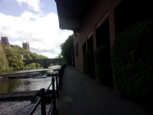
Cosy Club
Restaurant · British
14 Millburngate, Durham
Su-We 09:00-23:00, Th 09:00-24:00, Fr,Sa 09:00-01:00


Amaani Restaurant
Restaurant · Indian · 1.2 mi
Houghall Lane, Durham
Mo-Su 17:00-22:30; Sa 12:00-12:00; Sa 12:00-14:00

Brasserie Quartier
Restaurant · French
38 High Street, Durham
Th-Sa 10:00-20:30; Tu,We 10:00-15:00; Su 10:00-15:00
525 more on the map.
History
Archeological evidence suggests a history of settlement in the area since roughly 2000 BC. The present city can clearly be traced back to AD 995, when a group of monks from Lindisfarne chose the strategic high peninsula as a place to settle with the body of Saint Cuthbert, that had previously lain in Chester-le-Street, founding a church there.
Local legend states that the city was founded in A.D. 995 by divine intervention. The 12th-century chronicler Symeon of Durham recounts that after wandering in the north, Saint Cuthbert's bier miraculously came to a halt at the hill of Warden Law and, despite the effort of the congregation, would not move. Aldhun, Bishop of Chester-le-Street and leader of the order, decreed a holy fast of three days, accompanied by prayers to the saint. During the fast, Saint Cuthbert appeared to a certain monk named Eadmer, with instructions that the coffin should be taken to Dun Holm. After Eadmer's revelation, Aldhun found that he was able to move the bier, but did not know where Dun Holm was.
Read more of the history
The legend of the Dun Cow, which is first documented in The Rites of Durham, an anonymous account about Durham Cathedral, published in 1593, builds on Symeon's account. According to this legend, by chance later that day, the monks came across a milkmaid at Mount Joy (southeast of present-day Durham). She stated that she was seeking her lost dun cow, which she had last seen at Dun Holm. The monks, realising that this was a sign from the saint, followed her. They settled at a wooded "hill-island" – a high wooded rock surrounded on three sides by the River Wear. There they erected a shelter for the relics, on the spot where Durham Cathedral would later stand. Symeon states that a modest wooden building erected there shortly thereafter was the first building in the city. Bishop Aldhun subsequently had a stone church built, which was dedicated in September 998. This no longer remains, having been supplanted by the Norman structure.
The legend is interpreted by a Victorian relief stone carving on the north face of the cathedral and, more recently, by the bronze sculpture 'Durham Cow' (1997, Andrew Burton), which reclines by the River Wear in view of the cathedral.
During the medieval period the city gained spiritual prominence as the final resting place of Saint Cuthbert and Saint Bede the Venerable. The shrine of Saint Cuthbert, situated behind the High Altar of Durham Cathedral, was the most important religious site in England until the martyrdom of St Thomas Becket at Canterbury in 1170.
Saint Cuthbert became famous for two reasons. Firstly, the miraculous healing powers he had displayed in life continued after his death, with many stories of those visiting the saint's shrine being cured of all manner of diseases. This led to him being known as the "wonder worker of England". Secondly, after the first translation of his relics in 698 AD, his body was found to be incorruptible. Apart from a brief translation back to Holy Island during the Norman Invasion the saint's relics have remained enshrined to the present day. Saint Bede's bones are also entombed in the cathedral, and these also drew medieval pilgrims to the city.
In 1070, William I recognised the natural strength of Durham's site and began to construct a castle. Durham's geographical position has always given it an important place in the defence of England against the Scots. The city played an important part in the defence of the north, and Durham Castle is the only Norman castle keep never to have suffered a breach. In 1314, the Bishopric of Durham paid the Scots a 'large sum of money' not to burn Durham. The Battle of Neville's Cross took place around half a mile west of the city on 17 October 1346 between the English and Scots and was a disastrous loss for the Scots.
The city suffered from plague outbreaks in 1544, 1589 and 1598.
Owing to the divine providence evidenced in the city's legendary founding, the Bishop of Durham has always enjoyed the formal title "Bishop by Divine Providence", similar to the archbishops of Canterbury and York, as opposed to the style of "Bishop by Divine Permission" used by most bishops. However, as the north-east of England lay so far from Westminster, the bishops of Durham enjoyed extraordinary powers such as the ability to hold their own parliament, raise their own armies, appoint their own sheriffs and Justices, administer their own laws, levy taxes and customs duties, create fairs and markets, issue charters, salvage shipwrecks, collect revenue from mines, administer the forests and mint their own coins.
So far-reaching were the bishop's powers that the steward of Bishop Antony Bek commented in 1299 AD: "There are two kings in England, namely the Lord King of England, wearing a crown in sign of his regality and the Lord Bishop of Durham wearing a mitre in place of a crown, in sign of his regality in the diocese of Durham". All this activity was administered from the castle and buildings surrounding the Palace Green. Many of the original buildings associated with these functions of the county palatine survive on the peninsula that constitutes the ancient city.
From 1071 to 1836 the bishops of Durham ruled the county palatine of Durham. Although the term "prince bishop" has been used as a helpful tool in the understanding the functions of the bishops of Durham in this era, it is not a title they would have recognised. The last bishop to rule the palatinate, Bishop William Van Mildert, is credited with the foundation of Durham University in 1832. Henry VIII curtailed some of the bishop's powers and, in 1538, ordered the destruction of the shrine of Saint Cuthbert.
A UNESCO site describes the role of the bishops in the "buffer state between England and Scotland":
From the History section of Durham, England on Wikipedia, under CC BY-SA 4.0.
More about Durham
Geography
The River Wear flows north through the city, making an incised meander which encloses the centre on three sides to form Durham's peninsula.
At the base of the peninsula is the Market Place, which still hosts regular markets; a permanent indoor market, Durham Indoor Market, is also situated just off the Market Place. The Market Place and surrounding streets are one of the main commercial and shopping areas of the city. From the Market Place, the Bailey leads south past Palace Green; The Bailey is almost entirely owned and occupied by the university and the cathedral.
Durham is a hilly city, claiming to be built upon the symbolic seven hills. Upon the most central and prominent position high above the Wear, the cathedral dominates the skyline. The steep riverbanks are densely wooded, adding to the picturesque beauty of the city. West of the city centre, another river, the River Browney, drains south to join the Wear to the south of the city.
Education
New College Durham is the city's largest college of further education. It was founded in 1977 as a result of a merger between Neville's Cross College of Education and Durham Technical College. The college operated on two main sites near the city of Durham: Neville's Cross and Framwellgate Moor. The site at Framwellgate Moor opened in 1957 and has subsequently been rebuilt. The Neville's Cross centre is now home to Ustinov College, the postgraduate college of Durham University.
Durham Sixth Form Centre specialises in sixth form courses, while East Durham College has a campus specialising in land-based education at Houghall on the eastern outskirts of the city.
The city is home to Durham University. It was founded as the University of Durham (which remains its official and legal name) by Act of Parliament in 1832 and granted a Royal Charter in 1837. It was one of the first universities to open in England for more than 600 years, and is claimed to be England's third oldest after the Universities of Oxford and Cambridge. Durham University has an international reputation for excellence, as reflected by its ranking in the top 200 of the world's universities.
From the Wikipedia article Durham, England, under CC BY-SA 4.0.
Notable people from Durham
 Anthony EdenBritish soldier, diplomat and politician (1897–1977)Photo: Walter Stoneman, Public domain
 Elizabeth Barrett BrowningEnglish poet (1806–1861)Photo: Unknown author, Public domain
 Steph HoughtonEnglish association football player (born 1988)Photo: Katie Chan, CC BY-SA 4.0
 Gem ArcherBritish musicianPhoto: Raph_PH, CC BY 4.0
 Leslie MarrBritish painter and former racing driver (1922–2021)Photo: Edittoo, CC BY-SA 4.0
 Granville SharpEnglish abolitionist (1735-1813)Photo: G. Dance, Public domain
 William Eden, 1st Baron AucklandIrish politician (1745-1814)Photo: Thomas Lawrence, Public domain
- Dominic CummingsBritish political strategist who served as chief adviser to UK prime minister from July 2019 until Nov 2020
- Robert Ker PorterBritish artist, writer and diplomat (1777-1842)
- Thomas Caverhill JerdonBritish zoologist, botanist, and physician (1811-1872)
- Jane PorterScottish historical novelist, dramatist and literary figure (1776-1850)
- Violet HuntBritish writer (1862-1942)
Born in Durham, according to Wikidata (CC0). Each name links to its Wikipedia article.
Where to stay49
Churches and places of worship144
Shopping112
Gas and EV charging35
Schools, colleges and libraries135
Our Lady and St Joseph's Catholic Primary School
School · Roman Catholic · 2.6 mi
Durham Road, Durham
St Cuthbert's Catholic Primary School
School · Roman Catholic · 5.2 mi
Ropery Lane, Chester-le-Street
Healthcare53
Chester-le-Street Community Hospital
Hospital · 5.1 mi
Front Street, Chester-le-Street
University Hospital of North Durham
Hospital · 1.1 mi
North Road, Durham
Map of Durham
250 places. The map loads OpenStreetMap tiles when you open it.
Getting there and nearby towns
Newcastle International Airport (NCL) is the nearest airport with scheduled flights listed in OpenStreetMap, 19 miles away.
- Spennymoor 5 mi south, about 9 min by car
- Hetton-Le-Hole 6 mi northeast, about 9 min by car
- Houghton-Le-Spring 6 mi northeast, about 10 min by car
- Stanley 8 mi northwest, about 13 min by car
- Washington 9 mi north, about 14 min by car
- Annfield Plain 9 mi northwest, about 14 min by car
- Bishop Auckland 9 mi southwest, about 15 min by car
- Peterlee 10 mi east, about 15 min by car
- Seaham 10 mi northeast, about 16 min by car
- Sunderland 12 mi northeast, about 19 min by car
Drive times are estimates from straight-line distance, not routes.
Towns near Durham


Keep exploring
Local news
Headlines from INDB.
Reviews, tips and questions
Loading what members have shared...
Sources and licences
- GeoNames (CC BY 4.0): population, coordinates, regions and time zone
- Mapillary (see each image): photos
- OpenStreetMap contributors (ODbL 1.0): places, airports, map data
- Wikidata (CC0 1.0): elevation, founding date, time zone, website, landmarks and historic places
- Wikimedia Commons (see each image): photos
- Wikipedia (CC BY-SA 4.0): overview and history text
Photo credits
- Durham - Views from the central tower of the cathedral - 05, Benjamin Smith, CC BY-SA 4.0
- At Durham 2025 054, Photograph by Mike Peel ( www.mikepeel.net )., CC BY-SA 4.0
- At Durham 2025 057, Photograph by Mike Peel ( www.mikepeel.net )., CC BY-SA 4.0
- At Durham 2025 055, Photograph by Mike Peel ( www.mikepeel.net )., CC BY-SA 4.0
- At Durham 2025 056, Photograph by Mike Peel ( www.mikepeel.net )., CC BY-SA 4.0
- Market Place, Durham City, 2006 (01), Bahnfrend, CC BY-SA 4.0
- Saddler Street, Durham City, 2006 (01), Bahnfrend, CC BY-SA 4.0
- At Durham 2025 050, Photograph by Mike Peel ( www.mikepeel.net )., CC BY-SA 4.0
- At Durham 2025 051, Photograph by Mike Peel ( www.mikepeel.net )., CC BY-SA 4.0
- At Durham 2025 052, Photograph by Mike Peel ( www.mikepeel.net )., CC BY-SA 4.0
- At Durham 2025 037, Photograph by Mike Peel ( www.mikepeel.net )., CC BY-SA 4.0
- At Durham 2025 053, Photograph by Mike Peel ( www.mikepeel.net )., CC BY-SA 4.0
- St Nicholas Church Durham TSP 2, TSP, CC BY-SA 4.0
- At Durham 2025 035, Photograph by Mike Peel ( www.mikepeel.net )., CC BY-SA 4.0
- Durham - Elvet Bridge, Benjamin Smith, CC BY-SA 4.0
- Coxgreen Footbridge, Craigy ( talk ), CC BY-SA 3.0
- Durham - Framwellgate bridge - 3, Benjamin Smith, CC BY-SA 4.0
- Penshaw Bridge, Martin Le Roy, CC BY-SA 4.0
- Durham City 30c 20031207 Prebends Bridge 02a, PeterGHughes at English Wikipedia, CC BY 2.5
- River Wear Sunderland Bridge (2) 20070630, PeterGHughes at English Wikipedia, CC BY-SA 3.0
- Durham Castle, April 2017 (14) (33459522640), Carla Brain, CC BY-SA 2.0
- Auckland Castle Crop, Pit-yacker, CC BY-SA 3.0
- Beamish - The Living Museum of The North - 12, Benjamin Smith, CC BY-SA 4.0
- Deer at Whitworth Hall Country Park, Petershiltons, Public domain
- Penshaw from Herrington Park, Ajguy94, CC BY-SA 4.0
- Durham Union Palace Green, Uli Harder, CC BY-SA 2.5
- Durham - Cathedral - Exterior - 01, Benjamin Smith, CC BY-SA 4.0
- Brancepeth Castle, Oliver Dixon, CC BY-SA 2.0
- Durham School from the road, Teach46, CC BY 3.0
- Durham University Botanic Garden, Ken Walton, CC BY-SA 2.0
- Fichale, Unknown author, Public domain
- St Cuthbert's Church exterior, Durham, Tomasz Dunn, CC BY 2.0
- 36, Saddler Street, Marnanel, CC BY-SA 4.0
- 43, 43A And 44, Saddler Street, Marnanel, CC BY-SA 4.0
- St Cuthbert's Anglican Church, North Road, Durham, Rcsprinter123, CC BY 3.0
- Cornforth Village Green and Church, Oliver Dixon, CC BY-SA 2.0
- Silver Street, Durham (2021-05-27) 01, Simon Cobb, CC0
- Ushaw College 2, AlexD, CC BY 3.0
- Durham Cathedral from the south-2, Durham_Cathedral_from_the_south.jpg : Teach46 derivative work: Ericoides ( talk ), CC BY 3.0
- Durham MMB 02 Cathedral, mattbuck ( category ), CC BY-SA 4.0
- Lanchesterroadhospital, Myosotis Scorpioides, CC BY-SA 4.0
- Durham University Oriental Museum broad interior, Geni, CC BY-SA 4.0
- St Mary and St Cuthbert's Church, Chester-le-Street, County Durham, JohnBlackburne, CC BY-SA 3.0
- Durham Gala Theatre 2119, Clem Rutter, Rochester, Kent., CC BY 3.0
- Kingsgate Bridge - view of deck from W, Tom Parnell, CC BY-SA 4.0
- Street-level photo, stevenhorner, CC BY-SA 4.0
- Street-level photo, livingwithdragons, CC BY-SA 4.0
- Street-level photo, livingwithdragons, CC BY-SA 4.0
- Street-level photo, stevenhorner, CC BY-SA 4.0
- Street-level photo, livingwithdragons, CC BY-SA 4.0
- Street-level photo, livingwithdragons, CC BY-SA 4.0
- Street-level photo, livingwithdragons, CC BY-SA 4.0
- Street-level photo, livingwithdragons, CC BY-SA 4.0
- Street-level photo, stevenhorner, CC BY-SA 4.0


Page built November 10, 2026. Spotted a mistake? Tell us or suggest a place.