


East Keswick, United Kingdom
East Keswick is a town of 1,224 people in England, United Kingdom.
Why visit East Keswick
Townapedia lists 7 museums and landmarks, 14 parks and trails, 3 places to eat, 2 places to stay and 6 attractions in and around town.
Highlights include Collingham Bridge, Harewood Bridge, Bramham Park and Dalton Parlours Roman villa and Iron Age settlement.
Weather in East Keswick
Forecast from MET Norway (CC BY 4.0). Full forecast
About East Keswick
East Keswick is a village and civil parish in the City of Leeds metropolitan borough, West Yorkshire, England. It lies four miles south west of Wetherby. The population of the civil parish as of the 2011 census was 1,146.
From the Wikipedia article East Keswick (this version), under CC BY-SA 4.0.
Photos of East Keswick


Things to do6
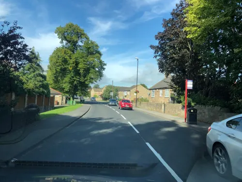
Collingham Bridge
Bridge · 1.9 mi
Bridge in Collingham, Leeds, West Yorkshire, England, UK
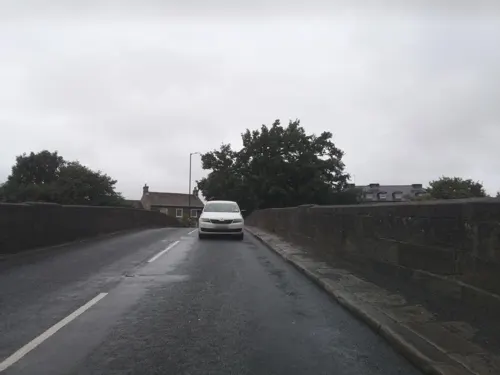
Harewood Bridge
Bridge · 3.2 mi
Bridge in Harewood, Leeds, West Yorkshire, England, UK

Linton Bridge
Bridge · 2.1 mi
Bridge in Collingham, Leeds, West Yorkshire, England, UK

Museums and landmarks7

Bramham Park
Museum · 3.4 mi
Grade I listed historic house museum in Bramham cum Oglethorpe, Leeds, West Yorkshire, England, UK

Dalton Parlours Roman villa and Iron Age settlement
Monument and historic site · 2.6 mi
Archaeological site in Collingham, Leeds, West Yorkshire, England, UK

Parks, trails and playgrounds14

Harewood House
Park · 3.1 mi
Grade I listed historic house museum and Zoo in Harewood, United Kingdom



2 more on the map.
Restaurants and cafes3



Where to stay2
Churches and places of worship8
Church of St Mary Immaculate (Rc), With Presbytery And Former Monastery Attached
Church · 2.5 mi
Schools, colleges and libraries1
Map of East Keswick
41 places. The map loads OpenStreetMap tiles when you open it.
Getting there and nearby towns
Leeds Bradford Airport (LBA) is the nearest airport with scheduled flights listed in OpenStreetMap, 9 miles away.
- Scarcroft 2 mi south, about 3 min by car
- Thorner 3 mi southeast, about 4 min by car
- Wetherby 4 mi northeast, about 6 min by car
- Bramham 4 mi east, about 7 min by car
- Spofforth 4 mi north, about 7 min by car
- Chapel Allerton 6 mi southwest, about 9 min by car
- Thorp Arch 6 mi east, about 9 min by car
- Aberford 7 mi southeast, about 10 min by car
- Leeds 8 mi southwest, about 13 min by car
- Harrogate 8 mi northwest, about 12 min by car
Drive times are estimates from straight-line distance, not routes.
Towns near East Keswick


Keep exploring
Local news
Headlines from INDB.
Reviews, tips and questions
Loading what members have shared...
Sources and licences
- GeoNames (CC BY 4.0): population, coordinates, regions and time zone
- Mapillary (see each image): photos
- OpenStreetMap contributors (ODbL 1.0): places, airports, map data
- Wikidata (CC0 1.0): elevation, founding date, time zone, website, landmarks and historic places
- Wikimedia Commons (see each image): photos
- Wikipedia (CC BY-SA 4.0): overview and history text
Photo credits
- East Keswick Methodist Church (8th July 2016) 003, Mtaylor848, CC BY-SA 4.0
- Interior of the Old Star Inn, East Keswick (22nd July 2026) 001, Mtaylor848, CC BY-SA 3.0
- Interior of the Old Star Inn, East Keswick (22nd July 2026) 002, Mtaylor848, CC BY-SA 3.0
- East Keswick (3743212783), Tim Green from Bradford, CC BY 2.0
- Grave at East Keswick (3723726013), Tim Green from Bradford, CC BY 2.0
- St Mary Magdalene, East Keswick (3724543140), Tim Green from Bradford, CC BY 2.0
- Methodist Church, East Keswick (3723728909), Tim Green from Bradford, CC BY 2.0
- Wharfe-linton, en:User:CiaranG, Public domain
- Harewood House from the terrace garden, Sirenuk, CC BY-SA 3.0
- Church of the Immaculate Conception, Sicklinghall (9th August 2017) 004, Mtaylor848, CC BY-SA 4.0
- St Oswald's Church, Collingham, West Yorkshire viewed from the South West (Taken by Flickr user 17th June 2012), Flickr user:Tim Green aka atouch, CC BY 2.0
- St Peter Church and Yard, Thorner, Tim Green, CC BY 2.0
- Bingleyarms, Mtaylor848 ( talk ), CC BY-SA 3.0
- Old Star, East Keswick (8th July 2016) 001, Mtaylor848, CC BY-SA 4.0
- Dalton parlours mosaic, York Museums Trust, CC BY-SA 4.0
- Signpost (3724532368), Tim Green from Bradford, CC BY 2.0
- Bramham Park Chapel, Paul Brooker, CC BY-SA 2.0
- Street-level photo, southglos, CC BY-SA 4.0
- Street-level photo, laye, CC BY-SA 4.0
- Street-level photo, southglos, CC BY-SA 4.0


Page built November 10, 2026. Spotted a mistake? Tell us or suggest a place.