
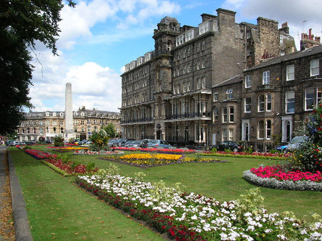


Harrogate, United Kingdom
Harrogate is a town of 89,060 people in England, United Kingdom.
Why visit Harrogate
Townapedia lists 16 museums and landmarks, 39 parks and trails, 168 places to eat, 17 places to stay and 9 attractions in and around town.
Highlights include Harrogate Theatre, Royal Hall, Jubilee Memorial and Knaresborough Castle.
Weather in Harrogate
Forecast from MET Norway (CC BY 4.0). Full forecast
About Harrogate
Harrogate () is a spa town and civil parish in North Yorkshire, England, historically part of the West Riding of Yorkshire.
From the Wikipedia article Harrogate (this version), under CC BY-SA 4.0.
Travel tips from other travellers: Harrogate on Wikivoyage (CC BY-SA 4.0).
Photos of Harrogate

Things to do9

Harrogate Theatre
Cinema and theater
Theatre in Harrogate, North Yorkshire, England, UK
Oxford Street, Harrogate

Royal Hall
Cinema and theater · 0.4 mi
Theatre and performance hall in Harrogate, North Yorkshire, England, UK

High Bridge
Bridge · 2.8 mi
Road bridge in Knaresborough, Harrogate, North Yorkshire, England, UK

Mother Shipton's Cave
Monument and historic site · 2.8 mi
Cave in United Kingdom

Mansfield House
Cinema and theater · 0.6 mi
Former theatre in Harrogate, England (1788-1830), later converted for residential use

Museums and landmarks16

Jubilee Memorial
Monument and historic site
Memorial in Harrogate, North Yorkshire, England, UK

Knaresborough Castle
Museum · 3.0 mi
Ruined fortress in North Yorkshire, England, UK

Knaresborough Trinitarian priory
Monument and historic site · 3.3 mi
Former Trinitarian priory in North Yorkshire, England

Mercer Art Gallery
Museum · 0.5 mi
Art gallery in Harrogate, England, United Kingdom
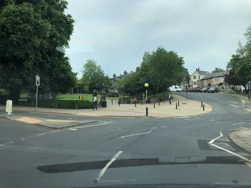
Royal Pump Room Museum
Museum · 0.4 mi
Former spa water pump, now a museum in Harrogate, Yorkshire, England, UK
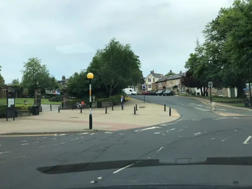
The Harrogate Museum at the Royal Pump Room
Museum · 0.4 mi
Mo off; Tu-Su 09:30-16:30



4 more on the map.
Parks, trails and playgrounds39

RHS Garden Harlow Carr
Park · 1.5 mi
One of five public gardens run by the Royal Horticultural Society


Knaresborough Zoo
Park · 2.9 mi
Former zoo in North Yorkshire, England
The Stray
Park · 0.5 mi
Open parkland in Harrogate, North Yorkshire, England

27 more on the map.
Restaurants and cafes168
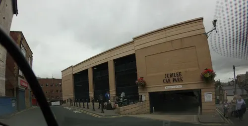
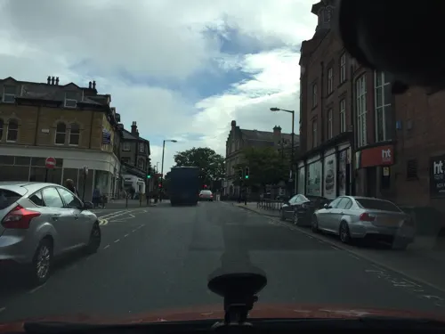
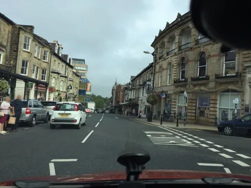
Bettys Café Tea Rooms
Restaurant · Coffee Shop
1 Parliament Street, Harrogate
Mo-Fr 09:00-16:30; Sa 09:00-17:00; Su 09:00-16:30
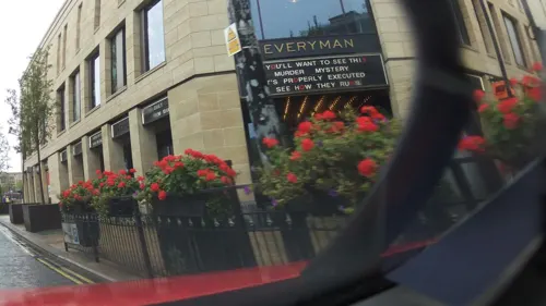
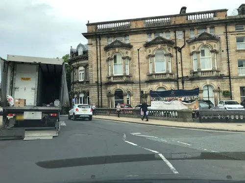
The Curry Counter
Restaurant · Pakistani · 0.9 mi
69-71 Leeds Road, Harrogate
Su-Th 11:00-21:00, Fr-Sa 11:00-22:00
Caffé Laco Di Como
Cafe · Italian
35 Beulah Street, Harrogate
Mo-Fr 09:00-16:00; Sa 08:30-16:30; Su 10:00-15:30
Gourmet Coffee Bar and Kitchen
Cafe
Station Parade, Harrogate
Mo-Fr 06:00-19:00; Sa 09:00-18:30; Su 06:30-19:00

Caffè Nero
Cafe · Coffee Shop
2 Beulah Street, Harrogate
Mo-Fr 07:00-19:00; Sa 07:30-18:30; Su 07:30-18:00

156 more on the map.
History
In medieval times Harrogate was a place on the boundary of the township of Bilton with Harrogate in the ancient parish of Knaresborough, and the parish of Pannal, also known as Beckwith with Rossett. The part within the township of Bilton developed into the community of Low Harrogate, and the part within Pannal developed into the community of High Harrogate. Both communities were within the Royal Forest of Knaresborough. In 1372 King Edward III granted the Royal Forest to his son John, Duke of Lancaster (also known as John of Gaunt), and the Duchy of Lancaster became the principal landowner in Harrogate.
Harrogate's development is due to the discovery of its chalybeate- and sulphur-rich spring water from the 16th century. The first mineral spring was discovered in 1571 by William Slingsby, who found that water from the Tewit Well in High Harrogate possessed similar properties to that from springs in the Belgian town of Spa, which gave its name to spa towns. The medicinal properties of the waters were publicised by Edmund Deane; his book, Spadacrene Anglica, or the English Spa Fountain was published in 1626.
Read more of the history
In the 17th and 18th centuries further chalybeate springs were discovered in High Harrogate, and both chalybeate and sulphur springs were found in Low Harrogate. The two communities attracted many visitors. A number of inns were opened for visitors in High Harrogate in the 17th century (the Queen's Head, the Granby, the Dragon and the World's End). In Low Harrogate, the Crown Hotel was open by the mid-18th century, and possibly earlier.
In accordance with the Forest of Knaresborough Inclosure Act 1770 (10 Geo. 3. c. 94 Pr.), promoted by the Duchy of Lancaster, the Royal Forest of Knaresborough was enclosed. The Enclosure award of 1778 clarified ownership of land in the Harrogate area. Under the award, 200 acres (81 ha) of land, which included the springs known at that time, were reserved as a public common, The Stray, which has remained public open space. The Enclosure Award facilitated development around the Stray. During the 19th century, the area between High Harrogate and Low Harrogate, which until then had remained two separate communities a mile apart, was developed, and what is now the central area of Harrogate was built on high ground overlooking Low Harrogate. An area to the north of the developing town was reserved to the Duchy of Lancaster, and was developed for residential building. To provide entertainment for the increasing numbers of visitors the Georgian Theatre was built in 1788. Bath Hospital (later the Royal Bath Hospital) was built in 1826. The Royal Pump Room was built in 1842. The site of Tewit Well is marked by a dome on the Stray. Other wells can be found in the Valley Gardens and Royal Pump Room museum.
In 1870, engineering inventor Samson Fox perfected the process of creating water gas, in the basement laboratory of Grove House. After constructing a trial plant at his home on Skipton Road, making it the first house in Yorkshire to have gas lighting and heating; he built a plant of suitable size to supply the whole town. When Parliament Street became the world's first route to be lit by water-gas, newspapers commented: "Samson Fox has captured the sunlight for Harrogate." After donating the town's first fire engine, and building the town's theatre, he was elected mayor for three successive years (1890–92), a record never equalled since.
In 1893, Harrogate doctor George Oliver was the first to observe the effect of adrenaline on circulation.
Like many spa towns all over Europe, Harrogate's popularity declined after the First World War. During the Second World War, Harrogate's large hotels accommodated government offices evacuated from London, paving the way for the town to become a commercial, conference, and exhibition centre.
Former employers in the town were the Central Electricity Generating Board (CEGB), the Milk Marketing Board and ICI who occupied offices and laboratories at Hornbeam Park where Crimplene was invented in the 1950s and named after the nearby Crimple Valley and beck.
In 2007, two metal detectorists found the Harrogate hoard, a 10th-century Viking treasure hoard, near Harrogate. The hoard contains almost 700 coins and other items from as far away as Afghanistan. The hoard was described by the British Museum as the most important find of its type in Britain for 150 years.
From the History section of Harrogate on Wikipedia, under CC BY-SA 4.0.
More about Harrogate
Geography
The town has good commuter services for people who work in the City of Leeds, City of Bradford, York and North Yorkshire in general. Harrogate is prosperous and has some of the highest property prices in England, with many properties in the town and surrounding villages valued at £1 million or more, it is generally considered the most expensive place to live in the North of England. Fulwith Mill Lane in Harrogate is the most expensive street in Yorkshire.
Harrogate is situated on the edge of the Yorkshire Dales, with the Vale of York to the east and the upland Yorkshire Dales to the west and north-west. It has a dry and mild climate, typical of places in the rain shadow of the Pennines. It is on the A59 from Skipton to York. At an altitude of between 100 and 200 metres (330 and 660 ft), Harrogate is higher than many English settlements. It has an average minimum temperature in January of slightly below 1 °C (34 °F) and an average maximum in July and August of 21 °C (70 °F).
Harrogate's climate is classified as warm and temperate. Rain can occur at any time of year, though precipitation tends to be light. There are significantly more dry days than those with precipitation. In a year, the average rainfall is 671 millimetres (26.4 in). The Köppen-Geiger climate classification is Cfb. The average annual temperature in Harrogate is 9.7 °C (49.5 °F).
Economy
Harrogate has a strong and varied economy. The town's main shopping district is focused on Cambridge Street, Oxford Street, Beulah Street and James Street where most of the high street shops can be found. There is a wide range of boutique and designer shopping on Parliament Street and in the Montpellier Quarter, as well as independent shopping around Commercial Street.
Eating out is popular in Harrogate, and the town is well served by restaurants. Parliament Street and Cheltenham Parade are lined with many independent and chain restaurants, while there is a concentration of chain restaurants on John Street and Albert Street.
The conference and exhibition industry is the focus of the town's business, with Harrogate International Centre the third largest fully integrated conference and exhibition centre in the UK, and one of the largest in Europe. Harrogate draws numerous visitors because of its conference facilities. In 2016 such events alone attracted 300,000 visitors to Harrogate. The convention centre was developed in 2020 to be used as a Nightingale Hospital. However, whilst it has been used in an NHS capacity, it has not treated any Coronavirus patients (as of late January 2021) because the conventional hospitals had not run out of capacity.
Arts and culture
On 11 January 1900, Harrogate Grand Opera House, now Harrogate Theatre, opened with a charity gala in aid of British soldiers fighting the Boer War in South Africa; this was followed, on 13 January 1900, by J Tully's pantomime Dick Whittington.
In 1966, the Harrogate Festival of Arts & Science was established, now known as the Harrogate International Festivals, and is recognised as the North of England's leading arts festival; it incorporates a number of festivals within the portfolio including the Theakstons Old Peculier Crime Writing Festival & Theakston's Old Peculier Crime Novel of the Year Award, Raworths Harrogate Literature Festival, Harrogate Music Festival and a number of year-round events.
The town hosted the Eurovision Song Contest 1982 in the Harrogate International Centre.
Harrogate won the 2003 and 2016 Britain in Bloom in the category of 'Large Town' and the European Entente Florale in 2004, reprising its win in the first Entente Florale in 1977. Harrogate was a gold medal winner of Europe in Bloom in 2004. In 2005, a Channel 4 TV show listed Harrogate as the UK's third best place to live; in 2006, it came fourth in the same league, where the programme claimed that it placed lower due to "a slight dip in exam results", although presenter Phil Spencer noted that it was his personal favourite.
Education
Harrogate has multiple colleges, schools and private schools:
Harrogate Grammar School, (An academy, part of the Red Kite Learning Trust) Specialist in Language and Technology
Harrogate High School, a specialist Sports College rebuilt under a governmental scheme in mid-2017
Rossett School a specialist computing and mathematics college
St. Aidan's C of E High School, a specialist Language and Science School
St John Fisher Catholic High School, a specialist arts and humanities school
From the Wikipedia article Harrogate, under CC BY-SA 4.0.
Notable people from Harrogate
 Olly AlexanderBritish singer and actorPhoto: Pedro J Pacheco, CC BY-SA 4.0
 Jim CarterBritish actorPhoto: Frankie Fouganthin, CC BY-SA 3.0
 Rachel DalyEnglish footballer (born 1991)Photo: James Boyes from UK, CC BY 2.0
 Luke GarbuttBritish footballer (born 1993)Photo: Catherine Kõrtsmik, CC BY 2.0
 Andrew HaighEnglish film director, screenwriter and producerPhoto: Amy Hecht, CC BY-SA 4.0
 Mik KaminskiEnglish violinistPhoto: Alterna2 http://www.alterna2.com, CC BY 2.0
 Dewey BunnellAmerican folk-rock musician, founder of the group AmericaPhoto: Derek Russell, CC BY-SA 2.0
 George MillsBritish runnerPhoto: Matthias Reiß, CC BY-SA 3.0
- H. L. A. HartEnglish legal philosopher (1907–1992)
- Andy O'BrienIrish association football player (born 1979)
- Jack LaugherBritish diver
- Jonathan Riley-SmithBritish historian
Born in Harrogate, according to Wikidata (CC0). Each name links to its Wikipedia article.
Where to stay17
Churches and places of worship49
Shopping56
Gas and EV charging3
Schools, colleges and libraries28
St Joseph's Catholic Primary School, Harrogate
School · Roman Catholic · 1.1 mi
Coppice Rise, Harrogate
Healthcare13
Map of Harrogate
250 places. The map loads OpenStreetMap tiles when you open it.
Getting there and nearby towns
Leeds Bradford Airport (LBA) is the nearest airport with scheduled flights listed in OpenStreetMap, 10 miles away.
- Knaresborough 3 mi northeast, about 5 min by car
- Wetherby 7 mi southeast, about 12 min by car
- Otley 9 mi southwest, about 14 min by car
- Ripon 10 mi north, about 16 min by car
- Yeadon 11 mi southwest, about 17 min by car
- Guiseley 11 mi southwest, about 17 min by car
- Horsforth 11 mi south, about 18 min by car
- Chapel Allerton 11 mi south, about 18 min by car
- Ilkley 12 mi west, about 20 min by car
- Leeds 13 mi south, about 22 min by car
Drive times are estimates from straight-line distance, not routes.
Towns near Harrogate


Keep exploring
Local news
Headlines from INDB.
Reviews, tips and questions
Loading what members have shared...
Sources and licences
- GeoNames (CC BY 4.0): population, coordinates, regions and time zone
- Mapillary (see each image): photos
- OpenStreetMap contributors (ODbL 1.0): places, airports, map data
- Wikidata (CC0 1.0): elevation, founding date, time zone, website, landmarks and historic places
- Wikimedia Commons (see each image): photos
- Wikipedia (CC BY-SA 4.0): overview and history text
Photo credits
- HarrogateCenotaph(DSPugh)Aug2005, DS Pugh, CC BY-SA 2.0
- Harrogate Library, DS Pugh, CC BY-SA 2.0
- Harrogate Theatre - Oxford Street Harrogate HG1 1QF, Spudgun67, CC BY-SA 4.0
- High Bridge, Simon Cobb, CC0
- Mother Shipton's Cave, Simon Cobb, CC0
- Jubilee Memorial 1887 Harrogate 16 July 2021 (30), Storye book, CC BY-SA 4.0
- Knaresborough Castle ruins, Redvers, CC BY 2.0
- The history of the castle, town and forest of Knaresbrough, with Harrogate, and it's medicinal springs (1809) (14579704317), Internet Archive Book Images, No restrictions
- Harlow Carr Entrance, DS Pugh, CC BY-SA 2.0
- Chapel of Our Lady of the Crag, Redvers, CC BY 2.0
- All Saints Harlow Hill 023, Linda Spashett Storye book, CC BY 3.0
- St John the Baptist, Knaresborough, Tim Green, CC BY 2.0
- St. Joseph and St James Church, Follifoot (24th December 2013) 002, Mtaylor848, CC BY-SA 3.0
- Beckwithshaw Church 034, Storye book, CC BY 3.0
- St Thomas Killinghall 638, Storye book, CC BY-SA 4.0
- Mercer Art Gallery (20a), Storye book, CC BY-SA 4.0
- Outside 03, Peter Astbury, Public domain
- St Aidan's Church of England High School, User:Bucs, CC BY-SA 3.0
- StWilfridHarrogate, Andrewrabbott ( talk ), Public domain
- OldSwanHotelHarrogate20080807 0183, Dragon tomato, CC BY 3.0
- White Hart Hotel, Harrogate (25th February 2013), Mtaylor848, CC BY-SA 3.0
- Harrogate district hospital main entrance, Akk7a at en.wikipedia, CC BY-SA 3.0
- Harrogate cenotaph (6156671829), Richard North, CC BY 2.0
- Mercer Art Gallery (39a), Storye book, CC BY-SA 4.0
- North Yorkshire - Royal Hall - 2025-09-13 20-00-09 003, PuddenTane17, CC BY-SA 4.0
- Valley Gardens, Harrogate (2440908767), Tim Green from Bradford, UK, CC BY 2.0
- Street-level photo, mackerski, CC BY-SA 4.0
- Street-level photo, hobgoblin, CC BY-SA 4.0
- Street-level photo, southglos, CC BY-SA 4.0
- Street-level photo, southglos, CC BY-SA 4.0
- Street-level photo, locator, CC BY-SA 4.0
- Street-level photo, mackerski, CC BY-SA 4.0
- Street-level photo, southglos, CC BY-SA 4.0
- Street-level photo, mackerski, CC BY-SA 4.0
- Street-level photo, locator, CC BY-SA 4.0
- Street-level photo, southglos, CC BY-SA 4.0
- Street-level photo, mackerski, CC BY-SA 4.0
- Street-level photo, mackerski, CC BY-SA 4.0
- Street-level photo, locator, CC BY-SA 4.0
- Street-level photo, southglos, CC BY-SA 4.0
- Street-level photo, locator, CC BY-SA 4.0
- Street-level photo, locator, CC BY-SA 4.0
- Street-level photo, southglos, CC BY-SA 4.0
- Street-level photo, aidan573, CC BY-SA 4.0
- Street-level photo, locator, CC BY-SA 4.0
- Street-level photo, southglos, CC BY-SA 4.0


Page built November 10, 2026. Spotted a mistake? Tell us or suggest a place.