


Why visit Elgin
Townapedia lists 22 museums and landmarks, 8 parks and trails, 69 places to eat, 21 places to stay and 5 attractions in and around town.
Highlights include Bishopmill Bridge, Landshut Bridge, Elgin Cathedral and Elgin Museum.
Weather in Elgin
Forecast from MET Norway (CC BY 4.0). Full forecast
About Elgin
Elgin ( EL-ghin; Scots: Ailgin; Scottish Gaelic: Eilginn [ˈel(e)kʲɪɲ]) is a historic market town (former cathedral city) and formerly a royal burgh in Moray, Scotland. It is the administrative and commercial centre for Moray. The town originated to the south of the River Lossie on the higher ground above the floodplain where the town of Birnie is. There, the church of Birnie Kirk was built in 1140 and still serves the community.
From the Wikipedia article Elgin, Moray (this version), under CC BY-SA 4.0.
Travel tips from other travellers: Elgin on Wikivoyage (CC BY-SA 4.0).
Photos of Elgin

Things to do5


Landshut Bridge
Bridge · 0.6 mi
2014 bridge in Elgin, Moray, Scotland, UK, carries a minor road across River Lossie


Cloddach Bridge
Bridge · 2.9 mi
Bridge in Moray, Scotland, UK, carries a minor road across River Lossie

Museums and landmarks22

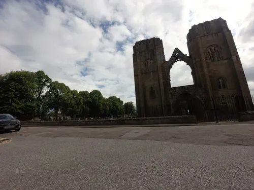
Elgin Cathedral
Monument and historic site · 0.5 mi
Historic ruin in Elgin, Scotland, United Kingdom
King Street, Elgin
Mar 29-Sep 30 10:00-16:30; Oct 01-Mar 28 10:00-16:00; Dec 25-26...


Elgin Castle
Monument and historic site
12th-century castle near Elgin, Moray, Scotland, UK




Duke of Gordon Monument, Lady Hill, Elgin
Monument and historic site
Monument in Moray, Scotland, UK
Knock of Alves
Monument and historic site · 3.2 mi
Archaeological site in Moray, Scotland, UK
Visitor Centre and Shop
Monument and historic site · 0.9 mi
Bruceland Road, Elgin
10 more on the map.
Parks, trails and playgrounds8






Restaurants and cafes69
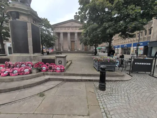
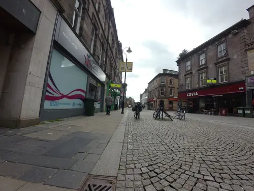
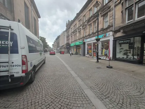



57 more on the map.
History
The discovery of the Elgin Pillar, a 9th-century class II Pictish stone, under the High Street in 1823 suggests there may have been an Early Christian presence in the area of the later market, but there is no further evidence of activity before Elgin was created a Royal Burgh in the 12th century. In August 1040, MacBeth's army defeated and killed Duncan I at Bothganowan (Pitgaveny), near Elgin. Elgin is first recorded in a charter of David I in 1151 in which he granted an annuity to the Priory of Urquhart. David had made Elgin a royal burgh around 1130, after his defeat of Óengus of Moray. During David's reign, the castle was established at the top of what is now Lady Hill. The town received a royal charter from Alexander II in 1224 when he granted the land for a new cathedral to Andrew, Bishop of Moray. This finally settled the episcopal see which had been at various times at Kinneddar, Birnie and Spynie. The ancient Forest of Darnaway was designated a Royal Forest and was used by the Scottish kings for hunting.
Read more of the history
Alexander II was Elgin's greatest benefactor and returned many times to his royal castle. He established the two religious houses of the town, the Dominicans or Blackfriars on the west side and the Franciscans or Greyfriars in the east. Further to the east stood the Hospital of Maison Dieu, or House of God also founded during the reign of Alexander II for the reception of poor men and women.
On 19 July 1224, the foundation stone of the new Elgin Cathedral was ceremoniously laid. The cathedral was completed sometime after 1242 but was completely destroyed by fire in 1270. The reasons for this are unrecorded. The buildings now remain as ruins date from the reconstruction following that fire. The Chartulary of Moray described the completed cathedral as "Mirror of the country and the glory of the kingdom".
Edward I of England travelled twice to Elgin. During his first visit in 1296, he was impressed by what he saw. Preserved in the Cotton library now held in the British Library is the journal of his stay, describing the castle and the town of Elgin as "bon chastell et bonne ville"—good castle and good town. By his second visit in September 1303, the castle's wooden interior had been burned while held by the English governor, Henry de Rye. As a result, he only stayed in Elgin for two days and then camped at Kinloss Abbey from 13 September until 4 October. King Edward was furious when David de Moravia, Bishop of Moray, joined Scotland's cause with Bruce, and Edward appealed to the Pope who excommunicated the bishop, thus removing papal protection, causing him to flee to Orkney, then to Norway, only to return after Robert Bruce's victories against the English. After Edward's death in July 1307, Robert the Bruce attacked Elgin and then retook Scotland in 1308.
In August 1370 Alexander Bur, Bishop of Moray began payments to Alexander Stewart, Wolf of Badenoch, King Robert III's brother, for the protection of his lands and men. In February 1390, the bishop then turned to Thomas Dunbar, son of the Earl of Moray, to provide the protection. This action infuriated Stewart and in May he descended from his castle on an island in Lochindorb and burned the town of Forres in revenge. In June he burned much of Elgin, including two monasteries, St Giles Church, the Hospital of Maison Dieu and the cathedral. Andrew of Wyntoun's Orygynale Cronykil of Scotland (a 15th-century history of Scotland) described this action by "wyld, wykked Heland-men". The rebuilding of the cathedral took many years; but much of it has since crumbled away due to the inferior quality of the stone made available to the 15th- and 16th-century masons, while the 13th-century construction still remains. In 1506, the great central tower collapsed and although rebuilding work began the next year it was not completed till 1538.
The citizens of Elgin and surrounding areas did not seem to object to the new religion following the Reformation. In 1568 the lead was stripped from the roof of the cathedral, by order of the Privy Council of Scotland. The lead was sold to William Birnie and Alexander Clark. The proceeds went to the maintenance of Regent Moray's soldiers, but the ship taking the lead cargo to Holland sank almost immediately on leaving Aberdeen harbour. Without this protection, the building began to deteriorate.
The Kirk Session records of Elgin name women who danced at New Year 1623 to the sound of a trumpet. Six men, described as guisers or "gwysseris" performed a sword dance wearing masks and visors covering their faces in the churchyard and in the courtyard of a house. They were fined 40 shillings each. The fabric of the Cathedral continued to deteriorate. In 1637, the rafters over the choir were blown down and in 1640 the minister of St Giles along with the Laird of Innes and Alexander Brodie of Brodie, all ardent Covenanters, removed and destroyed the ornately carved screen and woodwork that had remained intact. The tracery of the West window was destroyed sometime between 1650 and 1660 by Cromwell's soldiers. On Easter Sunday 1711 the central tower collapsed for the second time in its history but caused much more damage. The rubble was quarried for various projects in the vicinity until 1807 when, through the efforts of Joseph King of Newmill, a wall was built around the cathedral and a keeper's house erected. Mountains of this rubble were cleared by one John Shanks, enabling visitors to view the ornate stonemasonry. Shanks was presented with an ornate snuffbox by the authorities; it is now in Elgin Museum.
From the History section of Elgin, Moray on Wikipedia, under CC BY-SA 4.0.
More about Elgin
Geography
The modern town straddles the River Lossie, with the suburbs of Bishopmill to the north and New Elgin to the south. Permo–Triassic rocks, rare in Scotland, are commonly found around Elgin. These are composed of aeolian sandstone formed when this area was subjected to desert conditions. Quarry Wood, on the town's edge, has a formation nicknamed Cuttie's Hillock which produced the internationally known fossils called the Elgin Reptiles. In the Elgin district, boulders belonging to the lowest group of Jurassic strata, Oxford clay and chalk are found both in glacial deposits and on the surface of the ground. The largest of these deposits is at Linksfield, where limestone and shale lie on boulder clay. There is a large hill in Elgin's town centre, often viewed as the highlight of the Elgin tourist trail.
Economy
The Elgin–Forres–Lossiemouth triangle is heavily dependent on Royal Air Force stations for the employment of civilians. In 2005, RAF Lossiemouth along with its neighbour RAF Kinloss contributed £156.5 million (including civilian expenditure) to the Moray economy, of which £76.6 million was retained and spent locally. The bases provide, directly or indirectly, 21% of all employment in the area, although in 2010 the closure of RAF Kinloss had a significant effect on these numbers. Aware of the impact that the Air Force has on the area's economy, the local population instigated a long campaign to save RAF Lossiemouth, the future of which was also in doubt. How much of an influence this had upon the government's and Ministry of Defence's final decision is uncertain, but the base was ultimately saved and RAF Leuchars instead faced the axe as part of the same Strategic Defence and Security Review. RAF Leuchars will now become, like RAF Kinloss, an army base. Other areas offering significant employment are local authority, construction and real estate, food and drink, tourism, transport, business services and wholesale/retail.
Whisky is an important component of the wider local economy, with Glen Moray distillery, Miltonduff distillery and the BenRiach distillery all within six miles of Elgin.
Arts and culture
Moray Leisure Centre, Borough Briggs Road, containing swimming pool, ice rink and a gymnasium
Moray Jazz Club, ground floor of the Elgin City Football Club, Borough Briggs Road
Education
Jack 'n' Jill Pre-School Centre, Kinder House, 22 Wardend Place, New Elgin
Moray Leisure Centre Pre-School Nursery, Borough Briggs Road, Elgin
From the Wikipedia article Elgin, Moray, under CC BY-SA 4.0.
Notable people from Elgin
 Kevin McKiddScottish actorPhoto: gdcgraphics, CC BY-SA 2.0
 Helen JenkinsWelsh triathletePhoto: MartinPutz, CC BY-SA 3.0
 George BrownBritish soldier notable for commands in the Peninsular War and the Crimean WarPhoto: Roger Fenton, Public domain
 Robert CalderRoyal Navy admiral (1745-1818)Photo: Lemuel Francis Abbott, CC0
 Hugh Andrew Johnstone MunroBritish classical scholar (1819-1885); sold most of his father's art collection from 1864-1878Photo: Franklin Tuttle, Public domain
 Charles McFarlane InglisBritish naturalistPhoto: Unknown Photographer. Most certainly..., Public domain
 Charles MorisonNew Zealand barristerPhoto: New Zealand Graphic, 13 November..., Public domain
- Steven PressleyScottish association football manager (born 1973)
- F. F. BruceBritish biblical scholar (1910-1990)
- Mario ContiCatholic archbishop emeritus (1934–2022)
- George MacdonaldBritish archaeologist and numismatist (1862–1940)
- Robert HamiltonScottish footballer (1877-1948)
Born in Elgin, according to Wikidata (CC0). Each name links to its Wikipedia article.
Where to stay21
Churches and places of worship14
RCCG Jesus House Elgin, The Antioch Church
Church · Pentecostal
South Street, Elgin
Shopping22
Gas and EV charging6
Schools, colleges and libraries13
St Sylvester's RC Primary School
School · Roman Catholic · 0.4 mi
Abbey Street, Elgin
Healthcare10
Map of Elgin
190 places. The map loads OpenStreetMap tiles when you open it.
Getting there and nearby towns
RAF Lossiemouth (LMO) is the nearest airport with scheduled flights listed in OpenStreetMap, 4 miles away.
- Lhanbryde 4 mi east, about 6 min by car
- Lossiemouth 5 mi north, about 8 min by car
- Hopeman 6 mi northwest, about 9 min by car
- Burghead 7 mi northwest, about 12 min by car
- Mosstodloch 7 mi east, about 12 min by car
- Garmouth 8 mi east, about 13 min by car
- Nairn 21 mi west, about 34 min by car
- Inverness 36 mi west, about 57 min by car
- Inverurie 43 mi southeast, about 1 h 15 min by car
- Ellon 50 mi southeast, about 1 h 15 min by car
Drive times are estimates from straight-line distance, not routes.
Towns near Elgin


Keep exploring
Local news
Headlines from INDB.
Reviews, tips and questions
Loading what members have shared...
Sources and licences
- GeoNames (CC BY 4.0): population, coordinates, regions and time zone
- Mapillary (see each image): photos
- OpenStreetMap contributors (ODbL 1.0): places, airports, map data
- Wikidata (CC0 1.0): elevation, founding date, time zone, website, landmarks and historic places
- Wikimedia Commons (see each image): photos
- Wikipedia (CC BY-SA 4.0): overview and history text
Photo credits
- St Giles, Elgin (51395312514), Tom Parnell from Scottish Borders, Scotland, CC BY-SA 2.0
- Elgin Bus Station (1), Lucas Kendall, CC BY-SA 4.0
- Elgin Bus Station (2), Lucas Kendall, CC BY-SA 4.0
- Elgin Bus Station (3), Lucas Kendall, CC BY-SA 4.0
- Elgin High Street (15368698225), Tom Parnell from Scottish Borders, Scotland, CC BY-SA 2.0
- St Giles' Church, Elgin (51394839093), Tom Parnell from Scottish Borders, Scotland, CC BY-SA 2.0
- Thunderton House, Elgin (2), Lucas Kendall, CC BY-SA 4.0
- Elgin Cathedral from Newmill Road, Lucas Kendall, CC BY-SA 4.0
- Bishopmill Bridge April 2026, Lucas Kendall, CC BY-SA 4.0
- Landshut Bridge April 2026, Lucas Kendall, CC BY-SA 4.0
- Elgin museum Moray, Geni, CC BY-SA 4.0
- Elgin Castle, Lucas Kendall, CC BY-SA 4.0
- Birnie Church, Chh bck, CC BY-SA 4.0
- St Giles' Church, Elgin & War Memorial, Elgin, Lucas Kendall, CC BY-SA 4.0
- Elgin City Football Club, Lucas Kendall, CC BY-SA 4.0
- Dr Grays Hospital, Anne Burgess, CC BY-SA 2.0
- UHI Moray April 2026, Lucas Kendall, CC BY-SA 4.0
- Muckle Cross, Elgin, Lucas Kendall, CC BY-SA 4.0
- Elgin Baptist Church, Lucas Kendall, CC BY-SA 4.0
- Panoramic view of Elgin from Lady Hill, Lucas Kendall, CC BY-SA 4.0
- Duke of Gordon's Monument Up Close, Elgin, Lucas Kendall, CC BY-SA 4.0
- Elgin War Memorial (51419964483), Tom Parnell from Scottish Borders, Scotland, CC BY-SA 2.0
- Cooper Park Bowling Club, Lucas Kendall, CC BY-SA 4.0
- The Biblical Garden, Elgin (51409230597), Tom Parnell from Scottish Borders, Scotland, CC BY-SA 2.0
- Street-level photo, caz440, CC BY-SA 4.0
- Street-level photo, caz440, CC BY-SA 4.0
- Street-level photo, coetserw, CC BY-SA 4.0
- Street-level photo, tallguy, CC BY-SA 4.0
- Street-level photo, tallguy, CC BY-SA 4.0
- Street-level photo, coetserw, CC BY-SA 4.0
- Street-level photo, coetserw, CC BY-SA 4.0
- Street-level photo, tallguy, CC BY-SA 4.0
- Street-level photo, hobgoblin, CC BY-SA 4.0
- Street-level photo, hobgoblin, CC BY-SA 4.0
- Street-level photo, tallguy, CC BY-SA 4.0
- Street-level photo, caz440, CC BY-SA 4.0
- Street-level photo, caz440, CC BY-SA 4.0
- Street-level photo, tallguy, CC BY-SA 4.0
- Street-level photo, coetserw, CC BY-SA 4.0
- Street-level photo, coetserw, CC BY-SA 4.0
- Street-level photo, hobgoblin, CC BY-SA 4.0


Page built November 10, 2026. Spotted a mistake? Tell us or suggest a place.