


Why visit Forfar
Townapedia lists 12 museums and landmarks, 28 parks and trails, 61 places to eat, 4 places to stay and 3 attractions in and around town.
Highlights include Meffan Institute Museum & Gallery, Meffan Museum and Art Gallery, Frosty's Soft Play Centre and Forfar Indoor Sports.
Weather in Forfar
Forecast from MET Norway (CC BY 4.0). Full forecast
About Forfar
Forfar ( ; Scots: Farfar, Scottish Gaelic: Baile Fharfair) is a market town, historical royal burgh and the county town of Angus, Scotland, and the administrative centre for Angus Council, with a new multi-million-pound office complex located on the outskirts of the town. In 2022, Forfar had a population of 13,801.
From the Wikipedia article Forfar (this version), under CC BY-SA 4.0.
Travel tips from other travellers: Forfar on Wikivoyage (CC BY-SA 4.0).
Photos of Forfar


Things to do3


Balmashanner Hill
Scenic view · 0.8 mi
Great views of Strathmore and the surrounding hills, can see high up into the Grampians on a good day

Museums and landmarks12

Meffan Institute Museum & Gallery
Museum
20 West High Street, Forfar
Mo-Sa 10:00-17:00
Meffan Museum and Art Gallery
Museum
Museum and art gallery in Forfar, Angus, Scotland, United Kingdom

St Orland's Stone
Monument and historic site · 3.4 mi
Cross slab in Angus, Scotland, UK
Parks, trails and playgrounds28

Frosty's Soft Play Centre
Playground · 0.8 mi
Suttieside Road, Forfar
Mo 09:30-16:00; We-Su 09:30-16:00

Station Park
Sports field and stadium · 0.6 mi
Carseview Road, Forfar

16 more on the map.
Restaurants and cafes61
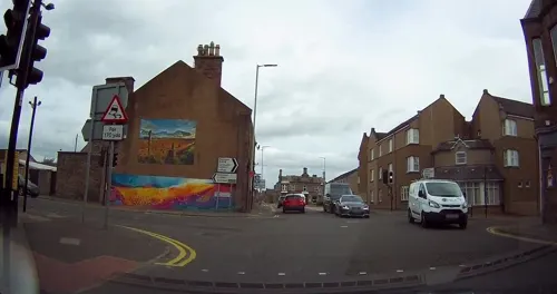


Jas. McLaren & Son Bakers
Bakery · Scottish, Pastry, Pie, Cake
8 The Cross, Forfar
Mo-We 08:00-15:00; Th 08:00-13:00; Fr 08:00-15:00; Sa 08:00-14:00
Jas. McLaren & Son Bakers
Bakery · Scottish, Pastry, Pie, Cake · 0.5 mi
22/26 Market Street, Forfar
Mo-We 08:00-14:00; Th 08:00-13:00; Fr 08:00-14:30; Sa 07:30-14:00

Jeet
Restaurant · Indian
111-115 Castle Street, Forfar
Tu-Th 16:30-22:30; Fr-Sa 12:00-14:30,17:00-23:00; Su 16:30-22:30

Auntie Jacqui's
Ice cream · Soup
9 Osnaburg Street, Forfar
Mo 10:30-16:30; We-Sa 10:30-16:30; Su 12:30-16:30
Costa
Cafe · Coffee Shop
16-18 Castle Street, Forfar
Mo-Sa 07:00-19:00; Su 09:00-18:00

The Osnaburg
Bar and pub
23 Osnaburg Street, Forfar
Mo-Th 11:00-24:00; Fr-Sa 11:00-01:00; Su 11:00-24:00
The Wee Bake Shop
Bakery
45 West High Street, Forfar
Mo-Fr 08:00-14:30, Sa 08:00-14:00
49 more on the map.
History
During one of the Roman invasions of modern-day Scotland, the Romans established a major camp at Battledykes, approximately 3 miles (5 km) north of Forfar; this camp was analysed to have held 50,000 to 60,000 men. From Battledykes northward the Romans established a succession of camps including Stracathro, Raedykes and Normandykes.
During the Middle Ages, a "claimant" to the throne, the daughter of the leader of the Meic Uilleim, who were descendants of King Duncan II, had her brains dashed out on Forfar market cross in 1230 while still an infant.
During the First War of Scottish Independence, the castle of Forfar was held by the English. After Robert the Bruce's victory over the Earl of Buchan, Philip, the Forester of Platane, together with some of his friends, raised ladders against the wall and, climbing over, surprised the garrison and killed them. He then yielded the castle to Bruce, who rewarded him and gave instructions for its slighting.
During the 16th and 17th century, several witch trials took place in Forfar, the last of which took place in 1662 and in which 52 people were accused. At the time, Forfar was a town of around 1000 inhabitants, with an additional 2000 people residing in the county.
Read more of the history
After attending the funeral of a daughter of Patrick Carnegie of Lour on the 9th of May 1728, Forfar became the place of the accidental killing of Charles Lyon, 6th Earl of Strathmore and Kinghorne by James Carnegie of Finhaven. Lyon of Brigton who was of foul temper, bullied Carnegie throughout the day during and by 9pm a mortally drunk Carnegie was attack by Lyon of Brigton who threw him into a kennel, (sewer) on Castle Street. Carnegie humiliated drew his sword and stumbled towards the retreating Brigton. The Earl stepped in between them at the tragic moment and was run through by Carnegie. He died 49 hours later. The subsequent trial established the "not guilty" verdict in Scots Law.
From the History section of Forfar on Wikipedia, under CC BY-SA 4.0.
More about Forfar
Education
Whitehills Primary School on Service Road contains a Gaelic Medium Unit where pupils are educated exclusively through the medium of Scottish Gaelic. The head teachers are Coureen Peters & Elaine Gallon (acting).
Strathmore Primary School is on St James' Road. The head teacher is Jennifer Garnes.
Langlands Primary School is on Glamis Road. The school reopened in May 2009 after the demolishing of the original buildings and an extensive period of rebuilding and landscaping. The head teacher is Jayne McLean.
Forfar Academy on Kirriemuir road is one of the largest schools in Angus, with a roll of around 1,200 pupils.
In 2007, the Forfar-Carnoustie Schools Project made major changes to schools in Forfar, with closure of the following primary schools:
From the Wikipedia article Forfar, under CC BY-SA 4.0.
Notable people from Forfar
 A. S. NeillScottish educator and theorist (1883-1973)Photo: Zoë Readhead, CC BY-SA 2.5
 Ian HudghtonScottish politician (born 1951)Photo: Diliff, CC BY-SA 3.0
 Florence PettyBritish cookery writer and broadcaster (1870–1948)Photo: Unknown author Unknown author, Public domain
 Enn ReitelScottish-Estonian actor (born 1950)Photo: Pebble Bay Entertainment, CC BY-SA 4.0
 Gregor FiskenBritish racing driverPhoto: Dave_S. from Witney, England, CC BY 2.0
 James HoweAustralian politicianPhoto: Unknown author, Public domain
- Bon ScottAustralian singer (1946–1980)
- George DonScottish botanist (1798-1856)
- Joseph WedderburnBritish mathematician (1882–1948)
- Greg DrummondScottish and British male curler and coach
- David McLeanScottish footballer, born 1890
- Helena Madelain Lamond ForbesScottish botanist (1900-1959)
Born in Forfar, according to Wikidata (CC0). Each name links to its Wikipedia article.
Where to stay4
Churches and places of worship8
Lowson Memorial Parish Church
Church · Church Of Scotland · 0.6 mi
1 Jamieson Street, Forfar
St. Margaret's Parish Church
Church · Church Of Scotland
West High Street, Forfar
Forfar East and Old Parish Church
Church · Church Of Scotland
East High Street, Forfar
Kingdom Hall of Jehovah's Witnesses
Church · Jehovahs Witness · 0.7 mi
Carseview Road, Forfar
St Fergus' RC Church
Church · Roman Catholic · 0.5 mi
94 Glenogil Terrace, Forfar
Shopping22
Gas and EV charging3
Schools, colleges and libraries6
Healthcare6
Map of Forfar
153 places. The map loads OpenStreetMap tiles when you open it.
Getting there and nearby towns
Dundee Airport (DND) is the nearest airport with scheduled flights listed in OpenStreetMap, 14 miles away.
- Dundee 12 mi south, about 20 min by car
- Montrose 17 mi east, about 27 min by car
- Saint Andrews 21 mi south, about 34 min by car
- Perth 27 mi southwest, about 43 min by car
- Methil 32 mi south, about 52 min by car
- Glenrothes 33 mi south, about 53 min by car
- Stonehaven 34 mi northeast, about 54 min by car
- Kirkcaldy 38 mi south, about 1 h by car
- Aberdeen 46 mi northeast, about 1 h 15 min by car
- Edinburgh 49 mi south, about 1 h 15 min by car
Drive times are estimates from straight-line distance, not routes.
Towns near Forfar


Keep exploring
Local news
Headlines from INDB.
Reviews, tips and questions
Loading what members have shared...
Sources and licences
- GeoNames (CC BY 4.0): population, coordinates, regions and time zone
- Mapillary (see each image): photos
- OpenStreetMap contributors (ODbL 1.0): places, airports, map data
- Wikidata (CC0 1.0): elevation, founding date, time zone, website, landmarks and historic places
- Wikimedia Commons (see each image): photos
- Wikipedia (CC BY-SA 4.0): overview and history text
Photo credits
- Forfar East and Old Parish Church, Russ Hamer, CC BY-SA 3.0
- Forfar 01, PaulT (Gunther Tschuch), CC BY-SA 4.0
- Forfar Meffan 02, PaulT (Gunther Tschuch), CC BY-SA 4.0
- Forfar Meffan 03, PaulT (Gunther Tschuch), CC BY-SA 4.0
- Forfar Meffan 01, PaulT (Gunther Tschuch), CC BY-SA 4.0
- Forfar Meffan 06, PaulT (Gunther Tschuch), CC BY-SA 4.0
- Forfar Meffan 05, PaulT (Gunther Tschuch), CC BY-SA 4.0
- Forfar Meffan 04, PaulT (Gunther Tschuch), CC BY-SA 4.0
- St Margaret's Kirk, Forfar,, Anne Burgess, CC BY-SA 2.0
- Lowson Memorial Forfar, Russ Hamer, CC BY-SA 3.0
- Forfar Reid Hall, Russ Hamer, CC BY-SA 3.0
- Street-level photo, tallguy, CC BY-SA 4.0
- Street-level photo, tallguy, CC BY-SA 4.0
- Street-level photo, tallguy, CC BY-SA 4.0
- Street-level photo, hobgoblin, CC BY-SA 4.0
- Street-level photo, tallguy, CC BY-SA 4.0
- Street-level photo, tallguy, CC BY-SA 4.0
- Street-level photo, hobgoblin, CC BY-SA 4.0
- Street-level photo, tallguy, CC BY-SA 4.0

Page built November 10, 2026. Spotted a mistake? Tell us or suggest a place.