


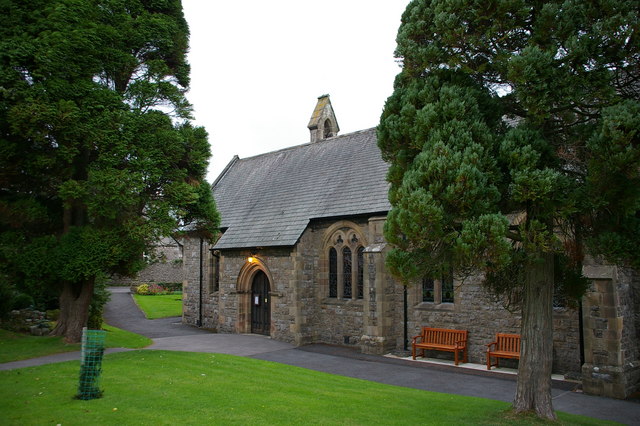


Milnthorpe, United Kingdom
Milnthorpe is a town of 2,199 people in England, United Kingdom.
Why visit Milnthorpe
Townapedia lists 8 museums and landmarks, 2 parks and trails, 16 places to eat, 1 place to stay and 10 attractions in and around town.
Highlights include Heron Corn Mill, Levens Hall, Lakeland Wildlife Oasis and Clawthorpe Fell.
Weather in Milnthorpe
Forecast from MET Norway (CC BY 4.0). Full forecast
About Milnthorpe
Milnthorpe is a village, civil parish, and former market town in Westmorland and Furness, Cumbria, England. It is 7 miles (11 km) south of Kendal. Historically in the county of Westmorland and on the A6, the village contains several old hostelries and hosts a market every Friday. The parish, which includes the village of Ackenthwaite, had a population of 2,199 according to the 2011 Census.
From the Wikipedia article Milnthorpe (this version), under CC BY-SA 4.0.
Photos of Milnthorpe


Things to do10


Museums and landmarks8


Levens Hall
Museum · 2.2 mi
Grade I listed historic house museum in South Lakeland, United Kingdom

Dog Hole Cave
Monument and historic site · 1.4 mi
Cave and archaeological site in Cumbria, United Kingdom
Parks, trails and playgrounds2

Lakeland Wildlife Oasis
Park · 2.5 mi
Small zoological collection near the town of Milnthorpe, Cumbria, England

Restaurants and cafes16
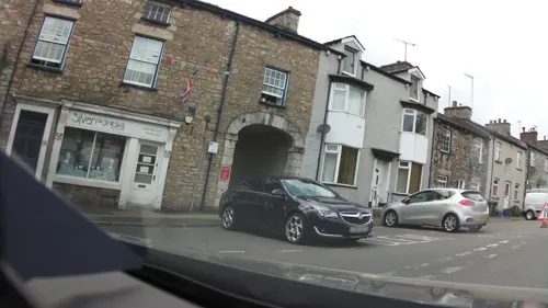
Beetham Nurseries Cafe
Cafe · 1.1 mi
Pool Darkin Lane, Beetham
Mo-Sa 09:30-17:00; Su 10:00-16:00
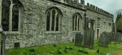

Rivers and Roads
Cafe · Coffee Shop, Cake, Sandwich · 0.4 mi
Park Road, Milnthorpe
Mo-Th 08:00-16:00; Fr 08:00-21:00; Sa 09:00-21:00; Su 09:00-17:00


Main Street Chip Shop
Fast food · Fish And Chips
19 Main Street, Milnthorpe
Tu-Th 16:30-20:00; Fr 12:00-13:30,16:30-20:30; Sa 16:30-20:30; Su,Mo off
4 more on the map.
History
Milnthorpe was granted a market charter in 1334, although this lapsed in the 1920s.
Milnthorpe was part of the township of Heversham-with Milnthorpe, and was in Heversham parish until 1896. The 19th-century Church of St Thomas, which overlooks The Green and The Square, was designed by Kendal architect George Webster.
Milnthorpe became a centre of business and activity because it was originally a port, using the River Bela and estuary (now only navigable to Arnside) and it remains a significant commercial centre for the area.
From the History section of Milnthorpe on Wikipedia, under CC BY-SA 4.0.
More about Milnthorpe
Economy
Tourism is a major contributor to the local economy. Milnthorpe had coaching inns on the main road north, the modern A6. The village used to be a major traffic bottleneck before the opening of the M6 motorway in 1970, and the A590/A591 Kendal link road a few years later. The congestion at Milnthorpe' cross roads was notoriously amongst the worst in the North West. The village is just outside the Arnside and Silverdale National Landscape (formerly AONB), with the River Bela forming its northern boundary.
The popular children's drink Um Bongo was made in Milnthorpe by Libby's in the 1980s. Nestlé plant sauces and fruit juice were made by Libby, which opened in 1935. The site made Libby's Creamed Rice and evaporated milk, until production was moved to southern Derbyshire in 1985. The Nestlé plant closed around early 1995, and made Crosse & Blackwell salad dressing, and tomato ketchup.
Milnthorpe is the home of Duralon Combs, a comb manufacturing business over 300 years old. Big Fish Internet Ltd (formerly BF Internet, now trading as BFI) was founded in Milnthorpe in 1996 and is now located 2 miles (3.2 km) away in Sandside; it is the longest-established web design company in the UK. The village has a branch of the family-owned supermarket Booths.
From the Wikipedia article Milnthorpe, under CC BY-SA 4.0.
Notable people from Milnthorpe
- John TaylorBritish-born American religious leader and third president of The Church of Jesus Christ of Latter-day Saints (1808–1887)
Born in Milnthorpe, according to Wikidata (CC0). Each name links to its Wikipedia article.
Where to stay1
Churches and places of worship10
Shopping4
Gas and EV charging1
Schools, colleges and libraries5
Healthcare1
Map of Milnthorpe
58 places. The map loads OpenStreetMap tiles when you open it.
Getting there and nearby towns
Walney Aerodrome (BWF) is the nearest airport with scheduled flights listed in OpenStreetMap, 21 miles away.
- Silverdale 5 mi southwest, about 7 min by car
- Warton 6 mi south, about 9 min by car
- Kendal 7 mi north, about 11 min by car
- Kirkby Lonsdale 7 mi east, about 11 min by car
- Burneside 9 mi north, about 14 min by car
- Flookburgh 9 mi southwest, about 14 min by car
- Staveley 10 mi north, about 17 min by car
- Morecambe 12 mi south, about 19 min by car
- Sedbergh 12 mi northeast, about 19 min by car
- Lancaster 13 mi south, about 20 min by car
Drive times are estimates from straight-line distance, not routes.
Towns near Milnthorpe


Keep exploring
Local news
Headlines from INDB.
Reviews, tips and questions
Loading what members have shared...
Sources and licences
- GeoNames (CC BY 4.0): population, coordinates, regions and time zone
- Mapillary (see each image): photos
- OpenStreetMap contributors (ODbL 1.0): places, airports, map data
- Wikidata (CC0 1.0): elevation, founding date, time zone, website, landmarks and historic places
- Wikimedia Commons (see each image): photos
- Wikipedia (CC BY-SA 4.0): overview and history text
Photo credits
- Flush Bracket at Milnthorpe, Library, Ray Hutchings, CC BY-SA 4.0
- Milnthorpe Library - panoramio, flipflopnick, CC BY-SA 3.0
- Lakeland Wildlife Oasis Entrance 2020, TheArmchairSoldier, CC BY-SA 4.0
- St James' Church, Arnside, Alexander P Kapp, CC BY-SA 2.0
- St Patrick's Church, Preston Patrick, Jon Clark, CC BY-SA 2.0
- St Michael's Church, Beetham, Alexander P Kapp, CC BY-SA 2.0
- St Peter's Church, Heversham, Alexander P Kapp, CC BY-SA 2.0
- Milnthorpe church, David Trochos, CC BY 3.0
- 15 Carrs Cottage - panoramio, flipflopnick, CC BY-SA 3.0
- Harmony Hill houses - panoramio (1), flipflopnick, CC BY-SA 3.0
- Harmony Hill houses - panoramio, flipflopnick, CC BY-SA 3.0
- Christ the King Catholic church - panoramio, flipflopnick, CC BY-SA 3.0
- Harmony Hall - panoramio, flipflopnick, CC BY-SA 3.0
- Oakleigh House - panoramio, flipflopnick, CC BY-SA 3.0
- Lea Bank - panoramio, flipflopnick, CC BY-SA 3.0
- Holly House - panoramio, flipflopnick, CC BY-SA 3.0
- Laburnum House - panoramio, flipflopnick, CC BY-SA 3.0
- Glasgow House - panoramio, flipflopnick, CC BY-SA 3.0
- Red Barn - panoramio (1), flipflopnick, CC BY-SA 3.0
- Victoria Cottages - panoramio, flipflopnick, CC BY-SA 3.0
- Haverflatts Lane - panoramio, flipflopnick, CC BY-SA 3.0
- Belvedere - panoramio (6), flipflopnick, CC BY-SA 3.0
- Pillars - panoramio, flipflopnick, CC BY-SA 3.0
- The Pillars - Hordale - panoramio, flipflopnick, CC BY-SA 3.0
- BT3132, Ray Hutchings, CC BY-SA 4.0
- Coach and Horses pub - panoramio, flipflopnick, CC BY-SA 3.0
- Local links library - panoramio, flipflopnick, CC BY-SA 3.0
- 1 Haverflatts Lane - panoramio, flipflopnick, CC BY-SA 3.0
- Market Square - panoramio (3), flipflopnick, CC BY-SA 3.0
- Heron Theatre, Beetham, Rob Burke, CC BY-SA 2.0
- Heron Corn Mill, Ashley Dace, CC BY-SA 2.0
- Levens hall front, Jhsteel, CC BY-SA 3.0
- Street-level photo, skifans, CC BY-SA 4.0
- Street-level photo, mfk, CC BY-SA 4.0
- Street-level photo, southglos, CC BY-SA 4.0
- Street-level photo, southglos, CC BY-SA 4.0
- Street-level photo, IpswichEdits, CC BY-SA 4.0
- Street-level photo, IpswichEdits, CC BY-SA 4.0
- Street-level photo, mfk, CC BY-SA 4.0
- Street-level photo, southglos, CC BY-SA 4.0
- Street-level photo, IpswichEdits, CC BY-SA 4.0
- Street-level photo, jethro10, CC BY-SA 4.0
- Street-level photo, southglos, CC BY-SA 4.0
- Street-level photo, jethro10, CC BY-SA 4.0
- Street-level photo, mfk, CC BY-SA 4.0
- Street-level photo, skifans, CC BY-SA 4.0
- Street-level photo, southglos, CC BY-SA 4.0
- Street-level photo, jethro10, CC BY-SA 4.0


Page built November 10, 2026. Spotted a mistake? Tell us or suggest a place.