




Kingston Bagpuize, United Kingdom
Kingston Bagpuize is a town of 2,349 people in England, United Kingdom.
Why visit Kingston Bagpuize
Townapedia lists 1 museum or landmark, 3 parks and trails, 4 places to eat and 4 attractions in and around town.
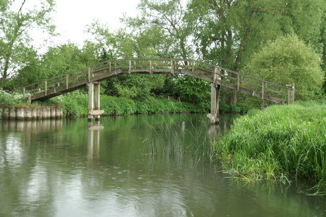
Highlights include Hart's Weir Footbridge, New Bridge and Hitchcopse Pit.
Weather in Kingston Bagpuize
Forecast from MET Norway (CC BY 4.0). Full forecast
About Kingston Bagpuize
Kingston Bagpuize () is a village in the civil parish of Kingston Bagpuize with Southmoor, in the Vale of White Horse, Oxfordshire, England. It is about 6 miles (10 km) west of Abingdon. It was part of Berkshire, until the 1974 boundary changes transferred it to Oxfordshire. The 2011 Census recorded the population of Kingston Bagpuize with Southmoor as 2,349.
From the Wikipedia article Kingston Bagpuize (this version), under CC BY-SA 4.0.
Things to do4

Hart's Weir Footbridge
Bridge · 2.1 mi
Footbridge in Northmoor, Oxfordshire, England, UK

New Bridge
Bridge · 2.0 mi
Bridge between Northmoor and Longworth, Oxfordshire, England


Museums and landmarks1

Parks, trails and playgrounds3


Restaurants and cafes4



History
Two charters dating to the reign of King Edward the Martyr (975-978) grant land at Kingston Bagpuize, then called Cingestune, to Abingdon Abbey and Bishop Ælfstan, probably of Ramsbury. The authenticity of the charters is disputed. The toponym Kingston Bagpuize is derived from the village's original name Kingston plus the surname of Ralph de Bachepuz, a Norman nobleman from Bacquepuis in Normandy who aided William of Normandy in the Norman Conquest of England in 1066. The Church of England parish church of Saint John the Baptist was designed by John Fidel of Faringdon and built in 1799–1800. The building was remodelled in 1882 to the designs of Edwin Dolby. Kingston Bagpuize House was built around 1660, but extensively re-modelled in about 1720. In the 20th century it was the home of John Buchan, 2nd Baron Tweedsmuir, the son of the novelist John Buchan, 1st Baron Tweedsmuir.
Read more of the history
In the Second World War there was a satellite airfield of RAF Abingdon east of the village called RAF Kingston Bagpuize. Remnants of the control tower are still visible near the cricket club. The lower part of the avenue of trees leading down from Kingston Bagpuize House were cut down during this time for aircraft safety. Evidence of this is that the trees at the east end of the avenue are shorter. The ancient parish of Kingston Bagpuize was a strip parish, extending from the River Thames in the north in a thin strip to the River Ock in the south. It became a civil parish in 1866. On 1 April 1971 it was merged with the civil parish of Draycott Moor to form the parish of Kingston Bagpuize with Southmoor. In 1961 the parish had a population of 166.
From the History section of Kingston Bagpuize on Wikipedia, under CC BY-SA 4.0.
More about Kingston Bagpuize
Geography
The village is next to the junction of the A420 (Oxford–Swindon) and A415 (Abingdon–Witney) main roads. It is contiguous with Southmoor village to the west and about 1 mile (1.6 km) southeast of Longworth village.
From the Wikipedia article Kingston Bagpuize, under CC BY-SA 4.0.
Notable people from Kingston Bagpuize
- Billy YensonEnglish footballer (1880-1944)
Born in Kingston Bagpuize, according to Wikidata (CC0). Each name links to its Wikipedia article.
Churches and places of worship6
Shopping2
Schools, colleges and libraries2
Map of Kingston Bagpuize
22 places. The map loads OpenStreetMap tiles when you open it.
Getting there and nearby towns
RAF Brize Norton (BZZ) is the nearest airport with scheduled flights listed in OpenStreetMap, 9 miles away.
- Standlake 3 mi north, about 5 min by car
- Marcham 3 mi east, about 6 min by car
- Aston 5 mi northwest, about 8 min by car
- Abingdon 6 mi east, about 10 min by car
- Wantage 6 mi south, about 10 min by car
- Steventon 6 mi southeast, about 9 min by car
- Ducklington 7 mi northwest, about 11 min by car
- Sutton Courtenay 7 mi southeast, about 11 min by car
- Witney 8 mi north, about 12 min by car
- Oxford 9 mi northeast, about 14 min by car
Drive times are estimates from straight-line distance, not routes.
Towns near Kingston Bagpuize


Keep exploring
Local news
Headlines from INDB.
Reviews, tips and questions
Loading what members have shared...
Sources and licences
- GeoNames (CC BY 4.0): population, coordinates, regions and time zone
- Mapillary (see each image): photos
- OpenStreetMap contributors (ODbL 1.0): places, airports, map data
- Wikidata (CC0 1.0): elevation, founding date, time zone, website, landmarks and historic places
- Wikimedia Commons (see each image): photos
- Wikipedia (CC BY-SA 4.0): overview and history text
Photo credits
- Hart's Weir Footbridge, Ian Paterson, CC BY-SA 2.0
- Newbridge, Oxfordshire, Bencherlite, CC BY-SA 3.0
- Tenfoot Bridge, Pierre Terre, CC BY-SA 2.0
- KingstonBagpuize StJohnBaptist, Motacilla, CC BY-SA 3.0
- Longworth StMary SE3 (cropped), Motacilla, CC BY-SA 4.0
- St. Giles church, Standlake (8237316219), Dave_S. from Witney, England, CC BY 2.0
- Street-level photo, RyanBush, CC BY-SA 4.0
Page built November 10, 2026. Spotted a mistake? Tell us or suggest a place.