


Abingdon, United Kingdom
Abingdon is a town of 38,676 people in England, United Kingdom.
Why visit Abingdon
Townapedia lists 19 museums and landmarks, 47 parks and trails, 77 places to eat, 7 places to stay and 14 attractions in and around town.
Highlights include Abingdon Bridge, Abingdon Lock, Abingdon County Hall Museum and Grave of George Orwell.
Weather in Abingdon
Forecast from MET Norway (CC BY 4.0). Full forecast
About Abingdon
Abingdon-on-Thames, commonly known as Abingdon, is a historic market town and civil parish on the River Thames in the Vale of the White Horse district of Oxfordshire, England. The historic county town of Berkshire, the area was occupied from the early to middle Iron Age and the remains of a late Iron Age and Roman defensive enclosure lies below the town centre. Abingdon Abbey was founded around 676 AD, giving its name to the emerging town. In the 13th and 14th centuries, Abingdon was an agricultural centre with an extensive trade in wool, alongside weaving and the manufacture of clothing.
From the Wikipedia article Abingdon-on-Thames (this version), under CC BY-SA 4.0.
Travel tips from other travellers: Abingdon on Wikivoyage (CC BY-SA 4.0).
Photos of Abingdon


Things to do14

Abingdon Bridge
Bridge
Bridge over the River Thames at the town of Abingdon-on-Thames, England


Clifton Hampden Bridge
Bridge · 3.3 mi
Bridge in Clifton Hampden, South Oxfordshire, England, UK


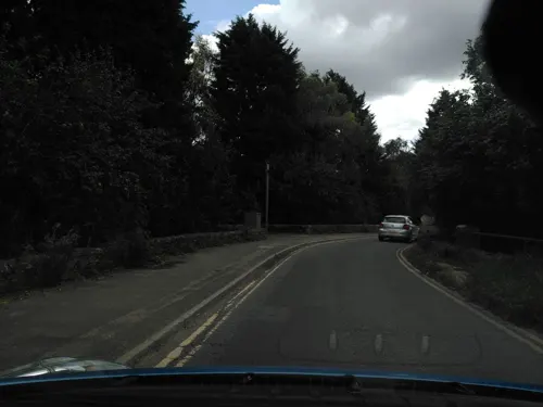
Sutton Bridge
Bridge · 1.7 mi
Grade II listed bridge in Oxfordshire, England, UK



The Northcourt
Cinema and theater · 0.8 mi
Music Venue & Public Bar based at a Sports Club
Northcourt Road
2 more on the map.
Museums and landmarks19

Abingdon County Hall Museum
Museum
Local Authority Museum in South East England, United Kingdom
Market Place
Tu-Su 10:00-16:00; Dec 24-Jan 02 off


Jarn Mound
Monument and historic site · 3.2 mi
Artificial hill in Oxfordshire, England

Pendon Museum
Museum · 3.6 mi
Museum in Oxfordshire, England, United Kingdom
7 more on the map.
Parks, trails and playgrounds47

Dry Sandford Pit
Park · 2.3 mi
UK Site of Special Scientific Interest
Lashford Lane Fen
Park · 3.0 mi
Nature reserve in Dry Sandford, Oxfordshire, UK
Parsonage Moor
Park · 2.8 mi
Nature reserve in Oxfordshire, England, UK



35 more on the map.
Restaurants and cafes77
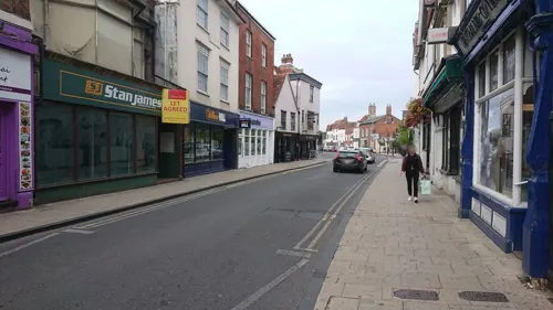
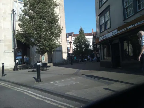
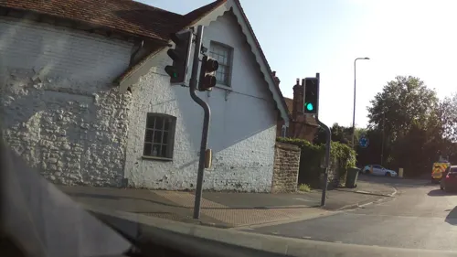
White Horse
Bar and pub · 0.5 mi
189 Ock Street, Abingdon
Mo-Th 12:00-23:00; Fr,Sa 12:00-24:00; Su 12:00-22:00
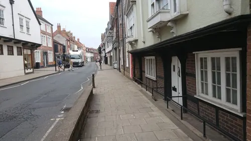
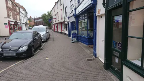
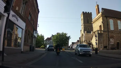
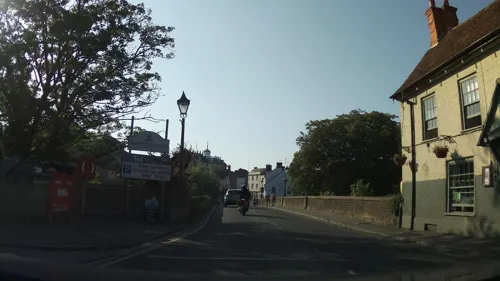
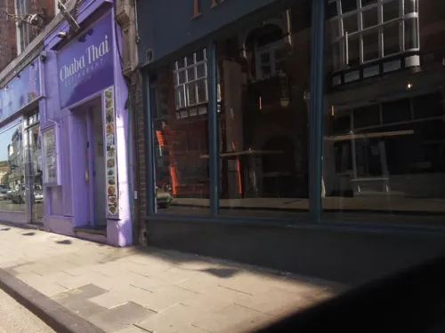
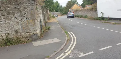
65 more on the map.
History
A Neolithic stone hand axe was found at Abingdon. Petrological analysis in 1940 identified the stone as epidotised tuff from Stake Pass in the Lake District, 250 mi (400 km) to the north. Stone axes from the same source have been found at Sutton Courtenay, Alvescot, Kencot and Minster Lovell. A Neolithic causewayed enclosure was found in Abingdon, dating to the 36th or 37th century BC. It was found in 1926 while quarrying for gravel, and was partly excavated in 1926 and 1927 by E.T. Leeds. Subsequent excavations took place in 1954 and 1963.
Abingdon has also been occupied from the early to middle Iron Age and the remains of a late Iron Age defensive enclosure (or oppidum) lie below the town centre. The oppidum was in use throughout the Roman occupation. A Roman villa and subsequent Saxon farmstead buildings have been excavated at Barton Court Farm.
Read more of the history
Abingdon Abbey was founded in Saxon times, possibly around 676, but its early history is confused by numerous legends, invented to raise its status and explain the place name. The name seems to mean 'Hill of a man named Æbba, or a woman named Æbbe', possibly the saint to whom St Ebbe's Church in Oxford was dedicated (Æbbe of Coldingham or a different Æbbe of Oxford). However, Abingdon stands in a valley and not on a hill. It is thought that the name was first given to a place on Boars Hill above Chilswell, and the name was transferred to its present site when the Abbey was moved. In 1084, William the Conqueror celebrated Easter at the Abbey and it is possible that his son Henry I received some schooling at the abbey.
In the 13th and 14th centuries, Abingdon was a flourishing agricultural centre with an extensive trade in wool and a famous weaving and clothing manufacturing industry. The abbot seems to have held a market from very early times and charters for the holding of markets and fairs were granted by various sovereigns, from Edward I to George II. In 1337 there was a famous riot in protest at the Abbot's control of this market in which several of the monks were killed. After the abbey's dissolution in 1538, the town sank into decay.
In 1556, upon receiving a representation of its pitiable condition, Mary I granted a charter incorporating the town as a borough, governed by a mayor, two bailiffs, twelve chief burgesses and sixteen secondary burgesses, the mayor to be clerk of the market, coroner and a JP. The present Christ's Hospital originally belonged to the Guild of the Holy Cross, on the dissolution of which Edward VI founded the almshouses instead, under its present name.
The borough elected one member of parliament; this right would continue until the Redistribution of Seats Act 1885. The 1556 charter also catered for the appointment of a town clerk and other officers, and the borough boundaries were described in detail. Later charters, from Elizabeth I, James I, James II, George II and George III, made no considerable change. James II changed the style of the corporation to that of a mayor, twelve aldermen and twelve burgesses.
Abingdon became the county town of Berkshire sometime after receiving its charter in 1556. Assize courts were held in Abingdon from 1570, but in the 17th century it was vying with Reading for county town status. The county hall and court house were built between 1678 and 1682, to assert this status. The building, now the Abingdon County Hall Museum, was reputedly designed by Christopher Kempster, who worked with Sir Christopher Wren.
Abingdon borough police was the police force responsible for policing the Borough until 1889. It was formed as a result of the Municipal Corporations Act 1835. The force was amalgamated into the Berkshire Constabulary following the Local Government Act 1888, which required all boroughs with populations of less than 10,000 to amalgamate their police forces with their adjoining county constabulary. Today, the area is policed by the successor to Berkshire Constabulary, Thames Valley Police.
In 1790 Abingdon Lock was built, replacing navigation via the Swift Ditch. In 1810, the Wilts & Berks Canal opened, linking Abingdon with Semington on the Kennet and Avon Canal. Abingdon became a key link between major industrial centres such as Bristol, London, Birmingham and the Black Country. In 1856 the Abingdon Railway opened, linking the town with the Great Western Railway at Radley. However, Abingdon's failure to engage fully with the railway revolution, accepting only a branch line, sidelined the town in favour of Reading which became the County Town in 1869.
The Wilts & Berks Canal was abandoned in 1906 but a voluntary trust is now working to restore and re-open it. Abingdon railway station was closed to passengers in September 1963. The line remained open for goods until 1984, including serving the MG car factory, which opened in 1929 and closed in October 1980 as part of a British Leyland rationalisation plan. The nearest railway station is Radley, two miles (3.2 km) away. Much of the original Abingdon branch line is now a cycle path, whilst the land on which the station stood has been extensively redeveloped, and is now the site of a large Waitrose store and surrounded by a large number of new flats and houses.
From the History section of Abingdon-on-Thames on Wikipedia, under CC BY-SA 4.0.
More about Abingdon
Geography
Abingdon is 6 miles (10 km) south of Oxford, 12 mi (19 km) south-east of Witney and 19 mi (31 km) north of Newbury in the flat valley of the Thames on its west (right) bank, where the small river Ock flows in from the Vale of White Horse. It is on the A415 between Witney and Dorchester, adjacent to the A34 trunk road, linking it with the M4 and M40 motorways. The B4017 and A4183 also link the town, both being part of the old A34 and often heavily congested. Local bus services to Oxford and the surrounding areas are run by the Oxford Bus Company, its sister company Thames Travel and smaller independent companies.
Abingdon no longer has a rail service. However, in recent years, urban expansion has brought Radley railway station close to the town's northeastern limits. The small, primarily stopping-service, railway stations at Culham and Radley are both just over two miles (3.2 km) from the town centre. Abingdon's eastern ring-road and newest suburbs are connected by footpath and cycleway from Radley.
Economy
Malting and brewing had been carried out for centuries in Abingdon, and by Victorian times there were many malthouses in the town. Eventually, the Morland Brewery predominated. It had been established by a farmer, John Morland in 1711. Morland's most famous ale was Old Speckled Hen, named after an early prototype MG car. Greene King Brewery bought Morland for £182 million in 1999, closed the brewery and moved production to Bury St Edmunds in Suffolk. The site of the brewery has been redeveloped into housing. The Maltings was demolished and is now a mixed residential area and council offices. In 2010, a craft brewery, Loose Cannon, reinstated brewing in the town at the Drayton Road Industrial Estate and sells its beers locally, including on draught at some local pubs.
Arts and culture
Bun-throwing is an Abingdon tradition that began with the 1761 Coronation of King George III. This longstanding tradition of the town has local dignitaries throwing buns (5,000 buns in 2018) from the roof of the Abingdon County Hall Museum into crowds assembled in the market square below on specific days of celebration (such as royal marriages, coronations and jubilees). The museum has a collection of the buns, dried and varnished, dating back to bun-throwings of the 19th century. To date there have been 35 bun-throwing events. Since 2000, there have been bun-throwing ceremonies to commemorate the Millennium, the Golden Jubilee of Queen Elizabeth II in 2002, the 450th anniversary of the town's being granted a royal charter in 2006, the Royal Wedding of Prince William and Catherine Middleton in 2011, the Diamond Jubilee of Elizabeth II in 2012, the centenary of the end of the World War I in November 2018 and the Platinum Jubilee of Elizabeth II in 2022.
Education
Abingdon School: independent, 11–18 and Abingdon Preparatory School 4–13, forming the Abingdon Foundation).
The Consortium: local authority, mixed, a partnership of schools including Abingdon and Witney College and the following secondary schools:
Our Lady's Abingdon: private, mixed, 3–18. Closed as of August 2025.
From the Wikipedia article Abingdon-on-Thames, under CC BY-SA 4.0.
Notable people from Abingdon
 Philip SelwayEnglish drummerPhoto: Raph_PH, CC BY 4.0
 William PacaAmerican judge (1740–1799)Photo: United States District Court for the..., Public domain
 Francis MaudeBritish politician (born 1953)Photo: ©House of Lords / photography by Roger Harris, CC BY 3.0
 Edward MooreEnglish dramatist and writer; (1712-1787)Photo: Charles Grignion engraving after..., Public domain
 Kate EdgerNew Zealand university graduate, educationalist, community workerPhoto: Randolph.hollingsworth, CC BY-SA 4.0
 Charles Abbot, 1st Baron ColchesterBritish barrister and politician (1757-1829)Photo: John Hoppner, Public domain
 John HoltEnglish lawyer and Lord Chief Justice of EnglandPhoto: Richard van Bleeck, Public domain
 Tom HingleyBritish singerPhoto: Cridders (Clare Cridland), CC BY 2.0
- Dean WhiteheadEnglish association football player
- Dorothy RichardsonBritish writer (1873–1957)
- Edmund of AbingdonArchbishop of Canterbury and saint
- Vivienne ChandlerFrench actress (1947–2013)
Born in Abingdon, according to Wikidata (CC0). Each name links to its Wikipedia article.
Where to stay7
Churches and places of worship18
Shopping18
Gas and EV charging3
Schools, colleges and libraries22
Healthcare10
Map of Abingdon
235 places. The map loads OpenStreetMap tiles when you open it.
Getting there and nearby towns
RAF Benson (BEX) is the nearest airport with scheduled flights listed in OpenStreetMap, 9 miles away.
- Didcot 5 mi south, about 7 min by car
- Cowley 5 mi northeast, about 9 min by car
- Oxford 6 mi north, about 9 min by car
- Wantage 8 mi southwest, about 13 min by car
- Wallingford 8 mi southeast, about 13 min by car
- Kidlington 10 mi north, about 17 min by car
- Witney 12 mi northwest, about 19 min by car
- Thame 14 mi east, about 23 min by car
- Carterton 15 mi northwest, about 24 min by car
- Bicester 17 mi north, about 27 min by car
Drive times are estimates from straight-line distance, not routes.
Towns near Abingdon


Keep exploring
Local news
Headlines from INDB.
Reviews, tips and questions
Loading what members have shared...
Sources and licences
- GeoNames (CC BY 4.0): population, coordinates, regions and time zone
- Mapillary (see each image): photos
- OpenStreetMap contributors (ODbL 1.0): places, airports, map data
- Wikidata (CC0 1.0): elevation, founding date, time zone, website, landmarks and historic places
- Wikimedia Commons (see each image): photos
- Wikipedia (CC BY-SA 4.0): overview and history text
Photo credits
- ThamesAtAbingdon, The original uploader was DJ Clayworth at English Wikipedia ., CC BY-SA 3.0
- Bury Street, Abingdon (2016), Sionk, CC BY-SA 4.0
- Corn Exchange sculpture - Market Place, Abingdon (54030555209), Elliott Brown, CC BY-SA 2.0
- AbingdonBrBu02, Motmit ( talk ), CC BY-SA 3.0
- AbingdonLock01, Motmit, CC BY-SA 3.0
- 2008-05 Appleford Rail Bridge (2), Nancy, CC BY-SA 3.0
- Clifton Hampden Bridge (4) (Nancy), Nancy, CC BY-SA 3.0
- NunehamRlyBridge01, Motmit ( talk ), CC BY-SA 3.0
- Sandford Lock 05, Simon Burchell, CC BY-SA 4.0
- DSCN3060-abingdon-market-hall, William M. Connolley, CC BY-SA 3.0
- Sutton Courtney Church from south, Rob Stallard, CC BY-SA 3.0
- Abingdon School, Abingdon, Oxfordshire, England-23April2011, Reading Tom from Reading, UK, CC BY 2.0
- Abingdon StMichael&AllAngels north, Motacilla, CC BY-SA 4.0
- Abingdon ChristChurch WSW, Motacilla, CC BY-SA 4.0
- GeorgeOrwellGrave, LordHarris, Public domain
- Abingdon StHelen west, Motacilla, CC BY-SA 4.0
- SuttonCourtenay AllSaints south, Motacilla, CC BY-SA 4.0
- Blue Boar Public House, Deryck Chan, CC BY-SA 4.0
- Old Culham Bridge (North Side), MrBalintore, CC BY-SA 4.0
- Detail of Abbey Gate, Abingdon, Decan, CC BY-SA 3.0
- Street-level photo, thx, CC BY-SA 4.0
- Street-level photo, southglos, CC BY-SA 4.0
- Street-level photo, southglos, CC BY-SA 4.0
- Street-level photo, thx, CC BY-SA 4.0
- Street-level photo, thx, CC BY-SA 4.0
- Street-level photo, voschix, CC BY-SA 4.0
- Street-level photo, thx, CC BY-SA 4.0
- Street-level photo, southglos, CC BY-SA 4.0
- Street-level photo, iknowjoseph, CC BY-SA 4.0
- Street-level photo, southglos, CC BY-SA 4.0
- Street-level photo, southglos, CC BY-SA 4.0
- Street-level photo, southglos, CC BY-SA 4.0
- Street-level photo, southglos, CC BY-SA 4.0
- Street-level photo, southglos, CC BY-SA 4.0
- Street-level photo, voschix, CC BY-SA 4.0
- Street-level photo, voschix, CC BY-SA 4.0
- Street-level photo, iknowjoseph, CC BY-SA 4.0
- Street-level photo, thx, CC BY-SA 4.0
- Street-level photo, thx, CC BY-SA 4.0
- Street-level photo, southglos, CC BY-SA 4.0
- Street-level photo, voschix, CC BY-SA 4.0
- Street-level photo, southglos, CC BY-SA 4.0
- Street-level photo, zymurgic, CC BY-SA 4.0
- Street-level photo, thx, CC BY-SA 4.0


Page built November 10, 2026. Spotted a mistake? Tell us or suggest a place.