


Why visit Lancing
Townapedia lists 42 museums and landmarks, 48 parks and trails, 241 places to eat, 12 places to stay and 12 attractions in and around town.
Highlights include Connaught Theatre, Shoreham Beach, Marlipins Museum and Bramber Castle.
Weather in Lancing
Forecast from MET Norway (CC BY 4.0). Full forecast
About Lancing
Lancing is a large coastal village and civil parish in the Adur district of West Sussex, England, on the western edge of the Adur Valley. It occupies part of the narrow central section of the Sussex coastal plain between smaller Sompting to the west, larger Shoreham-by-Sea to the east, and the parish of Coombes to the north. Excluding definitive suburbs it may have the largest undivided village cluster in Britain. However, its economy is commonly analysed as integral to the Brighton/Worthing/Littlehampton conurbation.
From the Wikipedia article Lancing, West Sussex (this version), under CC BY-SA 4.0.
Photos of Lancing


Things to do12

Connaught Theatre
Cinema and theater · 2.3 mi
Theatre in Worthing, England

Shoreham Lighthouse
Lighthouse · 3.2 mi
Lighthouse at Shoreham Harbour, West Sussex, England

Shoreham Tollbridge
Bridge · 1.7 mi
Bridge over the River Adur in West Sussex, England

Worthing Town Hall including Assembly Hall and Worthing Room
Cinema and theater · 2.4 mi
Town hall and theatre/concert hall complex in Worthing, West Sussex, England, UK

Peter Pans Playground
Monument and historic site · 2.1 mi
Amusement park in England


Museums and landmarks42

Marlipins Museum
Museum · 2.0 mi
Museum in West Sussex, England, United Kingdom
36 High Street, Shoreham-by-Sea

Bramber Castle
Monument and historic site · 3.8 mi
Norman castle in Bamber, West Sussex, England, UK
Worthing Museum and Art Gallery
Museum · 2.4 mi
Museum in Worthing, England, United Kingdom

Allied servicemen and women WWI & WWII
Monument and historic site · 1.4 mi
The propeller is from a Martin B-26 Marauder that crashed in the English Channel in June 1944


Farm Building Remaining From Buckingham Farm
Monument and historic site · 2.3 mi

30 more on the map.
Parks, trails and playgrounds48

Beach House Park, Worthing
Park · 2.1 mi
Formal garden in Worthing, England

Mill Hill, Shoreham
Park · 2.5 mi
Nature reserve in West Sussex, England


36 more on the map.
Restaurants and cafes241
The Old Bike Store
Bar and pub · 2.2 mi
65 Brighton Road, Worthing
Tu-Fr 16:00-23:00; Sa 13:00-23:30; Su 13:00-20:00

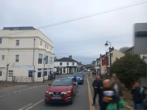
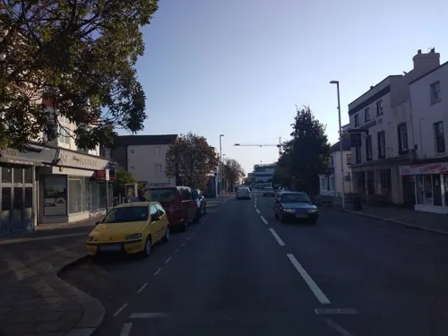



229 more on the map.
History
In 1828, remains of what may be an Iron Age shrine and to its west a later Romano-British temple were found just west of Lancing Ring. The Romano-British temple was located within an oval temenos and seems to have been built in the 1st century AD. A track has existed since Celtic British times which ran from Chanctonbury Ring via Cissbury Ring to Lancing Ring and from then on to a probable ford across the River Adur by the modern Sussex Pad, close to the Old Tollbridge at Old Shoreham. Among this lowest lying farmland to the east of the village proper are remains of medieval salt workings. The Roman road, Stane (Stone) Street, from Noviomagus Reginorum (Chichester) to Novus Portus (probably Portslade near Brighton) also ran through modern North Lancing (along the Street) down to the ford.
Much of the land which is residential was formerly taken up by family-run market gardening businesses growing fruit or flowers for the Brighton Market or Covent Garden in London. The largest businesses were Sparks who grew fruit such as tomatoes and Young's which produced carnations. Chrysanthemums were grown by Frank Lisher on land south of The Finches, in a house that he had built. Nash's fruit growers produced grapes under huge glass cloches that could be rolled into place on a rail track.
Read more of the history
Lancing railway station opened with what is now known as the West Coastway Line in 1849. Between 1908 and 1912 the London, Brighton and South Coast Railway developed its railway wagon and carriage works in the area that is now the Lancing Business Park, closed in 1965 as part of British Rail's Beeching Plan of 1963. The land on which the works were sited was predominantly turned over to this park, which is also known as the Churchill Industrial Estate.
Few buildings pre-dating 1820 are here, however one example is a central former farmhouse, which is now a home named Monks Farm Presbytery on North Road.
Following World War II market gardening gave way to housing as diets became more exotic and more difficult to ripen fruits such as grapes began to be imported in greater numbers; this growth was most rapid between 1945 and 1970, with more muted housing growth following on in most years. The village has a large business park, and many smaller local business establishments. In economics and transport, the suburb forms part of the linear and diverse Brighton/Worthing/Littlehampton conurbation.
From the History section of Lancing, West Sussex on Wikipedia, under CC BY-SA 4.0.
More about Lancing
Education
The local senior school, The Sir Robert Woodard Academy, is located just inside the contiguous village of Sompting. It is a mixed comprehensive of around 1,400 students from ages 11–18. The site was formerly occupied by Boundstone Community College.
In the north-east of the parish on the Downs lies Lancing College, an independent school and major landmark.
There are also three primary schools. Seaside Primary (formerly Freshbrook First School and Thornberry Middle School) is on Freshbrook Road and The Globe Primary (formerly The Willows First School and Oakfield Middle School) is on Irene Avenue. These two schools were formed in 2008-9 when each of the previous middle schools joined with the nearest of the first schools in Lancing. North Lancing Primary School has always been a first and middle school.
From the Wikipedia article Lancing, West Sussex, under CC BY-SA 4.0.
Notable people from Lancing
- Ted Walker1934-2004 poet, short story writer, travel writer, screenwriter, broadcaster
- Desmond CoryBritish writer
- Roderick Langmere Haig-BrownCanadian writer and conservationist (1908–1976)
Born in Lancing, according to Wikidata (CC0). Each name links to its Wikipedia article.
Where to stay12
Churches and places of worship50
Worthing Tabernacle
Church · Evangelical · 2.3 mi
64 Chapel Road, Worthing
Church of the Good Shepherd
Church · Anglican · 1.6 mi
Kings Walk, Shoreham-by-Sea
Shopping36
Gas and EV charging9
Schools, colleges and libraries25
Davison Church of England High School for Girls, Worthing
School · Anglican · 1.6 mi
Selborne Road, Worthing
Healthcare20
Map of Lancing
250 places. The map loads OpenStreetMap tiles when you open it.
Getting there and nearby towns
Brighton City Airport (ESH) is the nearest airport with scheduled flights listed in OpenStreetMap, 1 miles away.
- Shoreham-by-Sea 2 mi east, about 3 min by car
- Worthing 2 mi west, about 4 min by car
- Portslade 5 mi east, about 8 min by car
- Brighton 8 mi east, about 13 min by car
- Rustington 8 mi west, about 13 min by car
- Rottingdean 12 mi east, about 19 min by car
- Seaford 19 mi east, about 31 min by car
- Crawley 21 mi north, about 33 min by car
- Uckfield 21 mi northeast, about 33 min by car
- Selsey 21 mi west, about 34 min by car
Drive times are estimates from straight-line distance, not routes.
Towns near Lancing


Keep exploring
Local news
Headlines from INDB.
Reviews, tips and questions
Loading what members have shared...
Sources and licences
- GeoNames (CC BY 4.0): population, coordinates, regions and time zone
- Mapillary (see each image): photos
- OpenStreetMap contributors (ODbL 1.0): places, airports, map data
- Wikidata (CC0 1.0): elevation, founding date, time zone, website, landmarks and historic places
- Wikimedia Commons (see each image): photos
- Wikipedia (CC BY-SA 4.0): overview and history text
Photo credits
- Lancing Chapel, Operarius, CC BY-SA 3.0 de
- Lancing v Steyning (8162710722), grassrootsgroundswell, CC BY 2.0
- Lancing v Steyning (8162707226), grassrootsgroundswell, CC BY 2.0
- Lancing v Steyning (8162675347), grassrootsgroundswell, CC BY 2.0
- Lancing v Steyning (8162709056), grassrootsgroundswell, CC BY 2.0
- Lancing v Steyning (8162677077), grassrootsgroundswell, CC BY 2.0
- Lancing v Steyning (8162711492), grassrootsgroundswell, CC BY 2.0
- Lancing v Steyning (8162669899), grassrootsgroundswell, CC BY 2.0
- Lancing v Steyning (8162673753), grassrootsgroundswell, CC BY 2.0
- Lancing v Steyning (8162701712), grassrootsgroundswell, CC BY 2.0
- Lancing v Steyning (8162672709), grassrootsgroundswell, CC BY 2.0
- Lancing Tabernacle, North Street, Lancing, The Voice of Hassocks, Public domain
- A slam door passing Lancing signal box, Les Chatfield from Brighton, England, CC BY 2.0
- 20220806 GTR 377422 Lancing, Alex Noble, CC0
- Shoreham beach - Flickr - peganum, peganum from Small Dole, England, CC BY-SA 2.0
- Old Shoreham Bridge, Old Shoreham (IoE Code 297270), The Voice of Hassocks, Public domain
- Worthing Town Hall, The Voice of Hassocks, Public domain
- Shoreham, the Marlipins, Michael Coppins, CC BY-SA 4.0
- Bramber - Bramber Castle - 20220724153836, Michael Coppins, CC BY-SA 4.0
- Coombes church, Oxenhillshaw ( talk ), Public domain
- Lancing College Chapel, John Salmon, CC BY-SA 2.0
- Worthing Tabernacle, Chapel Road, Worthing (June 2013), The Voice of Hassocks, Public domain
- Christ Church, Worthing (from Marine Parade car park roof) (IoE Code 432521), The Voice of Hassocks, Public domain
- Jarvis Hall, Jarvis Lane, Steyning (IoE Code 298766), The Voice of Hassocks, CC0
- St Andrew's Church, West Tarring, Worthing, The Voice of Hassocks, Public domain
- St Andrew's Church, Victoria Road, Worthing, The Voice of Hassocks, CC0
- St Botolph's Church from the north west, Kinnerton, CC BY-SA 3.0
- St Botolph's Church, Heene Road, Worthing, The Voice of Hassocks, CC0
- Connaught Theatre, Worthing, The Voice of Hassocks, Public domain
- Beach House Park, Worthing (Looking Southwest towards War Pigeon Memorial), The Voice of Hassocks, Public domain
- Lancing in the summer Correction, Samwaters at English Wikipedia, Public domain
- Davison High School, Charlesdrakew, Public domain
- Vintners Parrot, Warwick Street, Worthing (IoE Code 433150), The Voice of Hassocks, Public domain
- Worthing Hospital, West Sussex, WSHFT Communications, CC BY-SA 4.0
- Martin B-26 Marauder propellor (6659094463), Hugh Llewelyn, CC BY-SA 2.0
- Shoreham Air Crash Memorial 05, HJ Mitchell, CC BY 4.0
- Lancing College (1392998994), allen watkin from London, UK, CC BY-SA 2.0
- Ropetackle Arts Centre, Shoreham-by-Sea, West Sussex, July 2025 (2), Gazamp, CC BY-SA 4.0
- Street-level photo, rskedgell, CC BY-SA 4.0
- Street-level photo, rskedgell, CC BY-SA 4.0
- Street-level photo, andreste96, CC BY-SA 4.0
- Street-level photo, southglos, CC BY-SA 4.0
- Street-level photo, andreste96, CC BY-SA 4.0
- Street-level photo, andreste96, CC BY-SA 4.0
- Street-level photo, andreste96, CC BY-SA 4.0
- Street-level photo, southglos, CC BY-SA 4.0
- Street-level photo, andreste96, CC BY-SA 4.0
- Street-level photo, andreste96, CC BY-SA 4.0
- Street-level photo, rskedgell, CC BY-SA 4.0
- Street-level photo, andreste96, CC BY-SA 4.0
- Street-level photo, andreste96, CC BY-SA 4.0
- Street-level photo, southglos, CC BY-SA 4.0


Page built November 10, 2026. Spotted a mistake? Tell us or suggest a place.