


Uckfield, United Kingdom
Uckfield is a town of 18,452 people in England, United Kingdom.
Why visit Uckfield
Townapedia lists 3 museums and landmarks, 22 parks and trails, 45 places to eat, 2 places to stay and 1 attraction in and around town.
Highlights include The Picture House Uckfield, Bentley Wildfowl and Motor Museum, Diane Hutt Gallery and Hempstead Meadow.
Weather in Uckfield
Forecast from MET Norway (CC BY 4.0). Full forecast
About Uckfield
Uckfield () is a town in the Wealden District of East Sussex in South East England. The town is on the River Uck, one of the tributaries of the River Ouse, on the southern edge of the Weald.
From the Wikipedia article Uckfield (this version), under CC BY-SA 4.0.
Travel tips from other travellers: Uckfield on Wikivoyage (CC BY-SA 4.0).
Photos of Uckfield

Things to do1

Museums and landmarks3

Bentley Wildfowl and Motor Museum
Museum · 3.2 mi
Visitor attraction at Halland, East Sussex, England


Parks, trails and playgrounds22



West Park
Park · 0.7 mi
Nature reserve in Uckfield, East Sussex, England, UK

10 more on the map.
Restaurants and cafes45

Amira’s Kirchen
Restaurant · Indian
Grange Road
We-Fr 15:00-17:00,Sa-Su 14:00-17:00,Su-Th 17:30-22:00,Fr-Sa 17:30-22:30

Craft Coffee And Roastery
Cafe · Coffee Shop
144 High Street, Uckfield
Mo-Fr 07:30-16:30; Sa 08:00-17:00; Su 09:00-16:00

33 more on the map.
History
A comprehensive historical timeline can be found at A vision of Britain website.
The first mention in historical documents is in the late 13th century. Uckfield developed as a stopping-off point on the pilgrimage route between Canterbury, Chichester and Lewes. The settlement began to develop around the bridging point of the river, including the locally famous Pudding Cake Lane where travellers visited a public house for slices of pudding cake; and the 15th-century Bridge Cottage, the oldest house still standing in Uckfield, now a museum. The town developed in the High Street and in the New Town areas (the latter to the south of the original town centre).
The Eversfield family, who later became prominent in Sussex history, giving their name to the prime waterfront street of St Leonards-on-Sea, first settled in Uckfield from their Surrey beginnings. The family, who later owned the mansion Denne Park in Horsham, which they represented in Parliament, acquired a large fortune through marriage, real estate acquisition and iron founding. Their climb to wealth and prominence was a heady one: in 15th-century Sussex they were described as "yeomen", but within a generation they were already among the first rank of Sussex gentry.
Read more of the history
Church Street was at the heart of the original settlement of Uckfield, near the medieval chapel (built c.1291), which was replaced by the present parish church in 1839. It is situated on an ancient ridgeway route from the direction of Winchester in the west, to Rye and Canterbury in the east. Local hostelries along the route are the Maiden's Head, the King's Head (now the Cinque Ports) or the Spread Eagle. Uckfield was part of the Archbishop's extensive Manor of South Malling.
Church Street contains a number of post-medieval buildings. These include the Old Grammar School (home of the former Uckfield Grammar School, closed in 1930), Bakers Cottage and the Malt House with Malt Cottage (all built before 1700), and Church House with Andertons, Copping Hall and Milton Cottage (all 18th century).
Studies suggest that the cottage dates to around 1436. Between 1500 and 1900, it was inhabited by a number of local families, including local merchants. In October 2014, the Heritage Lottery Fund granted one million pounds to enable the restoration of the cottage. Work started in October 2014, with an estimated completion date of late summer 2015.
From the History section of Uckfield on Wikipedia, under CC BY-SA 4.0.
More about Uckfield
Geography
The town of Uckfield has grown up as a road hub, and on the crossing point of the River Uck. Traffic on the A26 between Royal Tunbridge Wells and Lewes, from the north-east to the south-west, joins with that on the A22 London – Eastbourne road around the town on its bypass; whilst the long-distance cross-country A272 road (the old pilgrimage route) crosses them both north of the town.
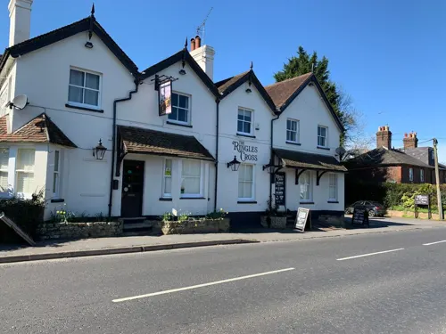
As the town has grown, new housing estates were developed: Hempstead Fields, Harlands Farm, Rocks Park, West Park, Manor Park and Ringles Cross among them.
Parts of Uckfield, owing to its location on the river, have been subject to extensive flooding on a number of occasions, the earliest recorded being in 1852. More recent floods have occurred approximately every nine years: in 1962, 1974, 1989, 1994, 2000 and 2007, although those in 2007 were not as severe as previous floods. Local residents have long been lobbying for flood defences in the town, and when the local Somerfield became a Co-op (now Waitrose), its car park's walls were rebuilt as flood defences with a ramp to access the car park and a watertight pedestrian gate that can be closed when flooding is imminent. It is hoped that this new wall will act as a reservoir to contain the flood water until it recedes, allowing the water to flow back into the river Uck, which runs alongside the carpark.
Arts and culture
The Picture House, an independently run three-screen cinema, was established in 1916 and is one of the oldest in England.
Uckfield FM is a community radio station that supported Uckfield for its four-week festival in June and at Christmas each year. In July 2009 the station was granted a licence by Ofcom to become a full-time community radio station, broadcasting live to Uckfield and the surrounding areas from 1 July 2010. The station was founded by Mike Skinner, Paddy Rea, Gary King and Alan French and now has more than 80 members, who are all voluntary. In the summer of 2008, ITV's Trinny and Suzannah was filmed at the Bird in Eye studios when Mayor Louise Eastwood was the star of the show. In 2014, the station was granted a five-year extension to its licence, taking "Uckfield FM's service through until 2020". As of 1 April 2022, the station expanded its FM coverage area to take in the neighbouring town of Crowborough, and has re-launched as Ashdown Radio.
The festival was originally intended "as a one off Millennium year celebration", from this event it has sought to "advance the public in the arts and in particular, the arts of music, speech, drama and the visual arts". A number of local organisations/events have grown from the festival some of these include The Art Trail, The Film Society & Uckfield FM.
Education
Uckfield College is the secondary school in the town. There are four primary schools: Harlands Primary School, Rocks Park Primary School St Philips Catholic Primary School and Manor Primary School.
From the Wikipedia article Uckfield, under CC BY-SA 4.0.
Notable people from Uckfield
 Ronald SandersonBritish rower (1876–1918)Photo: Andrewrabbott, CC BY-SA 3.0
 John Batcheloranthropologist (1854-1944)Photo: AleksandrGertsen, Public domain
 Veryan WestonBritish musicianPhoto: Tore Sætre, CC BY-SA 4.0
- Kenneth ScottEnglish cricketer (1915-1943)
- Nikki SievwrightEnglish fashion model (1943–2018)
- Gerald Coggercricketer (born 1933)
- Elphinstone BarchardBritish cricketer and barrister
- Frank TuohyEnglish writer
- Emma Lee FrenchAmerican pioneer
- Harry WaltersIpswich photographer
- Candice FarmerEnglish photographer
Born in Uckfield, according to Wikidata (CC0). Each name links to its Wikipedia article.
Where to stay2
Churches and places of worship14
Shopping12
Gas and EV charging5
Schools, colleges and libraries10
Healthcare4
Map of Uckfield
118 places. The map loads OpenStreetMap tiles when you open it.
Getting there and nearby towns
London Gatwick Airport (LGW) is the nearest airport with scheduled flights listed in OpenStreetMap, 18 miles away.
- Brighton 14 mi southwest, about 23 min by car
- Crawley 16 mi northwest, about 25 min by car
- Eastbourne 16 mi southeast, about 26 min by car
- Worthing 23 mi southwest, about 37 min by car
- Maidstone 27 mi northeast, about 44 min by car
- West Wickham 28 mi north, about 45 min by car
- Sutton 29 mi northwest, about 47 min by car
- Croydon 30 mi north, about 48 min by car
- Bexley 33 mi north, about 53 min by car
- London 38 mi north, about 1 h by car
Drive times are estimates from straight-line distance, not routes.
Towns near Uckfield


Keep exploring
Local news
Headlines from INDB.
Reviews, tips and questions
Loading what members have shared...
Sources and licences
- GeoNames (CC BY 4.0): population, coordinates, regions and time zone
- Mapillary (see each image): photos
- OpenStreetMap contributors (ODbL 1.0): places, airports, map data
- Wikidata (CC0 1.0): elevation, founding date, time zone, website, landmarks and historic places
- Wikimedia Commons (see each image): photos
- Wikipedia (CC BY-SA 4.0): overview and history text
Photo credits
- Uckfield High Street, Nigel Freeman, CC BY-SA 2.0
- Milepost Uckfield (3640279277), Simon Harriyott from Uckfield, England, CC BY 2.0
- Uckfield-centrum - panoramio, Stanicka Spirk, CC BY-SA 3.0
- Bentleymm-02, MilborneOne, CC BY-SA 3.0
- Five Ash Down Independent Chapel, The Voice of Hassocks, Public domain
- Uckfield Baptist Church, The Voice of Hassocks, Public domain
- Hempstead Meadow (3), Dudley Miles, CC BY-SA 4.0
- St Margaret the Queen's Church, Buxted Park, The Voice of Hassocks, Public domain
- Buxted Park Hotel, Buxted (NHLE Code 1353483) (October 2010), The Voice of Hassocks, CC BY-SA 3.0
- Holy Cross Church, Church Street, Uckfield (NHLE Code 1028118) (October 2010) (4), Hassocks5489, CC0
- St Michael, Horsted Parva, Poliphilo, CC0
- St Thomas a Becket's Church, Framfield, The Voice of Hassocks, Public domain
- Starý dům ve sněhovém hávu - panoramio, Stanicka Spirk, CC BY-SA 3.0
- Street-level photo, EstSsxKt, CC BY-SA 4.0
- Street-level photo, EstSsxKt, CC BY-SA 4.0
- Street-level photo, EstSsxKt, CC BY-SA 4.0


Page built November 10, 2026. Spotted a mistake? Tell us or suggest a place.