


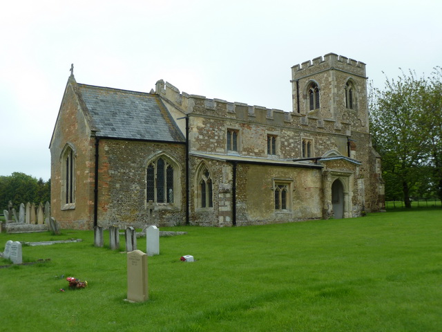


Why visit Langford
Townapedia lists 2 museums and landmarks, 4 parks and trails, 12 places to eat, 1 place to stay and 2 attractions in and around town.
Highlights include Shuttleworth Collection, Stratton Park Moated Enclosure and Arlesey Old Moat and Glebe Meadows.
Weather in Langford
Forecast from MET Norway (CC BY 4.0). Full forecast
About Langford
Langford is a village and civil parish in the Central Bedfordshire district of the county of Bedfordshire, England about 10 miles (16 km) south-east of the county town of Bedford. The 2011 census gives the population as 3,091.
From the Wikipedia article Langford, Bedfordshire (this version), under CC BY-SA 4.0.
Things to do2

Museums and landmarks2

Shuttleworth Collection
Museum · 3.2 mi
Aviation museum in Old Warden, Bedfordshire

Stratton Park Moated Enclosure
Monument and historic site · 2.3 mi
Moat in Biggleswade, Bedfordshire, England, UK
Parks, trails and playgrounds4

Arlesey Old Moat and Glebe Meadows
Park · 2.3 mi
Nature reserve in the United Kingdom

Restaurants and cafes12

The Cock
Bar and pub · 1.5 mi
23 High Street, Biggleswade
"Mo-Th, Sa 12:00-22:00; Fr 12:00-23:00; Su 12:00-19:00"



Biggleswade RUF & Associated Clubs
Bar and pub · 1.1 mi
Langford Road, Biggleswade


Langford Fish Bar
Fast food · Fish And Chips · 0.4 mi
71 Church Street, Biggleswade
History
Of Saxon origin, the village was first mentioned in 944 AD and at one time it had one or more fording points across the river. The name is based on the words long ford from the length of the settlement. At the time of the Domesday Book 1086, the population was around 21. The Church of England parish church is St. Andrew's. Before 1066 the lord of Langford was Lewin, a thane of Edward the Confessor. William the Conqueror granted the village to Walter le Fleming. In 1142 Walter's descendant Simon de Wahull gave land to the Knights Templar, who established themselves as Lords of the Manor of Langford Rectory.
The entry in the Domesday Book reads: Langeford: Walter of Flanders. 2 mills.
On Wednesday 16 November 1960 BAC Jet Provost G-AOUS crashed. The aircraft hit the village playing field, after the wings had snapped beforehand. 34 year old Lt-Cdr John Richard Stanley Overbury, the company test pilot, was killed. He had been at Luton as the test pilot since 1957.
From the History section of Langford, Bedfordshire on Wikipedia, under CC BY-SA 4.0.
More about Langford
Geography
Langford is a straggling village, nearly two miles long, alongside and to the east of the River Ivel. It is about 2.3 miles (4 km) south of Biggleswade, 19.5 miles (31 km) south-west of Cambridge and 38 miles (61 km) north of London.
The East Coast Main Line railway passes through the parish at the eastern edge of the village.
The village is within the Bedfordshire and Cambridgeshire Claylands National Character Area (NCA 88) as defined by Natural England. Central Bedfordshire Council has designated the local landscape as Lower Ivel Clay Valley in the northern section of the village and parish, and Upper Ivel Clay Valley in the southern section. Large, open arable fields are prominent to the east of the village.
Henlow Common and Langford Meadows local nature reserve is beside the Ivel. Lakes formed from old sand and gravel quarries are to the south of the village.
Seven of the ten wind turbines commissioned in 2013 at Biggleswade Wind Farm are within the parish. Each tower is 65 metres (213 ft) tall with four 45 metres (148 ft) blades. To the southeast of the village is a solar farm commissioned in 2015. The two installations have electrical generating capacities of 20 MW and 13 MW respectively.
The village centre is 35 metres (115 ft) above sea level. The land rises to over 70 metres (230 ft) towards Topler's Hill in the east of the parish.
From the Wikipedia article Langford, Bedfordshire, under CC BY-SA 4.0.
Notable people from Langford
- Richard RuttAnglican bishop, then converted to Catholicism (1925-2011)
Born in Langford, according to Wikidata (CC0). Each name links to its Wikipedia article.
Where to stay1
Churches and places of worship10
Gas and EV charging1
Schools, colleges and libraries1
Healthcare1
Map of Langford
34 places. The map loads OpenStreetMap tiles when you open it.
Getting there and nearby towns
London Luton Airport (LTN) is the nearest airport with scheduled flights listed in OpenStreetMap, 13 miles away.
- Henlow 2 mi south, about 3 min by car
- Biggleswade 2 mi north, about 4 min by car
- Meppershall 4 mi southwest, about 6 min by car
- Chicksands 4 mi west, about 6 min by car
- Sandy 5 mi north, about 8 min by car
- Ashwell 5 mi east, about 8 min by car
- Letchworth Garden City 6 mi south, about 9 min by car
- Baldock 6 mi southeast, about 9 min by car
- Shillington 6 mi southwest, about 9 min by car
- Hitchin 7 mi south, about 12 min by car
Drive times are estimates from straight-line distance, not routes.
Towns near Langford


Keep exploring
Local news
Headlines from INDB.
Reviews, tips and questions
Loading what members have shared...
Sources and licences
- GeoNames (CC BY 4.0): population, coordinates, regions and time zone
- OpenStreetMap contributors (ODbL 1.0): places, airports, map data
- Wikidata (CC0 1.0): elevation, founding date, time zone, website, landmarks and historic places
- Wikimedia Commons (see each image): photos
- Wikipedia (CC BY-SA 4.0): overview and history text
Photo credits
- Bristol F2B D8096 flying 1, Kogo, GFDL
- Stratton Park Moated Enclosure opposite the causewayed entrance, Acather96, CC BY-SA 3.0
- Arlesey Old Moat 6, Dudley Miles, CC BY-SA 4.0
- St George's Church, Edworth, Alexander P Kapp, CC BY-SA 2.0
- The Cock, Broom, Acather96, CC BY 3.0
- The White Horse, Broom, Acather96, CC BY 3.0
Page built November 10, 2026. Spotted a mistake? Tell us or suggest a place.