


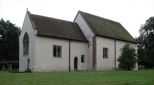

Why visit Baldock
Townapedia lists 9 museums and landmarks, 6 parks and trails, 35 places to eat and 3 places to stay in and around town.
Highlights include North Road, Baldock Museum, Broadway and Norton Common.
Weather in Baldock
Forecast from MET Norway (CC BY 4.0). Full forecast
About Baldock
Baldock is a historic market town in the North Hertfordshire district of Hertfordshire, England. The River Ivel rises from springs in the town. It lies 33 miles (53 km) north of London and 14 miles (23 km) north northwest of the county town of Hertford. Nearby towns include Royston to the northeast, Letchworth and Hitchin to the southwest and Stevenage to the south.
From the Wikipedia article Baldock (this version), under CC BY-SA 4.0.
Travel tips from other travellers: Baldock on Wikivoyage (CC BY-SA 4.0).
Museums and landmarks9


Parks, trails and playgrounds6

Broadway
Park · 2.1 mi
Road and green space in Letchworth, Hertfordshire, England, UK


Norton Common
Park · 1.6 mi
Local nature reserve in Letchworth Garden City, Hertfordshire, United Kingdom

Restaurants and cafes35

The Three Horseshoes
Bar and pub · 1.0 mi
102 Norton Road, Letchworth Garden City
Mo-Sa 12:00-23:00; Su 12:00-22:00


Pixmore Cafe
Cafe · Diner · 1.3 mi
1 Pixmore Avenue, Letchworth Garden City
Mo-Fr 08:00-14:00; Sa 08:00-13:00
Costa
Cafe · Coffee Shop · 1.1 mi
Avenue One, Letchworth Garden City
Mo-Fr 05:30-20:30; Sa 06:00-19:00; Su 07:00-19:00
The Orange Tree
Bar and pub
Norton Road, Baldock
Mo-Th 12:00-14:00,16:00-23:00; Fr-Su 12:00-23:00

23 more on the map.
Where to stay3


History
Baldock has an exceptionally rich archaeological heritage. Palaeolithic, Neolithic and Bronze Age settlements show the site of Baldock has been almost continuously occupied since prehistoric times.
The earliest monument in the area is a narrow cursus, probably from the middle Neolithic. At the beginning of the Iron Age there was a hillfort at Arbury Banks, 5 km to the northeast of Baldock, that dominated the area. In the Late Iron Age (c. 100 BC), the local power base shifted from the hillfort to the vicinity of Baldock. The soil was easily farmed and transportation was more convenient. In the later part of the middle Iron Age (from prior to c.100 BC) Baldock became the site of a large oppidum, arguably the largest such site in Britain. The oppidum in turn became a sizeable Roman settlement, which although not administratively important, seems to have been a significant cultural centre. The Baldock area is also host to the highest quantity of finds of ancient coins in Hertfordshire after the Verulamium region. The site was used until the fifth or sixth century, with some rare sub-Roman pottery found in the vicinity. The Roman settlement gradually disappeared during the so-called "Dark Ages" and left unoccupied through the eleventh century, and resultantly there is no entry for Baldock in the Domesday Book.
Read more of the history
Baldock was founded by the Knights Templar (after whom the town's secondary school is named) as a medieval market town in the 1140s. It was laid out by the Knights Templar on land in the manor of Weston in the hundred of Broadwater, granted by Gilbert de Clare, 1st Earl of Pembroke before his death in 1148. The 1850 tithe map, drawn up before the parish boundaries were extended in the later 19th century, clearly shows the boundaries of the land grant made from the manor of Weston in the 12th century; it is a triangular parcel of land beside the old Roman Road, cut out from an older estate.
The popular story for the origin of the name Baldock is that it is a derivation from the Old French name for Baghdad: Baldac or later Baudac. While Damascus was the farthest location of Templar military activity during the Crusades, they would have been aware of the significance of Baghdad, which was widely regarded as the most prosperous market in the world. Perhaps the Templars hoped that the name would confer a similar prosperity on their own market town in England. Founding contemporaneous documents use the spelling Baudac, but it is first recorded as "Baldac" in the Pipe Rolls of Hertfordshire in 1168.
Walter William Skeat writes in The Place-names of Hertfordshire (1904):
All that remains is to discover the reason for this curious name; nor is it difficult. In Clutterbuck's Hist. of Herts., ii, 267, we find that Baldock was built by the Knights Templars before the reign of Henry III; he cites from Monast. Anglic., ii. 524—"patribus milit. Templi Salomonis … manerio, in qua terra ipsi construxerunt quendam Burgum qui dicitur Baudac." Thus the mystery disappears when we perceive that the name was conferred by the Knights Templars, who were necessarily as familiar with the O.F. name Baldac as they were with that of Solomon. The statement in Salmon's Herts. seems to be quite correct, viz., that Baldock was "an arbitrary name given by the Knights Templars when they made their settlement and built here." He adds that the grant of the land was made to them by Gilbert, Earl of Pembroke, in the time of Stephen; and he refers the name to "Bagdet or Baldach, near Babylon, whence they were ejected by the Saracens."
Others, however, consider it more likely that the Knights Templar used a name already in use, particularly since the location was already a crossroads. In addition the settlement was already thriving as a late Anglo-Saxon part of Weston. Alternative etymologies have been suggested, including Middle English balled, meaning "bald", together with Old English āc, meaning "oak" (the site may have been identified by a large old tree near the Anglo-Saxon graveyard or where the Templar church was built); and a conjectured Old English personal name *Bealdoc, from beald, meaning "bold", with a diminutive -oc suffix. These derivations, however, are not entirely satisfactory.
The modern layout of the town and many buildings in the centre date from the sixteenth century, with the earliest dating from the fourteenth century.
Thanks to its location, the town was a major staging post between London and the north: many old coaching inns still operate as pubs and hotels, and Baldock has a surprising number of pubs for its size. The High Street is very wide, a typical feature of medieval market places where more than one row of buildings used to stand. In the case of Baldock, the bottom of the High Street had three such rows, until Butcher's Row was demolished by the turnpike authorities in the 1770s.
Since the 16th century, Baldock has been a centre for malting, subsequently becoming a regional brewing centre with at least three large brewers still operating at the end of the 19th century, despite a decline in demand for the types of beer produced locally. The 1881 Census records approximately 30 drinking establishments (the town's population was at that time around 1900). Throughout the early 20th century a large number of pubs continued to operate, many of which were sustained by the adjacent and much larger town of Letchworth, which had no alcohol retailers prior to 1958, and had only two pubs and a single hotel bar until the mid-1990s. Its larger population had for many years visited both Baldock and Hitchin for refreshment.
The Wynn almshouses, in the High Street, were founded in 1621 and were endowed "To the World's End" by John Wynne, a cloth merchant from London who left £1000 in his will of 1614 for their upkeep.
From the History section of Baldock on Wikipedia, under CC BY-SA 4.0.
Notable people from Baldock
- Albert IretonBritish boxer (1879-1947)
- Samuel FarrNew Zealand architect (1827–1918)
- Arthur Archdalecricketer (1882-1948)
- Sydney GregsonEngland rugby union player
- Simon SmithEnglish rugby union player
- Reginald RavenEnglish cricketer (1884-1936)
Born in Baldock, according to Wikidata (CC0). Each name links to its Wikipedia article.
Churches and places of worship24
Shopping6
Gas and EV charging6
Schools, colleges and libraries12
Norton St Nicholas CofE (VA) Primary School
School · Anglican · 0.9 mi
Norton Road, Letchworth Garden City
Healthcare5
Map of Baldock
106 places. The map loads OpenStreetMap tiles when you open it.
Getting there and nearby towns
London Luton Airport (LTN) is the nearest airport with scheduled flights listed in OpenStreetMap, 11 miles away.
- Henlow 5 mi northwest, about 8 min by car
- Biggleswade 8 mi northwest, about 12 min by car
- Royston 8 mi northeast, about 13 min by car
- Codicote 10 mi south, about 16 min by car
- Sandy 11 mi northwest, about 17 min by car
- Luton 12 mi southwest, about 20 min by car
- Flitwick 13 mi west, about 21 min by car
- Harpenden 14 mi southwest, about 22 min by car
- Hertford 14 mi south, about 23 min by car
- Ware 14 mi southeast, about 23 min by car
Drive times are estimates from straight-line distance, not routes.
Towns near Baldock


Keep exploring
Local news
Headlines from INDB.
Reviews, tips and questions
Loading what members have shared...
Sources and licences
- GeoNames (CC BY 4.0): population, coordinates, regions and time zone
- Mapillary (see each image): photos
- OpenStreetMap contributors (ODbL 1.0): places, airports, map data
- Wikidata (CC0 1.0): elevation, founding date, time zone, website, landmarks and historic places
- Wikimedia Commons (see each image): photos
- Wikipedia (CC BY-SA 4.0): overview and history text
Photo credits
- Baldock High Street, Richard Kelly, CC BY-SA 4.0
- Baldock Town Hall, Acather96, CC BY 3.0
- Emil Dale Academy, Richard Kelly, CC BY 4.0
- All Saints, Willian, AnemoneProjectors ( talk ), CC BY-SA 2.0
- St Margaret Church Bygrave 359743 00faaf1c, John Salmon, CC BY-SA 2.0
- St Nicholas Norton exterior, Jack1956, CC BY-SA 3.0
- Church of St Paul Letchworth, Jack1956, CC0
- St Mary the Virgin Baldock, Jack1956, CC0
- Holy Trinity Church Weston, Jack1956, CC0
- Church of All Saints, Radwell, AnemoneProjectors ( talk ), CC BY-SA 2.0
- Baldock - Town Hall, High Street, Richard Kelly, CC BY-SA 4.0
- This made me chuckle. A gate in the middle of nowhere at Radwell Meadows near Letchworth. (17014392247), Ben Sale from UK, CC BY 2.0
- Three Horseshoes, Norton (10153773094), Peter O'Connor aka anemoneprojectors, CC BY-SA 2.0
- Street-level photo, wasd42, CC BY-SA 4.0
- Street-level photo, volucris, CC BY-SA 4.0
- Street-level photo, zymurgic, CC BY-SA 4.0
- Street-level photo, volucris, CC BY-SA 4.0
- Street-level photo, zymurgic, CC BY-SA 4.0
- Street-level photo, volucris, CC BY-SA 4.0
- Street-level photo, wasd42, CC BY-SA 4.0
- Street-level photo, wasd42, CC BY-SA 4.0
- Street-level photo, zymurgic, CC BY-SA 4.0
- Street-level photo, wasd42, CC BY-SA 4.0


Page built November 10, 2026. Spotted a mistake? Tell us or suggest a place.