


Harpenden, United Kingdom
Harpenden is a town of 30,674 people in England, United Kingdom.
Why visit Harpenden
Townapedia lists 9 museums and landmarks, 16 parks and trails, 80 places to eat, 1 place to stay and 2 attractions in and around town.
Highlights include Southdown Road Skew Bridge, Shaw's Corner, The Three Horseshoes and Rothamsted Park.
Weather in Harpenden
Forecast from MET Norway (CC BY 4.0). Full forecast
About Harpenden
Harpenden () is a town and civil parish in the City and District of St Albans in the county of Hertfordshire, England. The population of the built-up area was 30,674 in the 2021 census and the population of the civil parish was 31,128. Harpenden is a commuter town, with a direct rail connection to Central London.
From the Wikipedia article Harpenden (this version), under CC BY-SA 4.0.
Travel tips from other travellers: Harpenden on Wikivoyage (CC BY-SA 4.0).
Photos of Harpenden


Things to do2

Southdown Road Skew Bridge
Bridge · 0.8 mi
Arch bridge in Harpenden, St. Albans, Hertfordshire, England, UK

Museums and landmarks9

Shaw's Corner
Museum · 4.0 mi
Writer's house museum in Ayot St Lawrence, Hertfordshire, England, UK



Beech Bottom Dyke
Monument and historic site · 3.6 mi
Iron Age ditch in St Albans, Hertfordshire, England, UK
Parks, trails and playgrounds16

Rothamsted Park
Park · 0.4 mi
Public park in Harpenden, Hertfordshire
24/7


Redbourn Golf Club
Golf course · 1.5 mi
18 hole Par 70 Ver Course & 9 hole Par 27 Kinsbourne Course
Kinsbourne Green Lane, St Albans


Harpenden Common Golf Course
Golf course · 1.4 mi
Cravells Road, Harpenden

4 more on the map.
Restaurants and cafes80

Inn on the Green
Bar and pub
18-20 Leyton Road, Harpenden
Mo-Th 10:00-23:00; Fr,Sa 10:00-24:00; Su 12:00-22:30
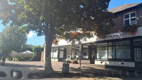
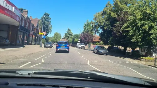
Bangkok Lounge
Restaurant · Thai
80 High Street, Harpenden
Tu-Th,Su 12:00-14:30,17:30-22:30; Fr,Sa 12:00-16:30,17:30-23:00
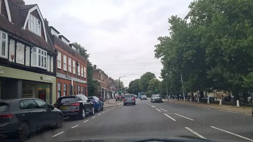
Caffè Nero
Cafe · Coffee Shop
High Street, Harpenden
Mo-Fr 07:00-17:30; Sa 07:30-17:30; Su 08:00-17:00
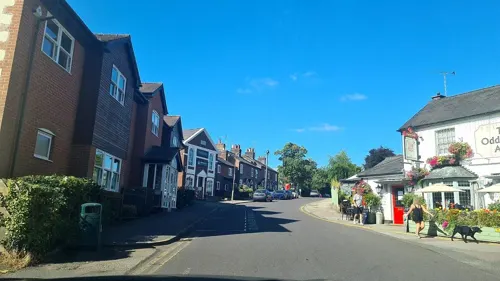
Giggling Squid
Restaurant · Tapas, Thai
Amenbury Lane, Harpenden
Mo-Th 12:00-22:00; Fr,Sa 12:00-22:30; Su 12:00-21:30


Bentozo
Restaurant · Japanese · 0.9 mi
131 Southdown Road, Harpenden
Mo-Th 11:00-14:15,17:00-20:45; Fr-Sa 11:00-14:15,17:00-21:15
Harpenden Grill & Kebab
Restaurant · Turkish
36 Station Road, Harpenden
Mo-Th 13:00-22:00; Fr-Sa 13:00-23:00; Su 14:00-22:00
68 more on the map.
History
There is evidence of pre-Roman Belgic farmers in the area. In 1867 several items were found, including a bronze escutcheon, rams-head shaped mounts and a bronze bowl.
There are Roman remains in the land around Harpenden, such as the site of a mausoleum in the park at Rothamsted. A tumulus near the river Lea was opened in the 1820s and contained a stone sarcophagus of Romano-Celtic origin. Five objects dating from around 150 AD were inside, including a glass jug with a Mediterranean stamp and samian ware dishes used for libations.
The name Harpenden may derive from the Old English hearpedenu, meaning 'harp valley'. Another theory suggests that the name derives from herepæðdenu, meaning 'military road valley'. This theory is considered because Harpenden lies on the ancient St Albans - Luton road.
Up to the 13th century the area of the parish consisted of woodland with small hamlets and single farmsteads around cleared areas called "End" or "Green"; today there are 19 Ends and 18 Greens in the areas of Harpenden and Wheathampstead parishes.
Read more of the history
Harpenden village grew out of Westminster Abbey's gradual clearing of woodland for farming and settlement within its Wheathampstead manor, granted by Edward the Confessor in 1060. The first reference to a parish church was in 1221 (when it was referred to as Harpendene) so it is inferred that the village grew up around then. The church of St Nicholas is the oldest church in the town, originally built as a Chapel of ease in 1217.
Just beyond the southern edge of the town lies Nomansland Common (sometimes simply called No Man's Land), upon which part of the Second Battle of St Albans was fought during the Wars of the Roses. Nomansland Common also saw the first annually contested steeplechase in England, in 1830, when it was organised by Thomas Coleman, and the last fight of 19th-century bare-knuckle fighter Simon Byrne. It was also the haunt of the highwaywoman Lady Katherine Ferrers, better known as the Wicked Lady.
A widespread but now little-known industry of Harpenden was straw-weaving, a trade mainly carried out by women in the 19th century. A good straw weaver could make as much as an agricultural labourer. The straw plaits were taken to specialist markets in St Albans or Luton and bought by dealers to be converted into straw items such as boaters and other hats or bonnets.
The arrival of the railway system from 1860 and the sale of farms for residential development after 1880 radically changed Harpenden's surroundings. First the Dunstable Branch of the Great Northern Railway passed through the Batford area, with a station later named Harpenden East railway station. (This line is now closed and forms a cycle track.) The Midland Railway main line was built in 1868 with a station near the main village, which still exists today, and the listed Southdown Road Skew Bridge nearby. The Harpenden and Hemel Hempstead Railway, known locally as the Nickey Line, was opened in 1877.
Between 1848 and 1914 the common was a regular venue for horse racing. In his History of Hertfordshire in 1879, John Edwin Cussans commented "Notwithstanding that these meetings are under the most unexceptional patronage as regards the Stewards, yet for two days in the year all the London pickpockets, sharpers and blackguards who happen to be out of gaol are permitted to make Harpenden their own and to make travelling in a first-class carriage on the Midland Railway a danger to men and an impossibility to ladies." Golf has been played on the Common since 1894 and it was at that time Harpenden Golf Club was set up by a group of Harpenden people with the help and a financial contribution of £5 from Sir John Bennet Lawes of Rothamsted Manor. The club moved to a new course at Hammonds End in 1931, at which time Harpenden Common Golf Club was formed by those who wanted to remain at the Common. In 1932 Bamville Cricket club was formed and shares part of the Common with the golfers.
Harpenden is the home of Rothamsted Manor and Rothamsted Research (formerly Rothamsted Experimental Station and later the Institute of Arable Crops Research), a leading centre for agricultural research. In front of its main building, which faces the common, is a stone, erected in 1893, commemorating 50 years of experiments by Sir John Bennet Lawes and Joseph Henry Gilbert.
Lawes inherited the family estate at Rothamsted in 1834. He was acknowledged as the father of agricultural science and his early field experiments on Hertfordshire farms led him to patent a phosphate fertiliser, the sales of which enriched him immensely. With the proceeds he established the experimental station, building laboratories in the 1850s. The station continued the development of the artificial fertilisers on which most modern farmers now depend. Some of the long-term 'classical field experiments' begun by Lawes and Gilbert remain in place to this day (such as Broadbalk) representing a unique resource for agricultural and environmental research.
In 1913 the National Children's Home moved to Harpenden with a large site Highfield Oval, which was home to more than 200 children. The site featured a print works, a carpenters' and joiners' shop, a bootmakers’ shop and a farm where boys undertook apprenticeships. Girls were mainly trained in domestic service and some in sewing and office work. The children lived in a "family" of 8-10 children, each run by a sister or house mother. The chapel was gift from Joseph Rank and was built in 1928. The home was run on site until 1985. The site is now the head office of Youth with a Mission, an international Christian missionary organization. The Harpenden Growth Study, one of the earliest longitudinal studies, was overseen by James Mourilyan Tanner and monitored the development of many of the children over a number of years.
From the History section of Harpenden on Wikipedia, under CC BY-SA 4.0.
More about Harpenden
Geography
There are two civil parishes: Harpenden and Harpenden Rural. The town straddles two valleys: a dry valley to the south-west containing the town centre and Harpenden Common, and the valley of the River Lea to the north-east, containing the Batford area.
Owing to its proximity and railway link to London, as well as its high-end housing, Harpenden is an area of extremely high property prices. Land Registry data suggests that the average house price in Harpenden in the first quarter of 2006 was £500,902, compared with £287,277 for the St Albans district generally and £183,598 nationally. The data also indicates that an unusually high proportion of houses in Harpenden are owner-occupied (81.4%, as opposed to 69.6% in the district generally and 66.2% nationally). The average price of a detached house was more than £900,000 in January 2012.
Harpenden has a large number of its streets named after English literary figures on the east side of the town (an area known, unsurprisingly, as the Poets' Corner), including Byron Road, Cowper Road, Kipling Way, Milton Road, Shakespeare Road, Spenser Road, Shelley Court, Tennyson Road, Townsend Road, Masefield Road and Wordsworth Road.
Economy
Harpenden is a prosperous town. In an analysis of the average income tax paid by constituency, Hitchin and Harpenden came tenth. In a list of the most valuable commuter areas compiled by Savills Research, Harpenden came seventh. Good transport links to central London have been cited as a key factor.
Rothamsted Research, the largest agricultural research centre in the UK, is based in Harpenden. It was founded in 1843.
Arts and culture
Harpenden Public Halls was a 410-seat live music and theatre venue in the town centre. It was replaced in 2021 with the newly built Eric Morecambe Centre in nearby Rothamsted Park, which is a 511-seat multi function space. The Public Halls site will be reused for housing.
Harpenden is also home to Musicale, a music school and music shop on the site of St George's School providing instrumental and vocal training to adults and children. It runs several orchestras and bands.
Other music groups based in Harpenden include The Lea Singers, Hardynge Choir, Magic Voices, Harpenden Choral Society, Music Makers, Harpenden Concert Band and Harpenden Musical Theatre Company.
As of September 2023, a new cultural hub Harpenden Arts Centre is set to launch as a fully accessible arts venue with a state of the art performance venue and rehearsal spaces for dance, music and drama.
Harpenden is also home to the Harpenden Live festival, which takes place in July every two years to promote new musical artists in Harpenden, Hertfordshire, and beyond.
Education
St George's School, a co-educational Christian day and boarding school and specialist Technology, and Language College.
Sir John Lawes School, a specialist media Arts College, Science College and teacher training college.
Aldwickbury School, an independent all-boys preparatory school (years Reception to 8).
The King's School, an independent Christian school (pre-school age to year 11).
St Hilda's School, an independent primary school for girls (years Reception to 6).
From the Wikipedia article Harpenden, under CC BY-SA 4.0.
Notable people from Harpenden
 David SharpBritish mountain climber (1972–2006)Photo: McKay Savage from London, UK, CC BY 2.0
 Alan ScarfeBritish-Canadian actor (1946–2024)Photo: Jeff Hitchcock from Vancouver, BC, Canada, CC BY 2.0
 Anna PattenEnglish footballer (born 1999)Photo: Katie Chan, CC BY-SA 4.0
 Ken Brownprofessional golferPhoto: Wojciech Migda ( Wmigda ), CC BY-SA 3.0
 Sarah McKennaEnglish rugby union footballer and coachPhoto: Stefano Delfrate, CC BY-SA 2.0
 Elaine DelmarBritish singerPhoto: Jack de Nijs for Anefo, CC BY-SA 3.0 nl
- Edward James SalisburyBritish botanist, ecologist, university lecturer and director of Kew gardens (1886-1978)
- George HoggBritish adventurer
- Steve SparksBritish volcanologist (born 1949)
- Frank O. SalisburyBritish painter (1874–1962)
- Simon MasonEnglish field hockey player
- Mollie Childcricketer (1908-1989)
Born in Harpenden, according to Wikidata (CC0). Each name links to its Wikipedia article.
Where to stay1
Churches and places of worship24
Shopping10
Gas and EV charging3
Schools, colleges and libraries24
Healthcare8
Map of Harpenden
177 places. The map loads OpenStreetMap tiles when you open it.
Getting there and nearby towns
London Luton Airport (LTN) is the nearest airport with scheduled flights listed in OpenStreetMap, 4 miles away.
- Luton 5 mi northwest, about 8 min by car
- Watford 11 mi south, about 18 min by car
- Potters Bar 11 mi southeast, about 18 min by car
- Hertford 12 mi east, about 19 min by car
- Rickmansworth 13 mi southwest, about 21 min by car
- Tring 13 mi west, about 21 min by car
- Ware 14 mi east, about 23 min by car
- New Barnet 14 mi southeast, about 22 min by car
- Harrow Weald 14 mi south, about 23 min by car
- Enfield Town 16 mi southeast, about 26 min by car
Drive times are estimates from straight-line distance, not routes.
Towns near Harpenden


Keep exploring
Local news
Headlines from INDB.
Reviews, tips and questions
Loading what members have shared...
Sources and licences
- GeoNames (CC BY 4.0): population, coordinates, regions and time zone
- Mapillary (see each image): photos
- OpenStreetMap contributors (ODbL 1.0): places, airports, map data
- Wikidata (CC0 1.0): elevation, founding date, time zone, website, landmarks and historic places
- Wikimedia Commons (see each image): photos
- Wikipedia (CC BY-SA 4.0): overview and history text
Photo credits
- Church Green Harpenden, HMIAN, CC BY-SA 4.0
- Harpenden War Memorial (16418074844), Peter O'Connor aka anemoneprojectors, CC BY-SA 2.0
- Railway Bridge Harpenden, Alistairirvine, CC BY-SA 3.0
- Shaw's Corner1, PaulSkin from UK, CC BY 2.0
- Rothamstead Park Entance 001, Forscher scs, CC BY-SA 4.0
- PalladianChurchAyotStLawrenceMay04, The original uploader was David Edgar at English Wikipedia ., CC BY-SA 3.0
- The ruined church at Ayot St Lawrence, Allan Engelhardt, CC BY-SA 2.0
- St. Mary's Church, Redbourn 33, Simon Burchell, CC BY-SA 4.0
- St Helen's Church, Wheathampstead, Colin Riegels / Legis at en.wikipedia, Public domain
- St Leonards Church, Sandridge, UKgeofan ( talk ) / UKgeofan at en.wikipedia, CC BY-SA 3.0
- Aldwickbury School, Legis at English Wikipedia, Public domain
- Rothamsted Manor House, AnemoneProjectors, CC BY-SA 4.0
- St George's School, St George's School, CC0
- GOC Harpenden and Rothamsted 020 Inn on the Green, Harpenden (26452249891), Peter O'Connor aka anemoneprojectors, CC BY-SA 2.0
- Methodist Church Harpenden, Alistairirvine, CC BY-SA 3.0
- All Saint's 2018 09 23, JamesL567, CC BY-SA 4.0
- Kinsbourne Green - church 01, Paweł 'pbm' Szubert ( talk ), CC BY-SA 4.0
- GOC Sandridge to Harpenden 117 St John the Baptist (8247122850), Peter O'Connor aka anemoneprojectors, CC BY-SA 2.0
- Lydekker Park, Colin Riegels / Legis at en.wikipedia, Public domain
- Wheathampstead LNR 2, Dudley Miles, CC BY-SA 4.0
- Tete a Tete 3, Forscher scs, CC BY-SA 4.0
- Tete a Tete 1, Forscher scs, CC BY-SA 4.0
- Tete a Tete 2, Forscher scs, CC BY-SA 4.0
- Tête à Tête, Herpenden (17040507045), Peter O'Connor aka anemoneprojectors, CC BY-SA 2.0
- The Three Horseshoes, Harpenden (51119565916), Peter O'Connor aka anemoneprojectors, CC BY-SA 2.0
- Redbourn-Golf-Club-20050828-019, Gary Houston, CC0
- Street-level photo, mappo2, CC BY-SA 4.0
- Street-level photo, mappo2, CC BY-SA 4.0
- Street-level photo, mappo2, CC BY-SA 4.0
- Street-level photo, mappo2, CC BY-SA 4.0
- Street-level photo, mappo2, CC BY-SA 4.0
- Street-level photo, mappo2, CC BY-SA 4.0
- Street-level photo, mappo2, CC BY-SA 4.0
- Street-level photo, mappo2, CC BY-SA 4.0
- Street-level photo, mappo2, CC BY-SA 4.0
- Street-level photo, mappo2, CC BY-SA 4.0
- Street-level photo, ris, CC BY-SA 4.0
- Street-level photo, mappo2, CC BY-SA 4.0
- Street-level photo, mappo2, CC BY-SA 4.0
- Street-level photo, adam2, CC BY-SA 4.0
- Street-level photo, mappo2, CC BY-SA 4.0
- Street-level photo, mappo2, CC BY-SA 4.0
- Street-level photo, mappo2, CC BY-SA 4.0
- Street-level photo, mappo2, CC BY-SA 4.0
- Street-level photo, zymurgic, CC BY-SA 4.0


Page built November 10, 2026. Spotted a mistake? Tell us or suggest a place.