


Maghera, United Kingdom
Maghera is a town of 4,085 people in Northern Ireland, United Kingdom.
Why visit Maghera
Townapedia lists 8 museums and landmarks, 4 parks and trails, 10 places to eat, 1 place to stay and 1 attraction in and around town.
Highlights include Old St Lurachs Church.
Weather in Maghera
Forecast from MET Norway (CC BY 4.0). Full forecast
About Maghera
Maghera ( MA-hə-RAH, MAK-ə-RAH; from Irish Machaire Rátha, meaning 'plain of
From the Wikipedia article Maghera (this version), under CC BY-SA 4.0.
Things to do1
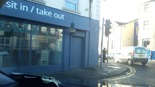
Museums and landmarks8


Parks, trails and playgrounds4

Restaurants and cafes10

History
Dated archaeological evidence of human settlement in the area runs from the Mesolithic. A single-chamber megalithic tomb known as Tirnony dolmen, thought to be between 4,000 to 8,000 years old, lies one mile north of the town. The town itself dates back at least to the 6th century to the church founded by Saint Lurach. Standing upon the site of the church, the earliest of the current ruins is the nave of Old Church which dates from the 10th century. . They include, over a doorway, a relief of the crucifixion, likely added in the 12th century, and possibly the oldest in Ireland. The crucifixion lintel is reproduced in the contemporary Catholic church, St Mary's.
The Old Church and town were burned in the 12th century. Afterwards, Maghera became the seat of the Bishop of Derry with a cathedral church. In 1246 its bishop, Germanus O'Carolan (Gilla in Choimded Ó Cerbailláin), pleading the remoteness of Maghera, obtained sanction from Pope Innocent IV to have the see transferred to Derry.
Read more of the history
As a result of the Plantation of Ulster and of the Rebellion of 1641 which drove out many of the first English families, Maghera and district attracted Scottish settlers. They came into conflict not only with the dispossessed Irish, but as tenants and as Presbyterians also with the land-owning, Church of Ireland, Ascendancy. A result was large-scale emigration to the American colonies (Charles Thomson, recording himself as from Maghera, signed the Declaration of Independence) and, in the 1790s, the organising of the United Irishmen.
Despairing of reform, and determined to make common cause with their Catholic neighbours, on 7 June 1798 the United Irishmen mustered upwards of 5,000 men in Maghera. But the poorly armed host broke up the following morning on news of the rebel defeat at Antrim and the approach of government troops. A Presbyterian church elder, Watty Graham, was executed for his part, and his head was paraded through the town. His minister, John Glendy, was forced into American exile.
On 12 July 1830, Orange Order and Ribbonmen clashed over demonstrations the Orange Order held in Maghera and Castledawson. Several Catholic homes were burnt by Protestants in the aftermath. Some repair of sectarian relations was achieved by an active tenant right movement. In the 1850s, Samuel MacCurdy Greer was able twice on a platform of tenant right to face down Orange opposition in the county and secure cross-community support for his election to parliament. But by the end of the century, with tenant purchase of land facilitated by the Land Acts and with Irish self-government ("home rule") returned to the political agenda, the national question prevailed. Politically the town has remained split between nationalists, now in the majority, and unionists.
The Great Famine of the 1840s and the years that followed, resulted in a since unrecovered loss of population in the surrounding rural districts. In 2003 the Ancient Order of Hibernians erected a headstone to make the "Famine Plot" were local victims were buried.
In the early 20th century, the town itself was relatively prosperous. With its own railway station, an embroidery factory, a busy weekly market and close proximity to Clark's linen mill in Upperlands, it was one of two major towns within Magherafelt Rural District. The town also benefited from post-war advances in education, housing and transport. Separate primary and secondary schools were built for Catholics and Protestants in the 1960s; new housing estates were constructed and motor cars forced a widening of many of the town's narrow streets
Maghera suffered violence during the Troubles. Over the three decades from the end of the 1960s a total of 14 people were killed in or near the village Maghera, half of them members of the security forces and a further two as a result of family membership of the Ulster Defence Regiment. The Provisional Irish Republican Army were responsible for ten of the deaths. Two, including a Sinn Féin councillor, were killed by loyalist paramilitaries.
From what was possibly a low of 879 in 1910 Maghera population has risen in the course of a century to a census figure in 2021 of 4,235. Reflecting European Union employment in local food processing, 213 residents in 2011 did not have English as a first language.
In 2015, the Maghera Historical Society established a Heritage Centre at 11 Main Street. Intended as "an inclusive community facility", it is committed to embracing "all the different social, religious and political strands" which exist in the town.
From the History section of Maghera on Wikipedia, under CC BY-SA 4.0.
Notable people from Maghera
 Kenny ShielsNorthern Irish manager (born 1956)Photo: Seaninryan, CC BY-SA 4.0
 Henry Clarkepolitician and businessman in New South Wales, AustraliaPhoto: Unknown author Unknown author, Public domain
 Conor GlassAustralian rules footballerPhoto: Flickerd, CC BY-SA 4.0
 John HarrisPolitician, mayor and land owner from New South Wales, Australia (1838-1911)Photo: Unknown author Unknown author, Public domain
- Charles ThomsonAmerican patriot leader (1729-1824)
- Eve BuntingAmerican children's writer
- Helena ConcannonIrish politician (1878–1952)
- Francis LaganIrish Roman Catholic bishop (1934-2020)
- Morris FosterIrish cyclist
- Matthew D. LaganAmerican politician (1829–1901)
- James LoganIrish-American education official in California
- Jim McCuskerNorthern Ireland footballer
Born in Maghera, according to Wikidata (CC0). Each name links to its Wikipedia article.
Where to stay1
Churches and places of worship4
Shopping3
Gas and EV charging5
Schools, colleges and libraries5
St Patrick's Primary School (Glen)
School · Roman Catholic · 1.5 mi
161 Glen Road, Maghera
Map of Maghera
41 places. The map loads OpenStreetMap tiles when you open it.
Getting there and nearby towns
Belfast International Airport (BFS) is the nearest airport with scheduled flights listed in OpenStreetMap, 22 miles away.
- Magherafelt 7 mi southeast, about 11 min by car
- Portglenone 8 mi east, about 13 min by car
- Moneymore 10 mi south, about 17 min by car
- Cookstown 14 mi south, about 23 min by car
- Ballymena 16 mi east, about 25 min by car
- Randalstown 16 mi southeast, about 26 min by car
- Limavady 18 mi northwest, about 29 min by car
- Coleraine 20 mi north, about 32 min by car
- Antrim 20 mi southeast, about 33 min by car
- Dungannon 24 mi south, about 38 min by car
Drive times are estimates from straight-line distance, not routes.
Towns near Maghera


Keep exploring
Local news
Headlines from INDB.
Reviews, tips and questions
Loading what members have shared...
Sources and licences
- GeoNames (CC BY 4.0): population, coordinates, regions and time zone
- Mapillary (see each image): photos
- OpenStreetMap contributors (ODbL 1.0): places, airports, map data
- Wikidata (CC0 1.0): elevation, founding date, time zone, website, landmarks and historic places
- Wikimedia Commons (see each image): photos
- Wikipedia (CC BY-SA 4.0): overview and history text
Photo credits
- Maghera Town Centre, Kenneth Allen, CC BY-SA 2.0
- County Londonderry - Tirnony Dolmen 20230303 from east, Otter, CC BY-SA 4.0
- Street-level photo, debigc, CC BY-SA 4.0
- Street-level photo, debigc, CC BY-SA 4.0
- Street-level photo, debigc, CC BY-SA 4.0
- Street-level photo, debigc, CC BY-SA 4.0
- Street-level photo, debigc, CC BY-SA 4.0
- Street-level photo, debigc, CC BY-SA 4.0
- Street-level photo, debigc, CC BY-SA 4.0
- Street-level photo, mackerski, CC BY-SA 4.0
- Street-level photo, mackerski, CC BY-SA 4.0
- Street-level photo, debigc, CC BY-SA 4.0
Page built November 10, 2026. Spotted a mistake? Tell us or suggest a place.