
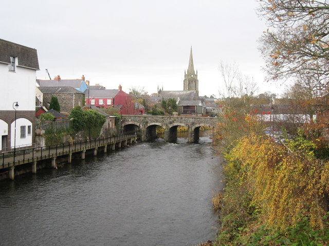


Antrim, United Kingdom
Antrim is a town of 19,661 people in Northern Ireland, United Kingdom.
Why visit Antrim
Townapedia lists 16 museums and landmarks, 9 parks and trails, 42 places to eat, 3 places to stay and 2 attractions in and around town.
Highlights include Omniplex, The Old Courthouse, Antrim Round Tower and Pogue's Entry.
Weather in Antrim
Forecast from MET Norway (CC BY 4.0). Full forecast
About Antrim
Antrim (Irish: Aontroim [ˈeːnˠt̪ˠɾˠɪmʲ], meaning 'lone ridge') is a historic market town, civil parish, and the county town of County Antrim in Northern Ireland. It lies on the banks of the Six Mile Water on the north-east shore of Lough Neagh, approximately 14 miles (23 km) north-west of Belfast. It had a population of 25,606 people in the 2021 census.
From the Wikipedia article Antrim, County Antrim (this version), under CC BY-SA 4.0.
Travel tips from other travellers: Antrim on Wikivoyage (CC BY-SA 4.0).
Things to do2

Museums and landmarks16




Ballymena Superintendent Registrars District
Monument and historic site · 1.1 mi
4 more on the map.
Parks, trails and playgrounds9



Restaurants and cafes42
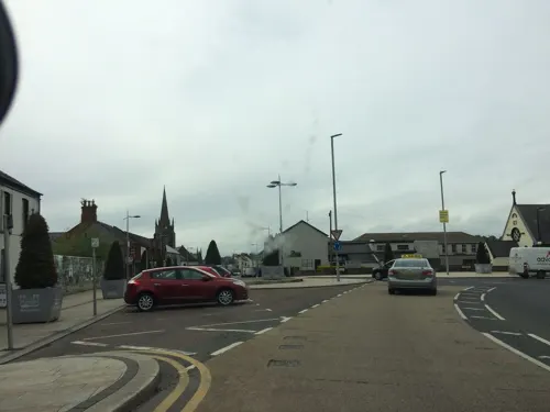
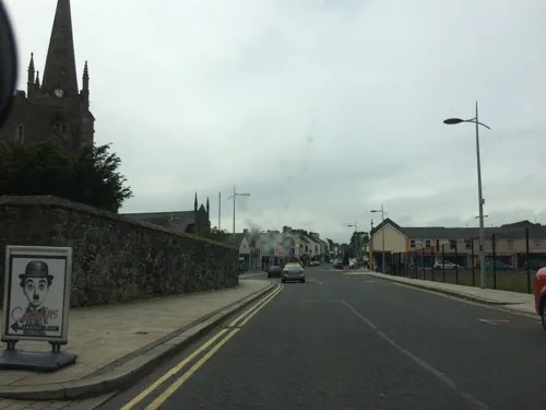




30 more on the map.
History
According to tradition, a monastery was founded at Antrim in AD 495, thirty years after the death of Saint Patrick, to take forward his ministry, with a small settlement growing up around it. The round tower (see below), also known as "the Steeple", is all that remains. The original name of Antrim was Aontreibh, Irish for 'lone house', referring to the monks' house. This later became or was reinterpreted as Aontroim ('lone ridge').
In the early Middle Ages, the area was part of the Gaelic territory of Dál Araide, which covered much of what is now County Antrim. At the eastern edge of town is a ringfort called Rathmore (Ráth Mór, 'great fort'), which was the royal residence of the kings of Dál Araide.
In the late 12th century, the area was conquered by Anglo-Normans led by John de Courcy, becoming part of the Earldom of Ulster. They built a motte-and-bailey castle at Antrim. Its mound (motte) still stands in Antrim Castle Gardens.
The Anglo-Norman earldom collapsed in the early 14th century and Antrim became part of the Gaelic territory of Clannaboy. During the late Middle Ages, the O'Neill chiefs of Clannaboy were based at Edenduffcarrick castle (later called Shane's Castle), two miles west of Antrim.
Read more of the history
Following the Nine Years' War (1593–1603), Antrim came under English control. The area was then colonized by English and Scottish settlers as part of the Plantation of Ulster. Hugh Clotworthy, the father of the Anglo-Irish politician John Clotworthy, 1st Viscount Massereene, supervised the building of Antrim Castle, a fortified mansion beside the old Norman motte. Hugh was knighted in 1617 and appointed High Sheriff of County Antrim. In 1642, during the Irish Confederate Wars, Clotworthy's fleet fought a naval engagement on Lough Neagh.
The Society of United Irishmen launched a rebellion in 1798, which began in Leinster and quickly spread to Ulster. The United Irishmen had been founded in 1791 by liberal Protestants in Belfast. Its goal was to unite Catholics and Protestants, to end British monarchical rule over Ireland, and to found a sovereign, independent Irish republic. Although its membership was mainly Catholic, many of its leaders and members in northeast Ulster were Protestant Presbyterians. On 7 June 1798 about 4,000 United Irishmen led by Henry Joy McCracken attacked the town. The rebels were about to take the town when British reinforcements arrived. Thanks to a rebel band led by James Hope, most of the United Irishmen withdrew safely. This is known as the Battle of Antrim.
Before the Act of Union, the parliamentary borough of Antrim returned two members to the Irish House of Commons by virtue of letters patent granted in 1666 by Charles II. It was disenfranchised in 1801.
Steeple House, a substantial 18th-century mansion that was home to the Clark family and then became the headquarters of Antrim Borough Council, was destroyed in a fire in 2019.
There were several incidents in and around Antrim during the Troubles. In 1976, six civilians (five Protestants and one Catholic) were shot and killed during a UVF gun attack on the Ramble Inn pub near Antrim.
From the History section of Antrim, County Antrim on Wikipedia, under CC BY-SA 4.0.
More about Antrim
Education
Junior schools serving the area include Antrim Primary School, Ballycraigy Primary School, Greystone Primary School, St Comgall's Primary School, and St Joseph's Primary School.
The secondary schools are Antrim Grammar School and Parkhall College.
The Greenmount campus of the College of Agriculture, Food and Rural Enterprise (CAFRE) is near Antrim.
From the Wikipedia article Antrim, County Antrim, under CC BY-SA 4.0.
Notable people from Antrim
 Mark AllenNorthern Irish snooker playerPhoto: BennyOnTheLoose, CC BY 4.0
 Jordan BrownBritish snooker playerPhoto: Benutzer:Bill da Flute, CC BY-SA 3.0
 Jamie DonleyNorthern Irish association football player (born 2005)Photo: Timmy96, CC0
 Caitlin BlackwoodBritish actressPhoto: Nightscream, CC BY 3.0
 Josh RockNorthern Irish darts playerPhoto: Sandro Halank, Wikimedia Commons, CC BY-SA 4.0
 Bertie DonnellycyclistPhoto: Ikirsty, CC BY-SA 4.0
 Shirley ArmstrongIrish fencer and art historianPhoto: Sunday Independent, CC0
 Mark GleghorneBritish field hockey playerPhoto: DJCOTTS - Ian Cottee, CC BY-SA 4.0
- Ross McCauslandNorthern Irish footballer
- Deirdre MaddenBritish Irish writer
- Edward HullIrish geologist (1829-1917)
- Sean McCombIrish boxer
Born in Antrim, according to Wikidata (CC0). Each name links to its Wikipedia article.
Where to stay3
Churches and places of worship14
Antrim Free Presbyterian Church
Church · Presbyterian · 0.6 mi
Queens Road, Antrim
Greystone Road Presbyterian Church
Church · Presbyterian · 1.0 mi
Greystone Road, Antrim
Shopping18
Gas and EV charging9
Schools, colleges and libraries14
Healthcare6
Map of Antrim
133 places. The map loads OpenStreetMap tiles when you open it.
Getting there and nearby towns
Belfast International Airport (BFS) is the nearest airport with scheduled flights listed in OpenStreetMap, 4 miles away.
- Ballymena 10 mi north, about 17 min by car
- Newtownabbey 13 mi east, about 20 min by car
- Belfast 14 mi southeast, about 23 min by car
- Lisburn 15 mi southeast, about 24 min by car
- Carrickfergus 16 mi east, about 26 min by car
- Holywood 16 mi east, about 26 min by car
- Larne 18 mi northeast, about 29 min by car
- Dundonald 19 mi southeast, about 30 min by car
- Bangor 22 mi east, about 35 min by car
- Portadown 22 mi southwest, about 36 min by car
Drive times are estimates from straight-line distance, not routes.
Towns near Antrim


Keep exploring
Local news
Headlines from INDB.
Reviews, tips and questions
Loading what members have shared...
Sources and licences
- GeoNames (CC BY 4.0): population, coordinates, regions and time zone
- Mapillary (see each image): photos
- OpenStreetMap contributors (ODbL 1.0): places, airports, map data
- Wikidata (CC0 1.0): elevation, founding date, time zone, website, landmarks and historic places
- Wikimedia Commons (see each image): photos
- Wikipedia (CC BY-SA 4.0): overview and history text
Photo credits
- Bridge over Six Mile Water, Antrim, Sue Adair, CC BY-SA 2.0
- PXL 20231213 112327748 Antrim Courthouse, Sourabh.biswas003, CC BY-SA 4.0
- St Comgall's RC Church, Antrim, Slowtech2000, CC BY-SA 4.0
- AGSQUAD, Cal118 ( talk ) ( Uploads ), Public domain
- Holywell Hospital 1, Rdfallis, CC BY-SA 4.0
- County Antrim - Antrim Round Tower 20230305 1, Otter, CC BY-SA 4.0
- PXL 20231213 112327748 The Old Courthouse, Antrim, Sourabh.biswas003, CC BY-SA 4.0
- Deerpark Bridge in the former Antrim Castle grounds, now a public park, Richard Robert Ashby, CC BY-SA 4.0
- Street-level photo, laye, CC BY-SA 4.0
- Street-level photo, rathcooleramble, CC BY-SA 4.0
- Street-level photo, rathcooleramble, CC BY-SA 4.0
- Street-level photo, rathcooleramble, CC BY-SA 4.0
- Street-level photo, rathcooleramble, CC BY-SA 4.0
- Street-level photo, rathcooleramble, CC BY-SA 4.0
- Street-level photo, ilmarinen946, CC BY-SA 4.0
- Street-level photo, rathcooleramble, CC BY-SA 4.0
- Street-level photo, ilmarinen946, CC BY-SA 4.0
- Street-level photo, rathcooleramble, CC BY-SA 4.0
- Street-level photo, laye, CC BY-SA 4.0
- Street-level photo, laye, CC BY-SA 4.0
- Street-level photo, laye, CC BY-SA 4.0
- Street-level photo, laye, CC BY-SA 4.0
- Street-level photo, rathcooleramble, CC BY-SA 4.0
- Street-level photo, rathcooleramble, CC BY-SA 4.0
- Street-level photo, rathcooleramble, CC BY-SA 4.0
- Street-level photo, rathcooleramble, CC BY-SA 4.0
- Street-level photo, laye, CC BY-SA 4.0
Page built November 10, 2026. Spotted a mistake? Tell us or suggest a place.