


Moneymore, United Kingdom
Moneymore is a town of 1,426 people in Northern Ireland, United Kingdom.
Why visit Moneymore
Townapedia lists 6 museums and landmarks, 4 parks and trails, 4 places to eat and 2 places to stay in and around town.
Highlights include Springhill House.
Weather in Moneymore
Forecast from MET Norway (CC BY 4.0). Full forecast
About Moneymore
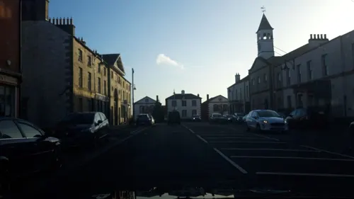
Moneymore (from Irish Muine Mór, meaning 'large thicket or large hill') is a village and townland in County Londonderry, Northern Ireland. It had a population of 1,897 in the 2011 census. It is situated within Mid-Ulster District. It is an example of a plantation village in Mid-Ulster built by the Drapers' Company of London.
From the Wikipedia article Moneymore (this version), under CC BY-SA 4.0.
Museums and landmarks6

Springhill House
Monument and historic site · 0.7 mi
17th century plantation house and farm
20 Springhill Road, Moneymore

Parks, trails and playgrounds4


Restaurants and cafes4
Where to stay2

History
There was an important battle fought near Moneymore called the battle of Móin Daire Lothair in the year 563 between the Northern Uí Néill and the Cruithin tribe which the Northern Uí Néill won. This battle is recorded in the Annals of Ulster and would have been a major event at the time. Much of Great Britain and Ireland would have descent from these two groups as there was notable mixing with Scotland over the years and the Uí Néill split to form the Southern Uí Néill in the Irish midlands around this time.
During The Troubles, seven people were killed in or near Moneymore in violence related to the conflict, six of them by the Provisional IRA and one by the Ulster Defence Association.
From the History section of Moneymore on Wikipedia, under CC BY-SA 4.0.
More about Moneymore
Geography
Moneymore lies in a glen. The Ballymully River flows through the southern part of the village. The river rises on a large hill, Slieve Gallion (one of the Sperrins), which has a radio tower on top. The village is about 35 miles (56.3 km) from the sea to the north.
From the Wikipedia article Moneymore, under CC BY-SA 4.0.
Notable people from Moneymore
 Andrew DavisonCanadian politicianPhoto: William John Oliver, Public domain
- Henry ConwellIrish-born American Catholic bishop
- Johnny Martin(1822-1892) member of the New Zealand Legislative Council, known as the "silent member"
- Rodney OrpheusIrish writer
- Frederick LabattNew Zealand cricketer
- Herbert W. ParkeBritish historian of antiquity (1903-1986)
Born in Moneymore, according to Wikidata (CC0). Each name links to its Wikipedia article.
Churches and places of worship5
Church of SS John & Trea (Roman Catholic)
Church · Roman Catholic
Springhill Road, Moneymore
St John's Church, Desertlynn (Church of Ireland)
Church · Anglican
Moneymore Road, Moneymore
Shopping1
Gas and EV charging2
Schools, colleges and libraries2
Map of Moneymore
26 places. The map loads OpenStreetMap tiles when you open it.
Getting there and nearby towns
Belfast International Airport (BFS) is the nearest airport with scheduled flights listed in OpenStreetMap, 19 miles away.
- Cookstown 5 mi southwest, about 7 min by car
- Dungannon 14 mi south, about 22 min by car
- Randalstown 15 mi east, about 25 min by car
- Portglenone 15 mi northeast, about 24 min by car
- Moy 17 mi south, about 27 min by car
- Antrim 18 mi east, about 30 min by car
- Craigavon 20 mi southeast, about 33 min by car
- Ballymena 20 mi northeast, about 32 min by car
- Portadown 21 mi southeast, about 33 min by car
- Armagh 24 mi south, about 38 min by car
Drive times are estimates from straight-line distance, not routes.
Towns near Moneymore


Keep exploring
Local news
Headlines from INDB.
Reviews, tips and questions
Loading what members have shared...
Sources and licences
- GeoNames (CC BY 4.0): population, coordinates, regions and time zone
- Mapillary (see each image): photos
- OpenStreetMap contributors (ODbL 1.0): places, airports, map data
- Wikidata (CC0 1.0): elevation, founding date, time zone, website
- Wikimedia Commons (see each image): photos
- Wikipedia (CC BY-SA 4.0): overview and history text
Photo credits
- Springhill House, Moneymore, Kenneth Allen, CC BY-SA 2.0
- The Barn at Springhill - 2025-09-25 17-18-21 001, Pickmewildflowers, CC BY-SA 4.0
- Street-level photo, debigc, CC BY-SA 4.0
- Street-level photo, debigc, CC BY-SA 4.0
- Street-level photo, debigc, CC BY-SA 4.0
- Street-level photo, debigc, CC BY-SA 4.0
- Street-level photo, debigc, CC BY-SA 4.0
- Street-level photo, debigc, CC BY-SA 4.0
Page built November 10, 2026. Spotted a mistake? Tell us or suggest a place.