
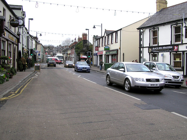


Randalstown, United Kingdom
Randalstown is a town of 5,378 people in Northern Ireland, United Kingdom.
Why visit Randalstown
Townapedia lists 2 museums and landmarks, 1 park or trail, 1 place to eat and 1 attraction in and around town.
Highlights include World of Owls.
Weather in Randalstown
Forecast from MET Norway (CC BY 4.0). Full forecast
About Randalstown
Randalstown (Irish: Baile Raghnaill) is a small town and townland in County Antrim, Northern Ireland, between Antrim and Toome. The town, which contains a prominent disused railway viaduct, lies beside Lough Neagh and the Shane's Castle estate. Randalstown is bypassed by the M22 motorway with junctions at both the eastern and western ends of the town. It had a population of 5,151 people in the 2021 census.
From the Wikipedia article Randalstown (this version), under CC BY-SA 4.0.
Things to do1

Museums and landmarks2

Parks, trails and playgrounds1

Restaurants and cafes1
History
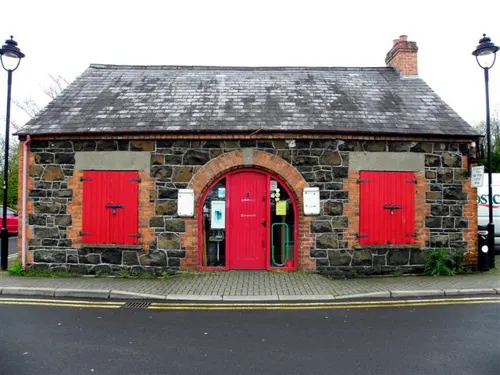
The townland of Randalstown was originally known as An Dún Mór ("the great fort"), anglicised as Dunmore. This refers to a medieval motte-and-bailey castle built by the Irish on the west bank of the river Main just south of the town. A castle known as Edenduffcarrick, later Shane's Castle, was built near Randalstown in the 14th century by the O'Neills of Clannaboy.
From at least the 1650s the town was known as "Iron Mills" (Muilinn Iarainn in Irish, anglicised "Mullynieren"). In 1667, the town was created a free borough and was officially renamed Randalstown. It was renamed to mark the marriage of Randal MacDonnell, 1st Marquess of Antrim to Rose O'Neill of Shane's Castle.
The 1798 United Irishmen rebellion began in Antrim following a meeting to prepare for revolt by the Ulster Directory on 1 February 1798, at McClean's Inn, Randalstown. Robert McClean's "Great Inn" had long been an Irish Volunteers meeting place. Following his death in 1790, his son Francis became the proprietor.
Dunmore Park was used as a training camp for the Ulster Volunteers during the Irish Home Rule crisis.
Read more of the history
Randalstown has a strong history of linen and iron industries. A memorial to this history is in the middle of the town and made from the original turbine used to generate mains electricity for the town and items salvaged from the Old Bleach Linen Company founded by James Webb in 1864. An old linen mill chimney from the Old Bleach factory can be seen from most parts of the town. The Dorma Old Bleach factory which operated from a neighbouring site closed down in 2002.
On 1 October 1989, a Provisional Irish Republican Army (IRA) car bomb exploded outside the town's police station on New Street causing serious damage to nearby property.
On 8 January 2010, PSNI Constable Peadar Heffron was seriously injured as a bomb exploded under his car on the Milltown Road near Randalstown. Dissident republicans were blamed for the attack.
From the History section of Randalstown on Wikipedia, under CC BY-SA 4.0.
More about Randalstown
Education
Primary schools in the area include Mount St. Michael's Primary School, Maine Integrated Primary School and Randalstown Central Primary School. The latter is a mixed non-denominational primary school within the North Eastern Education and Library Board area.
From the Wikipedia article Randalstown, under CC BY-SA 4.0.
Notable people from Randalstown
 Donal McKeownNorth Irish Roman Catholic bishopPhoto: Brian O'Neill from Belfast, Northern Ireland, CC BY 2.0
 Cathal O'ShannonIrish writer, politician and IRA volunteerPhoto: A. H. Poole, Public domain
- John Bodkin AdamsBritish general practitioner and fraudster (1899–1983)
- Gladys MaccabeBritish artist (1918-2018)
- Conor McCannIrish hurler
- Colin WallaceBritish whistleblower
Born in Randalstown, according to Wikidata (CC0). Each name links to its Wikipedia article.
Churches and places of worship5
Randalstown Presbyterian
Church · Presbyterian · 1.0 mi
Portglenone Road, Randalstown
Gas and EV charging3
Schools, colleges and libraries5
Mount St Michael's Primary School
School · Roman Catholic · 0.4 mi
3 Craigstown Road, Randalstown
Map of Randalstown
18 places. The map loads OpenStreetMap tiles when you open it.
Getting there and nearby towns
Belfast International Airport (BFS) is the nearest airport with scheduled flights listed in OpenStreetMap, 7 miles away.
- Antrim 4 mi southeast, about 7 min by car
- Ballymena 8 mi north, about 13 min by car
- Newtownabbey 17 mi east, about 27 min by car
- Belfast 18 mi southeast, about 29 min by car
- Lisburn 19 mi southeast, about 30 min by car
- Cookstown 19 mi west, about 31 min by car
- Carrickfergus 20 mi east, about 32 min by car
- Larne 20 mi east, about 33 min by car
- Holywood 20 mi east, about 33 min by car
- Craigavon 21 mi south, about 34 min by car
Drive times are estimates from straight-line distance, not routes.
Towns near Randalstown


Keep exploring
Local news
Headlines from INDB.
Reviews, tips and questions
Loading what members have shared...
Sources and licences
- GeoNames (CC BY 4.0): population, coordinates, regions and time zone
- OpenStreetMap contributors (ODbL 1.0): places, airports, map data
- Openverse (see each image): photos
- Wikidata (CC0 1.0): elevation, founding date, time zone, website
- Wikimedia Commons (see each image): photos
- Wikipedia (CC BY-SA 4.0): overview and history text
Photo credits
- Randalstown, County Antrim, Kenneth Allen, CC BY-SA 2.0
- Randalstown-Viaduct-Bridge, Acediscovery, CC BY 4.0
- Randalstown Presbyterian Church (Old Congregation), 2079agent, CC BY-SA 4.0
- The Old Forge, John Street, Randalstown, Kenneth Allen, CC BY-SA 2.0
Page built November 10, 2026. Spotted a mistake? Tell us or suggest a place.