


Maidenhead, United Kingdom
Maidenhead is a town of 70,374 people in England, United Kingdom.
Why visit Maidenhead
Townapedia lists 24 museums and landmarks, 35 parks and trails, 108 places to eat, 10 places to stay and 8 attractions in and around town.
Highlights include Maidenhead Bridge, Cookham Bridge, Cliveden and Stanley Spencer Gallery.
Weather in Maidenhead
Forecast from MET Norway (CC BY 4.0). Full forecast
About Maidenhead
Maidenhead is a market town in the Royal Borough of Windsor and Maidenhead in the county of Berkshire, England. It lies on the southwestern bank of the River Thames, which at this point forms the border with Buckinghamshire. In the 2021 Census, the Maidenhead built-up area had a population of 67,375. The town is 27 miles (43 km) west of Charing Cross, London and 13 miles (21 km) east-northeast of Reading.
From the Wikipedia article Maidenhead (this version), under CC BY-SA 4.0.
Travel tips from other travellers: Maidenhead on Wikivoyage (CC BY-SA 4.0).
Photos of Maidenhead


Things to do8

Maidenhead Bridge
Bridge · 0.8 mi
Grade I listed bridge in Buckinghamshire, England


Maidenhead Railway Bridge
Bridge · 0.8 mi
Railway bridge in Maidenhead, Berkshire, England

Norden Farm Centre for the Arts
Cinema and theater · 1.2 mi
Arts centre in Maidenhead, England
Altwood Road, Maidenhead

Taplow Bridge
Bridge · 1.2 mi
Footbridge over Thames between Maidenhead and Taplow

Museums and landmarks24

Cliveden
Museum · 2.8 mi
Country house in Taplow, Buckinghamshire, England, UK

Stanley Spencer Gallery
Museum · 2.6 mi
Art museum in Cookham, Berkshire, United Kingdom
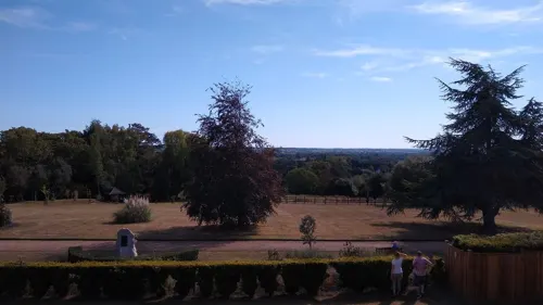
Taplow burial
Monument and historic site · 1.2 mi
Medieval barrow in England



Maidenhead Heritage Centre
Museum
Museum in United Kingdom
18 Park Street, Maidenhead
Tu-Sa 10:00-16:00

Cookham Abbey
Monument and historic site · 2.7 mi
Abbey in Berkshire, England, UK
Dorney Court
Museum · 2.6 mi
Grade I listed historic house museum in South Bucks, United Kingdom
Hitcham War Memorial
Monument and historic site · 2.1 mi
War memorial in Hitcham, Buckinghamshire, England, UK
Furze Platt War Memorial Hall
Monument and historic site · 1.2 mi
Furze Platt Road, Maidenhead
12 more on the map.
Parks, trails and playgrounds35


Ockwells Park
Park · 1.8 mi
Park in Cox Green, Berkshire, England, UK

Park Wood and Goulding's Wood
Park · 2.7 mi
Protected area in Berkshire, England



23 more on the map.
Restaurants and cafes108

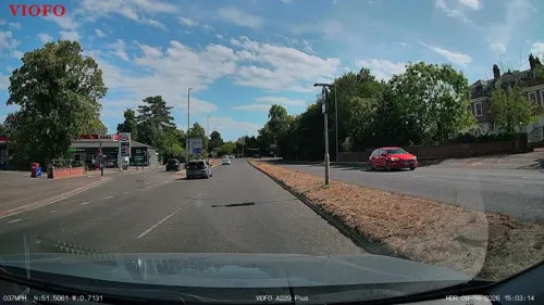
Emperor of India
Restaurant · Indian · 1.2 mi
5 Windsor Road, Maidenhead
Mo-Sa 17:30-22:00, Su 12:00-15:00, 17:30-22:00
Maidenhead Spice
Restaurant · Indian · 0.5 mi
117 Bridge Road, Maidenhead
Mo-Su 12:00-14:00, Su-Th 17:30-22:30, Fr,Sa 17:30-23:00
The Greek House
Restaurant · Greek
126 High Street, Maidenhead
Mo-Th 12:00-22:00, Fr-Sa 12:00-23:00, Su 12:00-21:00

Lee Dynasty
Restaurant · Chinese
29 High Street, Maidenhead
Mo off; Tu-Th 12:00-14:30,17:00-22:00; Fr-Sa...
Nando's
Restaurant · Chicken, Portuguese
57 King Street, Maidenhead
Mo-We 11:00-22:00; Th-Sa 11:00-22:30; Su 11:00-22:00

Caffè Nero
Cafe · Coffee Shop
53 High Street, Maidenhead
Mo-Fr 07:00-18:00; Sa 07:30-18:30; Su 08:30-17:30
Missing Bean
Cafe · Coffee Shop
20 Grenfell Road, Maidenhead
Mo-We 07:00-21:00; Th-Fr 07:00-22:00; Sa 09:00-22:00; Su 09:00-16:00
96 more on the map.
History
The antiquary John Leland claimed that the area around Maidenhead's present town centre was a small Roman settlement called Alaunodunum. He stated that it had all but disappeared by the end of the Roman occupation. Although his source is unknown, there is documented and physical evidence of Roman settlement in the town. There are two well known villa sites in the town, one being in the suburb of Cox Green, and the other just west of the town centre on Castle Hill. This villa was situated on the route of the Camlet Way which was a Roman road linking Silchester (Calleva Atrebatum) and Colchester (Camulodunum) via St Albans (Verulamium) and passes through the present town centre. Remnants of the road have been unearthed at various locations nearby, but its exact route is unclear.
Read more of the history
Maidenhead's name stems from the riverside area where the first "New wharf" or "Maiden Hythe" was built, as early as Saxon times. In the year 870, an army of Danes invaded the kingdom of Wessex. They disembarked from their longboats by the wharf and ferry crossing at Maidenhead and fought their way overland to Reading where they set up camp and made it their regional power base. The area of the present town centre was originally a small Anglo-Saxon town known as "South Ellington". The town would have likely developed on the Camlet Way on the site of Alaunodunum as the Bath Road was not re-routed until the 13th century. Maidenhead is recorded in the Domesday Book as the settlement of Ellington in the hundred of Beynhurst.
A wooden bridge was erected across the river in about 1280 to replace the ferry in South Ellington. The Great West Road to Reading, Gloucester and Bristol was diverted over the new bridge. Previously, it had kept to the north bank and crossed the Thames by ford at Cookham, and the medieval town, later to become Maidenhead grew up on the site of Alaunodunum and South Ellington, between the new bridge and the bottom of Castle Hill. Within a few years a new wharf was constructed next to the bridge to replace the old Saxon wharf which needed replacing. At this time, the South Ellington name was dropped with the town becoming known as Maidenhythe. The earliest record of this name change is in the Bray Court manorial rolls of 1296.
The new bridge and wharf led to the growth of medieval Maidenhead as a river port and market town. The present town was developed as a linear settlement in the 13th century along the newly diverted road with hostelries, a guildhall and a chapel dedicated to St Mary Magdalene was built in the middle of the road. The market was held outside the old guildhall which was set back from the High Street to form the market square. Maidenhead also became the first stopping point for coaches travelling from London to Gloucester and Bath and the town became populated with numerous inns. By the mid 18th century, Maidenhead was one of the busiest coaching towns in England with over ninety coaches a day passing through the town. The late 18th-century Bear Hotel on the High Street is the best of the town's old coaching inns surviving to this day.
King Charles I met his children for the last time before his execution in 1649 at the Greyhound Inn on the High Street, the site of which is now a branch of the NatWest Bank. A plaque commemorates their meeting. When the Great Western Railway came to the town, it began to expand. Muddy roads were replaced and public services were installed. The High Street began to change again, and substantial Victorian red brick architecture began to appear throughout the town. Maidenhead Citadel Corps of the Salvation Army was first opened in the town in the mid-1880s. Maidenhead Citadel Band was soon founded in 1886 by Bandmaster William Thomas, who later became mayor of the town. By Edwardian times, nearby Boulter's Lock became a favoured resort, especially on Ascot Sunday, and Skindles Hotel developed a reputation for illicit liaisons.
Although there are attractive residential and green areas in and around Maidenhead, the historic heart of the town has been redeveloped, primarily with office space, high technology company headquarters and apartments, making it one of the key business and commuter towns of the Silicon Corridor. This has happened in piecemeal fashion over the last forty years and Maidenhead town centre has lost most many historic buildings and much of its traditional English market town character. The High Street and Bridge Street areas only possess one heavily restored Medieval building and a handful of Georgian buildings in the Chapel Arches area.
Research by the New Economics Foundation in 2005 rated Maidenhead as an example of a clone town and the town centre is regarded as in need of improvement. In December 2007, the Royal Borough of Windsor and Maidenhead set up the Partnership for the Regeneration of Maidenhead (PRoM), which in October 2008 launched a comprehensive 20 Year Vision and Action Plan for rejuvenating the town centre. Launch of the plan coincided with confirmation by central government that Maidenhead will be part of the new Crossrail project.
From the History section of Maidenhead on Wikipedia, under CC BY-SA 4.0.
More about Maidenhead
Geography
The Maidenhead urban area includes urban and suburban regions within the bounds of the town, called Maidenhead Court, North Town, Furze Platt, Pinkneys Green, Highway, Tittle Row, Boyn Hill, Fishery and Bray Wick; as well as adjoining built-up areas in surrounding civil parishes: Cox Green and Altwood in Cox Green parish, Woodlands Park in White Waltham parish, and part of Bray Wick in Bray parish. Bray village is linked to Maidenhead by the exclusive Fishery Estate which lies on the west bank of the Thames.
To the east, on the opposite side of the river from Maidenhead, is the large village of Taplow in Buckinghamshire which almost adjoins the suburban village of Burnham, which itself nearly adjoins the urban area of the large, industrial town of Slough. To the north are the Cookhams: Cookham Village, Cookham Rise and Cookham Dean. To the west is the area of Pinkneys Green. These lie south of the Berkshire-Buckinghamshire border, which is formed by the River Thames (which then bends southwards to form the Maidenhead-Taplow border). Adjoining Bray and Bray Wick to the south is the suburban village of Holyport. Continuing by road to the south-east leads to the historic, royal twin towns of Windsor and Eton.
Economy
Maidenhead falls within the Slough and Heathrow travel to work area according to the 2011 classification, meaning that most people in Maidenhead stay within the town and the rest of the travel to work area for work.
Education
Although the town only has the one college, most students entering college level education travel to the various establishments in the area, including the Windsor Forest Colleges Group (formerly East Berkshire College) in both Windsor and Langley, as well as The Henley College and Reading College.
Claires Court (all-through 3–18:- co-ed nursery [3–5]; girls [4–16] & boys [4–16] in a diamond shape; co-ed sixth form)
Redroofs School for the Performing Arts (co-ed 9–18 full time and all ages for weekly classes)
The closest higher education institution is Buckinghamshire New University in High Wycombe, 14.5 km (9 mi) to the north. The University of Reading and University of West London (Berkshire Institute of Health – Reading) are both approximately 21 km (13 mi) to the south-west.
From the Wikipedia article Maidenhead, under CC BY-SA 4.0.
Notable people from Maidenhead
 Hugh LoftingBritish author (1886–1947)Photo: Los Angeles Times, CC BY 4.0
 Tony Trimmerracecar driverPhoto: Martin Lee, CC BY-SA 2.0
 Dave McKeanEnglish artist, photographer, filmmaker and musicianPhoto: Niccolò Caranti, CC BY-SA 4.0
 Tina BrownBritish-American journalist, talk-show host, and authorPhoto: Mikepaws, CC BY-SA 4.0
 Leslie WormaldBritish rower (1890-1965)Photo: Unknown author Unknown author, Public domain
 John BBritish musicianPhoto: Bizzurp, CC BY-SA 3.0
 Jessica FoxBritish actressPhoto: Raintheone, CC0
 Peter JonesBritish businessmanPhoto: TheRangePress, CC BY-SA 3.0
- Geraldine JamesBritish actress
- George EtheregeEnglish writer 1635-1691
- Jack BeaumontBritish rower
- Jamie BartlettSouth African actor (1966–2022)
Born in Maidenhead, according to Wikidata (CC0). Each name links to its Wikipedia article.
Where to stay10
Churches and places of worship28
Saint Mark's Hospital Church
Church · Anglican · 1.0 mi
St Mark's Road, Maidenhead
Shopping16
Gas and EV charging8
Schools, colleges and libraries26
St Edmund Campion Catholic Primary School and Nursery
School · Roman Catholic · 1.5 mi
Altwood Road, Maidenhead
Healthcare12
Map of Maidenhead
250 places. The map loads OpenStreetMap tiles when you open it.
Getting there and nearby towns
Wycombe Air Park (HYC) is the nearest airport with scheduled flights listed in OpenStreetMap, 7 miles away.
- Burnham 2 mi east, about 4 min by car
- Marlow 4 mi northwest, about 6 min by car
- Slough 5 mi east, about 9 min by car
- Windsor 6 mi southeast, about 9 min by car
- High Wycombe 7 mi north, about 12 min by car
- Beaconsfield 7 mi northeast, about 11 min by car
- Ascot 8 mi south, about 13 min by car
- Henley-on-Thames 8 mi west, about 13 min by car
- Gerrards Cross 8 mi northeast, about 13 min by car
- Wokingham 9 mi southwest, about 15 min by car
Drive times are estimates from straight-line distance, not routes.
Towns near Maidenhead


Keep exploring
Local news
Headlines from INDB.
Reviews, tips and questions
Loading what members have shared...
Sources and licences
- GeoNames (CC BY 4.0): population, coordinates, regions and time zone
- Mapillary (see each image): photos
- OpenStreetMap contributors (ODbL 1.0): places, airports, map data
- Wikidata (CC0 1.0): elevation, founding date, time zone, website, landmarks and historic places
- Wikimedia Commons (see each image): photos
- Wikipedia (CC BY-SA 4.0): overview and history text
Photo credits
- St Mary's Church, Maidenhead, Peter Broster, CC0
- Maidenhead (28333678098), David Short from Windsor, UK, CC BY 2.0
- Recovery of an Arriva bus, Maidenhead, England, 7 May 2011 (1), David Short from Windsor, UK, CC BY 2.0
- Hamptons International Land & New Homes Maidenhead, Hamptonsinternational, CC BY-SA 4.0
- Recovery of an Arriva bus, Maidenhead, England, 7 May 2011 (1) (1), David Short from Windsor, UK, CC BY 2.0
- Hamptons International Lettings Maidenhead, Hamptonsinternational, CC BY-SA 4.0
- Hamptons International Sales Maidenhead, Hamptonsinternational, CC BY-SA 4.0
- Queen Street, Maidenhead, Tom Bastin from Reading, UK, CC BY 2.0
- Maidenhead Bridge (1), Tom Bastin from Reading, UK, CC BY 2.0
- CookhamBridge01, Motmit, CC BY-SA 3.0
- Cliveden-2382, Antony McCallum. The original uploader was Wyrdlight at English Wikipedia ., CC BY 3.0
- Stanley Spencer Gallery, Cookham, Lagosman, CC BY-SA 3.0
- Bluebells (34146232732), Timo Newton-Syms from Helsinki, Finland & Maidenhead, Berkshire, UK, CC BY-SA 2.0
- Haymill Valley (5), Dudley Miles, CC BY-SA 4.0
- Ockwells Park (1), Dudley Miles, CC BY-SA 4.0
- Bisham Woods (40502128695), Timo Newton-Syms from Helsinki, Finland & Maidenhead, Berkshire, UK, CC BY-SA 2.0
- Tree Fungus (33750287933), Timo Newton-Syms from Helsinki, Finland & Maidenhead, Berkshire, UK, CC BY-SA 2.0
- Taplow court front, Troxx, CC BY 2.5
- Waterside Inn, Bray, Berkshire (Nancy), Nancy, CC BY-SA 3.0
- YorkRoad, Cls14 at English Wikipedia, Public domain
- Smythes Almshouses, Peter Broster, CC0
- St Mark's Hospital, Rho9998, CC BY-SA 3.0
- Maidenhead v Fylde 003, Neil Maskell, CC0
- RayMillIsland01, Motmit, CC BY-SA 3.0
- St. Lukes Church Maidenhead spire, Andrew Burdett, CC BY-SA 3.0
- Bray Pit (3), Dudley Miles, CC BY-SA 4.0
- The Gullet (2), Dudley Miles, CC BY-SA 4.0
- Carpenter's Wood (2), Dudley Miles, CC BY-SA 4.0
- United Reformed Church 3, Peter Broster, CC0
- United Reformed Church (rear view west side), Peter Broster, CC0
- Maidenhead Railway Bridge - The Sounding Bridge plaque, Oosoom at English Wikipedia, CC BY-SA 3.0
- Street-level photo, southglos, CC BY-SA 4.0
- Street-level photo, southglos, CC BY-SA 4.0
- Street-level photo, RyanBush, CC BY-SA 4.0
- Street-level photo, southglos, CC BY-SA 4.0
- Street-level photo, southglos, CC BY-SA 4.0
- Street-level photo, stuarth, CC BY-SA 4.0


Page built November 10, 2026. Spotted a mistake? Tell us or suggest a place.