


Why visit Slough
Townapedia lists 60 museums and landmarks, 94 parks and trails, 177 places to eat, 36 places to stay and 18 attractions in and around town.
Highlights include Theatre Royal, Windsor Bridge, Windsor Castle and Montem Mound.
Weather in Slough
Forecast from MET Norway (CC BY 4.0). Full forecast
About Slough
Slough () is a town in Berkshire, England, in the Thames Valley, 20 miles (32 km) west of central London and 19 miles (31 km) north-east of Reading, at the intersection of the M4, M40 and M25 motorways. It is part of the historic county of Buckinghamshire. In 2021, the population of the town was 143,184. The wider Borough of Slough had a population of 158,500.
From the Wikipedia article Slough (this version), under CC BY-SA 4.0.
Travel tips from other travellers: Slough on Wikivoyage (CC BY-SA 4.0).
Photos of Slough

Things to do18


Windsor Bridge
Bridge · 1.7 mi
Pedestrian and cycle bridge in sight of Windsor Castle, England


Datchet Bridge
Bridge · 2.0 mi
Road bridge which crossed the River Thames at Datchet

Legoland Windsor
Monument and historic site · 4.0 mi
Lego theme park in Windsor, Berkshire, England

Maidenhead Bridge
Bridge · 4.7 mi
Grade I listed bridge in Buckinghamshire, England

Maidenhead Railway Bridge
Bridge · 4.6 mi
Railway bridge in Maidenhead, Berkshire, England

Theatre Royal, Windsor
Cinema and theater · 1.8 mi
Theatre in Windsor, England

Victoria Bridge
Bridge · 1.5 mi
Road bridge between Datchet and Windsor in the English county of Berkshire

Taplow Bridge
Bridge · 4.7 mi
Footbridge over Thames between Maidenhead and Taplow
6 more on the map.
Museums and landmarks60

Windsor Castle
Monument and historic site · 1.8 mi
Historic castle, royal residence at Windsor in Berkshire, England, UK
Nov 01-Feb 29 Th-Mo 10:00-15:00; Mar 01-Oct 31 Th-Mo 10:00-16:00
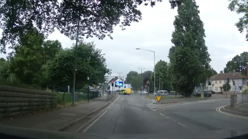
Montem Mound
Monument and historic site · 0.6 mi
Archaeological site in Slough, United Kingdom


Ankerwycke Priory
Monument and historic site · 4.8 mi
Benedictine nunnery with associated moat and fishponds

Eton College Collections
Museum · 1.3 mi
Collection of items kept by Eton College

Eton College Natural History Museum
Museum · 1.3 mi
Museum in Eton College, Berkshire, England

Dorney Court
Monument and historic site · 3.2 mi
Stately home, grounds and house open to public in June

Burnham War Memorial
Monument and historic site · 3.1 mi
First World War memorial, with bronze statue by Leonard S Merrifield, unveiled on 19 December 1920, with later additions for the Second...
Cippenham Moat
Monument and historic site · 1.5 mi
Remains of a 13th Century Royal Palace created by King Henry III
48 more on the map.
Parks, trails and playgrounds94

Stoke Park Golf Course
Golf course · 1.8 mi
9 hole Par 36 Colt Course & 9 hole Par 35 Alison Course & 9 hole Par 36 Lane Jackson Course
Park Road, Slough


Arthur Jacob Nature Reserve
Park · 3.8 mi
Local nature reserve located in Horton


Burnham Beeches
Park · 3.7 mi
Nature reserve in Buckinghamshire, England


Colne Valley regional park
Park · 3.5 mi
Area in Hertfordshire and Buckinghamshire
82 more on the map.
Restaurants and cafes177
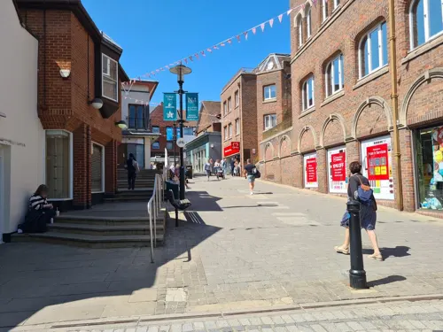
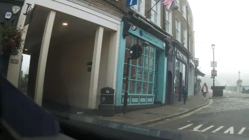
Costa
Cafe · Coffee Shop · 1.7 mi
64-65 High Street, Windsor
Mo-Fr 06:30-18:00; Sa 07:00-18:00; Su 08:00-18:00
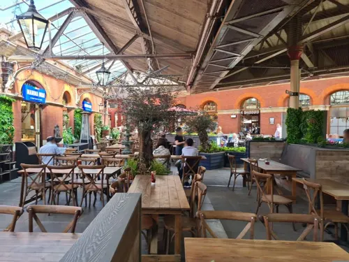

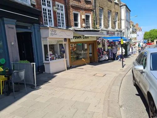



165 more on the map.
History
The town's name was first recorded in 1195 as Slo. It first seems to have applied to a hamlet between Upton to the east and Chalvey to the west, roughly around the "Crown Crossroads" where the road to Windsor (now the A332) met the Great West Road. The Domesday Survey of 1086 refers to Upton, and a wood for 200 pigs, worth £15.
During the 13th century, King Henry III had a palace at Cippenham. Parts of Upton Court were built in 1325. St Mary the Virgin Church in Langley was probably built in the late 11th or early 12th century, though it has been rebuilt and enlarged several times.
From the mid-17th century, stagecoaches passed through Slough and Salt Hill, later absorbed into Slough, as locations to change horses on the journey out from London. By 1838 and the opening of the Great Western Railway, Upton-cum-Chalvey's parish population was 1,502. In 1849, a branch line was completed from Slough to Windsor & Eton Central, opposite Windsor Castle, for Queen Victoria's convenience.
Slough has 96 listed buildings, i.e. protected historic structures. There are
Four Grade I: St Laurence's Church (Upton), St Mary the Virgin Church, Langley, Baylis House and Godolphin Court
Seven Grade II*: St Mary's Church (Upton-cum-Chalvey), Upton Court, the Kederminster and Seymour Almshouses in Langley, St Peter's Church (Chalvey), Ostrich Inn (Colnbrook) and King John's Palace (Colnbrook)
Read more of the history
Grade II listed structures include four milestones, Beech, Oak and Linden Houses at Upton Hospital, St Ethelbert's Church, Slough and Slough railway station.
In 1918, a large area of agricultural land to the west of Slough developed as an army motor repair depot, to store and repair huge numbers of motor vehicles coming back from the battlefields of the First World War in Flanders. In April 1920, the Government sold the site and its contents to the Slough Trading Co. Ltd. Repair of ex-army vehicles continued until 1925, when the Slough Trading Company Act was passed allowing the company, renamed Slough Estates Ltd, to establish an industrial estate. Spectacular growth and employment ensued, with Slough attracting workers from many parts of the UK and abroad. Slough Town Hall, which was designed by Charles Holloway James and Stephen Rowland Pierce, was completed in 1937.
During the Second World War, Slough experienced a series of air raids, mostly in October 1940. On the 13th, 5 people were killed in an air raid, the deadliest raid on Slough. An emergency hospital treating casualties from London was set up in Slough. Local air raid deaths and deaths at the hospital account for the 23 civilian lives lost in the borough area.
After the war, several further large housing developments arose to take large numbers of people migrating from war-damaged London. Between 1955 and 1957 the town was the site of the Slough experiment, a large-scale road safety trial.
The old Slough library opened in November 1974, named after Alderman Robert Taylor in recognition of his contribution to the library service. The library was officially opened by the Mayor, Councillor DR Peters, in May 1975. It was demolished in May 2017 as part of the programme of redevelopment in the town centre.
In the 21st century, Slough has seen major redevelopment of the town centre. Old buildings are being replaced with new offices and shopping complexes. Tesco has replaced an existing superstore with a larger Tesco Extra. The Heart of Slough Project is plan for the large-scale redevelopment of the town centre as a focus and cultural quarter for the creative media, information and communications industries created a mixed-use complex, multi-functional buildings, visual landmarks and a public space in the Thames Valley. Approval was given for the £400 million project by Slough Borough Council's planning committee in July 2009, and work began in 2010 for completion in 2018.
In December 2009, two key components of the project were signed: the Homes and Communities Agency (HCA) signed its agreement to provide £11m of funding for infrastructure and Thames Valley University (TVU) courses which were due to remain in the town found a new home at the Centre in Farnham Road, Slough. In parallel to the town centre redevelopment plan, Segro, owner of the Slough Trading Estate, planned to spend £600 million over the following 20 years on the estate. This was intended to create environmentally sustainable buildings, open green spaces, two hotels, a conference centre, cafés, restaurants and better transport facilities to improve links to Slough town centre and the surrounding residential areas. It was claimed that the plan would create more than 4,100 new jobs and contribute around £100m a year to Slough's economy. If both plans went ahead, nearly £1 billion would be spent on redeveloping Slough over the next 20 years.
In 2009, Herschel Park, known as Upton Park until 1949, named for astronomer William Herschel, was relandscaped in a multimillion-pound effort to bring it back to its former Victorian era glory. The park was featured in an episode of the documentary programme Who Do You Think You Are? focusing on the TV presenter Davina McCall.
In 2010, £2 million was set aside to improve disabled access to Slough railway station in preparation for an expected increase in use during the 2012 London Olympics. Preparations were under way for the regeneration of the Britwell suburb of Slough, involving tearing down a dilapidated block of flats and the closing of the public house the Jolly Londoner in Wentworth Avenue and replacing them with new homes, as well as relocating the shopping parade in the street to nearby Kennedy Park.
As part of the Heart of Slough project, construction work on a new bus station began in March 2010, following weeks of demolition work to half of the existing bus station and the removal of Compair House near the railway station. It was opened in May 2011.
From the History section of Slough on Wikipedia, under CC BY-SA 4.0.
More about Slough
Geography
Slough is 20 miles (32 km) west of Charing Cross, central London, 2 miles (3 km) north of Windsor, 5 miles (8 km) east of Maidenhead, 11 miles (18 km) south-east of High Wycombe and 19 miles (31 km) north-east of the county town of Reading. Slough is within the Greater London Urban Area and on the border with London Borough of Hillingdon and London Borough of Hounslow. Heathrow Airport is 5 miles away. Nearby towns are Uxbridge to the northeast and Beaconsfield to the north.
Most of the area that now makes up Slough was anciently part of Buckinghamshire. Poyle was historically in Middlesex. The town developed by the expansion and amalgamation of villages along the Great West Road. Over the years Slough has expanded greatly, incorporating a number of different villages. Original villages that are now suburbs of Slough include Chalvey, Cippenham, Colnbrook, Langley, Poyle, Upton, and Wexham.
Economy
Before the 19th century, the main businesses of Slough were brickfields and agriculture. The bricks for the building of Eton College were made in Slough. Later, as the Great West Road traffic increased, inns and pubs sprang up along the road to service the passing trade. Until the town developed as an industrial area, nurseries were prominent in the local economy; the Cox's Orange Pippin apple was first raised in Colnbrook (not then within Slough) around 1825, and the dianthus "Mrs Sinkins Pink" was first raised at some point between 1868 and 1883 by John Sinkins, the master of the Eton Union Workhouse, which lay in Slough.
In the mid-19th century, the only major employer apart from the brickfields was James Elliman, who started as a draper in Chandos Street. In 1847, he changed business and manufactured his Elliman's Embrocation and Royal Embrocation horse liniment at factories in Wellington Street and Chandos Street. Elliman became a major benefactor to the town, and is remembered today in the names of local roads and schools.
Education
There are numerous primary and secondary schools serving Slough. Of the latter there are four state grammar schools. In addition, East Berkshire College has a campus in the area. Slough schools are in the top 10 best performers in the country at GCSE level. In 2011, 68.1% of pupils left school with a minimum of 5 A*-C grades (with English and maths). The national average is 58.9%.
Thames Valley University (Slough Campus) is currently closed due to the Heart of Slough project. The new campus was scheduled to be opened in 2013 as part of the University of West London, but as of March 2022 there had been no progress, as the former site of the university had been sold for housing.
From the Wikipedia article Slough, under CC BY-SA 4.0.
Notable people from Slough
 John Frederick William HerschelEnglish polymath, mathematician, astronomer, chemist, inventor and photographer (1792–1871)Photo: W. Ward, Public domain
 Tracey UllmanBritish actress (born 1959)Photo: JoshPopov, CC BY 4.0
 Armando BrojaAlbanian-English association football playerPhoto: Timmy96, CC0
 Matty CashPolish-English association football playerPhoto: Nottingham Forest F.C., CC0
 Sam HutchinsonEnglish association football player (born 1989)Photo: Timmy96, CC0
 Marian McPartlandBritish pianist, composer, writer and radio host (1918–2013)Photo: Tom Marcello Webster, New York, USA, CC BY-SA 2.0
 Brian McDermottassociation football player and manager (born 1961)Photo: Jake from Manchester, UK, CC BY 2.0
 Kerry IngramEnglish actressPhoto: Gage Skidmore, CC BY-SA 3.0
- Fiona MayBritish-born Italian long jumper
- Rod EvansEnglish singer
- George LarnerBritish athlete (1875–1949)
- Mark RichardsonBritish athlete
Born in Slough, according to Wikidata (CC0). Each name links to its Wikipedia article.
Where to stay36
Churches and places of worship55
Shopping86
Gas and EV charging17
Schools, colleges and libraries44
Our Lady of Peace Catholic Primary and Nursery School
School · Roman Catholic · 2.8 mi
Derwent Drive, Slough
Slough and Eton Church of England Business and Enterprise College
School · Anglican · 0.6 mi
Ragstone Road, Slough
Healthcare37
Map of Slough
250 places. The map loads OpenStreetMap tiles when you open it.
Getting there and nearby towns
Heathrow Airport (LHR) is the nearest airport with scheduled flights listed in OpenStreetMap, 7 miles away.
- Watford 13 mi northeast, about 21 min by car
- Woking 13 mi south, about 21 min by car
- London 20 mi east, about 33 min by car
- City of Westminster 20 mi east, about 32 min by car
- Sutton 20 mi southeast, about 33 min by car
- Tottenham 24 mi east, about 38 min by car
- Walthamstow 25 mi east, about 41 min by car
- Worthing 49 mi south, about 1 h 15 min by car
- Swindon 51 mi west, about 1 h 15 min by car
- Southampton 55 mi southwest, about 1 h 30 min by car
Drive times are estimates from straight-line distance, not routes.
Towns near Slough


Keep exploring
Local news
Headlines from INDB.
Reviews, tips and questions
Loading what members have shared...
Sources and licences
- GeoNames (CC BY 4.0): population, coordinates, regions and time zone
- Mapillary (see each image): photos
- OpenStreetMap contributors (ODbL 1.0): places, airports, map data
- Wikidata (CC0 1.0): elevation, founding date, time zone, website, landmarks and historic places
- Wikimedia Commons (see each image): photos
- Wikipedia (CC BY-SA 4.0): overview and history text
Photo credits
- Slough, Wielka Brytania - panoramio (118), Kazimierz Mendlik, CC BY-SA 3.0
- Windsortownbridge, The original uploader was Wyrdlight at English Wikipedia ., CC BY-SA 2.5
- Albert Bridge, Dachet (Nancy), Nancy, CC BY-SA 3.0
- Black Potts Bridge (Nancy), Nancy, CC BY-SA 3.0
- Entrance to Legoland Windsor, Rob Young profile, CC BY 2.0
- Maidenhead Bridge (1), Tom Bastin from Reading, UK, CC BY 2.0
- Queen Elizabeth Bridge, Windsor (Nancy), Nancy, CC BY-SA 3.0
- Victoria Bridge Datchet, Nancy, CC BY-SA 4.0
- Windsor Castle at Sunset - Nov 2006, Diliff, CC BY 2.5
- Ruins of Ankerwyke Priory, Andrew Gray, CC BY-SA 4.0
- Etoncoll natural History mus, Kobayashis ( talk ), CC BY-SA 3.0
- Cocksherd Wood (3), Dudley Miles, CC BY-SA 4.0
- Haymill Valley (5), Dudley Miles, CC BY-SA 4.0
- Herschel Park LNR (5), Dudley Miles, CC BY-SA 4.0
- Arthur Jacob Nature Reserve at Horton, Berkshire, Nathan Harvey, CC BY-SA 4.0
- Tree Fungus (33750287933), Timo Newton-Syms from Helsinki, Finland & Maidenhead, Berkshire, UK, CC BY-SA 2.0
- Stoke Poges Church, UKgeofan at English Wikipedia )UKGeofan, CC BY-SA 3.0
- Theatre Royal - Windsor, Jim Linwood uploaded and derivative work: MrPanyGoff, CC BY 2.0
- Blackpark Lake, UKgeofan, CC BY-SA 3.0
- St. Mary's Church, Slough, Jordan Butterfield, CC BY-SA 4.0
- Aerial Shot of the Mansion, Stoke Park, Buckinghamshire, Durkc ( talk ) ( Uploads ), CC BY-SA 3.0
- Master Gifts & Souvenirs, 22 Thames St, Windsor, Paul the Archivist, CC BY-SA 4.0
- Castle Hotel, High St, Windsor, Paul the Archivist, CC BY-SA 4.0
- Harte & Garter, High St, Windsor, Paul the Archivist, CC BY-SA 4.0
- Nando's, 10 Thames St, Windsor, Paul the Archivist, CC BY-SA 4.0
- Eton College Natural History Museum Darwin, Kobayashis ( talk ), CC BY-SA 2.5
- Datchet Bridge 1750 William Oram, William Oram, Public domain
- Guildhall, Windsor, Inglaterra, 2014-08-12, DD 15, Diego Delso, CC BY-SA 4.0
- St Marys Church Slough, Prosthetic Head, CC BY-SA 4.0
- Bray Pit (3), Dudley Miles, CC BY-SA 4.0
- Maidenhead Railway Bridge - The Sounding Bridge plaque, Oosoom at English Wikipedia, CC BY-SA 3.0
- Nile Stream, Burnham Beeches 073 (26927663105), Peter O'Connor aka anemoneprojectors, CC BY-SA 2.0
- Street-level photo, kravietz, CC BY-SA 4.0
- Street-level photo, southglos, CC BY-SA 4.0
- Street-level photo, southglos, CC BY-SA 4.0
- Street-level photo, dsmm, CC BY-SA 4.0
- Street-level photo, dsmm, CC BY-SA 4.0
- Street-level photo, dsmm, CC BY-SA 4.0
- Street-level photo, dsmm, CC BY-SA 4.0
- Street-level photo, dsmm, CC BY-SA 4.0
- Street-level photo, southglos, CC BY-SA 4.0
- Street-level photo, dsmm, CC BY-SA 4.0
- Street-level photo, dsmm, CC BY-SA 4.0
- Street-level photo, southglos, CC BY-SA 4.0
- Street-level photo, southglos, CC BY-SA 4.0
- Street-level photo, southglos, CC BY-SA 4.0
- Street-level photo, southglos, CC BY-SA 4.0
- Street-level photo, gmc, CC BY-SA 4.0


Page built November 10, 2026. Spotted a mistake? Tell us or suggest a place.