


Beaconsfield, United Kingdom
Beaconsfield is a town of 13,797 people in England, United Kingdom.
Why visit Beaconsfield
Townapedia lists 22 museums and landmarks, 26 parks and trails, 89 places to eat, 7 places to stay and 5 attractions in and around town.
Highlights include The Chiltern, Bourne End Railway Bridge, Amersham Museum and Cliveden.
Weather in Beaconsfield
Forecast from MET Norway (CC BY 4.0). Full forecast
About Beaconsfield
Beaconsfield is a market town and civil parish in Buckinghamshire, England, 24 miles (39 kilometres) northwest of Central London and 16 miles (26 kilometres) southeast of Aylesbury. Three other towns are within 5 miles (8 kilometres): Gerrards Cross, Amersham and High Wycombe.
From the Wikipedia article Beaconsfield (this version), under CC BY-SA 4.0.
Things to do5
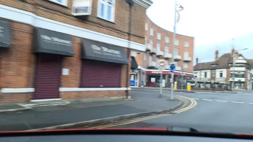
The Chiltern
Cinema and theater
Pub in Beaconsfield, Buckinghamshire, England, UK
12 Station Road, Beaconsfield



T Rayner & Son (Castlemans Farm Shop)
Farm and orchard · 2.3 mi
Green Common Lane, High Wycombe
Mo-Su 09:00-17:00
Museums and landmarks22

Amersham Museum
Museum · 3.9 mi
Private museum, local history in Buckinghamshire, England, United Kingdom

Cliveden
Museum · 4.1 mi
Country house in Taplow, Buckinghamshire, England, UK

Milton's Cottage
Museum · 3.4 mi
Grade I listed historic house museum in Chiltern, United Kingdom

Stanley Spencer Gallery
Museum · 4.4 mi
Art museum in Cookham, Berkshire, United Kingdom

Cookham Abbey
Monument and historic site · 4.4 mi
Abbey in Berkshire, England, UK

Wycombe Museum
Museum · 4.5 mi
Museum in High Wycombe, Buckinghamshire, United Kingdom
10 more on the map.
Parks, trails and playgrounds26


Bekonscot
Park
Oldest original model village in the world, located in Beaconsfield, Buckinghamshire, England, United Kingdom

Burnham Beeches
Park · 3.8 mi
Nature reserve in Buckinghamshire, England

Gomm's Wood
Park · 3.0 mi
Local nature reserve in Buckinghamshire, England

Holtspur Bank
Park · 1.4 mi
Local nature reserve in Buckinghamshire, England

Littleworth Common
Park · 3.1 mi
Protected area in Buckinghamshire, England

Warren Nature Reserve
Park · 2.5 mi
Local nature reserve in Buckinghamshire, England

Bulstrode Park
Park · 3.4 mi
Grade II* listed park and garden in Buckinghamshire, England, UK


Odds Farm Park
Sports field and stadium · 2.4 mi
Wooburn Common Road, High Wycombe
Mo-Su 10:00-17:30; Dec 25-26 off; Jan 01 off
14 more on the map.
Restaurants and cafes89
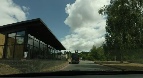
Starbucks
Cafe · Coffee Shop · 1.7 mi
Area 2 ExtraMSA Beaconsfield Services, Beaconsfield
Mo-Su 05:30-21:00
PizzaExpress
Restaurant · Pizza · 1.9 mi
ExtraMSA Beaconsfield Services, Beaconsfield
Mo-Su 11:30-22:00




Nando's
Restaurant · Chicken, Portuguese · 1.9 mi
ExtraMSA Beaconsfield Services, Beaconsfield
Tu-Th,Sa,Su 11:30-22:00; Mo 11:30-18:00; Fr 11:30-17:00
77 more on the map.
History
The parish comprises Beaconsfield town and land mainly given over arable land. Some beech forest remains to supply an established beech furniture industry in High Wycombe, the making of modal and various artisan uses.
Beaconsfield is recorded in property returns of 1185 where it is spelt Bekenesfeld, literally beechen field which would less archaically be read as clearing in the beeches. Nearby Burnham Beeches is a forest named after the beech genus. Although, it is often incorrectly contested that Beaconsfield derived its name from a street called Beacon Hill in neighbouring village, Penn, which was a lookout point and beacon originating in Saxon times. Local men were called to defend an island fort as the beacon was part of a chain from the naval base at Portsmouth via Butser Hill Hindhead, Hogsback and Windsor.
The parish church at the crossroads of Old Beaconsfield is dedicated to St Mary, it was rebuilt of flint and bath stone by the Victorians in 1869. The United Reformed Church in Beaconsfield can trace its roots of non-conformist worship in the town back to 1704. Old Beaconsfield has a number of old coaching inns along a wide street of red brick houses and small shops. It was the first (coach) stopping point on the road between London and Oxford, as it is equidistant between the two places.
Read more of the history
An annual charter fair is traditionally held on 10 May and has been held every year since 1269 celebrating its 750th year in 2019.
In the Victorian era the town was the home constituency of Benjamin Disraeli, Prime Minister of the United Kingdom in 1868 and then again from 1874 until 1880 (in fact his home, Hughenden Manor is in the nearby town of High Wycombe). In 1876 he was made the 1st Earl of Beaconsfield by Queen Victoria with whom he was very popular. It was due to this that Beaconsfield became a popular road name in industrial cities across the country in the late Victorian era.
It is the burial place of the author G. K. Chesterton, the writer Edmund Burke and the poet Edmund Waller, for whom a tall stone obelisk was erected over the tomb chest in St Mary and All Saints’ churchyard.
In 1624 Waller's family acquired Wilton Manor and Hall Barn in the town. "The Wallers, who came from Speldhurst, Kent," says the Victoria County history of Buckinghamshire, "were settled at Beaconsfield as early as the 14th century."
Ledborough was a former hamlet in the parish of Beaconsfield, in Buckinghamshire, England which has become incorporated into the urban area of the town of Beaconsfield as it rapidly expanded in the early part of the 20th century.
Beaconsfield is the home of Bekonscot model village, which was the first model village in the world; and Beaconsfield Film Studios becoming the National Film and Television School, where many filmmakers have trained, including the directors Nick Park, Lynne Ramsay and David Yates and the cinematographer Roger Deakins. It is the birthplace of Terry Pratchett, author of the Discworld series of fantasy novels. Several scenes in Brief Encounter, a classic film about a woman in a dull middle class marriage who almost undertakes an affair, were filmed in the town: Station Parade served as Milford High Street and Boots on Burke's Parade was where Alec runs into Laura. The exterior of the Royal Saracens Head Inn can be seen in the James Bond film Thunderball, and the interior shots for the pub in Hot Fuzz were filmed in the Royal Standard of England pub. Many other parts of the town have been used in films due to the old film studio and nearby Pinewood Studios.
The New Town was built one mile further to the north, when the railway arrived, at the turn of the 20th century. The railway station is on the Chiltern Main Line out of Marylebone towards High Wycombe, after which it then branches to Aylesbury, and Birmingham Snow Hill. Old Beaconsfield which grew up on the Oxford Road in part to serve the coach traffic, is mirrored by New Beaconsfield which has grown up round the station.
From the History section of Beaconsfield on Wikipedia, under CC BY-SA 4.0.
More about Beaconsfield
Education
Buckinghamshire Council operates a selective secondary education system, rather than a comprehensive system. Pupils can take the 11+ test at the beginning of year 6, when they are age 10 or 11. Approximately 30% attain a score that makes them eligible to go to grammar schools, as well as to the county's upper schools.
Alfriston School is a special school for girls, with moderate learning difficulties, between the ages of 11 and 18
Beaconsfield High School is a grammar school for girls between the ages of 11 and 18
The Beaconsfield School is a co-educational secondary school and sixth form. Its sixth-form students join with Beaconsfield High to increase the courses available
Davenies School is a private preparatory day school for boys between ages 4 and 13, with facilities including: a sports field, swimming pool, astroturf and sports hall
High March School is a private preparatory day school for girls between the ages of 3 and 11 with a few boys in the Nursery
St Mary's and All Saints is a Church of England primary school for girls and boys
Holtspur School & Pre-School is a pre-school and primary school for boys and girls
From the Wikipedia article Beaconsfield, under CC BY-SA 4.0.
Notable people from Beaconsfield
 Terry PratchettEnglish fantasy author (1948–2015)Photo: Luigi Novi, CC BY 3.0
 Jonathan WheatleyBritish engineerPhoto: Liauzh, CC BY 4.0
 Sam GyimahBritish politician (born 1976)Photo: Chris McAndrew, CC BY 3.0
 Chris HarrisBritish automotive journalist, racing driver and television presenterPhoto: Mac Edmunds, CC BY 4.0
 Suzy MenkesAmerican journalistPhoto: Myles Kalus Anak Jihem, CC BY-SA 4.0
 Christopher MeyerBritish diplomatPhoto: DoD photo by R. D. Ward. (Released), Public domain
 Sam TogwellEnglish association football player (born 1984)Photo: Mattythewhite, CC BY-SA 4.0
 Paul LaytonBritish actor and musicianPhoto: Nationaal Archief, Den Haag,..., CC BY-SA 3.0 nl
- Sarah BrownBritish campaigner for global health and education
- Piers Paul ReadBritish writer (born 1941)
- Christopher FrankFrench writer and film director
- Philip HubbleBritish swimmer, Olympic silver medallist
Born in Beaconsfield, according to Wikidata (CC0). Each name links to its Wikipedia article.
Where to stay7
Travelodge Beaconsfield Central
Motel and hotel · 0.8 mi
Aylesbury End, Beaconsfield
Churches and places of worship24
Shopping13
Gas and EV charging3
Schools, colleges and libraries17
Healthcare5
Map of Beaconsfield
211 places. The map loads OpenStreetMap tiles when you open it.
Getting there and nearby towns
Wycombe Air Park (HYC) is the nearest airport with scheduled flights listed in OpenStreetMap, 7 miles away.
- Chalfont Saint Peter 4 mi east, about 6 min by car
- High Wycombe 5 mi west, about 7 min by car
- Burnham 5 mi south, about 9 min by car
- Marlow 6 mi southwest, about 10 min by car
- Chesham 6 mi north, about 10 min by car
- Chorleywood 6 mi northeast, about 10 min by car
- Slough 7 mi south, about 12 min by car
- Rickmansworth 8 mi east, about 12 min by car
- Croxley Green 9 mi east, about 14 min by car
- Windsor 9 mi south, about 15 min by car
Drive times are estimates from straight-line distance, not routes.
Towns near Beaconsfield


Keep exploring
Local news
Headlines from INDB.
Reviews, tips and questions
Loading what members have shared...
Sources and licences
- GeoNames (CC BY 4.0): population, coordinates, regions and time zone
- Mapillary (see each image): photos
- OpenStreetMap contributors (ODbL 1.0): places, airports, map data
- Wikidata (CC0 1.0): elevation, founding date, time zone, website, landmarks and historic places
- Wikimedia Commons (see each image): photos
- Wikipedia (CC BY-SA 4.0): overview and history text
Photo credits
- -2022-02-17 Barclays Bank on Baring Road, Beaconsfield, Buckinghamshire, David Howard, CC BY-SA 2.0
- Bourne End Railway and Foot Bridge, Nancy, CC BY-SA 4.0
- CookhamBridge01, Motmit, CC BY-SA 3.0
- Amersham Museum, Jpbowen at English Wikipedia, CC BY-SA 3.0
- Cliveden-2382, Antony McCallum. The original uploader was Wyrdlight at English Wikipedia ., CC BY 3.0
- MiltonsCottage, MortimerCat, CC BY-SA 3.0
- Stanley Spencer Gallery, Cookham, Lagosman, CC BY-SA 3.0
- Holtspur Bank 4, Dudley Miles, CC BY-SA 4.0
- General view, Bekonscot, MichaelMaggs, CC BY-SA 2.5
- Golf Club House at Beaconsfield 02, Unknown author Unknown author, Public domain
- Jordans Meeting House exterior, LouiseBrown1981, CC BY-SA 3.0
- Coleshill Church, User:Sealman, Public domain
- Beaconsfield church, Sealman at English Wikipedia, Public domain
- Seer Green Church, Sealman ( talk ), CC BY-SA 3.0
- The Crown pub, Penn (27200475963), Peter O'Connor aka anemoneprojectors, CC BY-SA 2.0
- St Michael and All Angels Church, Beaconsfield, Buckinghamshire, Cristian Bortes from Cluj-Napoca, Romania, CC BY 2.0
- The Greyhound, Windsor End, Beaconsfield, May 2024, No Swan So Fine, CC BY-SA 4.0
- Warren Nature Reserve 3, Dudley Miles, CC BY-SA 4.0
- Long Grove Wood 1, Dudley Miles, CC BY-SA 4.0
- Gomm's Wood 4, Dudley Miles, CC BY-SA 4.0
- Nile Stream, Burnham Beeches 073 (26927663105), Peter O'Connor aka anemoneprojectors, CC BY-SA 2.0
- Littleworth Spinney, Littleworth Common, Burnham 054 (26906460425), Peter O'Connor aka anemoneprojectors, CC BY-SA 2.0
- Street-level photo, tallguy, CC BY-SA 4.0
- Street-level photo, southglos, CC BY-SA 4.0
- Street-level photo, tallguy, CC BY-SA 4.0
- Street-level photo, southglos, CC BY-SA 4.0
- Street-level photo, southglos, CC BY-SA 4.0
- Street-level photo, alexanderar, CC BY-SA 4.0
- Street-level photo, southglos, CC BY-SA 4.0
- Street-level photo, alexanderar, CC BY-SA 4.0
- Street-level photo, alexanderar, CC BY-SA 4.0
- Street-level photo, alexanderar, CC BY-SA 4.0
- Street-level photo, tallguy, CC BY-SA 4.0
- Street-level photo, alexanderar, CC BY-SA 4.0
- Street-level photo, southglos, CC BY-SA 4.0
- Street-level photo, alexanderar, CC BY-SA 4.0
- Street-level photo, alexanderar, CC BY-SA 4.0
- Street-level photo, southglos, CC BY-SA 4.0
- Street-level photo, alexanderar, CC BY-SA 4.0
- Street-level photo, southglos, CC BY-SA 4.0
- Street-level photo, alexanderar, CC BY-SA 4.0
- Street-level photo, trigpoint, CC BY-SA 4.0
- Street-level photo, tallguy, CC BY-SA 4.0
- Street-level photo, southglos, CC BY-SA 4.0


Page built November 10, 2026. Spotted a mistake? Tell us or suggest a place.