


Markinch, United Kingdom
Markinch is a town of 2,430 people in Scotland, United Kingdom.
Why visit Markinch
Townapedia lists 17 museums and landmarks, 20 parks and trails, 44 places to eat, 6 places to stay and 5 attractions in and around town.
Highlights include The River Leven Suspension Bridge, Balfarg Henge, Balbirnie Stone Circle and Riverside Park, Glenrothes.
Weather in Markinch
Forecast from MET Norway (CC BY 4.0). Full forecast
About Markinch
Markinch (, Scottish Gaelic: Marc Innis) is both a village and a parish in Fife, Scotland. According to an estimate taken in 2008, the village has a population of 2,420. The civil parish had a population of 16,530 (in 2011). Markinch is east of Fife's administrative centre, Glenrothes, and preceded Cupar as Fife's place of warranty and justice prior to the 13th century.
From the Wikipedia article Markinch (this version), under CC BY-SA 4.0.
Photos of Markinch


Things to do5

The River Leven Suspension Bridge
Bridge · 2.2 mi
Bridge in Glenrothes, Fife, Scotland


Museums and landmarks17

Balfarg Henge
Monument and historic site · 1.3 mi
20m wide henge with only two stones left
The Henge
24/7

Balbirnie Stone Circle
Monument and historic site · 1.1 mi
Archaeological site in Fife, Scotland
Balfarg Riding School enclosure
Monument and historic site · 1.2 mi
A reconstructed site interpreted as a mortuary enclosure on the site of Balfarg Riding School.


Balbirnie stone circle (original site)
Monument and historic site · 1.1 mi
Moved in 1970s to SE during road widening

5 more on the map.
Parks, trails and playgrounds20




8 more on the map.
Restaurants and cafes44
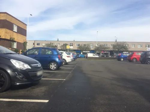
Rara Tal
Restaurant · Indian · 1.5 mi
Mo-Th 12:00-15:00,16:30-21:00; Fr,Sa 12:00-21:30; Su 15:00-21:00


Costa
Cafe · Coffee Shop · 1.5 mi
38 Lyon Way
Mo-Fr 08:00-17:30; Sa 08:00-17:00; Su 09:30-16:30

Balgonie Arms
Bar and pub · 1.2 mi
42 Main Street
Th 16:00-23:00, Fr 12:00-24:00, Sa 11:30-24:00, Su 12:00-23:00

32 more on the map.
History
The earliest indications of human activity around Markinch are Balfarg henge and Balbirnie Stone Circle, in an area now incorporated into the new town of Glenrothes, but formerly part of Markinch Parish. They are said to date back to 3,000 BC from the Neolithic period.
The name Markinch derives from the Scottish Gaelic Mark Innis. Mark is the Gaelic for horse, specifically a steed or charger, and innis is the Gaelic for a meadow or an island, here probably meaning a piece of land rising out of or above a body of water or a bog. The earliest written reference is a charter of around 1050 transferring ownership of the church to the Culdees of Loch Leven. Fife's early medieval place of legal assembly is listed as Dalgynch in early Scottish law books and charters. The original site of Dalginch is now believed to have been on the cemetery mound at Northhall, 500m northeast of Markinch Church. This has led to Markinch's designation as "The Capital Place of Fife".
Read more of the history
The provincial importance of Markinch under the MacDuff Earls of Fife is likely to account for the very high architectural quality of the early 12th century church tower. The church was originally dedicated to St Drostan but later in the 13th century a re-dedication to St John the Baptist took place. Both saints fair days were celebrated up until the 19th century. The Norman-style tower and the east and west gables date from this early period and chip-cut stone carving can be seen surrounding the tower as well as in reset stones on the south wall. The Hepburn coat of arms was inserted into the west gable by Prior John Hepburn in the early part of the 16th century but none of his work is now visible. The south wall was rebuilt from mainly 12th century masonry when the church was enlarged in the 17th century. Further enlargements to the north took place in the 19th century (1807 and 1884). The octagonal spire on the Norman tower dates from 1807 and is now lacking its four corner pinnacles. 19th century Brunton Church and Balbirnie Church have both been converted for domestic use and the parishes of Thornton and Markinch have been merged.
On the northern outskirts of the town beside the East Lodge of Balbirnie House stands the ancient Stob Cross which may be a Pictish Class II symbol stone defaced during the Reformation.
The town is built on the top and sides of a low ridge, which was once high ground surrounded by marshes (innis in Scots Gaelic). The height of this ridge is greater at its northern and southern extremities than at the centre. Markinch Hill has six terraces on the northern side cut into the sand and gravel. These are thought to be either medieval or Neolithic in origin. Recent rhododendron clearance has made them visible once more, and the view from the top of the hill to the south has been restored. The trees on the hill were planted by General Balfour of Balbirnie around 1820.
During the Industrial Revolution in the middle of the 19th century, the village started to adapt to spinning and weaving production. The use of water wheels of the corn and meal mills encouraged new industries to begin along the River Leven on land between Auchmuty (now part of Glenrothes) and Milton of Balgonie in the form of paper mills, bleach mills and ironworks. Papermaking was an important local employer based on the town's close proximity to the River Leven, until one of the two paper mills in the town, Sappi Graphics, closed down in 2001. The Tullis Russell paper mill, however, was still in operation, with a 474 strong workforce, until it went into administration in April 2015. Markinch's former Haig's Whisky bottling plant is now used as a business park and is split into small units. This is where Fife radio station Kingdom FM was based until October 2016. Haig's operated here for over a century until 1983 before moving to modern premises at Banbeath, Leven. It provided employment to a large workforce drawn from the town and from various parts of Fife. A queue of buses would be waiting for them at finishing time. Even in 1983 the workforce comprised some 500 employees. Many local residents still have connections with the firm, now absorbed into Diageo.
Markinch war memorial was erected in 1920 to a design by Sir Robert Lorimer. Further names were added to the memorial following the Second World War.
From the History section of Markinch on Wikipedia, under CC BY-SA 4.0.
Notable people from Markinch
- Jamie RossAmerican actor
- James StuartBritish educator and politician (1843-1913)
- Davie DuncanScottish footballer (1921-1991)
- David JackBritish pharmacologist
- Robert CraigScottish academic and church leader (1917-1995)
- Bill JohnstoneScottish footballer
- James Imrieassociation football player
Born in Markinch, according to Wikidata (CC0). Each name links to its Wikipedia article.
Where to stay6
Churches and places of worship10
Coaltown of Balgonie United Reformed Church
Church · United Reformed · 1.3 mi
Main Street, Coaltown of Balgonie
St Margaret's Church
Church · Church Of Scotland · 1.1 mi
Woodside Road, Glenrothes
Shopping27
Gas and EV charging2
Schools, colleges and libraries8
Fife College - Auchmuty Learning Centre
School · 1.4 mi
81 Alexander Road, Glenrothes
Healthcare6
Map of Markinch
145 places. The map loads OpenStreetMap tiles when you open it.
Getting there and nearby towns
Leuchars Station (ADX) is the nearest airport with scheduled flights listed in OpenStreetMap, 16 miles away.
- Glenrothes 2 mi west, about 2 min by car
- Thornton 3 mi south, about 4 min by car
- Falkland 4 mi northwest, about 7 min by car
- Methil 5 mi east, about 7 min by car
- Ladybank 5 mi north, about 8 min by car
- Kirkcaldy 6 mi south, about 10 min by car
- Cowdenbeath 10 mi southwest, about 16 min by car
- Newburgh 11 mi north, about 18 min by car
- Milnathort 11 mi west, about 18 min by car
- Abernethy 11 mi northwest, about 18 min by car
Drive times are estimates from straight-line distance, not routes.
Towns near Markinch


Keep exploring
Local news
Headlines from INDB.
Reviews, tips and questions
Loading what members have shared...
Sources and licences
- GeoNames (CC BY 4.0): population, coordinates, regions and time zone
- Mapillary (see each image): photos
- OpenStreetMap contributors (ODbL 1.0): places, airports, map data
- Wikidata (CC0 1.0): elevation, founding date, time zone, website, landmarks and historic places
- Wikimedia Commons (see each image): photos
- Wikipedia (CC BY-SA 4.0): overview and history text
Photo credits
- Markinch, Mcwesty at English Wikipedia (Michael Westwater), Public domain
- Town Hall, Betson Street, Markinch, Drkirstyross, CC BY-SA 3.0
- Markinch, Betson Street, Primary School, Drkirstyross, CC BY-SA 3.0
- Morven, Victoria Road, Markinch, Drkirstyross, CC BY-SA 3.0
- 16 Betson Street, Markinch, Drkirstyross, CC BY-SA 3.0
- 12, 14 Betson Street, Markinch, Drkirstyross, CC BY-SA 3.0
- Clinic, Betson Street, Markinch, Drkirstyross, CC BY-SA 3.0
- Markinch, Betson Street, Markinch Institute, Drkirstyross, CC BY-SA 3.0
- Laurel Bank Hotel, Balbirnie Street, Markinch, Drkirstyross, CC BY-SA 3.0
- 27 Balbirnie Street And 2 Betson Street, Markinch, Drkirstyross, CC BY-SA 3.0
- 29 Balbirnie Street, Markinch, Drkirstyross, CC BY-SA 4.0
- Markinch (1), Drkirstyross, CC BY-SA 3.0
- 76, 78 High Street, 74A, Markinch, Drkirstyross, CC BY-SA 3.0
- Markinch, Balbirnie Street, War Memorial, Drkirstyross, CC BY-SA 3.0
- Royal Bank Of Scotland, Balbirnie Street, Markinch, Drkirstyross, CC BY-SA 3.0
- 32 Balbirnie Street, Markinch, Drkirstyross, CC BY-SA 3.0
- 27 High Street, Markinch, Drkirstyross, CC BY-SA 4.0
- Outbuilding, Beechcroft, Balbirnie Street, Markinch, Drkirstyross, CC BY-SA 3.0
- Beechcroft, Balbirnie Street, Markinch, Drkirstyross, CC BY-SA 3.0
- Stable And Gig House, Antique Shop, 13-15 Commercial Street, Markinch, Drkirstyross, CC BY-SA 4.0
- Markinch Station from across the car park, Drkirstyross, CC BY-SA 4.0
- Markinch Station with wall in front, Drkirstyross, CC BY-SA 4.0
- Balbirnie Stone Circle, Kilnburn ( talk ) 18:49, 18 June 2009 (UTC), Attribution
- Park at Glenrothes, User:Victuallers, CC BY-SA 1.0
- New Auchmuty High School, Yoostar, CC BY-SA 3.0
- Balbirnie House, Michael Westwater ( Mcwesty ) at en.wikipedia, Public domain
- BalgonieCastle04, No machine-readable author provided. Supergolden assumed (based on copyright claims)., CC BY-SA 3.0
- Kingdom Shopping Centre - west entrance, Mcwesty at English Wikipedia, CC BY-SA 3.0
- St Pauls RC Church Glenrothes, Michael Westwater ( Mcwesty ) at en.wikipedia, CC BY-SA 3.0
- Balfarg Henge Remains, Glenrothes, RRRW001, CC BY-SA 4.0
- Auchmuty High School 2004, Mcwesty ( talk ), CC BY-SA 3.0
- SNP Office Peter Grant, Xabier Cid, CC BY-SA 2.0
- Church Service Society, Drkirstyross, CC BY-SA 3.0
- Street-level photo, communitylinks, CC BY-SA 4.0
- Street-level photo, southglos, CC BY-SA 4.0
- Street-level photo, communitylinks, CC BY-SA 4.0
- Street-level photo, hobgoblin, CC BY-SA 4.0
- Street-level photo, communitylinks, CC BY-SA 4.0
- Street-level photo, communitylinks, CC BY-SA 4.0
- Street-level photo, communitylinks, CC BY-SA 4.0
- Street-level photo, communitylinks, CC BY-SA 4.0


Page built November 10, 2026. Spotted a mistake? Tell us or suggest a place.