


Why visit Moffat
Townapedia lists 7 museums and landmarks, 6 parks and trails, 14 places to eat, 13 places to stay and 2 attractions in and around town.
Highlights include Moffat Museum, Auldton Mote and Moffat Golf Course.
Weather in Moffat
Forecast from MET Norway (CC BY 4.0). Full forecast
About Moffat
Moffat is a historic market town, burgh and parish in Dumfries and Galloway, Scotland. Historically part of Dumfriesshire, it lies on the River Annan, and was a centre of the wool trade and a spa town. It had a population of 2,497 in 2022.
From the Wikipedia article Moffat, Dumfries and Galloway (this version), under CC BY-SA 4.0.
Photos of Moffat


Things to do2


Museums and landmarks7

Parks, trails and playgrounds6


Restaurants and cafes14
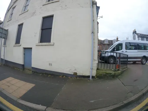
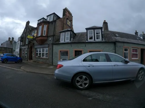
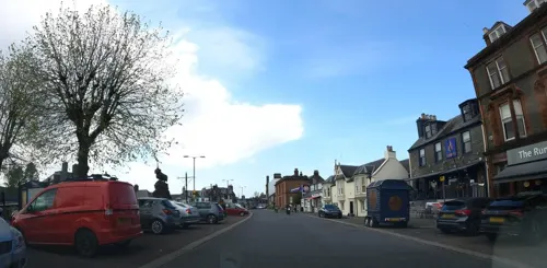
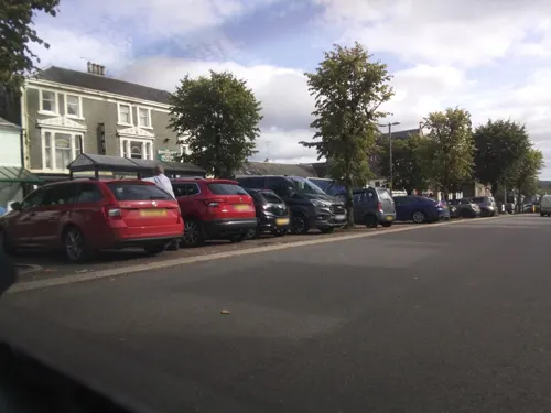

Coachman Bar
Bar and pub
3 High Street, Moffat
Mo-We 11:00-23:00; Th-Fr 11:00-24:00; Sa 11:00-01:00; Su 12:00-23:00




2 more on the map.
History
From 1633 Moffat began to grow from a small village into a popular spa town. The sulphurous and saline waters of Moffat Spa were believed to have healing properties, specifically curative for skin conditions, gout, rheumatism and stomach complaints. In 1730 these were complemented by the addition of iron springs. During the Victorian era the high demand led to the water being piped down from the well to a tank in Tank Wood and on to a specially built bath house in the town centre (Moffat Town Hall).
The population of Moffat at the time of the 1841 census was 1,413 inhabitants.
Luxurious hotels sprang up to accommodate the increasing numbers of tourists. One such hotel opened during Moffat's heyday in 1878, Moffat's Hydropathic hotel was destroyed in a fire in 1921.
The old well was refurbished in the mid 1990s, and is still accessible by vehicle and foot. The water smells very strongly of sulphur, with deposits on the walls and well itself. At the grand reopening of the well, people visiting were encouraged to drink a glass full.
Read more of the history
The well can be reached by following Haywood Road and climbing up Tank Wood (on the right at the top): the path at the end was the original route to the well. An alternative is to drive or walk up Well Road, and eventually, one reaches the Well Cottage and the car park for the well. As stated, when the water was first piped into town for the baths, it was pumped uphill to a tank in the appropriately named Tank Wood, before travelling back downhill to the bath house.
Larchhill Well was a chalybeate well located on Old Well Road near Wellwoodhead Cottage. The well is no longer visible.
The name of the town Moffat is the anglicised form of an endonym, of Gaelic origin. This quasi-place-name has been theorized to be translated as "the long plain," which could be derived from two elements: magh ("plain") and fada ("long"). The area of Moffat lies at the head of the plain of Annandale which stretches south as far as the eye can see from the hills above Moffat.
From the History section of Moffat, Dumfries and Galloway on Wikipedia, under CC BY-SA 4.0.
More about Moffat
Arts and culture
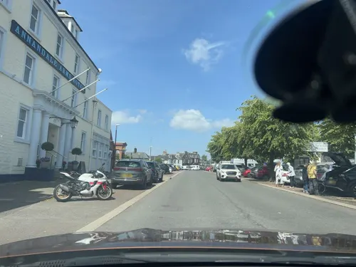
The town attracts many tourists all year round, both as visitors and as walkers in the surrounding hills. Notable buildings include the Annandale Arms Hotel and Restaurant which has been awarded several AA rosettes, Real and Local Food medals and four stars from Food Review Scotland.
Shops include the Moffat Toffee Shop and The Edinburgh Woollen Mill, while its restaurants and cafes include The Bombay Cuisine, Claudio's, Arietes, The Rumblin' Tum, The Balmoral and the Buccleuch Arms Hotel and Restaurant. The Buccleuch has also been awarded Gold in Visitscotland's Green Tourism Business Scheme.
Moffat also has a recreation park with a boating pond and a memorial to Air Chief Marshal Hugh Dowding.
There is an official Camping and Caravanning Club campsite (for tents, caravans and motorhomes) that is open all year as of 13 March 2008. This is situated next to the Hammerlands Centre - a combination garden centre, gift shop, restaurant, fish farm and children's play area with farmyard animals.
For walkers there is also the Gallow Hill. Moffat is also situated only a few miles from the Southern Upland Way where it passes through Beattock, and the Sir Walter Scott Way starts here.
Northeast of Moffat is the Grey Mare's Tail waterfall, this hanging-valley waterfall is 60m tall and lies within a nature reserve.
Education
Moffat Academy teaches pupils of Nursery, Primary and Secondary School age; there are currently just over 520 pupils taught at the school. It was sited in its former location in the north of the town from 1834. In February 2010 the school moved to a new site in the south-east of the town on Jeff Brown Drive.
From the Wikipedia article Moffat, Dumfries and Galloway, under CC BY-SA 4.0.
Notable people from Moffat
 Hugh Dowding, 1st Baron DowdingBritish officer in the Royal Air Force (1882-1970)Photo: Ministry of Information official photographer, Public domain
 Danny BhoyBritish comedianPhoto: Anirudh Koul from Montreal, Canada, CC BY-SA 2.0
 John F. CowanNorth Dakota lawyer and politician (1858–1917)Photo: Unknown author, Public domain
- William CarruthersBritish botanist (1830–1922)
- James D. MurrayAmerican mathematician
- George TaitEnglish footballer (1859-1882)
- John Alexander StewartScottish writer, poet, teacher, lecturer and philosopher
- John GreigAmerican politician (1779-1858)
- Linda GilroyBritish politician (born 1949)
- Anita de St. QuentinScottish-born French figure skater
- James B. NivenScottish footballer (1861-1933)
- Edward Ewartrugby player (1860-1935)
Born in Moffat, according to Wikidata (CC0). Each name links to its Wikipedia article.
Where to stay13
Churches and places of worship3
Shopping14
Gas and EV charging2
Schools, colleges and libraries1
Healthcare4
Map of Moffat
66 places. The map loads OpenStreetMap tiles when you open it.
Getting there and nearby towns
Carlisle Lake District Airport (CAX) is the nearest airport with scheduled flights listed in OpenStreetMap, 37 miles away.
- Thornhill 15 mi southwest, about 24 min by car
- Sanquhar 19 mi west, about 31 min by car
- Dumfries 20 mi south, about 31 min by car
- Peebles 24 mi northeast, about 39 min by car
- Hawick 26 mi east, about 42 min by car
- Selkirk 28 mi northeast, about 45 min by car
- Longtown 29 mi southeast, about 47 min by car
- New Cumnock 29 mi west, about 47 min by car
- Galashiels 31 mi northeast, about 51 min by car
- Carluke 32 mi northwest, about 51 min by car
Drive times are estimates from straight-line distance, not routes.
Towns near Moffat


Keep exploring
Local news
Headlines from INDB.
Reviews, tips and questions
Loading what members have shared...
Sources and licences
- GeoNames (CC BY 4.0): population, coordinates, regions and time zone
- Mapillary (see each image): photos
- OpenStreetMap contributors (ODbL 1.0): places, airports, map data
- Wikidata (CC0 1.0): elevation, founding date, time zone, website, landmarks and historic places
- Wikimedia Commons (see each image): photos
- Wikipedia (CC BY-SA 4.0): overview and history text
Photo credits
- Moffat from the hills, The original uploader was Robma at English Wikipedia ., CC BY-SA 2.5
- Boundary wall to Victoria Place, Larch-hill house Moffat, Mainlymazza, CC BY-SA 4.0
- 03481 Former United Presbyterian Church, Moffat 001, WeeHolly, CC BY-SA 4.0
- 03481 Former United Presbyterian Church, Moffat 003, WeeHolly, CC BY-SA 4.0
- 03481 Former United Presbyterian Church, Moffat 004, WeeHolly, CC BY-SA 4.0
- 03481 Former United Presbyterian Church, Moffat 002, WeeHolly, CC BY-SA 4.0
- 04761 Former St Mary's United Free Church, Moffat 014, WeeHolly, CC BY-SA 4.0
- 04761 Former St Mary's United Free Church, Moffat 020, WeeHolly, CC BY-SA 4.0
- 04761 Former St Mary's United Free Church, Moffat 013, WeeHolly, CC BY-SA 4.0
- 04761 Former St Mary's United Free Church, Moffat 019, WeeHolly, CC BY-SA 4.0
- 04761 Former St Mary's United Free Church, Moffat 001, WeeHolly, CC BY-SA 4.0
- 04761 Former St Mary's United Free Church, Moffat 010, WeeHolly, CC BY-SA 4.0
- 04761 Former St Mary's United Free Church, Moffat 003, WeeHolly, CC BY-SA 4.0
- 04761 Former St Mary's United Free Church, Moffat 012, WeeHolly, CC BY-SA 4.0
- 04761 Former St Mary's United Free Church, Moffat 006, WeeHolly, CC BY-SA 4.0
- 04761 Former St Mary's United Free Church, Moffat 002, WeeHolly, CC BY-SA 4.0
- Street-level photo, ccbb7766, CC BY-SA 4.0
- Street-level photo, hobgoblin, CC BY-SA 4.0
- Street-level photo, southglos, CC BY-SA 4.0
- Street-level photo, lucagm, CC BY-SA 4.0
- Street-level photo, hobgoblin, CC BY-SA 4.0
- Street-level photo, hobgoblin, CC BY-SA 4.0
- Street-level photo, lucagm, CC BY-SA 4.0
- Street-level photo, hobgoblin, CC BY-SA 4.0
- Street-level photo, hobgoblin, CC BY-SA 4.0
- Street-level photo, hobgoblin, CC BY-SA 4.0
- Street-level photo, hobgoblin, CC BY-SA 4.0
- Street-level photo, hobgoblin, CC BY-SA 4.0
- Street-level photo, hobgoblin, CC BY-SA 4.0
- Street-level photo, southglos, CC BY-SA 4.0
- Street-level photo, southglos, CC BY-SA 4.0
- Street-level photo, lucagm, CC BY-SA 4.0
- Street-level photo, ccbb7766, CC BY-SA 4.0
- Street-level photo, ccbb7766, CC BY-SA 4.0
- Street-level photo, hobgoblin, CC BY-SA 4.0
- Street-level photo, southglos, CC BY-SA 4.0


Page built November 10, 2026. Spotted a mistake? Tell us or suggest a place.