


Dumfries, United Kingdom
Dumfries is a town of 46,500 people in Scotland, United Kingdom.
Why visit Dumfries
Townapedia lists 27 museums and landmarks, 18 parks and trails, 77 places to eat, 12 places to stay and 3 attractions in and around town.
Highlights include Theatre Royal, Dumfries, Dumfries Museum, Gracefield Arts Centre and Palmerston Park.
Weather in Dumfries
Forecast from MET Norway (CC BY 4.0). Full forecast
About Dumfries
Dumfries ( dum-FREESS; from Scottish Gaelic: Dùn Phris [ˌt̪un ˈfɾʲiʃ]) is a market town and former royal burgh in Dumfries and Galloway, Scotland, near the mouth of the River Nith on the Solway Firth, 25 miles (40 km) from the Anglo-Scottish border. Dumfries is the county town of the historic county of Dumfriesshire.
From the Wikipedia article Dumfries (this version), under CC BY-SA 4.0.
Travel tips from other travellers: Dumfries on Wikivoyage (CC BY-SA 4.0).
Things to do3

Theatre Royal, Dumfries
Cinema and theater
Theatre in Dumfries, Scotland


Museums and landmarks27

Dumfries Museum
Museum
Museum in Dumfries, United Kingdom
Rotchell Road, Dumfries
Mar 23-Sep 30 Mo-Sa 10:00-17:00, Su 14:00-17:00; Oct 01-Mar 22...
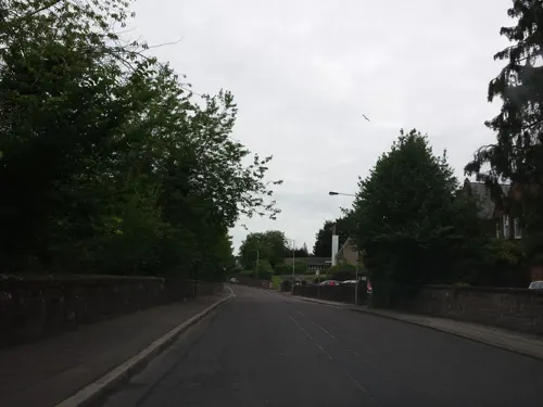
Gracefield Arts Centre
Museum
Museum in Dumfries and Galloway, Scotland, UK
Edinburgh Road, Dumfries

Dumfries and Galloway Aviation Museum
Museum · 2.2 mi
Aviation museum in Dumfries, Scotland, United Kingdom


Twelve Apostles Stone Circle
Monument and historic site · 2.5 mi
Stone circle at Newbridge, Dumfries and Galloway, Scotland, UK


Old Bridge House Museum
Museum
Mill Road, Dumfries
Apr-Sep: Mo-Sa 10:00-17:00; Apr-Sep: Su 14:00-17:00

Curriestanes cursus
Monument and historic site · 1.0 mi
Cursus now seen as field markings, in Troqueer, Dumfries and Galloway, Scotland, UK, protected as scheduled monument SM5738
Benches Plaque
Monument and historic site · 0.6 mi
A plaque explaining the origin of the nine nearby benches dated from as far back as 1828 which used to be located at the old infirmary.
British Merchant Navy Memorial
Monument and historic site · 0.5 mi
Sandstone structure in the style of a boat.
15 more on the map.
Parks, trails and playgrounds18





6 more on the map.
Restaurants and cafes77
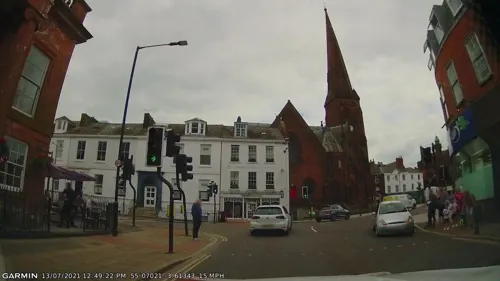
Robert the Bruce
Bar and pub · Breakfast, Burger, Curry, Fish And Chips, Local, Pasta
81-85 Buccleuch Street, Dumfries
Su-Th 08:00-24:00, Fr,Sa 08:00-01:00
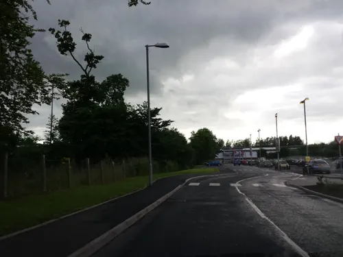
Costa Drive Thru
Cafe · Coffee Shop · 0.7 mi
Glasgow Road, Dumfries
Mo-Fr 07:00-20:00, Sa 09:00-19:00, Su 09:30-19:00



65 more on the map.
History
There is no definite record about the time and manner of Dumfries's founding. Some writers hold that Dumfries flourished as a place of distinction during the Roman occupation of North Great Britain. The Selgovae inhabited Nithsdale at the time and may have raised some military works of a defensive nature on or near the site of Dumfries; and it is more than probable that a castle of some kind formed the nucleus of the town. This is inferred from the etymology of the name, which, according to one theory, is resolvable into two Gaelic terms signifying a castle or fort in the copse or brushwood. Dumfries was once within the borders of the Kingdom of Northumbria.
According to another theory, the name is a corruption of two words which mean the Friars' Hill; those who favour this idea allege that St. Ninian, by planting a religious house near the head of what is now the Friars' Vennel, at the close of the fourth century, became the virtual founder of the Burgh; however Ninian, so far as is known, did not originate any monastic establishments anywhere and was simply a missionary. In the list of British towns given by the ancient historian Nennius, the name Caer Peris occurs, which some modern antiquarians suppose to have been transmuted, by a change of dialect, into Dumfries.
From the History section of Dumfries on Wikipedia, under CC BY-SA 4.0.
More about Dumfries
Geography
Like the rest of Dumfries and Galloway, of Scotland's three major geographical areas Dumfries lies in the Southern Uplands. The river Nith runs through Dumfries toward the Solway Firth in a southwards direction splitting the town into East and West. At low tide, the sea recedes to such an extent on the shallow sloping sands of the Solway that the length of the Nith is extended by 13 km to 113.8 km (70.7 mi). This makes the Nith Scotland's seventh longest river. There are several bridges across the river within the town. In between the Devorgilla Bridge (also known as 'The Old Bridge') and the suspension bridge is a weir colloquially known as 'The Caul'. In wetter months of the year the Nith can flood the surrounding streets. The Whitesands has flooded on average once a year since 1827.
Economy
Dumfries has a long history as a county town, and as the market town of a surrounding rural hinterland.
The North British Rubber Company started manufacturing in 1946 at Heathhall on the former site of the Arrol-Johnston Motor Company which was said to be the most advanced light engineering factory of its day in Scotland. It became Uniroyal Ltd in the 1960s and was where the Hunter Boot and Powergrip engine timing belts were manufactured. In 1987 it changed name to the British subsidiary of the Gates Rubber Company and later was known as Interfloor from 2002 until the factory closed in 2013.
Dumfries is a relatively prosperous community but the town centre has been exposed to the centrifugal forces that have seen retail, business, educational, residential and other uses gravitate towards the town's urban fringe. This was started in the 1980s with the building of the Dumfries bypass. The immediate effect of this was as intended the diversion of transiting traffic away from the town centre. This brought with it an accompanying reduction in economic input to the town centre. The second effect of this has been more pronounced. Sites close to the bypass have attracted development to utilise the bypass as a high speed urban highway without the bottlenecks of the town centre and without the constraining limited town centre parking.
Arts and culture
Dumfries got its nickname 'Queen of the South' from David Dunbar, a local poet, who in 1857 stood in the general election. In one of his addresses he called Dumfries "Queen of the South" and this became synonymous with the town.
The term doonhamer comes from the way that natives of Dumfries over the years have referred to the area when working away from home. The town is often referred to as doon hame in the Scots language (down home). The term doonhamer followed, to describe those that originate from Dumfries. The Doonhamers is also the nickname of Queen of the South who represent Dumfries and the surrounding area in the Scottish Football League. The crest of Dumfries contains the words, "A Lore Burne". In the history of Dumfries close to the town was the marsh through which ran the Loreburn whose name became the rallying cry of the town in times of attack – A Lore Burne (meaning 'to the muddy stream').
In 2017 Dumfries was ranked the happiest place in Scotland by Rightmove.
Located on top of a small hill, Dumfries Museum is centred on the 18th-century windmill which stands above the town. Included are fossil footprints left by prehistoric reptiles, the wildlife of the Solway marshes, tools and weapons of the earliest peoples of the region and stone carvings of Scotland's first Christians. On the top floor of the museum is a camera obscura.
From the Wikipedia article Dumfries, under CC BY-SA 4.0.
Notable people from Dumfries
 Calvin HarrisScottish electronic music producer and DJ (born 1984)Photo: Sony BMG, CC BY 3.0
 Grant HanleyScottish association football player (born 1991)Photo: Bryan Berlin, CC BY-SA 4.0
 Allan McNishBritish racing driverPhoto: David Merrett from Daventry, England, CC BY 2.0
 David MundellScottish Conservative politician and government minister (born 1962)Photo: ©House of Commons / photography by..., CC BY 3.0
 Flora MurrayScottish doctorPhoto: Unknown photographer, Public domain
 John LaurieScottish actor (1897–1980)Photo: Walt Disney Productions, Public domain
 Dougal DixonBritish authorPhoto: Jean Dixon, CC BY 4.0
 Ian CallumBritish car designerPhoto: Jaguar MENA, CC BY 2.0
 Sam MalcolmsonNew Zealand footballer (1947–2024)Photo: Snowypeak, CC BY-SA 3.0
- John RichardsonScottish naval surgeon, naturalist and arctic explorer (1787–1865)
- Alister JackBritish politician
- David MurdochScottish and British curler and coach
Born in Dumfries, according to Wikidata (CC0). Each name links to its Wikipedia article.
Where to stay12
Churches and places of worship16
St Bride's Anglican Church (former Greyfriars' Church), Church Crescent, Dumfries
Church
Troqueer Parish Church
Church · Church Of Scotland · 0.7 mi
Troqueer Road, Dumfries
Dumfries Northwest Parish Church
Church · Church Of Scotland · 1.2 mi
Lochside Road, Dumfries
St John's Scottish Episcopal Church
Church · Scottish Episcopal
6 Newall Terrace, Dumfries
Shopping17
Gas and EV charging3
Schools, colleges and libraries18
Healthcare8
G R Blount Pharmacy
Clinic and pharmacy · 0.4 mi
St Michael's Bridge Road, Dumfries
Map of Dumfries
199 places. The map loads OpenStreetMap tiles when you open it.
Getting there and nearby towns
Carlisle Lake District Airport (CAX) is the nearest airport with scheduled flights listed in OpenStreetMap, 33 miles away.
- Carlisle 29 mi southeast, about 47 min by car
- Workington 30 mi south, about 48 min by car
- Whitehaven 36 mi south, about 58 min by car
- Hawick 41 mi northeast, about 1 h by car
- Penrith 44 mi southeast, about 1 h 15 min by car
- Larkhall 48 mi north, about 1 h 15 min by car
- Meikle Earnock 50 mi north, about 1 h 15 min by car
- Wishaw 50 mi north, about 1 h 15 min by car
- Hamilton 51 mi north, about 1 h 15 min by car
- Kilmarnock 51 mi northwest, about 1 h 15 min by car
Drive times are estimates from straight-line distance, not routes.
Towns near Dumfries


Keep exploring
Local news
Headlines from INDB.
Reviews, tips and questions
Loading what members have shared...
Sources and licences
- GeoNames (CC BY 4.0): population, coordinates, regions and time zone
- Mapillary (see each image): photos
- OpenStreetMap contributors (ODbL 1.0): places, airports, map data
- Wikidata (CC0 1.0): elevation, founding date, time zone, website, landmarks and historic places
- Wikimedia Commons (see each image): photos
- Wikipedia (CC BY-SA 4.0): overview and history text
Photo credits
- Dumfries - panoramio (1), cisko66, CC BY 3.0
- Hole i' the Wa' entrance, Dumfries - 2023-12-26, The wub, CC BY-SA 4.0
- Dumfries downtown 4, Ruskin, CC BY-SA 4.0
- Greyfriars' Church, Dumfries (48814927137), Tom Parnell from Scottish Borders, Scotland, CC BY-SA 2.0
- Dumfries downtown 3, Ruskin, CC BY-SA 4.0
- Shakespeare St, Dumfries, Contains Mild Peril ( talk ), CC BY-SA 3.0
- Dumfries Museum Windmill tower at night, FutureMuseumSW, CC BY-SA 3.0
- Dunfries and Galloway Aviation Museum Lightning F53, Expatscot, CC BY-SA 3.0
- Twelve Apostles Stone Circle 2017-05-16 - 1, August Schwerdfeger, CC BY 4.0
- Lincluden Collegiate Church - April 2008, Bubobubo2, CC BY-SA 3.0
- Burns Statue and Greyfriars, Dumfries, MSDMSD, CC BY-SA 3.0
- Palmerston Park main stand, en:User:Jmorrison230582, CC BY-SA 3.0
- Crichton church winter, Grant McIntosh Photography, CC BY-SA 4.0
- Burns Mausoleum, Jonathan Oldenbuck, CC BY-SA 3.0
- Queensberry Hotel, 16 English Street, Dumfries, Sara Thomas, CC BY-SA 4.0
- Troqueer parish church, Grant McIntosh Photography, CC BY-SA 4.0
- Robert Burns statue at night, Grant McIntosh Photography, CC BY-SA 4.0
- The Theatre Royal at nyt, Grant McIntosh Photography, CC BY-SA 4.0
- Street-level photo, rudolfmayer, CC BY-SA 4.0
- Street-level photo, gmc, CC BY-SA 4.0
- Street-level photo, gmc, CC BY-SA 4.0
- Street-level photo, rudolfmayer, CC BY-SA 4.0
- Street-level photo, rudolfmayer, CC BY-SA 4.0
- Street-level photo, rudolfmayer, CC BY-SA 4.0
- Street-level photo, rudolfmayer, CC BY-SA 4.0
- Street-level photo, rudolfmayer, CC BY-SA 4.0
- Street-level photo, rudolfmayer, CC BY-SA 4.0
- Street-level photo, gmc, CC BY-SA 4.0
- Street-level photo, rudolfmayer, CC BY-SA 4.0
- Street-level photo, gmc, CC BY-SA 4.0
- Street-level photo, albertdougie15, CC BY-SA 4.0
- Street-level photo, rudolfmayer, CC BY-SA 4.0


Page built November 10, 2026. Spotted a mistake? Tell us or suggest a place.