


Sanquhar, United Kingdom
Sanquhar is a town of 1,980 people in Scotland, United Kingdom.
Why visit Sanquhar
Townapedia lists 15 museums and landmarks, 4 parks and trails, 5 places to eat, 3 places to stay and 2 attractions in and around town.
Highlights include Euchan Fall, Sanquhar Tolbooth Museum, Tolbooth, High Street, Sanquhar and Crawick Multiverse.
Weather in Sanquhar
Forecast from MET Norway (CC BY 4.0). Full forecast
About Sanquhar
Sanquhar (Scots: Sanchar, Scottish Gaelic: Seanchair) is a historic market town and former royal burgh on the River Nith in Dumfries and Galloway, Scotland, north of Thornhill and west of Moffat. The town is approximately 49 miles (79 km) southwest of Edinburgh, 36 miles (58 km) southeast of Glasgow, and 24 miles (38 km) north-northwest of Dumfries. It had a population of 1,913 in 2022.
From the Wikipedia article Sanquhar (this version), under CC BY-SA 4.0.
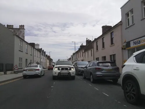
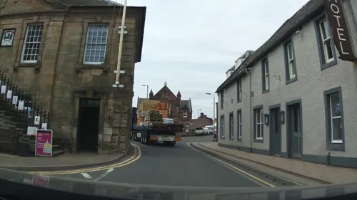
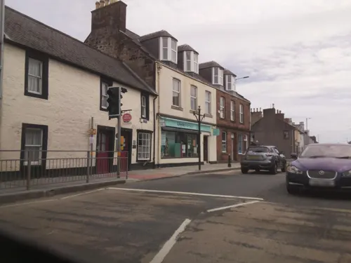
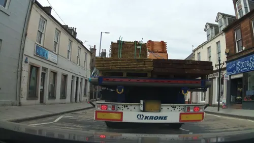
Photos of Sanquhar


Things to do2

Euchan Fall
Waterfall · 0.8 mi
Waterfall in Dumfries and Galloway, Scotland, UK

Clarks Little Ark Petting Zoo
Zoo and aquarium · 0.5 mi
St Mary’s Street, Sanquhar
Museums and landmarks15
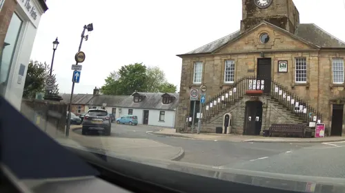
Tolbooth, High Street, Sanquhar
Museum
Municipal building in Sanquhar, Scotland


Centerary of The Riding of the Marches statue
Monument and historic site · 0.5 mi

3 more on the map.
Parks, trails and playgrounds4



Restaurants and cafes5
History
The name "Sanquhar" comes from the Scottish Gaelic language An t-Seanchair, meaning "old fort". A 15th-century castle ruin overlooks the town, but the name predates even this ancient fort. The antiquary, William Forbes Skene even considered it the probable location of the settlement named Corda in Ptolemy's Geographia.
The ancient hill fort at Tynron Doon is located about 28 kilometres away from the town. This fort is described in Archaeology of late Celtic Britain and Ireland by L R Laing (1975) as "a well-preserved multivallate hillfort" which probably began its existence in the Iron Age and continued to be used throughout the Dark Ages and into the early Medieval period. During Roman times the fort would have been in Selgovae territory; after the Romans departed it lay on the borders of the Strathclyde Britons and the Galwyddel. This place is associated with a local legend of a "heidless horseman" who is supposed to have ridden down from it as an omen of death, a story which possibly has some origin in a Celtic head cult. The Poetical Works of Sir Walter Scott (1822) attest that Robert the Bruce hid in the forests about this hill after he had killed one of his rivals, John "the Red" Comyn.
Read more of the history
In the 9th and 10th centuries, waves of Gaelic settlers came to the area from Ireland. These Scoto-Irish people replaced the native Britons and became the dominant inhabitants for hundreds of years. In the 12th century, Norman colonization of the British Isles brought a feudal system of government and barons and sheriffs ruled the land for several centuries. In around 1213, Walter Stewart, 3rd High Steward of Scotland, made a grant of timber from the forest of Sanquhar for the construction of Paisley Priory.
From the late 13th Century, the border counties were often in a state of turmoil as groups raided each other across the dividing lines. During the war of Scottish Independence the English army took over the old castle at Sanquhar. The Lord of the Castle, Sir William the Hardy, Lord of Douglas, learned of this and came up with a clever plot where one man sneaked into the castle and threw open the gates, allowing Lord Douglas to seize it. The English began a counter-attack, but William Wallace learned of the battle and came to the rescue. As the English army retreated, Wallace chased them down and killed 500 of them. Wallace visited the castle on several occasions.
During the reign of Robert the Bruce the Crichton family obtained the lands round about Sanquhar and ruled over the area from the mid-14th until the mid-17th centuries. Mary, Queen of Scots, (cousin of Queen Elizabeth the 1st) came to Sanquhar in May 1568 after her defeat at the battle of Langside. Lord Crichton of Sanquhar was loyal to Mary, and harboured her until she escaped across the River Nith.
The end of the Crichton family power in the area was the result of a lavish party. In July 1617, the King of Great Britain, James VI and I, travelled through Scotland to Glasgow, and on his way home stopped at the castle in Sanquhar. The Crichtons welcomed him with a display so huge that it bankrupted them. It is said that Lord Crichton escorted the king to bed carrying a lighted torch made from £30,000 in bond notes that the king owed Lord Crichton. By 1639, the Crichtons had moved to Ayrshire, and sold their holdings in Sanquhar to the Earl of Queensberry.
A joke in the region is that many a young woman who worked for the Crichtons would "Go in the servants' entrance and come out the family way". However, one well-regarded member of Crichton family was James Crichton (known as 'The Admirable Crichton').
Sanquhar was a hotbed of unrest during the Covenanting period. With its position as the only major town in a large area, and situated by the River Nith, it seemed that whenever any remarkable political movement was going on people would go to Sanquhar to proclaim their testimonies on the subject. It was here, in 1680, that Richard Cameron, with a band of armed supporters, posted on the town cross the first declaration of Sanquhar renouncing allegiance to Charles II.
The year 1685 saw the second declaration, by James Renwick, who also took a large armed party into Sanquhar, frightening all the townspeople who thought a battle was coming. The Sanquhar Declarations, as they are known, set forth the basis of religious freedom in Scotland.
In the Victorian period the town's mercat cross was transformed into a monument bearing the inscription: In commemoration of the two famous Sanquhar Declarations, which were published on this spot, where stood the ancient Cross of the Burgh; the one by the Rev. Richard Cameron, on 22 June 1680; the other by the Rev. James Renwick, on 25 May 1685, during the Killing Time.
The end of the Covenanting period in the early 18th century was not the last religious upheaval for the area. The Church of Scotland was torn by several disputes over the years. One of the major issues was whether the local populations or church headquarters could hire local ministers. In the 1830s many churches seceded and in 1843 a large number of churches broke away to form the Free Church of Scotland. The time was known as the “Great Disruption”. In Sanquhar the minister joined the splinter group in 1843.
In the 1780s, the legendary Scottish poet Robert Burns was a frequent visitor to Sanquhar. When he was renovating a farm in 1788, he often passed through on the way back to his wife, Jean, in Ayrshire. Afterwards, he became a well-known face because of his excise duties. Burns called the town "Black Joan" in his ballad "Five Carlins" in which he represented the local burghs as characters. He would stay overnight at the Queensberry Arms in the High Street, making friends with the owner, bailie Edward Whigham and calling it "the only tolerable Inn in the place".
From the History section of Sanquhar on Wikipedia, under CC BY-SA 4.0.
Notable people from Sanquhar
 John Dickson Wyselaskiebenefactor and grazier.Photo: Alexander Sutherland (book author), Public domain
- John CookChurch minister and educator (1805-1892)
- Peter TurnbullScottish footballer (1875-1942)
- Colin HarrisScottish footballer (born 1961)
- Jock ScottFootballer (1906-1981)
Born in Sanquhar, according to Wikidata (CC0). Each name links to its Wikipedia article.
Where to stay3
Churches and places of worship4
Shopping1
Gas and EV charging1
Schools, colleges and libraries2
Healthcare1
Map of Sanquhar
38 places. The map loads OpenStreetMap tiles when you open it.
Getting there and nearby towns
Glasgow Prestwick Airport (PIK) is the nearest airport with scheduled flights listed in OpenStreetMap, 28 miles away.
- Thornhill 11 mi southeast, about 18 min by car
- Logan 14 mi northwest, about 22 min by car
- Strathaven 22 mi north, about 36 min by car
- Dumfries 24 mi southeast, about 38 min by car
- Larkhall 25 mi north, about 41 min by car
- Carluke 26 mi north, about 42 min by car
- Meikle Earnock 27 mi north, about 43 min by car
- Hamilton 28 mi north, about 45 min by car
- Kilmarnock 28 mi northwest, about 45 min by car
- Wishaw 28 mi north, about 45 min by car
Drive times are estimates from straight-line distance, not routes.
Towns near Sanquhar


Keep exploring
Local news
Headlines from INDB.
Reviews, tips and questions
Loading what members have shared...
Sources and licences
- GeoNames (CC BY 4.0): population, coordinates, regions and time zone
- Mapillary (see each image): photos
- OpenStreetMap contributors (ODbL 1.0): places, airports, map data
- Wikidata (CC0 1.0): elevation, founding date, time zone, website, landmarks and historic places
- Wikimedia Commons (see each image): photos
- Wikipedia (CC BY-SA 4.0): overview and history text
Photo credits
- 04775 St Ninian's Baptist Church, Sanquhar 009, WeeHolly, CC BY-SA 4.0
- 04775 St Ninian's Baptist Church, Sanquhar 005, WeeHolly, CC BY-SA 4.0
- 04775 St Ninian's Baptist Church, Sanquhar 003, WeeHolly, CC BY-SA 4.0
- 04775 St Ninian's Baptist Church, Sanquhar 001, WeeHolly, CC BY-SA 4.0
- 04775 St Ninian's Baptist Church, Sanquhar 010, WeeHolly, CC BY-SA 4.0
- 04775 St Ninian's Baptist Church, Sanquhar 008, WeeHolly, CC BY-SA 4.0
- 04775 St Ninian's Baptist Church, Sanquhar 007, WeeHolly, CC BY-SA 4.0
- 04775 St Ninian's Baptist Church, Sanquhar 006, WeeHolly, CC BY-SA 4.0
- 04775 St Ninian's Baptist Church, Sanquhar 002, WeeHolly, CC BY-SA 4.0
- 04775 St Ninian's Baptist Church, Sanquhar 004, WeeHolly, CC BY-SA 4.0
- 12202 Sanquhar Apostolic Church, Sanquhar 002, WeeHolly, CC BY-SA 4.0
- 12202 Sanquhar Apostolic Church, Sanquhar 001, WeeHolly, CC BY-SA 4.0
- The Multiverse and Galaxies at the Crawick Multiverse, Rosser1954, CC BY-SA 4.0
- Kemp's Castle, Euchan Glen, Sanquhar, Dumfries & Galloway, Rosser1954, CC BY-SA 4.0
- Scotland.Sanquhar01, Phouka at English Wikipedia, CC BY 2.5
- Street-level photo, southglos, CC BY-SA 4.0
- Street-level photo, IpswichEdits, CC BY-SA 4.0
- Street-level photo, trigpoint, CC BY-SA 4.0
- Street-level photo, southglos, CC BY-SA 4.0
- Street-level photo, gmc, CC BY-SA 4.0
- Street-level photo, southglos, CC BY-SA 4.0
- Street-level photo, southglos, CC BY-SA 4.0
- Street-level photo, southglos, CC BY-SA 4.0
- Street-level photo, trigpoint, CC BY-SA 4.0
- Street-level photo, trigpoint, CC BY-SA 4.0
- Street-level photo, southglos, CC BY-SA 4.0
- Street-level photo, southglos, CC BY-SA 4.0
- Street-level photo, southglos, CC BY-SA 4.0
- Street-level photo, IpswichEdits, CC BY-SA 4.0
- Street-level photo, IpswichEdits, CC BY-SA 4.0


Page built November 10, 2026. Spotted a mistake? Tell us or suggest a place.