


Why visit Morpeth
Townapedia lists 7 museums and landmarks, 8 parks and trails, 45 places to eat and 1 attraction in and around town.
Highlights include Ha' Hill, Morpeth Chantry Bagpipe Museum, Newminster Abbey and Carlisle Park.
Weather in Morpeth
Forecast from MET Norway (CC BY 4.0). Full forecast
About Morpeth
Morpeth is a historic market town in Northumberland, England, lying on the River Wansbeck. Nearby towns include Ashington and Bedlington. In the 2011 census, the population of Morpeth was given as 14,017, up from 13,833 in the 2001 census. The earliest evidence of settlement is believed to be from the Neolithic period, and some Roman artefacts have also been found.
From the Wikipedia article Morpeth, Northumberland (this version), under CC BY-SA 4.0.
Travel tips from other travellers: Morpeth on Wikivoyage (CC BY-SA 4.0).
Photos of Morpeth


Things to do1

Museums and landmarks7
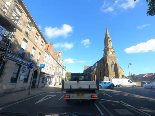
Morpeth Chantry Bagpipe Museum
Museum
Bagpipe museum in Morpeth, England
Bridge Street, Morpeth
Mo-Sa 09:30-17:00

Newminster Abbey
Monument and historic site · 0.6 mi
Abbey in Morpeth, Northumberland, England, UK
Motte and bailey castle on Haw Hill
Monument and historic site
Motte-and-bailey castle in Morpeth, Northumberland, England, UK



Parks, trails and playgrounds8


Mafeking Park
Park · 0.4 mi
Public park in Morpeth, Northumberland, England



Restaurants and cafes45






33 more on the map.
History
Morpeth was founded at a crossing point of the River Wansbeck. Remains from prehistory are scarce, but the earliest evidence of occupation found is a stone axe thought to be from the Neolithic period. There is a lack of evidence of activity during the Roman occupation of Britain, although there were probably settlements in the area at that time. The first written reference is from 1080 when William de Merlay was rewarded for his part in suppressing a rebellion in Northumbria with "the Barony of Morthpeth stretching from the Tyne to the Coquet". The name derives from Old English morð pæð and literally means "murder path"; writing in 1666, the antiquarian John Stainsby attributed this moniker to "the many robberies and murders in those parts committed".
Read more of the history
The barony of Morpeth was granted to the de Merlay family in around 1080, and by 1095 a motte-and-bailey castle had been built by William de Merlay. It is uncertain whether there was any settlement at Morpeth at the time that the barony was created, and documents relating to the foundation of an abbey in 1137 refer to the "new town of Morpeth". Newminster Abbey, located on the outskirts of Morpeth, was founded in 1138 by William's son, Ranulf de Merlay, lord of Morpeth, and his wife, Juliana, daughter of Gospatric II, Earl of Lothian, as one of the first daughter houses of Fountains Abbey. King John granted a market charter for the town to Roger de Merlay in 1200. It became one of the main markets in Northern England by the mid-1700s and by the mid 18th century was one of the key cattle markets in England selling cattle driven by drovers over the border from Scotland; however, the opening of the railways made transport to Newcastle easier in the 19th century, and the market accordingly declined. The market is still held on Wednesdays.
The town was badly damaged by fire set by the barons in 1215 during the First Barons' War, in an attempt to block the military operations of King John. Whilst it is common report that the motte-and-bailey castle was burnt down by King John in 1216 and a new Morpeth Castle was built later in the 13th century by Ranulph de Merlay, to the south of Haw Hill, there is no firm evidence that King John destroyed the castle and an alternative narrative suggests that the second castle was in fact "completed by William de Merlay (the 2nd) in the year of his death" (c. 1170). In the 13th century, a stone bridge was built over the Wansbeck in Morpeth, to the west of the current bridge, replacing the ford previously in use in Morpeth. For some months in 1515–16, Margaret Tudor (Henry VIII's sister) who was the Queen Consort of Scotland (James IV's widow), had laid ill in Morpeth Castle, having been brought there from Harbottle Castle. The only remains of the castle are the inner gatehouse, which was restored by the Landmark Trust, and parts of the ruined castle walls.
In 1540, Morpeth was described by the royal antiquary John Leland as "long and metely well-builded, with low houses" and "a far fairer town than Alnwick". During the 1543–51 war of the Rough Wooing, Morpeth was occupied by a garrison of Italian mercenaries, who "pestered such a little street standing in the highway" by killing deer and withholding payment for food. In 1552, William Hervey, Norroy King of Arms, granted the borough of Morpeth a coat of arms. The arms were the same as those granted to Roger de Merlay, but with the addition of a gold tower. In the letters patent, Hervey noted that he had included the arms of the "noble and valyaunt knyght ... for a p'petuall memory of his good will and benevolence towardes the said towne".
Morpeth was a borough by prescription, but received its first charter of confirmation from Charles II. The corporation it created was controlled by seven companies: the Merchant Tailors, the Tanners, the Fullers and Dyers, the Smiths, the Cordwainers, the Weavers and the Butchers. This remained the governing charter until the borough was reformed by the Municipal Corporations Act 1835. During the Second World War, RAF Morpeth, an air-gunnery training school, opened at nearby Tranwell.
The town and the county's history and culture are celebrated at the annual Northumbrian Gathering. The gathering is held over a weekend in mid-April and includes the Border Cavalcade and Pageant. The 50th gathering took place in 2017.
From the History section of Morpeth, Northumberland on Wikipedia, under CC BY-SA 4.0.
More about Morpeth
Education
The local state school, King Edward VI School, was originally founded as a chantry school in the early 14th century and was located in the Morpeth Chantry. The school was refounded in 1552 by royal charter as the Free Grammar School of King Edward the Sixth, being commonly referred to as the Morpeth Grammar School by locals. The school was renamed to King Edward VI Grammar School by 1947 and in the 1970s lost its grammar-school status, becoming a comprehensive under the current name.
The town has two middle schools, Newminster and Chantry, which are built next to each other. It also has several first schools: Abbeyfields First School in Kirkhill, Morpeth First School in Loansdean to the south of the town, Stobhillgate First School in the Stobhillgate housing estate, and Morpeth All Saints' Church of England-aided First School in Lancaster Park, north of the town. Additionally, St. Robert's R.C. First School, a primary school for Roman Catholics, is located in Oldgate, Morpeth.
From the Wikipedia article Morpeth, Northumberland, under CC BY-SA 4.0.
Notable people from Morpeth
 N. T. WrightAnglican bishopPhoto: Gareth Saunders, CC BY-SA 2.0
 Hamish TurnbullBritish cyclistPhoto: Nicola, CC BY-SA 4.0
 Tom StoddartBritish photographerPhoto: Virgil Lucky, CC BY-SA 4.0
 Dave PearsonEnglish rugby union refereePhoto: Massimiliano Calamelli, CC BY-SA 2.0
- William Turner16th century English Protestant reformer, physician and natural historian
- Joseph CrawhallBritish artist (1861-1913)
- Kevin CarrFootballer (born 1958)
- Albert BartlettEnglish footballer (1884-1969)
- John Cuthbert HedleyBishop of Newport and Menevia; Bishop of Newport (1837–1915)
- John ScottBritish entomologist (1823-1888)
- Allen FairhallAustralian politician (1909-2006)
- Albert JohnsonEnglish footballer (Bradford City)
Born in Morpeth, according to Wikidata (CC0). Each name links to its Wikipedia article.
Churches and places of worship9
Shopping21
Gas and EV charging3
Schools, colleges and libraries9
Healthcare8
Map of Morpeth
111 places. The map loads OpenStreetMap tiles when you open it.
Getting there and nearby towns
Newcastle International Airport (NCL) is the nearest airport with scheduled flights listed in OpenStreetMap, 9 miles away.
- Ponteland 8 mi south, about 14 min by car
- Newcastle upon Tyne 14 mi south, about 22 min by car
- Whickham 15 mi south, about 25 min by car
- Prudhoe 16 mi southwest, about 25 min by car
- Sunderland 22 mi southeast, about 35 min by car
- Ryhope 24 mi southeast, about 39 min by car
- Seaham 27 mi southeast, about 43 min by car
- Peterlee 31 mi southeast, about 51 min by car
- Spennymoor 33 mi south, about 53 min by car
- Newton Aycliffe 38 mi south, about 1 h by car
Drive times are estimates from straight-line distance, not routes.
Towns near Morpeth


Keep exploring
Local news
Headlines from INDB.
Reviews, tips and questions
Loading what members have shared...
Sources and licences
- GeoNames (CC BY 4.0): population, coordinates, regions and time zone
- Mapillary (see each image): photos
- OpenStreetMap contributors (ODbL 1.0): places, airports, map data
- Wikidata (CC0 1.0): elevation, founding date, time zone, website, landmarks and historic places
- Wikimedia Commons (see each image): photos
- Wikipedia (CC BY-SA 4.0): overview and history text
Photo credits
- Morpeth Old Gatehouse, Glen Bowman from Newcastle, England, CC BY 2.0
- Lidl in Morpeth, Dreamy Jazz, CC BY-SA 4.0
- Newminster Abbey near Morpeth Northumberland 1780, Unknown author Unknown author, Public domain
- Mafeking Park (Roundabout), Dreamy Jazz, CC BY-SA 4.0
- Carlisle Park, Morpeth (2022-12-26) 63, Simon Cobb, CC0
- Roman Catholic Church of St Robert, Simon Cobb, CC0
- St James' Church, Morpeth, JThomas, CC BY-SA 2.0
- Morpeth Castle Gatehouse, C G Burke, CC BY-SA 2.0
- 13, Oldgate, Simon Cobb, CC0
- Black Bull Hotel, Morpeth (2022-12-26) 80, Simon Cobb, CC0
- Oldgate, Morpeth (2022-12-26) 54, Simon Cobb, CC0
- Joiners Arms, Morpeth (2022-12-26) 73, Simon Cobb, CC0
- Tap & Spile from Manchester Street, Dreamy Jazz, CC BY-SA 4.0
- Waterford Lodge, Morpeth (2022-12-26) 71, Simon Cobb, CC0
- Newgate Street, Morpeth (2022-12-26) 12, Simon Cobb, CC0
- Newgate Street, Morpeth (2022-12-26) 17, Simon Cobb, CC0
- Haw Hill, Dreamy Jazz, CC BY-SA 4.0
- Church of St James the Great, Morpeth, Tzdelski13, CC BY-SA 4.0
- St Robert of Newminster Church, Morpeth, Tzdelski13, CC BY-SA 4.0
- Sanderson Arcade - panoramio, tormentor4555, CC BY-SA 3.0
- Sanderson Arcade - panoramio (1), tormentor4555, CC BY-SA 3.0
- Emily Wilding Davison Statue Morpeth, Dreamy Jazz, CC BY-SA 4.0
- Carlisle Park, Morpeth (2022-12-26) 61, Simon Cobb, CC0
- Street-level photo, floatingboater, CC BY-SA 4.0
- Street-level photo, floatingboater, CC BY-SA 4.0
- Street-level photo, floatingboater, CC BY-SA 4.0
- Street-level photo, floatingboater, CC BY-SA 4.0
- Street-level photo, floatingboater, CC BY-SA 4.0
- Street-level photo, floatingboater, CC BY-SA 4.0
- Street-level photo, floatingboater, CC BY-SA 4.0
- Street-level photo, floatingboater, CC BY-SA 4.0
- Street-level photo, floatingboater, CC BY-SA 4.0
- Street-level photo, floatingboater, CC BY-SA 4.0
- Street-level photo, floatingboater, CC BY-SA 4.0
- Street-level photo, floatingboater, CC BY-SA 4.0
- Street-level photo, floatingboater, CC BY-SA 4.0
- Street-level photo, floatingboater, CC BY-SA 4.0
- Street-level photo, floatingboater, CC BY-SA 4.0
- Street-level photo, floatingboater, CC BY-SA 4.0
- Street-level photo, floatingboater, CC BY-SA 4.0
- Street-level photo, floatingboater, CC BY-SA 4.0
- Street-level photo, floatingboater, CC BY-SA 4.0
- Street-level photo, floatingboater, CC BY-SA 4.0
- Street-level photo, floatingboater, CC BY-SA 4.0
- Street-level photo, floatingboater, CC BY-SA 4.0


Page built November 10, 2026. Spotted a mistake? Tell us or suggest a place.