


Why visit Prudhoe
Townapedia lists 12 museums and landmarks, 12 parks and trails, 41 places to eat, 2 places to stay and 5 attractions in and around town.
Highlights include Wylam Bridge, Wylam Railway Bridge, Prudhoe Castle and Cherryburn - Thomas Bewick Museum.
Weather in Prudhoe
Forecast from MET Norway (CC BY 4.0). Full forecast
About Prudhoe
Prudhoe is a town and civil parish in the south of Northumberland, England. It is 11 miles (18 km) west of Newcastle upon Tyne and situated on a steep, north-facing hill on the south bank of the River Tyne. Prudhoe had a population of 11,675 at the 2011 census, making it the second largest town in the Tyne Valley after Hexham.
From the Wikipedia article Prudhoe (this version), under CC BY-SA 4.0.
Travel tips from other travellers: Prudhoe on Wikivoyage (CC BY-SA 4.0).
Things to do5


Wylam Railway Bridge
Bridge · 1.2 mi
Bridge in Wylam, Northumberland, England, UK

Bywell Bridge
Bridge · 2.8 mi
Grade II listed bridge in Northumberland, England, UK
Ovingham Bridges
Bridge · 0.7 mi
Pair of bridges that cross the River Tyne in Northumberland, United Kingdom
Museums and landmarks12


Vindobala
Monument and historic site · 2.9 mi
Ancient Roman fort at Northumberland, the fourth fort on Hadrian's Wall, after Segedunum (Wallsend), Pons Aelius (Newcastle) and...

Cherryburn
Museum · 1.3 mi
18th-century historic vernacular building in Mickley, Northumberland, England, UK
George Stephenson's Birthplace
Museum · 2.2 mi
Historic house museum in Wylam, Northumberland, England, UK

Rudchester Mithraeum
Monument and historic site · 2.9 mi
Mithraeum at Rudchester, Heddon-on-the-Wall, United Kingdom
Parks, trails and playgrounds12




Restaurants and cafes41
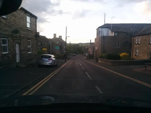
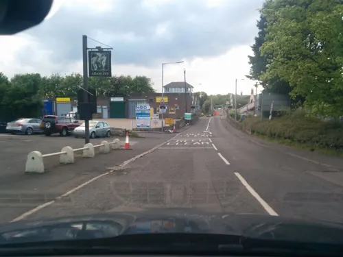



29 more on the map.
History
The name derives from the Anglo-Saxon personal name Prud (from prūd, meaning 'proud') and hoe or haugh, 'a spur of land'.
There has been a castle at Prudhoe since ancient times, when England was at war with Scotland. The area now known as Castlefields was a fruit orchard, and the Scots were rumoured to have burnt this orchard while attempting to capture Prudhoe Castle. In 1297, Scots led by William Wallace laid waste to Northumberland from Hexham up to the walls of Newcastle, burning Prudhoe and a number of other townsThe castle, originally owned by the d'Umfraville family, then the Percys and now English Heritage, is considered to be the only medieval fortification in Northumberland never to have been captured by the Scots.
In 1914, a Territorial Army drill hall was developed on Swalwell Close, which housed a company of the 4th Battalion of the Northumberland Fusiliers. The drill hall site (now disused) was scheduled to be redeveloped from 2018, with the scheme further delayed and complicated by the jailing of the owner for eight years in 2021.
Read more of the history
During the Cold War, there was a Royal Observer Corps Underground Monitoring Post opposite Highfield Park; the surface features have since been demolished. It was one of approximately 1,563 similar underground monitoring posts built all across the UK during the Cold War to monitor the effects of a nuclear strike. They were operated by the Royal Observer Corps (ROC), mostly civilian volunteers, who worked in groups of three inside the posts. Prudhoe ROC post was opened in June 1962 and closed in September 1991 after the collapse of the Soviet Union, which saw the end of the Cold War.
From the History section of Prudhoe on Wikipedia, under CC BY-SA 4.0.
More about Prudhoe
Geography
The town of Prudhoe is built on a steep, north-facing hill, which reaches elevations exceeding 200 metres up on the Prudhoe and Mickley Moors. The south of the parish is largely rural and comprises both farmland and forest. The castle overlooks a gentle bend in the River Tyne. To the south of Prudhoe is Hedley on the Hill and then Ebchester over the County Durham border. Prudhoe is also home to Hagg Bank, a steep hill which winds down to Hagg Bank Farm on the riverside. The civil parish borders Tyne and Wear (as well as historic County Durham) over Stanley Burn in the east of town.
Arts and culture
Tyne Riverside Country Park in Low Prudhoe lies on the southern bank of the River Tyne. The park includes the artificial chalk hills known as the "Spetchells" which have attracted some natural chalk-loving flora and fauna not normally found in the region. It has been proposed that they be made 'sites of scientific interest'. A public bridleway runs from the country park to Hagg Bank, over the Points Bridge to Wylam. Now forming a traffic-free part of National Cycle Network Route 72, it runs on the bed of a disused railway line to Newburn, Tyne and Wear, Newcastle upon Tyne, and on to the coast at Tynemouth.
Prudhoe Town Football Club are currently in the Wearside Football League, in the eleventh tier of the English football league system. The future of the club has recently been in doubt following the loss of its ground, Kimberley Park, in West Wylam.
Prudhoe Waterworld provides swimming and other fitness activities and is the home of Prudhoe Millennium Tapestry.
The town has a skatepark, Highfield Park, which is located at the top of Prudhoe.
Education
Prudhoe West First Academy (which celebrated its 100-year anniversary in 2009).
Eastwood Middle School (closed in 2006 and is now home of Prudhoe Youth Football Club)
From the Wikipedia article Prudhoe, under CC BY-SA 4.0.
Notable people from Prudhoe
 George HoneymanEnglish association football player (born 1994)Photo: Timmy96, CC0
 Nerina ShuteBritish writer (1908-2004)Photo: Unknown author Unknown author, Public domain
- Ben AlnwickEnglish footballer (born 1987)
- Jack BuckleyEnglish footballer (1903-1985)
- Billy CallenderEnglish footballer (1903-1932)
- Edward ThompsonEnglish footballer (1895-1918)
- Ned Vincentassociation football player (1909-1980)
- Ted WinshipEnglish professional football left back (1901-1929)
- Joseph NixonEnglish footballer
Born in Prudhoe, according to Wikidata (CC0). Each name links to its Wikipedia article.
Where to stay2
Churches and places of worship9
Shopping6
Gas and EV charging1
Schools, colleges and libraries10
Healthcare4
Map of Prudhoe
102 places. The map loads OpenStreetMap tiles when you open it.
Getting there and nearby towns
Newcastle International Airport (NCL) is the nearest airport with scheduled flights listed in OpenStreetMap, 8 miles away.
- Wylam 2 mi northeast, about 3 min by car
- Whickham 7 mi east, about 11 min by car
- Newcastle upon Tyne 9 mi east, about 15 min by car
- Sunderland 19 mi east, about 31 min by car
- Ryhope 20 mi east, about 32 min by car
- Spennymoor 21 mi southeast, about 33 min by car
- Seaham 22 mi southeast, about 35 min by car
- Middlesbrough 36 mi southeast, about 58 min by car
- Thornaby-on-Tees 37 mi southeast, about 59 min by car
- Yarm 37 mi southeast, about 1 h by car
Drive times are estimates from straight-line distance, not routes.
Towns near Prudhoe


Keep exploring
Local news
Headlines from INDB.
Reviews, tips and questions
Loading what members have shared...
Sources and licences
- GeoNames (CC BY 4.0): population, coordinates, regions and time zone
- Mapillary (see each image): photos
- OpenStreetMap contributors (ODbL 1.0): places, airports, map data
- Wikidata (CC0 1.0): elevation, founding date, time zone, website, landmarks and historic places
- Wikimedia Commons (see each image): photos
- Wikipedia (CC BY-SA 4.0): overview and history text
Photo credits
- Wylam Bridge3, Andrew Curtis, CC BY-SA 2.0
- Points Bridge Wylam, The original uploader was Craighennessey at English Wikipedia ., CC BY 2.5
- Befundskizze Kastell Rudchester, Veleius, CC0
- Prudhoe Castle 2, Chris Tweedy, CC BY-SA 2.0
- Wylam St Oswin's Church, Vesselina Garcheva, CC BY-SA 4.0
- Cherryburn on a summer's day, Ian Alexander, CC BY-SA 4.0
- Street-level photo, floatingboater, CC BY-SA 4.0
- Street-level photo, floatingboater, CC BY-SA 4.0
- Street-level photo, floatingboater, CC BY-SA 4.0
- Street-level photo, floatingboater, CC BY-SA 4.0
- Street-level photo, fozy81, CC BY-SA 4.0
- Street-level photo, floatingboater, CC BY-SA 4.0
Page built November 10, 2026. Spotted a mistake? Tell us or suggest a place.