


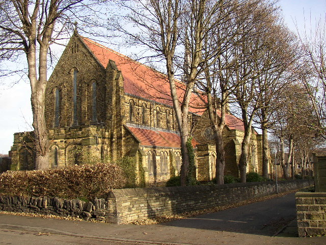


Huddersfield, United Kingdom
Huddersfield is a city of 149,017 people in England, United Kingdom, founded in 1086.
Why visit Huddersfield
Townapedia lists 13 museums and landmarks, 12 parks and trails, 264 places to eat, 6 places to stay and 6 attractions in and around town.
Highlights include Colne Bridge, Turnbridge Lift Bridge, Tolson Museum and Colne Valley Museum.
Weather in Huddersfield
Forecast from MET Norway (CC BY 4.0). Full forecast
About Huddersfield
Huddersfield is a town in the Metropolitan Borough of Kirklees, West Yorkshire, England. It is the administrative centre and largest settlement in the Kirklees district, in the foothills of the Pennines. The River Holme's confluence into the similar-sized Colne is to the south of the town centre, which then flows into the Calder in the north-eastern outskirts of the town.
From the Wikipedia article Huddersfield (this version), under CC BY-SA 4.0.
Travel tips from other travellers: Huddersfield on Wikivoyage (CC BY-SA 4.0).
Photos of Huddersfield


Things to do6

Colne Bridge
Bridge · 2.9 mi
Grade II listed bridge in Kirklees, West Yorkshire, England, UK

Turnbridge Lift Bridge
Bridge · 0.4 mi
Bridge in West Yorkshire, England, UK



Museums and landmarks13

Tolson Museum
Museum · 1.2 mi
Museum in Huddersfield, West Yorkshire, England, United Kingdom
Ravensknowle Park, Huddersfield
Mo 11:00-15:00; Tu-Th 11:00-17:00; Sa-Su 12:00-17:00; PH 11:00-17:00

Colne Valley Museum
Museum · 3.1 mi
Historic house museum, United Kingdom

Huddersfield Library and Art Gallery
Museum
Library and art gallery in Huddersfield, United Kingdom



Robin Hood's Grave
Monument and historic site · 3.4 mi
Monument in Calderdale, West Yorkshire, England, UK
Rugby League Heritage Centre
Museum
Former rugby museum in Huddersfield, England
1 more on the map.
Parks, trails and playgrounds12


Greenhead Park
Park · 0.5 mi
Park in Huddersfield, West Yorkshire, England, UK





Restaurants and cafes264

Grappolo's
Restaurant · Italian · 1.2 mi
2 Water Street, Huddersfield
Mo off; Tu-Sa 16:00-22:00; Su 16:00-21:00

Dixons Milk Ices
Ice cream · 0.7 mi
Opening Times: Mon-Sun: 10pm – 10am Deliveries Mon-Fri: 5pm-9pm Sat-Sun: 4pm-9pm
275 Leeds Road, Huddersfield
Mo-Su 10:00-22:00
Kebabish Aspley
Restaurant · Indian · 0.7 mi
57 Wakefield Road, Huddersfield
Mo off; Tu-Su 17:30-23:00
La Ranchito
Restaurant · Pizza, Pasta
35 John William Street, Huddersfield
Mo-Th 11:55-23:00; Fr,Sa 11:55-23:55; Su 11:55-23:00

Lost Property Coffee Shop & Kitchen
Cafe · Coffee Shop
15 Byram Street, Huddersfield
Tu-Fr 09:30-16:00; Sa 10:00-17:30
Meson La Pepa
Restaurant · Spanish
22 John William Street, Huddersfield
Mo-Sa 12:00-23:00; Su 12:00-22:00
The Ephesus
Restaurant · Turkish
52 John William Street, Huddersfield
Mo-Th,Su 12:00-22:00; Fr,Sa 12:00-22:30

The Yorkshire Rose
Bar and pub · 0.5 mi
Food Service between 11:30-21:00
217 Leeds Road, Huddersfield
Mo-Su 11:00-23:00
Arcade Coffee and Food
Restaurant · Coffee
9 Byram Arcade, Huddersfield
Mo-Sa 08:00-16:30; Su 10:00-16:00
Caffè Nero
Cafe · Coffee Shop
1-3 King Street, Huddersfield
Mo-Fr 07:00-18:30; Sa 07:00-19:00; Su 08:00-18:00
252 more on the map.
History
Local settlement dates back over 4,000 years. Castle Hill, a major landmark, was the site of an Iron Age hill fort. The remains of a Roman fort were unearthed in the mid 18th century at Slack near Outlane, west of the town.
The earliest surviving record of the place name is in the Domesday Book of 1086, Oderesfelt. It appears as Hudresfeld in a Yorkshire charter from 1121 to 1127, and as Huderesfeld in subsidy rolls in 1297. The name meaning has not complicated with the shifts of English, remaining 'Hud(d)er's field'.
The modern name is pronounced without a word-initial /h/ in the local dialect, a trait independently shared by many Norman scribes' dialects of the Domesday Book era (see Old and modern French).
Huddersfield has been a market town since Anglo-Saxon times. The market cross is on Market Place.
The manor of Huddersfield was owned by long lease by the de Lacy family until its 1322 takeback by the Crown. In 1599, William Ramsden bought it, and the Ramsden family continued to own the manor, which was known as the Ramsden Estate, until 1920. During their ownership they supported the development of the town. Sir John Ramsden, 3rd Baronet built the Huddersfield Cloth Hall in 1766 and his son the fourth baronet was responsible for Huddersfield Broad Canal in 1780. The Ramsdens endorsed the railway in the first wave of national railway building, in the 1840s.
Read more of the history
Huddersfield was a centre of civil unrest during the Industrial Revolution. Europe saw frequent wars during and after which, as to those most acutely affecting Britain, cloth trade slumped which could be compounded by local crops failure. Many local weavers faced starvation and losing their livelihood due to the new, mechanised weaving sheds. Luddites began destroying the mills, sheds and machinery at such times; one of the most notorious attacks was on Cartwright – a Huddersfield mill-owner who had a reputation for cruelty – and his Rawfolds Mill. Kirkpatrick Sale describes how an army platoon was stationed at Huddersfield to deal with these; at its peak, having about a thousand soldiers and ten thousand civilians. Luddites thus began to focus criminal damage on nearby towns and villages (less well-protected); their most damaging act was to destroy Foster's Mill at Horbury – a village about 10 miles (16 kilometres) east. The government campaign that crushed the movement was provoked by a murder that took place in Huddersfield. William Horsfall, a mill-owner and a passionate prosecutor of Luddites, was killed in 1812. Although the movement faded out, Parliament began to increase welfare provision for those out of work, and introduce regulations to improve conditions in the mills.
Two Prime Ministers spent part of their childhood in Huddersfield: the Labour Prime Minister Harold Wilson, who was born locally and attended Royds Hall School, and the Liberal Prime Minister H. H. Asquith. Wilson is commemorated by a statue on the forecourt to the town's station.
In 1920, the corporation bought the Ramsden Estate from that family that had owned much of the town at least as to the reversion of long leases (a minor, overarching interest) since 1599, for £1.3 million. The town became "the town that bought itself." Most of the keynote central building freeholds belong to the local authority, as in a few towns in England such as Basingstoke.
On 4 July 1981, Huddersfield held the first pride march outside of London in a move of solidarity with the Gemini Club and its harassment by the local police force and their referral to it as a "cesspit of filth". Upwards of 2,000 gay rights campaigners marched through the town from the football stadium up to Greenhead Park.
Work on the Our Cultural Heart project, a regeneration of Huddersfield town centre, began in 2020. The first phase of the development opened in 2026 with a new library hub and town square.
From the History section of Huddersfield on Wikipedia, under CC BY-SA 4.0.
More about Huddersfield
Geography
Huddersfield lies at the confluence of the shallow valley floors of the River Colne and the River Holme, south of the town centre. It is in the eastern foothills of the Pennines, which blend into the moorlands of the South Pennines to the west of the town.
As with all of West Yorkshire, a temperate oceanic climate exists, wetter than the low plains rain shadow proper towards East Yorkshire but drier than Cumbria. It is mild for the latitude – overnight frosts are quite frequent in winter yet daytime tends to exceed such temperatures due to onshore breezes from around Britain and as the Gulf Stream moderates temperatures. Summers are usually warm, punctuated by frequent rainy and hot spells. Winters are usually cool and damp, punctuated by frequent cold spells where snow is possible, especially on higher ground. According to the Köppen climate classification, Huddersfield is certified as Cfb.
After boundary changes in 2004, Huddersfield now covers eight of the twenty-three electoral wards for Kirklees Council. Neighbouring wards in the Colne Valley, Holme Valley, and Kirkburton are often considered to be part of Huddersfield though they are predominantly semi-rural. The very centre of town forms the Newsome ward of councillors. Eight wards make up Huddersfield proper; these with populations, extent and constituent suburbs (mid-year 2005 estimates) are:
Economy
Huddersfield is a manufacturing town, despite the university being the largest employer. Historically the town produced woollen textiles. This area of business, along with the chemical and engineering industries that emerged to support the manufacture of textiles, was the basis of the town's nineteenth and early twentieth century prosperity. The number of people who work in textiles has declined greatly, but the surviving companies produce large quantities of woollen products with little labour.
The town is home to textile, chemical and engineering companies, including Brook Motors Ltd founded by Ernest Brook in 1904. Against conventional wisdom, he started making alternating current electric motors, and he did this in one room with two assistants and starting capital of just £300. On its 50th anniversary in 1954, it employed more than 2,000 people and, with Ernest's sons Frank and Jack in charge, was the largest exclusive producer of AC motors in the world, with had a turnover of £4,500,000. That same year Brook Motors Ltd operated 10 factories in Huddersfield, its biggest being Empress Works on St Thomas's Road, and opened one at Barugh Green, Barnsley.
Education
As well as primary and secondary schools, which cover compulsory and sixth form education for the town's population, Huddersfield has two sixth form colleges: Huddersfield New College at Salendine Nook and Greenhead College west of the town centre. Huddersfield Grammar School is the only independent school for secondary education up to age 16.
The town has a further education college, Kirklees College, formed following the merger of Dewsbury College and Huddersfield Technical College. Its one establishment of higher education is the University of Huddersfield, whose chancellor until 2019 was the former Prince Andrew. The actor Patrick Stewart, from Mirfield, is emeritus chancellor.
From the Wikipedia article Huddersfield, under CC BY-SA 4.0.
Notable people from Huddersfield
 Harold WilsonPrime Minister of the United Kingdom from 1964-1970 and 1974-1976 (1916–1995)Photo: Courtesy Gerald R. Ford Library, Public domain
 Cameron JeromeBritish footballer (born 1986)Photo: Jon Candy from Cardiff, Wales, CC BY-SA 2.0
 Gorden KayeBritish actor (1941–2017)Photo: Allan warren, CC BY-SA 3.0
 Marcus EllisEnglish badminton playerPhoto: Nardisoero, CC BY-SA 4.0
 Simon ArmitageBritish poet, playwright, and novelist (born 1963)Photo: Paul Hudson from United Kingdom, CC BY 2.0
 Vivek H. MurthyAmerican physician, surgeon general, vice admiral of the United States NavyPhoto: United States Department of Health..., Public domain
 John WhitakerBritish equestrianPhoto: Dieses Foto ist von Olaf Kosinsky..., CC BY-SA 3.0
 Billy CurrieBritish multi-instrumentalistPhoto: Thargol, Public domain
 Zöe LuckerBritish actressPhoto: ChryedCrazy, CC BY-SA 4.0
- James MasonBritish actor (1909–1984)
- Karen Spärck JonesBritish computer scientist (1935–2007)
- Anita LonsbroughBritish swimmer, Olympic gold medallist, former world record-holder
Born in Huddersfield, according to Wikidata (CC0). Each name links to its Wikipedia article.
Where to stay6
Churches and places of worship60
Baitus Samad
Place of worship · Ahmadiyya
41 Lower Fitzwilliam Street, Huddersfield
Baitul Tauhid Mosque
Place of worship · Ahmadiyya · 0.9 mi
(The Pavillion) Spaines Road, Huddersfield
Gledholt Methodist Church
Church · Methodist · 0.7 mi
Edgerton Grove Road, Huddersfield
Shopping45
Gas and EV charging7
Schools, colleges and libraries32
Healthcare20
Map of Huddersfield
250 places. The map loads OpenStreetMap tiles when you open it.
Getting there and nearby towns
Leeds Bradford Airport (LBA) is the nearest airport with scheduled flights listed in OpenStreetMap, 16 miles away.
- Wakefield 12 mi east, about 19 min by car
- Leeds 14 mi northeast, about 23 min by car
- Oldham 16 mi southwest, about 25 min by car
- Manchester 22 mi southwest, about 35 min by car
- Sheffield 23 mi southeast, about 36 min by car
- Stockport 23 mi southwest, about 36 min by car
- Rotherham 23 mi southeast, about 37 min by car
- Salford 24 mi southwest, about 38 min by car
- Wigan 36 mi west, about 58 min by car
- York 36 mi northeast, about 57 min by car
Drive times are estimates from straight-line distance, not routes.
Towns near Huddersfield


Keep exploring
Local news
Headlines from INDB.
Reviews, tips and questions
Loading what members have shared...
Sources and licences
- GeoNames (CC BY 4.0): population, coordinates, regions and time zone
- Mapillary (see each image): photos
- OpenStreetMap contributors (ODbL 1.0): places, airports, map data
- Wikidata (CC0 1.0): elevation, founding date, time zone, website, landmarks and historic places
- Wikimedia Commons (see each image): photos
- Wikipedia (CC BY-SA 4.0): overview and history text
Photo credits
- Turnbridge Liftbridge RLH, Richard Harvey, CC BY-SA 3.0
- Tolson Museum 004, Charlesdrakew, Public domain
- ColneValleyMuseum(RLH), Richard Harvey, CC BY-SA 3.0
- All Saints Church Elland SE1020, Humphrey Bolton, CC BY-SA 2.0
- Holy Trinity, Huddersfield (12467318383), Tim Green from Bradford, CC BY 2.0
- LawrenceBatleyTheatre, Ian M, CC BY-SA 2.0
- Hudderslfield 0 Chelsea 3 (30144863978), @cfcunofficial (Chelsea Debs) London from London, UK, CC BY-SA 2.0
- Kirklees College, Simon Cobb, CC0
- Market Cross, Huddersfield, habiloid, CC BY-SA 2.0
- Baitus Samad Exterior–1, Huddersfield, HolyArtThou, CC BY-SA 4.0
- Huddersfield Station, Tim Green, CC BY 2.0
- Huddersfield the-john-smiths-stadium, Arne Müseler, CC BY-SA 3.0 de
- Kirklees College (22488457527), Tim Green from Bradford, CC BY 2.0
- Harold Wilson statue, Tony Hisgett from Birmingham, UK, CC BY 2.0
- Royal and Ancient, Colne Bridge (4636537240), Tim Green from Bradford, CC BY 2.0
- Huddersfield Library and Art Gallery, Hammersfan, CC BY-SA 4.0
- Greenhead Park - panoramio, Events Yorkshire, CC BY-SA 3.0
- Street-level photo, mappo2, CC BY-SA 4.0
- Street-level photo, livingwithdragons, CC BY-SA 4.0
- Street-level photo, mappo2, CC BY-SA 4.0


Page built November 10, 2026. Spotted a mistake? Tell us or suggest a place.