


Why visit Burnley
Townapedia lists 15 museums and landmarks, 23 parks and trails, 82 places to eat, 7 places to stay and 4 attractions in and around town.
Highlights include Burnley Mechanics, Burnley Youth Theatre, Towneley Hall and Park House.
Weather in Burnley
Forecast from MET Norway (CC BY 4.0). Full forecast
About Burnley
Burnley () is a town and the administrative centre of the wider Borough of Burnley in Lancashire, England, with a 2021 population of 78,266. It is 21 miles (34 km) north of Manchester and 20 miles (32 km) east of Preston, at the confluence of the River Calder and River Brun.
From the Wikipedia article Burnley (this version), under CC BY-SA 4.0.
Travel tips from other travellers: Burnley on Wikivoyage (CC BY-SA 4.0).
Photos of Burnley

Things to do4
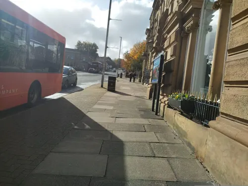
Burnley Mechanics
Cinema and theater · 1.0 mi
Theatre and former Mechanics' Institute in Burnley, Lancashire, England, UK
Manchester Road, Burnley

Burnley Youth Theatre
Cinema and theater
Youth theatre in Burnley, Lancashire, England
Queen's Park Road, Burnley

Empire Theatre
Cinema and theater · 0.9 mi
Former theatre and cinema in Burnley, Lancashire, England, later converted to a bingo hall
Town Hall
Cinema and theater · 3.3 mi
Town hall, now council offices, with theatre and ball-room in Padiham, Burnley, Lancashire, England, UK
Museums and landmarks15


Castercliff
Monument and historic site · 3.7 mi
Hillfort in Lancashire, England, UK

Gawthorpe Hall
Museum · 2.5 mi
Grade I listed historic house museum in Lancashire, England, UK

Pendle Heritage Centre
Museum · 3.8 mi
Museum and art gallery in Lancashire, England, United Kingdom

Towneley Hall Art Gallery and Museum
Museum · 1.9 mi
Country house and park with art gallery and museum in Burnley, Lancashire, England, United Kingdom

Weavers' Triangle
Museum · 1.1 mi
Historic textie-producing area with a cotton museum in Lancashire, England

Queen Street Mill Textile Museum
Museum · 1.5 mi
Museum in Burnley, England, United Kingdom
Queen Street, Burnley

3 more on the map.
Parks, trails and playgrounds23






11 more on the map.
Restaurants and cafes82



Baltic Homeland
Restaurant · Continental · 0.9 mi
133 St James's Street, Burnley
12:00+

The Bay Horse
Bar and pub · 2.0 mi
17 Church Square, Burnley
Mo-Th, Su 12:00 - 22:00; Fr-Sa 12:00 - 22:30
70 more on the map.
History
The name Burnley is believed to have been derived from Brun Lea, meaning "meadow by the River Brun". Various other spellings have been used: Bronley (1241), Brunley (1251) and commonly Brumleye (1294)
Stone Age flint tools and weapons have been found on the moors around the town, as have numerous tumuli, stone circles, and some hill forts (see: Castercliff, which dates from around 600 BC). Modern-day Back Lane, Stump Hall Lane and Noggarth Road broadly follow the route of a classic ridgeway running east–west to the north of the town, suggesting that the area was populated during pre-history and probably controlled by the Brigantes.
Limited coin finds indicate a Roman presence, but no evidence of a settlement has been found in the town. Gorple Road (running east from Worsthorne) appears to follow the route of a Roman road that may have crossed the present-day centre of town, on the way to the fort at Ribchester. It has been claimed that the nearby earthworks of Ring Stones Camp (53.793°N 2.174°W / 53.793; -2.174), Twist Castle (53.800°N 2.171°W / 53.800; -2.171) and Beadle Hill (53.803°N 2.169°W / 53.803; -2.169) are of Roman origin, but little supporting archaeological information has been published.
Read more of the history
Following the Roman period, the area became part of the kingdom of Rheged, and then the kingdom of Northumbria. Local place-names Padiham and Habergham show the influence of the Angles, suggesting that some had settled in the area by the early 7th century; sometime later the land became part of the hundred of Blackburnshire.
There is no definitive record of a settlement until after the Norman Conquest of England. In 1122, a charter granted the church of Burnley to the monks of Pontefract Abbey. In its early days, Burnley was a small farming community, gaining a corn mill in 1290, a market in 1294, and a fulling mill in 1296. At this point, it was within the manor of Ightenhill, one of five that made up the Honor of Clitheroe, then a far more significant settlement, and consisted of no more than 50 families. Little survives of early Burnley apart from the Market Cross, erected in 1295, which now stands in the grounds of the old grammar school.
Over the next three centuries, Burnley grew in size to about 1,200 inhabitants by 1550, still centred around the church, St Peter's, in what is now known as "Top o' th' Town". Prosperous residents built larger houses, including Gawthorpe Hall in Padiham and Towneley Hall.
In 1532, St Peter's Church was largely rebuilt. Burnley's grammar school was founded in 1559, and moved into its own schoolhouse next to the church in 1602. Burnley began to develop in this period into a small market town, with a population of not more than 2,000 by 1790. It is known that weaving was established in the town by the middle of the 18th century, and in 1817 a new Market House was built. The town continued to be centred on St Peter's Church, until the market was moved to the bottom of what is today Manchester Road, at the end of the 19th century.
In the second half of the 18th century, the manufacture of cotton began to replace wool. Burnley's earliest known factories – dating from the mid-century – stood on the banks of the River Calder, close to where it is joined by the River Brun, and relied on water power to drive the spinning machines. The first turnpike road through the area now known as Burnley was begun in 1754, linking the town to Blackburn and Colne eventually leading to the area of Brun Lea developing into a town, and by the mid 19th century, there were daily stagecoach journeys to Blackburn, Skipton and Manchester, the latter taking just over two hours.
The 18th century also saw the rapid development of coal mining on the Burnley Coalfield: the drift mines and shallow bell-pits of earlier centuries were replaced by deeper shafts, meeting industrial as well as domestic demand in Nelson, Colne and Padiham, and by 1800 there were over a dozen pits in the modern-day centre of the town alone.
The arrival of the Leeds and Liverpool Canal in 1796 made possible transportation of goods in bulk, bringing a huge boost to the area's economy and the town of Burnley was born. Dozens of new mills were constructed, along with many foundries and ironworks that supplied the cotton mills and coal mines with machinery and cast and wrought iron for construction. The town became renowned for its mill-engines, and the Burnley Loom was recognised as one of the best in the world.
A permanent military presence was established in the town with the completion of Burnley Barracks in 1820.
Disaster struck Burnley in April 1824, when its only local bank, Holgate's Bank, collapsed, forcing the closure of some of the largest mills. Hardship continued for a few years, with wages repeatedly reduced between 1824 and 1826.
By 1830, there were 32 steam engines in cotton mills throughout the rapidly expanding town, an example of which, originally installed at Harle Syke Mill, is on display in the Science Museum in London.
Around 1840, a traveller described the town as ugly, stating that: "parts of it were so situated that good architectural effects might have been obtained had the disposition and the resources co-existed".
The Great Famine of Ireland led to an influx of Irish families during the 1840s, who formed a community in one of the poorest districts. At one time, the Park District (modern-day town centre, around Parker St.) was known as Irish Park.
In 1848, the East Lancashire Railway Company's extension from Accrington linked the town to the nation's nascent railway network for the first time. This was another significant boost to the local economy and, by 1851, the town's population had reached almost 21,000.
The Burnley Building Society, incorporated in Burnley in 1850, was, by 1911, not only 'by far the largest in the County of Lancashire... but the sixth in magnitude in the kingdom'.
From the History section of Burnley on Wikipedia, under CC BY-SA 4.0.
More about Burnley
Geography
The town lies in a natural three-forked valley at the confluence of the River Brun and the River Calder, surrounded by open fields, with wild moorland at higher altitudes. To the west of Burnley lie the towns of Padiham, Accrington and Blackburn, with Nelson and Colne to the north. The centre of the town stands at approximately 387 feet (118 m) above sea level and 30 miles (48 km) east of the Irish Sea coast.
Areas in the town include: Burnley Wood, Rose Hill, Healey Wood, Harle Syke, Haggate, Daneshouse, Stoneyholme, Burnley Lane, Heasandford, Brunshaw, Pike Hill, Gannow, Ightenhill, Whittlefield, Rose Grove, Habergham, and Lowerhouse. Although Reedley is considered to be a suburb of the town, it is actually part of the neighbouring borough of Pendle.
Economy
In 2013, Burnley was awarded an Enterprising Britain award from the UK Government for being the 'Most Enterprising Area in the UK'. This accolade subsequently received praise from the British Prime Minister, David Cameron, and His Royal Highness, the Prince of Wales.
A series of high-profile regeneration schemes, including: a direct rail link to Manchester, an aerospace supply village and multimillion-pound investment in the former Victorian industrial heartland through a project called 'On The Banks' are radically transforming the economy of the Lancashire town. Although traditional manufacturing has been in decline in the town for several decades, high end advanced manufacturing remains very strong in the town. The Secretary of State for Business, Innovation and Skills, Vince Cable, said in 2013: "Burnley in the north of Lancashire is currently now booming economically on the back of manufacturing and proximity to the aerospace industry." Cable praised the town again in 2014 saying: "If every other part of Britain was like Burnley we wouldn't be talking about a recession".
Arts and culture
On the outskirts of the town there are galleries in two stately homes, the Burnley council-owned Towneley Hall and Gawthorpe Hall in Padiham, which is owned by Lancashire County Council and managed by the National Trust. There are also two local museums: the Weavers' Triangle Trust operates the Visitor Centre and Museum of Local History in the historic surroundings of the Weavers' Triangle, while the Queen Street Mill Textile Museum is unique as the world's only surviving steam driven cotton weaving shed.
Mid Pennine Arts were instrumental in the Panopticons project and run exhibitions and creative learning projects across the town and wider area.
Education
Burnley Grammar School was first established in St Peter's Church in 1559, with its first headmaster a former chantry priest, Gilbert Fairbank. In 1602, one of the governors, John Towneley, paid for a new schoolhouse to be built in the churchyard; the school moved again in 1874 to a new building on Bank Parade, which still remains and is now a business centre. The first technical school, in Elizabeth Street, was erected in 1892. The equivalent school for girls, Burnley Girls' High School, was established in 1909 on a site in Ormerod Road (along with the Technical School and Art School) later moving to Kiddrow Lane in the 1960s. The tripartite system of Education established by the Education Act 1944 affected Burnley in the following ways: Heasandford Technical High School for Girls and Towneley Technical High School for Boys were established (Burnley Technical High School was formed in 1956 by the merger of the two), as were Barden, Burnley Wood, Rosegrove & St. Mary's (Roman Catholic) Secondary Modern Schools.
The borough lost control of its schools and as Education Authority to Lancashire County Council in 1974 and the move to comprehensive education was completed in 1981. At this point the town had the following schools:
From the Wikipedia article Burnley, under CC BY-SA 4.0.
Notable people from Burnley
 Ian McKellenBritish actor (born 1939)Photo: Gage Skidmore, CC BY-SA 2.0
 Jay RodriguezEnglish association football player (born 1989)Photo: Timmy96, CC0
 Oliver NorwoodNorthern Irish footballer (born 1991)Photo: MGPetch, CC0
 Steven BurkeEnglish cyclistPhoto: Nicola, CC BY-SA 4.0
 Sophie HitchonBritish hammer throwerPhoto: Citizen59, CC BY 3.0
 Rachel BrownEnglish footballer (born 1980)Photo: joshjdss, CC BY 2.0
 Lucien LaviscountBritish actorPhoto: Dian, CC BY 3.0
 Neil HodgsonEnglish motorcycle racerPhoto: Marcus Liversedge, CC BY 3.0
 Edwin SouthernEnglish molecular biologistPhoto: Jane Gitschier, CC BY 2.5
 Paul AbbottEnglish writer and producerPhoto: Paul_Abbott.jpg : University of..., CC BY 2.0
- Alfred TysoeBritish athlete (1874-1901)
- Lee InglebyBritish actor
Born in Burnley, according to Wikidata (CC0). Each name links to its Wikipedia article.
Where to stay7
Churches and places of worship33
Shopping19
Gas and EV charging10
Schools, colleges and libraries49
Burnley Holy Trinity Church of England Primary School
School · Anglican · 1.3 mi
Raglan Road, Burnley
Burnley St Stephen's Church of England Voluntary Aided Primary School
School · Anglican · 1.3 mi
Woodgrove Road, Burnley
Christ The King Roman Catholic Primary School
School · Roman Catholic · 1.8 mi
Calderbrook Avenue, Burnley
St James' Lanehead Church of England Primary School
School · Anglican · 0.9 mi
Briercliffe Road, Burnley
St Mary Magdalene's Roman Catholic Primary School
School · Roman Catholic · 1.2 mi
Wellfield Drive, Burnley
Wellfield Methodist & Anglican Church School
School · Anglican, Methodist · 1.2 mi
Wellfield Drive, Burnley
Healthcare7
Map of Burnley
249 places. The map loads OpenStreetMap tiles when you open it.
Getting there and nearby towns
Leeds Bradford Airport (LBA) is the nearest airport with scheduled flights listed in OpenStreetMap, 24 miles away.
- Oldham 19 mi south, about 30 min by car
- Preston 19 mi west, about 31 min by car
- Huddersfield 21 mi southeast, about 34 min by car
- Manchester 22 mi south, about 35 min by car
- Salford 22 mi south, about 35 min by car
- Wigan 24 mi southwest, about 39 min by car
- Stockport 27 mi south, about 44 min by car
- Leeds 28 mi east, about 45 min by car
- Warrington 32 mi southwest, about 51 min by car
- St Helens 32 mi southwest, about 51 min by car
Drive times are estimates from straight-line distance, not routes.
Towns near Burnley


Keep exploring
Local news
Headlines from INDB.
Reviews, tips and questions
Loading what members have shared...
Sources and licences
- GeoNames (CC BY 4.0): population, coordinates, regions and time zone
- Mapillary (see each image): photos
- OpenStreetMap contributors (ODbL 1.0): places, airports, map data
- Wikidata (CC0 1.0): elevation, founding date, time zone, website, landmarks and historic places
- Wikimedia Commons (see each image): photos
- Wikipedia (CC BY-SA 4.0): overview and history text
Photo credits
- Stable block, Stanley Mill, Burnley, Trappedinburnley, CC BY-SA 4.0
- Gawthorpe new, Chil dzy ¤ Ta lk, GFDL
- Scott Park bandstand, Trappedinburnley, CC BY-SA 4.0
- Spire of St Mary's Church from Nelson town centre, RailwayJG, CC BY-SA 4.0
- Towneley Hall, Humphrey Bolton, CC BY-SA 2.0
- St James' Church, Briercliffe, Alexander P Kapp, CC BY-SA 2.0
- Turf Moor panorama, Adam Haworth, CC BY 2.0
- Park House, Burnley, Trappedinburnley, CC BY-SA 4.0
- Turf Moor - Harry Potts Way (east), Trappedinburnley, CC BY-SA 4.0
- 2005 BYT Building (2), Pjhindle, CC BY-SA 4.0
- Castercliff hillfort 02, Trappedinburnley, CC BY-SA 4.0
- At Pendle Heritage Centre - panoramio, Immanuel Giel, CC BY 3.0
- Spring Bank, Burnley, Trappedinburnley, CC BY-SA 4.0
- Warehouses at Weavers' Triangle, Burnley, Dave Bevis, CC BY-SA 2.0
- Thompson Park, Burnley, United Kingdom (Unsplash), Paul Green pgreen1983, CC0
- Street-level photo, skifans, CC BY-SA 4.0
- Street-level photo, tonys999, CC BY-SA 4.0
- Street-level photo, skifans, CC BY-SA 4.0
- Street-level photo, tonys999, CC BY-SA 4.0
- Street-level photo, tonys999, CC BY-SA 4.0
- Street-level photo, southglos, CC BY-SA 4.0
Page built November 10, 2026. Spotted a mistake? Tell us or suggest a place.