


Petersfield, United Kingdom
Petersfield is a town of 14,974 people in England, United Kingdom.
Why visit Petersfield
Townapedia lists 12 museums and landmarks, 17 parks and trails, 41 places to eat, 1 place to stay and 2 attractions in and around town.
Highlights include Petersfield Museum, Petersfield Museum and Art Gallery, Queen Elizabeth Country Park and Liss Riverside Railway Walk South.
Weather in Petersfield
Forecast from MET Norway (CC BY 4.0). Full forecast
About Petersfield
Petersfield is a market town and civil parish in the East Hampshire district of Hampshire, England. It is 15 miles (24 km) north of Portsmouth. The town has its own railway station on the Portsmouth Direct line, the mainline rail link connecting Portsmouth and London Waterloo. Situated below the northern slopes of the South Downs, Petersfield lies wholly within the South Downs National Park.
From the Wikipedia article Petersfield (this version), under CC BY-SA 4.0.
Travel tips from other travellers: Petersfield on Wikivoyage (CC BY-SA 4.0).
Things to do2

Museums and landmarks12

Petersfield Museum and Art Gallery
Museum
Local museum in Petersfield, Hampshire, England, United Kingdom



Parks, trails and playgrounds17

Queen Elizabeth Country Park
Park · 3.3 mi
Country Park in Hampshire, England




5 more on the map.
Restaurants and cafes41
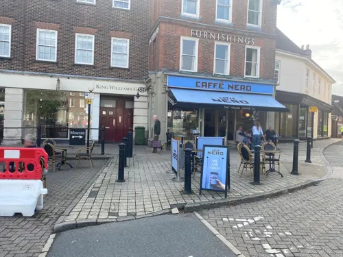
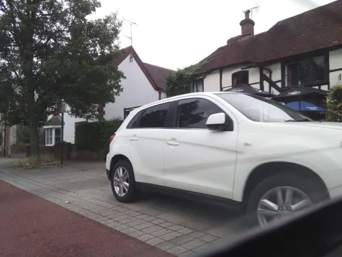
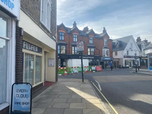
The Paradise Balti House
Restaurant
23 Lavant Street, Petersfield
Mo-Su 12:00-14:30; Su-Th 17:30-23:30; Fr-Sa 17:30-00:00
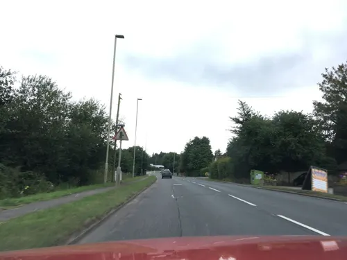


Chinwags
Cafe · Sandwich, Ice Cream, Cake, Coffee Shop
10/12 College Street, Petersfield
Mo-Fr 09:30-17:00; Sa 09:30-16:00

29 more on the map.
History
Petersfield Heath's burial mounds may be up to 4,000 years old; their distribution is mainly to the east and south east of the Heath. These are considered to be one of the more important lowland barrow groups in this country. The barrows indicate that the area of the Heath was occupied by people who may have come to regard this area as sacred to their religion. As yet no trace has been confirmed for the dwellings of these people as the structures would have been wooden but Petersfield Museum hosts a community project to throw more light on this period of history.
The town was founded during the 12th century by William FitzRobert, 2nd Earl of Gloucester, later chartered by his widow, Hawise de Beaumont, and confirmed by charter in 1198 from "John, Count of Mortain" (later to be King John). In 1415 King Henry V granted the burgesses of Petersfield freedom from toll, stallage, picage, pannage, murage, and pontage throughout the realm of England. All charters are preserved in the archive files at Petersfield Town Council.
Read more of the history
The town grew in prosperity due to its position on frequently travelled routes, local sheep farming, and cottage industries including leather and cloth. There were weekly markets in the town square for sheep, horse and cattle trading, and two annual fairs, in June (on the feast of St Peter and St Paul) and November (on the feast of St Andrew). An autumn fair which began in the early 19th century was held in October on The Heath, called "The Taro Fair".
The town's market square has an 18th-century equestrian statue of King William III by John Cheere. The king is mounted and the statue is on an engraved plinth. It is one of only five statues of William in the United Kingdom outside Northern Ireland (the others being in Glasgow, Brixham, Hull and Bristol) and, as such, attracts bands of marching Orangemen in mid-July to commemorate William's victory at the Battle of the Boyne.
From the History section of Petersfield on Wikipedia, under CC BY-SA 4.0.
More about Petersfield
Geography
Petersfield is situated in the valley of the Western Rother, on the Lower Greensand at the northern edge of the South Downs. The town lies at the western end of the Greensand Ridge, a sandstone ridge running through Hampshire, Surrey and Kent.
The town is surrounded on all sides by farmed countryside, with the South Downs south of the town, the Hampshire Downs to the west, and forested hills, including Durford Wood, to the north east.
Close to the town and situated on the South Downs is Queen Elizabeth Country Park, which incorporates Butser Hill (270 metres), and has a variety of scenery including chalk hills, beech woodland and pine forest. The Hangers Way footpath starts from the country park, goes to Buriton, through Petersfield and in to Alton.
On the south east side of the town is Petersfield Heath, 91 acres (37 ha) of heathland including woodland, grassland, a 22 acres (8.9 ha) fishing and boating lake, and a picnic and recreation area. Petersfield Heath is a Site of Nature Conservation Interest (SNCI). It also contains 21 Bronze Age barrows which have resulted in the site being given Scheduled Ancient Monument status.
Economy
There is employment in shops and offices in the town centre, and farms in nearby villages, while other people commute to London and Portsmouth. Light industry tends to be concentrated on the Bedford Road estate on the west side of Petersfield, including Whitman Laboratories (part of Estée Lauder). In 2007 the Norwegian-owned oil-supply giant Aibel Ltd added an engineering office in addition to their UK head office in Petersfield.
Rubber products were manufactured in the town from 1919 to the 1980s, making parts for footwear, and in the 1930s sets of interlocking bricks as construction toys, marketed as Minibrix, pre-dating the plastic versions created by Lego.
Arts and culture
On the nearest week-end to 6 October every year the Taro Fair is held on Petersfield Heath, a reminder of cattle fairs that were held annually until the 1950s.
("Tarw" is the Welsh shout by the herders for "Bull"; pronounced "Taro" in English).
Free festivals are held throughout the year. The Petersfield Spring Festival over the May Bank Holiday weekend, the Petersfield Summer Festival over the August Bank Holiday weekend and the Petersfield Christmas Festival Market on the first Sunday in December. These are organised by a Community Interest Company called "Petersfield Community Events, based in the town.
The town also plays host to an annual "Scooter Sunday" festival, a mod-themed event which sees several hundred scooter riders gather in the square and live music. The event is organised by The Five Fifteen, a local menswear retailer.
Petersfield's market square holds markets every Wednesday and Saturday, there are also monthly Farmers' markets. Stallholders and farmers from Petersfield's French twin town Barentin visit Petersfield and hold a French market.
In the High Street is the physic garden, which is a recreation of a 17th-century herb garden. It is open to the public nearly every day of the year. Next to the Red Lion public house is the small Charles Dickens garden.
Education
The local state secondary school is The Petersfield School, usually referred to as 'TPS'. Primary schools are Petersfield Infant School, Sheet Primary School and Herne Junior School. A number of other primary schools feed into the Petersfield secondary schools.
Petersfield lacks a state-sector sixth-form. Pupils normally continue their education at Havant and South Downs College, Bohunt Sixth Form or Alton College.
The town and the surrounding villages are home to several independent schools. Churcher's College is in Petersfield, and counts Tim Rodber and Tiny Rowland amongst its former pupils. Ditcham Park School is just outside the town, and Bedales School is in the neighbouring village of Steep. The former Moreton House School in the town centre was bought by Churcher's College in 1993 to become Churcher's College Junior School, but it soon outgrew these premises and subsequently relocated to Liphook. The old Moreton House school site was converted to housing.
From the Wikipedia article Petersfield, under CC BY-SA 4.0.
Notable people from Petersfield
 Calum ChambersEnglish association football player (born 1995)Photo: Anish Morarji from St Albans, England, CC BY 2.0
 Alex LawtherBritish actorPhoto: Philip Romano, CC BY-SA 4.0
 Jon SchofieldBritish canoeistPhoto: Ollie Harding, CC BY 2.0
 William CowperEnglish surgeon and anatomistPhoto: Unknown author, Public domain
 Joseph TrumanBritish Male track cyclistPhoto: Nicola, CC BY-SA 4.0
 William PoynterCatholic bishopPhoto: James Ramsay, Public domain
 John HildropEnglish Anglican cleric and writer (1682–1756)Photo: John Hildrop, Public domain
 Joseph Gouge GreenwoodBritish academic (1821-94)Photo: Warwick Brookes, 350 Oxford Street,..., Public domain
 Loftus William Jonesrecipient of the Victoria CrossPhoto: Unknown author Unknown author, Public domain
- Stuart PiggottBritish archaeologist (1910-1996)
- Arthur BroughBritish actor (1905-1978)
- Jonathan KellyBritish oboist
Born in Petersfield, according to Wikidata (CC0). Each name links to its Wikipedia article.
Where to stay1
Churches and places of worship9
Shopping16
Gas and EV charging4
Schools, colleges and libraries10
Steep Church of England Voluntary Controlled Primary School
School · Anglican · 1.3 mi
95-97 Church Road, Petersfield
Healthcare2
Map of Petersfield
114 places. The map loads OpenStreetMap tiles when you open it.
Getting there and nearby towns
Goodwood Aerodrome (QUG) is the nearest airport with scheduled flights listed in OpenStreetMap, 12 miles away.
- South Hayling 15 mi south, about 24 min by car
- Portsmouth 16 mi southwest, about 25 min by car
- Basingstoke 19 mi north, about 31 min by car
- Selsey 20 mi south, about 32 min by car
- Ryde 21 mi southwest, about 35 min by car
- Southampton 22 mi west, about 35 min by car
- Rustington 23 mi southeast, about 37 min by car
- Sandhurst 24 mi north, about 39 min by car
- Romsey 25 mi west, about 40 min by car
- Woking 27 mi northeast, about 44 min by car
Drive times are estimates from straight-line distance, not routes.
Towns near Petersfield


Keep exploring
Local news
Headlines from INDB.
Reviews, tips and questions
Loading what members have shared...
Sources and licences
- GeoNames (CC BY 4.0): population, coordinates, regions and time zone
- Mapillary (see each image): photos
- OpenStreetMap contributors (ODbL 1.0): places, airports, map data
- Wikidata (CC0 1.0): elevation, founding date, time zone, website, landmarks and historic places
- Wikimedia Commons (see each image): photos
- Wikipedia (CC BY-SA 4.0): overview and history text
Photo credits
- Bronze Age bowl barrows on Petersfield Heath 02, Simon Burchell, CC BY-SA 4.0
- Butser Hill, The original uploader was StephenDawson at English Wikipedia ., CC BY-SA 2.0
- Petersfield Museum (former Police Station), St Peter's Road, Petersfield (July 2019), Hassocks5489, CC0
- Petersf church2, Ericoides, CC BY-SA 3.0
- The Petersfield School entrance, Bashereyre ( talk ), CC BY-SA 3.0
- King William III Statue2, Petersfield, Captain Fishy - Purveyor of fine cod milkshakes since 1842 ( talk ), Public domain
- All Saints' Church, Steep 09, Simon Burchell, CC BY-SA 4.0
- Petersfield - Petersfield War Memorial - 20221103152103, Djm-leighpark, CC BY-SA 4.0
- Waitrose, Geoff Welding, CC BY-SA 2.0
- Street-level photo, noid, CC BY-SA 4.0
- Street-level photo, southglos, CC BY-SA 4.0
- Street-level photo, sjmarshalluk, CC BY-SA 4.0
- Street-level photo, sjmarshalluk, CC BY-SA 4.0
- Street-level photo, sjmarshalluk, CC BY-SA 4.0
- Street-level photo, sjmarshalluk, CC BY-SA 4.0
- Street-level photo, southglos, CC BY-SA 4.0
- Street-level photo, sjmarshalluk, CC BY-SA 4.0
- Street-level photo, southglos, CC BY-SA 4.0
- Street-level photo, southglos, CC BY-SA 4.0
- Street-level photo, sjmarshalluk, CC BY-SA 4.0
- Street-level photo, sjmarshalluk, CC BY-SA 4.0
- Street-level photo, sjmarshalluk, CC BY-SA 4.0
- Street-level photo, sjmarshalluk, CC BY-SA 4.0
- Street-level photo, sjmarshalluk, CC BY-SA 4.0
- Street-level photo, sjmarshalluk, CC BY-SA 4.0
- Street-level photo, sjmarshalluk, CC BY-SA 4.0
- Street-level photo, sjmarshalluk, CC BY-SA 4.0
- Street-level photo, sjmarshalluk, CC BY-SA 4.0
- Street-level photo, southglos, CC BY-SA 4.0

Page built November 10, 2026. Spotted a mistake? Tell us or suggest a place.