


Why visit Preston
Townapedia lists 68 museums and landmarks, 77 parks and trails, 145 places to eat, 26 places to stay and 12 attractions in and around town.
Highlights include SCHOOL LANE BRIDGE, Penwortham Bridge, Harris Museum and South Ribble Museum & Exhibition Centre.
Weather in Preston
Forecast from MET Norway (CC BY 4.0). Full forecast
About Preston
Preston is a city on the north bank of the River Ribble in Lancashire, England. The city is the administrative centre of the county of Lancashire and the wider City of Preston local government district. Preston and its surrounding district obtained city status in 2002, becoming England's 50th city in the 50th year of Queen Elizabeth II's reign. Preston had a population of 147,835 at the 2021 census, the City of Preston district 156,411 in 2023 and the Preston Built-up Area 313,322.
From the Wikipedia article Preston, Lancashire (this version), under CC BY-SA 4.0.
Travel tips from other travellers: Preston on Wikivoyage (CC BY-SA 4.0).
Photos of Preston


Things to do12





Museums and landmarks68

Harris Museum
Museum · 0.4 mi
Art museum in Preston, United Kingdom
Market Square, Preston
Mo-Sa 09:00-17:00; Su 11:00-16:00
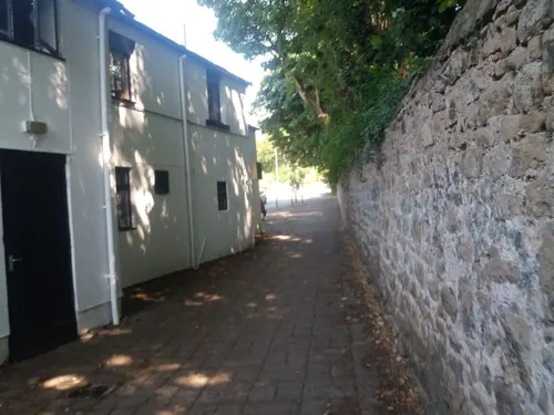
South Ribble Museum & Exhibition Centre
Museum · 5.1 mi
Church Road, Leyland
Tu 10:00-16:00;Th 13:00-16:00;Fr 10:00-16:00;Sa 10:00-13:00
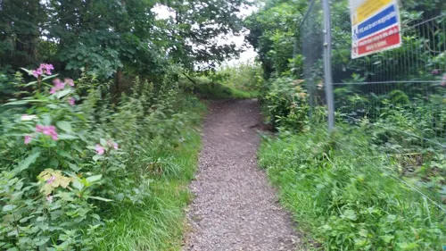


British Commercial Vehicle Museum
Museum · 4.8 mi
Automotive museum in Lancashire, England, United Kingdom
King Street, Leyland


Hoghton Tower
Museum · 5.7 mi
Grade I listed house in Hoghton, Lancashire, England, United Kingdom

Museum of Lancashire
Museum · 0.7 mi
Currently closed due to funding issues.
closed


Lancashire Infantry Museum
Museum · 1.3 mi
Military museum at Fulwood Barracks, Preston, Lancashire, United Kingdom
56 more on the map.
Parks, trails and playgrounds77


Winckley Square
Park · 0.5 mi
Garden square in Preston, Lancashire, UK


Bank Hall Gardens
Park · 7.5 mi
Immediate grounds belonging to the above



Cuerden Valley Park
Park · 5.1 mi
Park in Cuerden, Lancashire, England

65 more on the map.
Restaurants and cafes145
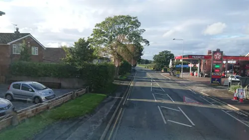
The Pepper Bistro
Restaurant · Indian · 3.4 mi
"Elevated Indian Cuisine"
523 Garstang Road
Mo-Th 17:00-22:00; Fr-Sa 12:00-14:00,17:00-22:00; Su off
Coco's Soul Food
Restaurant · Caribbean
88 Friargate, Preston
Mo-Th 11:00-20:30; Fr 11:00-21:30; Sa 12:00-18:00
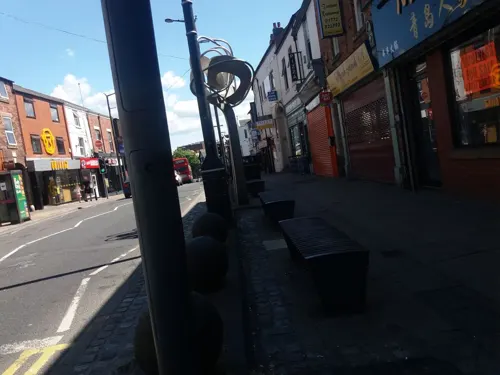
Fino
Restaurant · Tapas, Spanish
115 Friargate, Preston
Mo-Th 12:00-20:30; Fr-Sa 12:00-21:00; Su 12:00-19:00
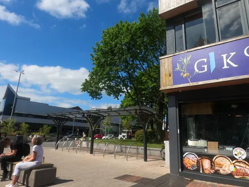


Caffè Nero
Cafe · Coffee Shop
168-170 Friargate, Preston
Mo-Fr 07:00-18:30; Sa 08:00-18:30; Su 08:30-17:30
Frurt
Cafe · Coffee Shop, Frozen Yogurt
101-105 Friargate, Preston
Mo-Th 08:30-23:45; Fr 08:30-01:45; Sa 10:00-01:45; Su 10:00-11:45

Galloways
Bakery
70-72 Lancaster Road, Preston
Mo-Sa 07:00-17:15
133 more on the map.
History
During the Roman period, Roman roads passed close to what is now the centre of Preston. For example, the road from Luguvalium to Mamucium (now Carlisle to Manchester) crossed the River Ribble at Walton-le-Dale, 3⁄4 mile (1 km) south-east of the centre of Preston, and a Roman camp or station may also have been here. At Withy Trees, 1+1⁄2 miles (2 km) north of Preston, the road crossed another Roman road from Bremetennacum (the Roman fort at Ribchester) to the coast.
An explanation of the origin of the name is that the Priest's Town refers to a priory set up by St Wilfrid near the Ribble's lowest ford. This idea is supported by the similarity of the Paschal lamb on Preston's crest with that on St Wilfrid's.
When first mentioned in the 1086 Domesday Book, Preston was already the most important town in Amounderness (the area of Central Lancashire between the rivers Ribble and Cocker, including The Fylde and the Forest of Bowland). When assessed for tax purposes in 1218–19, it was the wealthiest town in the county.
The right to hold a Guild Merchant was conferred by King Henry II upon the burgesses of Preston in a charter of 1179; the associated Preston Guild is a civic celebration held every 20 years, the last being in 2012. It is the only guild still celebrated in the UK.
Read more of the history
Before 1328, celebrations were held at irregular intervals, but at the guild of that year it was decreed that subsequent guilds should be held every 20 years. After this, there were breaks in the pattern for various reasons, but an unbroken series were held from 1542 to 1922. A full 400-year sequence was frustrated by the cancellation of the 1942 guild due to World War II, but the cycle resumed in 1952. The expression "(Once) every Preston Guild", meaning 'very infrequently', has passed into fairly common use, especially in Lancashire.
Guild week is always started by the opening of the Guild Court, which since the 16th century has traditionally been on the first Monday after the feast of the Beheading of John the Baptist celebrated on 29 August. As well as concerts and other exhibitions, the main events are a series of processions through the city. Numerous street parties are held in the locality.
In 1952, the emphasis was on the bright new world emerging after the war. The major event, held in the city's Avenham Park, had every school participating, and hundreds of children, from toddlers to teenagers, demonstrated different aspects of physical education in the natural amphitheatre of the park.
The 2012 guild formally opened on 2 September, with a mayoral proclamation and the return of "friendship scrolls" that had travelled the world. Highlights in the programme for the 2012 celebration included two concerts in Avenham Park – one by Human League and another, a "Proms In The Park", featuring José Carreras, Katherine Jenkins and the Manchester Camerata.
In the mid-12th century, Preston was in the hundred of Amounderness, in the deanery of Amounderness and the archdeaconry of Richmond. The name "Amounderness" is more ancient than the name of any other "Wapentake" or hundred in the County of Lancashire, and the fort at Tulketh, strengthened by William the Conqueror, shows that the strategic importance of the area was appreciated even then.
The location of the city, almost exactly midway between Glasgow and London, led to many confrontations with Scotland. Preston was burned by the Scots during The Great Raid of 1322 but two years later had quickly recovered. Decisive battles were also fought here, most notably during the English Civil War at the Battle of Preston (1648), and then the first Jacobite rebellion, whose invasion of England was brought to a conclusion by the defeat of the pro-Catholic and pro-monarchial Jacobite army at the Battle of Preston (1715). Letitia Elizabeth Landon alludes to this latter defeat in her poetical illustration, Preston, to an engraving of a painting by Thomas Allom, in Fisher's Drawing Room Scrap Book 1834.
In the last great Jacobite Rising, on 27 November 1745 the Jacobite Prince of Wales and Regent, Bonnie Prince Charlie passed through Preston with his Highland Army on the way south through Chorley and Manchester to Derby intending to take London and the Crown. Preston was the first of quite a few places in England where the Prince was cheered as he rode by and where he was joined by some English volunteers for his Army. One Jacobite eyewitness noted that from Preston onwards, "at every town we were received with ringing of bells, and at night we have bonfires, and illuminations". Another Jacobite eyewitness noted in a private letter from Preston on 27 November 1745: "People here are beginning to join [us] very fast; we have got about sixty recruits today". From 10 to 12 December the Prince gave his retreating Army a rest in Preston on their long, last and fatal retreat from Derby through Lancaster and Carlisle to their dreadful day of destiny the following 16 April on Culloden Moor, near Inverness.
Merchants from Preston took part in the transatlantic slave trade in the 18th century.
The 19th century saw a transformation in Preston from a small market town to a much larger industrial one. The innovations of the latter half of the previous century, such as Richard Arkwright's water frame (invented in Preston), brought cotton mills to many northern English towns. With industrialisation came examples of both oppression and enlightenment.
Preston was the first English town outside London to be lit by gas. The Preston Gas Company was established in 1815 by, amongst others, a Catholic priest: Rev. Joseph "Daddy" Dunn of the Society of Jesus. The Preston and Wigan Railway arrived in 1838, shortly afterwards renamed the North Union Railway. The Sheffield firm of Thos. W. Ward Ltd opened a ship breaking yard at Preston Dock in 1894.
From the History section of Preston, Lancashire on Wikipedia, under CC BY-SA 4.0.
More about Preston
Geography
The River Ribble provides a southern border for the city. The Forest of Bowland forms a backdrop to the city to the north-east, while the Fylde lies to the west. Preston is located approximately 27 miles (43 km) north-west of Manchester, 26 miles (42 km) north-east of Liverpool and 15 miles (24 km) east of Blackpool.
The current borders came into effect on 1 April 1974, when the Local Government Act 1972 merged the existing County Borough of Preston with Fulwood Urban District as an unparished area within the Borough of Preston. Preston was designated as part of the Central Lancashire new town in 1970.
The climate of Preston is of a temperate maritime type, with a narrow range of temperatures, similar to the rest of the British Isles. Being relatively close to the Irish sea, this is more pronounced than areas to the south and east of Preston. The official Met Office weather station is located at Moor Park, less than 1 mile (1.6 km) north of the city centre, and surrounded by built-up areas, suggesting a degree of urban warming is likely, particularly during clear and calm nights.
Economy
Preston has seen many changes over the course of its history in regards to its local economy, shifting from a market town to the textile industry and more recently to tertiary education and research.
The city was home to Alstom Transport's main UK spare parts distribution centre (formerly GEC Traction Ltd), until it transferred operations to Widnes in July 2018. Matalan Retail Ltd was also founded in Preston under the name Matalan Cash and Carry. Although the head office of Matalan moved to Skelmersdale in 1998, the city still has the tax office for the company (located in Winckley Square).
Goss Graphic Systems Limited, a global supplier of printing presses based in the United States, formerly employed more than 1,000 people in Preston, but in 2007 the company moved manufacturing to the United States, China and Japan and now has around 160 employees in the city.
Unemployment in Preston rose 15% in the year up to April 2012, to a total of 3,783 claimants. However, in November 2018, Preston was named as Most improved city in UK, with unemployment down to 3.1% from 6.5% in 2014, and improvements above the national average for health, transport, the work-life balance of its residents, and for the skills among both the youth and adult populations.
Arts and culture
In September 2024, Moor Park in the city was the venue for Radio 2 in the Park, with guest artists including Sting, Sister Sledge, Manic Street Preachers and the Pet Shop Boys.
Education
The city is home to the University of Lancashire. Formerly known as The Harris Institute, Preston Polytechnic and more recently (1985–1992) as Lancashire Polytechnic, the university was the sixth largest in the country in 2006, with over 33,000 students.
Lancaster University School of Mathematics - state selective Maths school based in central Preston, near Cardinal Newman College. It focuses on a curriculum of A-levels with all students taking maths and further maths.
Preston College – based mainly in Fulwood with two campuses – one near the Royal Preston Hospital for A-Levels and vocational courses, and an arts college in Moor Park. It has COVE (Centre of Vocational Excellence) status in retail.
TUC Education Unit – based at Buckingham House, in the city centre
Royal Preston Hospital – a teaching hospital, with a proportion of medical students from the University of Manchester based here for their clinical training.
Cardinal Newman College – based on a single campus in Avenham, close to the city centre.
From the Wikipedia article Preston, Lancashire, under CC BY-SA 4.0.
Notable people from Preston
 Richard Arkwrighttextile entrepreneur; developer of the spinning frame (known as the water frame)Photo: Mather Brown, Public domain
 Sam JohnstoneEnglish association football player (born 1993)Photo: Catherine Kõrtsmik, CC BY 2.0
 Tim FarronBritish politician (born 1970)Photo: Richard Townshend, CC BY 3.0
 Kevin KilbaneIrish association football playerPhoto: vagueonthehow from England, CC BY 2.0
 John Bagot GlubbBritish military officer, scholar and author (1897–1986)Photo: Willem van de Poll, CC0
 James SalterAmerican novelist and short-story writer (1925–2015)Photo: Tulane Public Relations, CC BY 2.0
 Mark LawrensonAssociation football playerPhoto: Marcel Antonisse / Anefo, CC0
 Holly BradshawBritish pole vaulterPhoto: MarkHaz88, CC BY-SA 4.0
 Joseph DelaneyBritish writer (1945–2022)Photo: Georges Seguin ( Okki ), CC BY-SA 3.0
- Phil JonesEnglish association football player, born 1992
- Tom FinneyEnglish footballer (1922–2014)
- Steve SumnerNew Zealand footballer (1955–2017)
Born in Preston, according to Wikidata (CC0). Each name links to its Wikipedia article.
Where to stay26
Churches and places of worship92
Christ Church, Fulwood
Church · Anglican · 1.0 mi
Victoria Road, Preston
Shopping76
Gas and EV charging31
Schools, colleges and libraries40
Archbishop Temple Church of England High School
School · Anglican · 1.4 mi
St Vincent's Road, Preston
Broughton-in-Amounderness Church of England Primary School
School · Anglican · 2.9 mi
Church Lane, Preston
Fulwood, St Peter's Church of England Primary School and Nursery
School · Anglican · 2.3 mi
Meadowfield, Preston
Healthcare36
Map of Preston
250 places. The map loads OpenStreetMap tiles when you open it.
Getting there and nearby towns
Warton Aerodrome (WRT) is the nearest airport with scheduled flights listed in OpenStreetMap, 7 miles away.
- Woodplumpton 4 mi northwest, about 6 min by car
- Goosnargh 4 mi north, about 7 min by car
- Leyland 5 mi south, about 7 min by car
- Clayton-le-Woods 5 mi south, about 8 min by car
- Wigan 15 mi south, about 25 min by car
- St Helens 22 mi south, about 35 min by car
- Salford 25 mi southeast, about 41 min by car
- Warrington 26 mi south, about 42 min by car
- Stockport 33 mi southeast, about 53 min by car
- Wakefield 50 mi east, about 1 h 15 min by car
Drive times are estimates from straight-line distance, not routes.
Towns near Preston


Keep exploring
Local news
Headlines from INDB.
Reviews, tips and questions
Loading what members have shared...
Sources and licences
- GeoNames (CC BY 4.0): population, coordinates, regions and time zone
- Mapillary (see each image): photos
- OpenStreetMap contributors (ODbL 1.0): places, airports, map data
- Wikidata (CC0 1.0): elevation, founding date, time zone, website, landmarks and historic places
- Wikimedia Commons (see each image): photos
- Wikipedia (CC BY-SA 4.0): overview and history text
Photo credits
- Preston Riversway Docks, Karl1587, Public domain
- Preston Magistrates Court, Betty Longbottom, CC BY-SA 2.0
- 20190803-Preston-Bus-40004, Alex Noble, CC0
- Crown Street, Preston (6893414154), Craig Sunter from Manchester, UK, CC BY 2.0
- The former Craggs Row tower windmill, Preston (6653991117), Craig Sunter from Manchester, UK, CC BY 2.0
- The former Craggs Row tower windmill, Preston (6653993057), Craig Sunter from Manchester, UK, CC BY 2.0
- Penwortham old bridge west side, Devadude2, CC BY-SA 3.0
- Harris Museum ( Preston ) ( Web), Dave Wilson, CC BY-SA 3.0
- Bus lineup, 2012 Leyland Transport Festival, Sherpa_536, CC BY 2.0
- Hoghton Tower 2, Poliphilo, CC0
- Moor Park, Garstang Road, Oct 2016, Stufroguk, CC BY-SA 4.0
- Avenham Park Preston Lancashire, Soloist at English Wikipedia, CC BY-SA 3.0
- Miller Park, Preston, Dr Greg, CC BY-SA 4.0
- Bank Hall Snowdrops Feb 2009, Bankhallbretherton, CC BY 3.0
- Brockholes, Frombowen, CC BY-SA 4.0
- Museum of Lancashire, Preston, JThomas, CC BY-SA 2.0
- Preston cenotaph, Francis C. Franklin, CC BY-SA 4.0
- St Andrew's Church, Leyland, Alexander P Kapp, CC BY-SA 2.0
- PrestonStJohnTheEvangelistMinsterChurch, KGGucwa, CC BY-SA 3.0
- St Mark's Church, Preston 2, Alexander P Kapp, CC BY-SA 2.0
- School Lane Bridge, Whittle-le-Woods, Ann Cook, CC BY-SA 2.0
- The Lamb, Preston, Rept0n1x, CC BY-SA 3.0
- Church of St Walburge, Francis Franklin, CC BY-SA 4.0
- Preston Docks Swing Bridge - Linda (Princess), Geof Sheppard, CC BY-SA 4.0
- Preston cenotaph 2, Francis C. Franklin, CC BY-SA 4.0
- St Mark's Church, Preston, Betty Longbottom, CC BY-SA 2.0
- St John's Minster Pano, Francis Franklin, CC BY-SA 4.0
- 22 Winckley Square, Preston, Peter James, CC BY-SA 4.0
- Railway Worden Park, Ann Cook, CC BY-SA 2.0
- Street-level photo, tonys999, CC BY-SA 4.0
- Street-level photo, tonys999, CC BY-SA 4.0
- Street-level photo, tonys999, CC BY-SA 4.0
- Street-level photo, tonys999, CC BY-SA 4.0
- Street-level photo, skifans, CC BY-SA 4.0
- Street-level photo, tonys999, CC BY-SA 4.0
- Street-level photo, tonys999, CC BY-SA 4.0
- Street-level photo, tonys999, CC BY-SA 4.0
- Street-level photo, tonys999, CC BY-SA 4.0
- Street-level photo, tonys999, CC BY-SA 4.0
- Street-level photo, tonys999, CC BY-SA 4.0
- Street-level photo, tonys999, CC BY-SA 4.0
- Street-level photo, tonys999, CC BY-SA 4.0
- Street-level photo, tonys999, CC BY-SA 4.0
- Street-level photo, tonys999, CC BY-SA 4.0
- Street-level photo, tonys999, CC BY-SA 4.0
- Street-level photo, tonys999, CC BY-SA 4.0
- Street-level photo, tonys999, CC BY-SA 4.0
- Street-level photo, davidsong, CC BY-SA 4.0
- Street-level photo, davidsong, CC BY-SA 4.0
- Street-level photo, davidsong, CC BY-SA 4.0
- Street-level photo, tonys999, CC BY-SA 4.0
- Street-level photo, tonys999, CC BY-SA 4.0
- Street-level photo, tonys999, CC BY-SA 4.0
- Street-level photo, tonys999, CC BY-SA 4.0
- Street-level photo, tonys999, CC BY-SA 4.0
- Street-level photo, tonys999, CC BY-SA 4.0
- Street-level photo, victuallers, CC BY-SA 4.0


Page built November 10, 2026. Spotted a mistake? Tell us or suggest a place.