
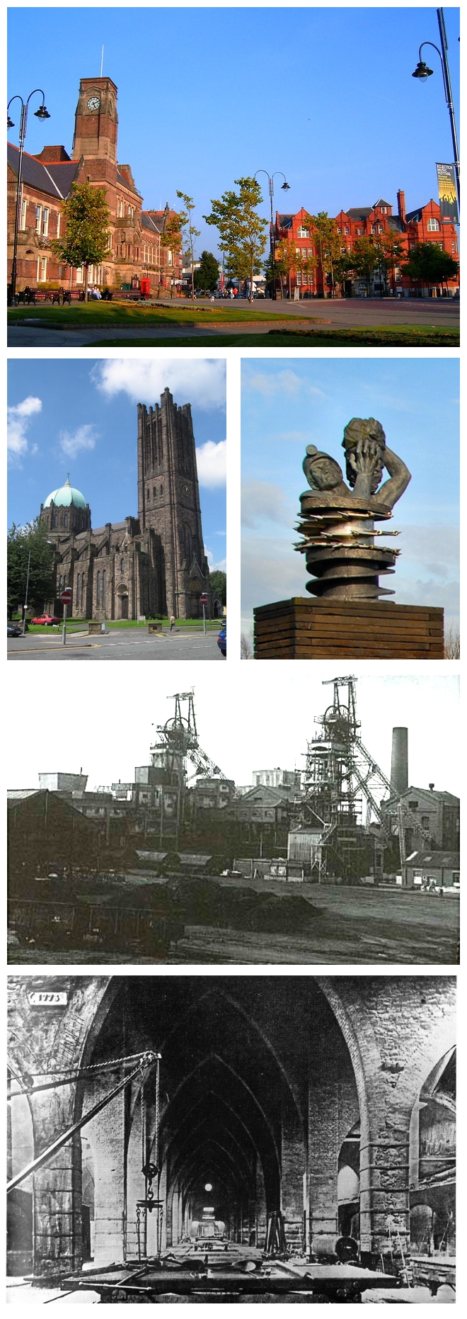


St Helens, United Kingdom
St Helens is a city of 183,200 people in England, United Kingdom.
Why visit St Helens
Townapedia lists 88 museums and landmarks, 83 parks and trails, 140 places to eat, 30 places to stay and 37 attractions in and around town.
Highlights include Shakespeare North Playhouse, Mersey Gateway Bridge, North West Museum of Road Transport and Catalyst Science Discovery Centre.
Weather in St Helens
Forecast from MET Norway (CC BY 4.0). Full forecast
About St Helens
St Helens () is a large town in Merseyside, England, with a population of 117,308. It is the administrative centre of the Metropolitan Borough of St Helens which had a population of 183,200 at the 2021 Census.
From the Wikipedia article St Helens, Merseyside (this version), under CC BY-SA 4.0.
Travel tips from other travellers: St Helens on Wikivoyage (CC BY-SA 4.0).
Photos of St Helens


Things to do37


Mersey Gateway Bridge
Bridge · 6.8 mi
Toll bridge over the River Mersey

Old Quay Bridge
Bridge · 7.3 mi
Grade II listed swing bridge in Wigg Island, Runcorn, Cheshire, England, United Kingdom

Runcorn Railway Bridge
Bridge · 7.1 mi
Bridge in Halton, Cheshire, England, UK
Shakespeare North
Cinema and theater · 3.3 mi
Auditorium in Merseyside, England


Citadel Arts Centre
Cinema and theater
Arts and community centre in St Helens, England

Gulliver's World Resort
Monument and historic site · 5.6 mi
Children's theme park resort in Warrington, Cheshire.

Howley Footbridge
Bridge · 7.7 mi
Footbridge in Warrington, Cheshire, England, UK
Prescot Playhouse
Cinema and theater · 3.2 mi
Elizabethan theater in Prescot
Silver Jubilee Bridge
Bridge · 7.2 mi
Grade II listed through arch bridge in Runcorn/Widnes, UK
25 more on the map.
Museums and landmarks88


Catalyst Science Discovery Centre
Museum · 6.8 mi
Science centre and museum devoted to the chemical industry in the United Kingdom

Croxteth Hall
Museum · 6.5 mi
Country house in Croxteth, Liverpool, England, UK


Museum of Wigan Life
Museum · 7.8 mi
Centre in Wigan, Greater Manchester, England, United Kingdom

Norton Priory Museum and Gardens
Museum · 7.8 mi
Historic site in Norton, Runcorn, Cheshire, England, United Kingdom

World of Glass
Museum
Museum and visitor centre in St Helens, Merseyside, United Kingdom
Chalon Way East, St Helens
We-Su 10:00-16:00
Prescot Museum
Museum · 3.2 mi
Local museum in Prescot, Knowsley, Merseyside, England, UK
Aspinal Street, Prescot
Mo-Fr 10:00-17:00; Sa 10:00-13:00
Museum of Policing in Cheshire
Museum · 7.0 mi
Museum in Warrington, England, United Kingdom
West Derby Castle
Monument and historic site · 7.3 mi
Motte-and-bailey castle in Liverpool, Merseyside, England, UK
76 more on the map.
Parks, trails and playgrounds83


Victoria Park
Park · 1.0 mi
Park in St Helens, Merseyside, England, United Kingdom


Downall Croft
Park · 4.2 mi
Doorstep Greens (Polygons). The Doorstep Greens initiative provides new or renovated areas of public open space close to people's homes...
24/7

71 more on the map.
Restaurants and cafes140
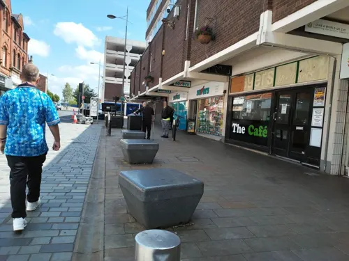
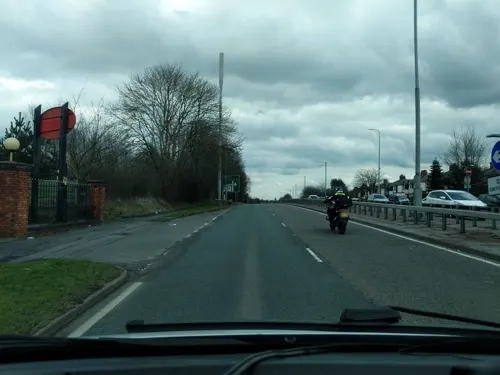
Sing Faye Chinese Restaurant St Helens
Restaurant · Chinese · 1.6 mi
Site in use since circa 1995.
16 East Lancashire Road, St Helens
Mo-Th 17:00-21:30; Fr-Sa 17:00-22:30; Su 14:00-21:00

Galloways Bakers
Bakery · 1.5 mi
1 Millfields Court, St Helens
Mo-Sa 07:30-18:00; Su 10:00-16:00; BH 10:00-16:00

The Dam Bar
Cafe · Breakfast, Local · 2.0 mi
Clubhouse serving food and providing activities.
Garswood Old Road, St Helens
Mo-We 09:30-18:00; Th 09:30-21:00; Fr 09:30-22:00; Sa-Su 09:30-20:00

Balti Spice, Indian Restaurant, St Helens
Restaurant · Indian · 0.6 mi
113 Duke Street
Su-Th 16:30-22:00; Fr-Sa 16:30-23:00

Brickhouse Tavern
Bar and pub · International · 0.5 mi
Rigby Street, St Helens
Mo-Th 16:00-22:00; Fr 16:00-01:00; Sa 12:00-01:00; Su 12:00-21:00
Butty-licious
Cafe · Breakfast, Coffee Shop, Local · 1.5 mi
26 Nutgrove Road
Mo-Fr 07:00-15:00; Sa 07:00-14:00; Su 08:30-13:30
128 more on the map.
History
The southern part of what became the traditional county of Lancashire was at least partially settled by the Brigantes, a Celtic tribe, who were subjugated by the Romans during their 1st Century conquest, with nearby Wigan suggested as a location for the Roman settlement of Coccium. Eccleston in St Helens appears to derive its name from either the Latin ecclesia or the Brittonic eglwys, both meaning "church", suggesting a common link to a place of worship although none is known in that township until the 19th century.
The first recorded settlements are the Manors, Parishes and Titled Lands listed in the Domesday Book in the 11th century. The titled lands would have encompassed the modern townships of Sutton, Windle and Parr as part of their fiefdoms, though it may be inferred from the listed tithes that the land was populated before then.
St Helens did not exist as a town in its own right until as late as the middle of the 18th century when it is referenced in Parliament. The development of the town has a complex history: it was spurred on by the rapid population growth in the region during the Industrial Revolution. Between 1629 and 1839, St Helens grew from a small collection of houses surrounding an old chapel, to a village, before becoming the significant urban centre of the four primary manors and surrounding townships that make up the modern town.
Read more of the history
The Domesday Book of 1086 reveals that several manors existed at that time, although there are no specific references to "St Elyn", or mentions of the particular "vill" or villages. Windle is first recorded on some maps as "Windhull" (or variations thereof) in 1201, Bold in 1212 (as Bolde) and Parr (or Parre) in 1246, whilst Sutton and Ecclestone composed part of the Widnes "fee" (a hereditary entitlement of ownership) under a Knight or Earl. It is known that the Hospitallers held lands in the area of Hardshaw as early as 1292, known as Crossgate (which may be referred to by the long built-over Cross Street in the town centre beneath the modern College campus) and many of the original parishes, townships and local areas are named after the families that owned the land between the 11th and 18th centuries.
The Ecclestone family owned the Eccleston township. Their ancestral home dates to 1100; it was built by Hugh Ecclestone. The family is referred to throughout the period until the 18th century when they departed for nearby Southport.
The manor of Parr remained in control of the Parr family and their descendants from the 13th to the early 15th century when a distant relative of the original family line, William Parr, 1st Marquess of Northampton (brother of Henry VIII's wife Catherine Parr) sold the manor to the Byroms of Lowton. The family later supported the Royalists during the English Civil War, and Henry Byrom (son of the Lord of the Manor) died at the Battle of Edgehill.
The extensive lands of Sutton Manor stretched across the open and flat land leading towards the Mersey. The manor's name is of unknown origin, but the land within the estate referred to several leading families, including Eltonhead, Ravenhead, and Sherdley. In 1212, William de Daresbury was the title holder of the manors. The Sherdley family can be traced back to the Northales, who had been settled in the area since at least 1276 when they were referred to as plaintiffs in a boundary dispute with the Lords of Rainhill.
Windle contained the smaller Hardshaw, described as a berewick in the Domesday Book. It was in Hardshaw that Chapel Lane was constructed. The Windle Family were Lords of the Manor and Township from the Norman period onward before ceding control to the Gerards of Bryn.
"This tiny hamlet [in] Hardshaw including the chapel-of-ease, from which its name was taken, became the nucleus of the town."
In 1139, the earldom of Derby, in the Peerage of England, was created: Norman descendant Robert De Ferrers was the first Earl. Subsequently, the region passed to John of Gaunt, and eventually the Stanley family. Their ancestral home was eventually established in the nearby Knowsley area (to the west of the modern St Helens borough), with the foundation of a hunting lodge in the 15th century and subsequently Knowsley Hall in the 18th century. The Earl of Derby's lands encompassed a region from Liverpool to Manchester, and to the north beyond Lancaster and were primarily turned to meeting the pastoral needs of the people.
Throughout this period, the area was predominantly arable land and was noted for its large swathes of moss, heath and bog land while elsewhere in parts, it was covered by the greater Mersey Forest (the larger "Community Forest" was not established until much later).
The origin of the name "St Helens" stretches back at least to a chapel of ease dedicated to St Elyn, the earliest documented reference to which is in 1552. The first time the chapel was formally referred to appears to be 1558, when Thomas Parr of Parr bequeathed a sum of money "to a stock towards finding a priest at St. Helen's Chapel in Hardshaw, and to the maintenance of God's divine service there for ever, if the stock go forward and that the priest do service as is aforesaid". Early maps show that it was originally in Chapel Lane, near the site of the modern pedestrianised Church Street. Historically this would have fallen within the berewick of Hardshaw, within the greater township of Windle (making up the southern border) abutting onto the open farmland of Parr to the east, and Sutton and Eccleston to the south and west respectively.
From the History section of St Helens, Merseyside on Wikipedia, under CC BY-SA 4.0.
More about St Helens
Geography
Approximately 22% of the St Helens Borough's 136 km2 (53 sq mi) is made up of soft rolling hills (30 km2 (12 sq mi)) used primarily for agricultural purposes, mainly arable. The highest point in the borough, and in the whole of Merseyside, is Billinge Hill, 5.6 km (3 mi) north of the town centre. From the top of this hill on a clear day the mountains of Snowdonia, fells of the Lake District and Blackpool Tower are all visible, as well as the cities of Manchester and Liverpool and the towns of Wigan, Bolton and Warrington. The Mill Brook/Windle Brook runs through Eccleston and connects with the disused St Helens branch/section of the Sankey Canal in the town centre. St Helens is around 160 feet (50 metres) above sea level.
Carr Mill Dam is Merseyside's largest body of inland water, with lakeside trails and walks. It is used for national competitive powerboating and angling events.
Moss Bank, a suburb of St Helens, is about 4 km (2+1⁄2 mi) north of the town centre. It has a community library and St David's
The Burgies are two tailings on the site of the old Rushy Park coal mine. They were created by dumping toxic chemical waste from the manufacture of glass; they have since been covered with tall grass and woodland.
Economy
The glass industry is no longer the major employer it once was; however, it still employs over a thousand people in the town. The large Pilkington Brothers works, founded in 1826, dominates the town's industrial quarter and still produces all the UK's output of flat glass.
In 1994, planning permission was sought out for a link road connecting the M62 directly with the town centre. The development included a £5m retail and commercial property project in the Ravenhead area that had seen successive business closures with the folding of UGB and Ravenhead Glass.
The town's shopping area is centred on the St Helens Minster, the original site of St Mary's open market. The open market was later replaced by an awned covered market that populated Chapel Lane and the locale.
The current Church Square shopping centre surrounds St Helens on three sides. Church Street, the main high street, runs parallel to Church Square and is sandwiched by the town's second shopping centre known as The Hardshaw Centre. The other main shopping streets in the town centre include the more traditional small store based Bridge Street, Duke Street and Westfield Street populated by independent specialists. Church Square was bought by St Helens Borough Council in 2017 for £26.6m as part of local regeneration plans.
Arts and culture
Located in the town centre, The World of Glass Museum opened in 2000 incorporating the Pilkington Glass Museum and the St Helens Local Museum.
The North West Museum of Road Transport is another museum located in the town. The Smithy Heritage Centre is a small museum in Kiln Lane, Eccleston about the works of a local blacksmith.
The borough of St Helens has several major parks and open spaces. These include the Taylor Park, a listed Grade II Historic Park and Garden opened in 1893, as well as Victoria Park located near the town centre.
Sherdley Park is a modern park in Sutton which used to feature a funfair in the summer, usually in July. Called the St Helens Festival (originally named the St Helens Show), it was one of the biggest free festivals in Europe.
Parr has Gaskell Park in addition to the reclaimed open space known as The Duckeries (or Ashtons Green), and shares a boundary with boggy heathland known as "The Moss" or "Colliers Moss" (traditionally associated with Bold and its power station), and the area known as the "Flash" (remnants of the canal tributary system and fishing ponds) with a nature walk along part of the 7 mi (11 km) route that makes up the Sankey Valley Country Park (part of the Trans Pennine trail).
A 20m tall sculpture, called Dream, has been erected on a former colliery in Sutton Manor in St Helens.
Education
The Borough of St Helens has one nursery school, one infant school, one junior school, fifty-two primary schools and one independent school for pupils aged 3–16. Performance in the Key Stage 1 and Key Stage 2 SATs has been consistently above national averages over the past 5 years.
There are three SEN schools in St Helens - Penkford, Mill Green and Lansbury Bridge.
The Borough of St Helens has one independent and nine maintained secondary schools:
From the Wikipedia article St Helens, Merseyside, under CC BY-SA 4.0.
Notable people from St Helens
 David YatesEnglish filmmaker (born 1963)Photo: Gage Skidmore, CC BY-SA 3.0
 Thomas BeechamBritish conductor and impresario (1879–1961)Photo: Culver Pictures, New York, Public domain
 John William DraperBritish-American academic (1811-1882)Photo: Edward Bierstadt, Public domain
 Conor CoadyEnglish association football playerPhoto: Timmy96, CC0
 Emma RigbyBritish actressPhoto: Emma Rigby, CC BY-SA 4.0
 Geoff DukeBritish motorcycle racer (1923-2015)Photo: Harry Pot for Anefo ]], CC BY-SA 3.0 nl
 Jeffrey WalkerBritish singerPhoto: Birgit Fostervold, CC BY-SA 4.0
 Michael SmithEnglish darts player (born 1990)Photo: Sven Mandel, CC BY-SA 4.0
 Mark JoyceEnglish snooker playerPhoto: Benutzer:Bill da Flute, CC BY-SA 3.0
- Bill FoulkesEnglish football player and coach (1932–2013)
- John ConnellyEnglish footballer (1938-2012)
- Johnny VegasEnglish actor, comedian, and ceramicist
Born in St Helens, according to Wikidata (CC0). Each name links to its Wikipedia article.
Where to stay30
Churches and places of worship77
Shopping69
Gas and EV charging36
Schools, colleges and libraries36
St Augustine of Canterbury Catholic Academy
School · Roman Catholic · 1.3 mi
Boardmans Lane, St Helens
Healthcare35
Map of St Helens
250 places. The map loads OpenStreetMap tiles when you open it.
Getting there and nearby towns
Liverpool John Lennon Airport (LPL) is the nearest airport with scheduled flights listed in OpenStreetMap, 9 miles away.
- Haydock 2 mi northeast, about 4 min by car
- Rainhill 3 mi southwest, about 4 min by car
- Prescot 3 mi southwest, about 5 min by car
- Whiston 3 mi southwest, about 5 min by car
- Billinge 3 mi north, about 6 min by car
- Warrington 7 mi southeast, about 12 min by car
- Wigan 8 mi northeast, about 12 min by car
- Stockport 24 mi east, about 38 min by car
- Stoke-on-Trent 38 mi southeast, about 1 h by car
- Wakefield 53 mi east, about 1 h 30 min by car
Drive times are estimates from straight-line distance, not routes.
Towns near St Helens


![Photo: Harry Pot for Anefo ]], CC BY-SA 3.0 nl](https://commons.wikimedia.org/wiki/File:Geoff_Duke_(1951).jpg)


Keep exploring
Local news
Headlines from INDB.
Reviews, tips and questions
Loading what members have shared...
Sources and licences
- GeoNames (CC BY 4.0): population, coordinates, regions and time zone
- Mapillary (see each image): photos
- OpenStreetMap contributors (ODbL 1.0): places, airports, map data
- Wikidata (CC0 1.0): elevation, founding date, time zone, website, landmarks and historic places
- Wikimedia Commons (see each image): photos
- Wikipedia (CC BY-SA 4.0): overview and history text
Photo credits
- St Helens Photo Montage, See below, CC BY-SA 2.0
- View east from footbridge over Ravenhead Branch of St Helens Canal, Rodhullandemu, CC BY-SA 4.0
- View west from footbridge over Ravenhead Branch of St Helens Canal, Rodhullandemu, CC BY-SA 4.0
- Tank House, St Helens, Alexander P Kapp, CC BY-SA 2.0
- The Mersey Gateway Bridge viewed from Halton Castle in Runcorn, Cheshire, England, David Peace, CC BY-SA 4.0
- Old Quay Bridge Closed, Outwivcamera, CC BY-SA 4.0
- Runcorn Railway Bridge, Unknown author, Public domain
- Catalyst 2149, Chemical Engineer, CC BY-SA 3.0
- Taylor Gallery at the Museum of Wigan Life, Hindleyite, CC BY 3.0
- Norton Priory, Unknown author, Public domain
- Folly, Victoria Park, St Helens, Paul Brooker, CC BY-SA 2.0
- St Mary's Catholic Church, Birchley (4), Rept0n1x, CC BY-SA 3.0
- Improvements plaque at Prescot railway station, Rodhullandemu, CC BY-SA 4.0
- Totally Wicked Stadium 4, Rodhullandemu, CC BY-SA 4.0
- Knowsleyhall, Unknown author, Public domain
- St Mary's Church, Prescot 2, Rodhullandemu, CC BY-SA 4.0
- Holy Cross & St Helen Church 1, Rodhullandemu, CC BY-SA 4.0
- St. Bartholomew's Church, Roby (5), Rept0n1x, CC BY-SA 3.0
- St Helens Quaker Meeting House 2, Rodhullandemu, CC BY-SA 4.0
- Whiston Hospital, Merseyside, Rept0n1x, CC BY-SA 3.0
- St Helens Hospital, Merseyside (1), Rept0n1x, CC BY-SA 3.0
- St Mark's Church, Haydock 1, Rodhullandemu, CC BY-SA 4.0
- St Mary's Church, Prescot, Sue Adair, CC BY-SA 2.0
- Knowsley Hall, Merseyside-6116302107, SLR Jester, CC BY 2.0
- Aerial view of Langtree Park Rugby Stadium 2019, Harvey Milligan, CC BY-SA 4.0
- Holy Cross and St Helen Church, St Helens, viewed from Hall Street, Rept0n1x, CC BY-SA 3.0
- 46233 Duchess Of Sutherland pulling the Cumbrian Mountain Express, ARG_Flickr, CC BY 2.0
- Zwischengoldglas, Frombowen, CC BY-SA 4.0
- View north from Salisbury Street bridge, Vera Page Park, Rodhullandemu, CC BY-SA 4.0
- View south from Salisbury Street bridge, Vera Page Park, Rodhullandemu, CC BY-SA 4.0
- Aerial view of the 138 hard hats, John E Ryelea, CC0
- The Sand Wagons, ARG_Flickr, CC BY 2.0
- BUT 9611T trolleybus, North West Museum of Road Transport, October 2022, Mwsmith20, CC BY-SA 4.0
- Farm Lodge To Croxteth Hall, Frombowen, CC BY-SA 4.0
- Street-level photo, tonys999, CC BY-SA 4.0
- Street-level photo, rikwilson, CC BY-SA 4.0
- Street-level photo, rikwilson, CC BY-SA 4.0
- Street-level photo, davidsong, CC BY-SA 4.0
- Street-level photo, tonys999, CC BY-SA 4.0
- Street-level photo, tonys999, CC BY-SA 4.0
- Street-level photo, tonys999, CC BY-SA 4.0
- Street-level photo, rikwilson, CC BY-SA 4.0
- Street-level photo, tonys999, CC BY-SA 4.0
- Street-level photo, rikwilson, CC BY-SA 4.0
- Street-level photo, rikwilson, CC BY-SA 4.0
- Street-level photo, rikwilson, CC BY-SA 4.0


Page built November 10, 2026. Spotted a mistake? Tell us or suggest a place.