


Seer Green, United Kingdom
Seer Green is a town of 2,200 people in England, United Kingdom.
Why visit Seer Green
Townapedia lists 9 museums and landmarks, 7 parks and trails, 5 places to eat, 2 places to stay and 2 attractions in and around town.
Highlights include The Chiltern, The Hatchery Farm Shop, Amersham Museum and Chiltern Open Air Museum.
Weather in Seer Green
Forecast from MET Norway (CC BY 4.0). Full forecast
About Seer Green
Seer Green is a village and civil parish in Buckinghamshire, England. It is in the Chiltern Hills, 1.8 miles (2.9 km) east-north-east of Old Beaconsfield and 1.8 miles (2.9 km) south-west of Chalfont St Giles.
From the Wikipedia article Seer Green (this version), under CC BY-SA 4.0.
Things to do2
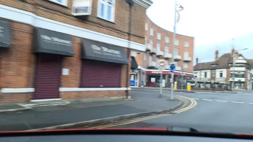
The Chiltern
Cinema and theater · 1.8 mi
Pub in Beaconsfield, Buckinghamshire, England, UK
Museums and landmarks9

Amersham Museum
Museum · 3.4 mi
Private museum, local history in Buckinghamshire, England, United Kingdom

Chiltern Open Air Museum
Museum · 3.0 mi
Museum in the Chiltern Hills, United Kingdom

Gerrards Cross Memorial Building
Monument and historic site · 3.3 mi
Community centre and First World War memorial in Gerrards Cross in Buckinghamshire, England, UK

Milton's Cottage
Museum · 1.7 mi
Grade I listed historic house museum in Chiltern, United Kingdom

Parks, trails and playgrounds7


Bekonscot
Park · 1.7 mi
Oldest original model village in the world, located in Beaconsfield, Buckinghamshire, England, United Kingdom

Holtspur Bank
Park · 3.2 mi
Local nature reserve in Buckinghamshire, England

Bulstrode Park
Park · 2.5 mi
Grade II* listed park and garden in Buckinghamshire, England, UK

Restaurants and cafes5
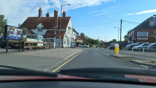
The Village Chippy
Fast food · Fish And Chips · 1.2 mi
1 Three Households, Chalfont St. Giles

History
According to the Chilterns Conservation Board the toponym "Seer" is derived from the Norman French for "dry or arid place". However "sere" is also the Middle English word for dry - derived from Old English "seare", additionally the Buckinghamshire government website notes that both "sear\sere" and "grene" appear to be of English origin. Village legend has it that the "Seer" refers to King Arthur's Court visiting the area and locals consulting his "seer" Merlin.
When the Domesday Book was complied in 1086 Seer Green was a part of Farnham Royal, governed by Bertram I de Verdun - the land in pre-conquest England having previously belonged to Princess Godgifu. The land was passed down by the Verduns to their descendants until through marriage it was passed onto the Furnival, Neville and Talbot families.
In a manorial roll dating back to Henry III's reign in 1232 it was called La Sere, after this other recorded names during the Medieval Era, in chronological order, have been La Cere, Le Shere, La Zere, Sera and Sere.
In 1541 Seer Green along with the rest of the manor of Farnham became a holding of Henry VIII when he exchanged land with the 5th Earl of Shrewsbury.
The oldest building in Seer Green is Hall Place which is a Grade II listed building.
The Holy Trinity Church was built in 1846. It is brick and flint with lancet windows. There is also a Baptist church.
Read more of the history
Seer Green became a separate parish in 1866, having previously been a hamlet of the parish of Farnham Royal. It had levied a separate poor rate before then.
Until the early part of the 20th century Seer Green was mainly an agricultural village, known for its cherry orchards. The remnants of some of these orchards remain and in honour of this tradition the local school holds a "Cherry Pie Fair" every summer which usually involves a fancy dress parade and a procession through the village.
From the History section of Seer Green on Wikipedia, under CC BY-SA 4.0.
Notable people from Seer Green
- Benedict ReadBritish art historian (1945–2016)
- Edmund HamblyBritish civil engineer
Born in Seer Green, according to Wikidata (CC0). Each name links to its Wikipedia article.
Where to stay2
Churches and places of worship5
Schools, colleges and libraries3
Map of Seer Green
33 places. The map loads OpenStreetMap tiles when you open it.
Getting there and nearby towns
Wycombe Air Park (HYC) is the nearest airport with scheduled flights listed in OpenStreetMap, 9 miles away.
- Beaconsfield 2 mi west, about 3 min by car
- Chalfont Saint Peter 2 mi east, about 4 min by car
- Gerrards Cross 3 mi southeast, about 5 min by car
- Amersham 3 mi north, about 5 min by car
- Chorleywood 5 mi northeast, about 8 min by car
- High Wycombe 6 mi west, about 10 min by car
- Rickmansworth 6 mi east, about 9 min by car
- Chesham 6 mi north, about 9 min by car
- Batchworth 6 mi east, about 10 min by car
- Burnham 6 mi southwest, about 10 min by car
Drive times are estimates from straight-line distance, not routes.
Towns near Seer Green


Keep exploring
Local news
Headlines from INDB.
Reviews, tips and questions
Loading what members have shared...
Sources and licences
- GeoNames (CC BY 4.0): population, coordinates, regions and time zone
- Mapillary (see each image): photos
- OpenStreetMap contributors (ODbL 1.0): places, airports, map data
- Wikidata (CC0 1.0): elevation, founding date, time zone, website, landmarks and historic places
- Wikimedia Commons (see each image): photos
- Wikipedia (CC BY-SA 4.0): overview and history text
Photo credits
- Amersham Museum, Jpbowen at English Wikipedia, CC BY-SA 3.0
- Chiltern Open Air Museum Henton Mission, Dorothea Witter-Rieder, Public domain
- Gerrards Cross Memorial Building (9), Harry Mitchell, CC BY 4.0
- MiltonsCottage, MortimerCat, CC BY-SA 3.0
- General view, Bekonscot, MichaelMaggs, CC BY-SA 2.5
- Holtspur Bank 4, Dudley Miles, CC BY-SA 4.0
- Golf Club House at Beaconsfield 02, Unknown author Unknown author, Public domain
- Jordans Meeting House exterior, LouiseBrown1981, CC BY-SA 3.0
- Seer Green Church, Sealman ( talk ), CC BY-SA 3.0
- Long Grove Wood 1, Dudley Miles, CC BY-SA 4.0
- Street-level photo, alexanderar, CC BY-SA 4.0
- Street-level photo, southglos, CC BY-SA 4.0
- Street-level photo, alexanderar, CC BY-SA 4.0
- Street-level photo, southglos, CC BY-SA 4.0
- Street-level photo, alexanderar, CC BY-SA 4.0
- Street-level photo, southglos, CC BY-SA 4.0
- Street-level photo, alexanderar, CC BY-SA 4.0
- Street-level photo, southglos, CC BY-SA 4.0
- Street-level photo, thomasrosen, CC BY-SA 4.0
- Street-level photo, alexanderar, CC BY-SA 4.0


Page built November 10, 2026. Spotted a mistake? Tell us or suggest a place.