


Chorleywood, United Kingdom
Chorleywood is a town of 11,917 people in England, United Kingdom.
Why visit Chorleywood
Townapedia lists 5 museums and landmarks, 11 parks and trails, 26 places to eat and 4 places to stay in and around town.
Highlights include Chiltern Open Air Museum, Milton's Cottage, Chorleywood House Estate and Rickmansworth Aquadrome.
Weather in Chorleywood
Forecast from MET Norway (CC BY 4.0). Full forecast
About Chorleywood
Chorleywood is a village and civil parish in the Three Rivers District, Hertfordshire, on the border with Buckinghamshire, approximately 20 miles (32 km) northwest of Charing Cross. The village is adjacent to the Chiltern Hills Area of Outstanding Natural Beauty and is part of the London commuter belt included in the government-defined Greater London Urban Area. Chorleywood was historically part of the parish of Rickmansworth, becoming a separate ecclesiastical parish in 1845 and a separate civil parish in 1898. The population of the parish was 11,286 at the 2011 census.
From the Wikipedia article Chorleywood (this version), under CC BY-SA 4.0.
Photos of Chorleywood


Museums and landmarks5

Chiltern Open Air Museum
Museum · 1.7 mi
Museum in the Chiltern Hills, United Kingdom

Milton's Cottage
Museum · 3.0 mi
Grade I listed historic house museum in Chiltern, United Kingdom

Chenies Manor House
Museum · 1.6 mi
Grade I listed historic house museum in Chiltern, United Kingdom

Parks, trails and playgrounds11


Rickmansworth Aquadrome
Park · 2.1 mi
Park and nature reserve in Hertfordshire, England, UK

Sarratt Bottom nature reserve
Park · 1.7 mi
Biological Site of Special Scientific Interest in England


Chorleywood Common
Park · 0.8 mi
Nature reserve in Hertfordshire, England


Restaurants and cafes26
Costa
Cafe · Coffee Shop
24-38 Lower Road, Rickmansworth
Mo-Fr 06:30-18:00; Sa 07:00-18:00; Su 08:00-17:00

The Red Lion
Bar and pub · Regional · 1.3 mi
Latimer Road, Rickmansworth
Mo-Fr 12:00-23:00; Sa 10:00-23:00; Su 10:00-21:30

14 more on the map.
Where to stay4


History
Settlement at Chorleywood dates to the Paleolithic era when the plentiful flint supply led to swift development of tools by man. The Romans built a village on the ancient site complete with a mill and brewery.
Though variants have been proposed, the name has been derived from the Anglo-Saxon leah, meaning a clearing or a wood, of the ceorla or peasants. A line runs through Chorleywood that once divided the Kingdoms of Mercia and Wessex and now divides the counties of Hertfordshire and Buckinghamshire. Edward the Confessor gave Chorleywood to the Monastery of St Albans.
By 1278, it was known, perhaps duplicating the "woodland" element, as 'Bosco de Cherle' or 'Churl's Wood', Norman for 'Peasant's Wood'. Upon the Dissolution of the Monasteries, it passed to the Bishopric of London, being renamed 'Charleywoode'. It became Crown property during the reign of Elizabeth I. The Turnpike Act (1663) gave Chorleywood a chance to exploit its strategic position, allowing locals the opportunity to charge civilians to use the road from Hatfield to Reading.
Chorleywood is most famous for its Quakers. Non-conformists flocked to Chorleywood, promised sanctuary by the locals. William Penn founded the Pennsylvania Colony with settlers from Chorleywood, Rickmansworth and nearby towns in southern Buckinghamshire, having lived and married in Chorleywood.
Read more of the history
Chorleywood House, a Regency mansion, was built in 1822 by John Barnes, replacing an earlier house. John Saunders Gilliat, the Governor of the Bank of England in 1883–1885, lived in it. In 1892, the house was bought by Lady Ela Sackville Russell, eldest daughter of the 9th Duke of Bedford. She modified and enlarged the house turning the grounds into a model estate with market gardens.
The Metropolitan Railway opened Chorleywood station on 8 July 1889.
In the early 1960s, researchers at the British Baking Industries Research Association in Chorleywood improved upon an earlier American bread-making process. This resulted in the Chorleywood bread process which is now used in over 80% of commercial bread production throughout the UK.
In the 1973 BBC Television documentary, Metro-land, Sir John Betjeman described Chorleywood as "essential Metro-land".
Chorleywood has frequently been used as a filming location. The Royal Masonic School is featured in Indiana Jones and the Last Crusade, while the Black Horse pub is featured in Peep Show. Midsomer Murders, Lewis and Jonathan Creek have also been filmed in Chorleywood.
From the History section of Chorleywood on Wikipedia, under CC BY-SA 4.0.
Notable people from Chorleywood
- Caroline FordEnglish actress
- Dee CaffariBritish yacht racer
- Barbara MillsBritish barrister, DBE and QC (1940-2011)
- Roger WaltersBritish architect
Born in Chorleywood, according to Wikidata (CC0). Each name links to its Wikipedia article.
Churches and places of worship9
Shopping2
Gas and EV charging1
Schools, colleges and libraries10
Healthcare3
Map of Chorleywood
71 places. The map loads OpenStreetMap tiles when you open it.
Getting there and nearby towns
RAF Northolt (NHT) is the nearest airport with scheduled flights listed in OpenStreetMap, 8 miles away.
- Rickmansworth 2 mi southeast, about 3 min by car
- Croxley Green 3 mi southeast, about 5 min by car
- Watford 5 mi east, about 8 min by car
- Northwood 5 mi southeast, about 8 min by car
- Ruislip 7 mi southeast, about 11 min by car
- Pinner 7 mi southeast, about 11 min by car
- Ickenham 7 mi southeast, about 11 min by car
- Harrow Weald 8 mi east, about 13 min by car
- Harrow 9 mi southeast, about 15 min by car
- Hillingdon 9 mi south, about 14 min by car
Drive times are estimates from straight-line distance, not routes.
Towns near Chorleywood


Keep exploring
Local news
Headlines from INDB.
Reviews, tips and questions
Loading what members have shared...
Sources and licences
- GeoNames (CC BY 4.0): population, coordinates, regions and time zone
- Mapillary (see each image): photos
- OpenStreetMap contributors (ODbL 1.0): places, airports, map data
- Wikidata (CC0 1.0): elevation, founding date, time zone, website, landmarks and historic places
- Wikimedia Commons (see each image): photos
- Wikipedia (CC BY-SA 4.0): overview and history text
Photo credits
- GOC Chorleywood & Chess Valley 004 Chorleywood Common (21437377630), Peter O'Connor aka anemoneprojectors, CC BY-SA 2.0
- GOC Chorleywood & Chess Valley 005 Chorleywood Common (21646066005), Peter O'Connor aka anemoneprojectors, CC BY-SA 2.0
- GOC Chorleywood & Chess Valley 007 Chorleywood Common (21023205704), Peter O'Connor aka anemoneprojectors, CC BY-SA 2.0
- GOC Chorleywood & Chess Valley 006 Chorleywood Common (21459062409), Peter O'Connor aka anemoneprojectors, CC BY-SA 2.0
- GOC Chorleywood & Chess Valley 001 Rose Cottage, Chorleywood (21625461285), Peter O'Connor aka anemoneprojectors, CC BY-SA 2.0
- GOC Chorleywood & Chess Valley 008 Chorleywood Common (21654995781), Peter O'Connor aka anemoneprojectors, CC BY-SA 2.0
- GOC Chorleywood & Chess Valley 002 Gate Cottages, Chorleywood (21634347901), Peter O'Connor aka anemoneprojectors, CC BY-SA 2.0
- GOC Chorleywood & Chess Valley 247 Rose & Crown, Chorleywood (21427994433), Peter O'Connor aka anemoneprojectors, CC BY-SA 2.0
- Chiltern Open Air Museum Henton Mission, Dorothea Witter-Rieder, Public domain
- MiltonsCottage, MortimerCat, CC BY-SA 3.0
- At Rickmansworth Aquadrome 2024 003, Photograph by Mike Peel ( www.mikepeel.net )., CC BY-SA 4.0
- Sarratt Bottom SSSI 2, Dudley Miles, CC BY-SA 4.0
- HolyCrossSarratt, UKgeofan ( talk ), CC BY-SA 3.0
- Bug in the Wild (Unsplash), Ritchie Valens ritchievalens, CC0
- GOC Chorleywood & Chess Valley 028 Chorleywood House Estate (21707298731), Peter O'Connor aka anemoneprojectors, CC BY-SA 2.0
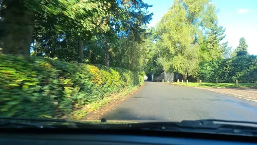
- Street-level photo, endszbrxns, CC BY-SA 4.0
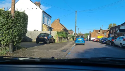
- Street-level photo, alfa145, CC BY-SA 4.0
- Street-level photo, endszbrxns, CC BY-SA 4.0
- Street-level photo, alexanderar, CC BY-SA 4.0
- Street-level photo, alfa145, CC BY-SA 4.0
- Street-level photo, endszbrxns, CC BY-SA 4.0
- Street-level photo, alexanderar, CC BY-SA 4.0
- Street-level photo, alexanderar, CC BY-SA 4.0
- Street-level photo, alfa145, CC BY-SA 4.0
- Street-level photo, alfa145, CC BY-SA 4.0
- Street-level photo, alfa145, CC BY-SA 4.0
- Street-level photo, alfa145, CC BY-SA 4.0
- Street-level photo, alfa145, CC BY-SA 4.0
- Street-level photo, alfa145, CC BY-SA 4.0
- Street-level photo, alfa145, CC BY-SA 4.0

Page built November 10, 2026. Spotted a mistake? Tell us or suggest a place.