


Why visit Skidby
Townapedia lists 3 museums and landmarks, 3 parks and trails, 7 places to eat and 2 places to stay in and around town.
Highlights include Cottingham Castle Tower and Skidby Windmill Museum of East Riding Rural Life.
Weather in Skidby
Forecast from MET Norway (CC BY 4.0). Full forecast
About Skidby
Skidby is a small village and civil parish in Yorkshire Wolds of the East Riding of Yorkshire, England. It is situated about 6 miles (10 km) north-west of Hull city centre, 2.2 miles (3.5 km) west of Cottingham and 5 miles (8 km) south of Beverley.
From the Wikipedia article Skidby (this version), under CC BY-SA 4.0.
Museums and landmarks3
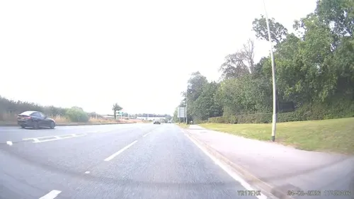


Parks, trails and playgrounds3


Restaurants and cafes7
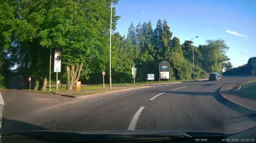





Where to stay2

History
The village's name is thought mean dwelling (-bý) of a person called Skítr, ("Skyti's farm") the words are of Scandinavian origin. An alternative origin meaning 'firewood place' (from skið and by), an origin from the person's name skiði has also been suggested. Other alternatives are 'dirty place', from the old English scite.
The village name 'Skidby' is first recorded by Oswald, Archbishop of York in the 10th century, as Scyteby: the bishop Oscytel was recorded as having acquired it for £20. In Domesday Book it is referred to as Schitebi – at the time of the survey it was recorded together with 'Burtone' (near Bishop Burton): the land belonged to the manor of Beverley (in the hands of the church), with over 20 villains and 3 knights.
The forms Skipbie, and Skitby were in use in the 16th century, in the 19th century 'Skitby' was a common form, as was the current form Skidby.
The church of St Michael dates to 1777, with a tower built in 1827. The church was designated a Grade II* listed building in 1968.
Wesleyan and Baptist chapels were built in the early 1800s, and a school and teacher's house built in 1849. A cornmill, Skidby Mill was constructed in 1821, raised in the 1870s and listed in 1952.
By the 1850s the village population had reached 306; in 1857 the ecclesiastical parish of Skidby became fully separated from Cottingham and received a resident clergyman.
Read more of the history
Around 1885 the Hull and Barnsley Railway was constructed (section closed 1960s), running north-east through the parish: no stations were constructed on the section near Skidby; at the point the railway crossed the Eppleworth valley a five arched brick viaduct was constructed, known locally as 'five arches', or as 'Eppleworth viaduct'.
North-west of the viaduct the line required an 83 ft (25 m) cutting, known as the Little Weighton Cutting.
In 1972, 120 acres (49 ha) of land north of the Eppleworth to Raywell road was acquired for the Hessle Golf Club, which was relocating due to the construction of the Humber Bridge; the eighteen-hole course was opened in 1975.
A traveller's site was established on Westfield Road in a disused chalk pit in the 1980s. During the COVID pandemic in 2020, volunteers set up a mini-library in a village phone box as a way of boosting interactions between villagers. In 2025, the BBC reported that the book swap was stopped after telecoms company KCOM cited that the telephone was still in use and that shelves of books posed "a serious fire risk."
From the History section of Skidby on Wikipedia, under CC BY-SA 4.0.
More about Skidby
Geography
The modern civil parish includes the village of Skidby and the hamlet of Eppleworth, and Raywell. Most of the parish lies west-south-west of the village in the Yorkshire Wolds, rising from about 160 feet (50 m) above sea level at Skidby to about 330 feet (100 m) on the western fringes. The A164 road forms part of the south-eastern boundary of the parish, on the edge of the Wolds.
Part of the parish is to the east of the village and A164 beyond the Wolds, and north of Cottingham, extending as far as the Hull to Bridlington railway line at its easternmost extent, the land height drops to the east reaching a low of less than 33 feet (10 m) near the railway line. The part of the parish east of the A164 includes a golf course 'Skidby Lakes Golf course' and associated leisure club, as well as a major (400/275 kV AC) electricity substation "Creyke Beck", The remainder of the low-lying area is agricultural.
From the Wikipedia article Skidby, under CC BY-SA 4.0.
Churches and places of worship4
Schools, colleges and libraries5
Skidby Church of England Voluntary Controlled Primary School
School · Anglican
Main Street, Cottingham
Healthcare5
Hull University Teaching Hospital HIV Services
Clinic and pharmacy · 1.1 mi
Castle Road, Cottingham
Map of Skidby
29 places. The map loads OpenStreetMap tiles when you open it.
Getting there and nearby towns
Humberside Airport (HUY) is the nearest airport with scheduled flights listed in OpenStreetMap, 16 miles away.
- Little Weighton 2 mi west, about 3 min by car
- Walkington 2 mi northwest, about 4 min by car
- Beverley 4 mi north, about 7 min by car
- Kingston upon Hull 6 mi southeast, about 10 min by car
- Brough 6 mi southwest, about 10 min by car
- Tickton 6 mi northeast, about 10 min by car
- Barton upon Humber 7 mi south, about 11 min by car
- Winteringham 9 mi southwest, about 14 min by car
- Hedon 11 mi east, about 18 min by car
- Scunthorpe 17 mi southwest, about 27 min by car
Drive times are estimates from straight-line distance, not routes.
Towns near Skidby


Keep exploring
Local news
Headlines from INDB.
Reviews, tips and questions
Loading what members have shared...
Sources and licences
- GeoNames (CC BY 4.0): population, coordinates, regions and time zone
- Mapillary (see each image): photos
- OpenStreetMap contributors (ODbL 1.0): places, airports, map data
- Wikidata (CC0 1.0): elevation, founding date, time zone, website, landmarks and historic places
- Wikimedia Commons (see each image): photos
- Wikipedia (CC BY-SA 4.0): overview and history text
Photo credits
- Skidby, Main Street - panoramio, Paul Lakin, CC BY 3.0
- Skidby Scarecrows 2012 - panoramio, Paul Lakin, CC BY 3.0
- Skidby, Main St - panoramio, Paul Lakin, CC BY 3.0
- St Andrews Church, Paul Stabeler, CC BY 3.0
- Castle Hill Hospital Cottingham, Paul Harrop, CC BY-SA 2.0
- Cottingham High School, George Robinson, CC BY-SA 2.0
- Dene Wood, Cottingham, Yorkshire, autumn, IMG 2775 - panoramio, Paul Lakin, CC BY 3.0
- The Half Moon public house Skidby, George Robinson, CC BY-SA 2.0
- Street-level photo, aidan573, CC BY-SA 4.0
- Street-level photo, aidan573, CC BY-SA 4.0
- Street-level photo, aidan573, CC BY-SA 4.0
Page built November 10, 2026. Spotted a mistake? Tell us or suggest a place.