


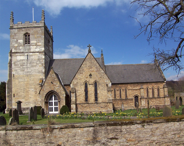
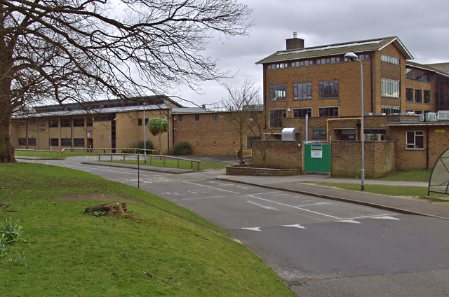
Why visit Brough
Townapedia lists 6 museums and landmarks, 2 parks and trails and 20 places to eat in and around town.
Highlights include Ferriby Boats, Petuaria and Brough Golf Club.
Weather in Brough
Forecast from MET Norway (CC BY 4.0). Full forecast
About Brough
Brough is a town in the East Riding of Yorkshire, England. It is part of the civil parish of Elloughton-cum-Brough with the neighbouring village of Elloughton. Brough is situated on the edge of the Yorkshire Wolds and the town serves as a gateway to the rolling hills of the Wolds. The Yorkshire Wolds Way National Trail also passes by the eastern end of Brough.
From the Wikipedia article Brough, East Riding of Yorkshire (this version), under CC BY-SA 4.0.
Museums and landmarks6

Ferriby Boats
Monument and historic site · 2.9 mi
Museum ships in the UK

Petuaria
Monument and historic site
Roman fort on the site of Brough in the East Riding of Yorkshire, England

Romano-British villa at Cockle Pits, near Brantingham
Monument and historic site · 1.5 mi
Building in East Riding of Yorkshire, England, UK

Parks, trails and playgrounds2


Restaurants and cafes20

The Buccaneer
Bar and pub
Family Friendly pub serving fresh homemade food and a variety of beverages
47 Station Road, Brough

The Village Paint Pot
Cafe · 0.8 mi
55 Main Street, Brough
Mo-Fr 08:00-17:00; Sa 09:00-17:00; Su 10:00-16:00

Emon Spice Lounge
Restaurant · Indian · 0.4 mi
76 Station Road, Brough
Su-Th 17:30-23:30; Fr,Sa 17:30-24:00

Dessert Lounge
Cafe · Dessert
Mo 12:00-19:00, Tu 10:00-19:00, We 09:00-19:00, Th-Sa 09:00-21:00,...


8 more on the map.
Churches and places of worship9

All Saints
Church · Anglican
Church in Brough, East Riding of Yorkshire

Church of All Saints
Church · 2.1 mi
Church in Brantingham, East Riding of Yorkshire, England, UK
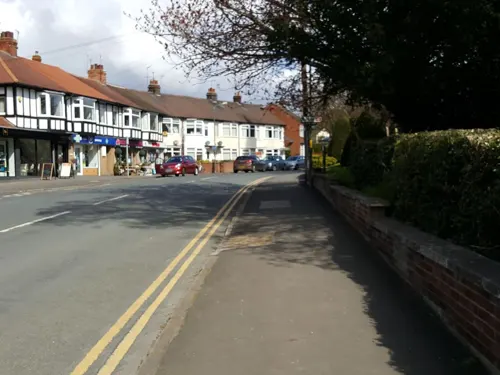
Church of All Saints
Church · 2.9 mi
Church building in North Ferriby, East Riding of Yorkshire, England, UK
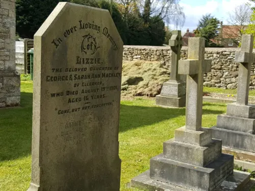
Church of St Anne
Church · 2.1 mi
Church building in Ellerker, East Riding of Yorkshire, England, UK

Church of St Mary
Church · 0.9 mi
Church in Elloughton, East Riding of Yorkshire, England, UK


History
The town was known as Petuaria during the Roman period, and served as the capital of the Celtic tribe of the Parisi. Petuaria marked the southern end of the Roman road known now as Cade's Road which ran roughly northwards for a hundred miles to Pons Aelius (modern day Newcastle upon Tyne).
The town's name is from the Old English burh meaning "fortification" and is related to the terms borough and burgh.
Brough was created a town by the Archbishop of York in 1239 and granted the same liberties as Beverley. There is no record of these liberties having been employed, and the settlement operated as a village for further centuries.
The town is associated with the highwayman Dick Turpin. About June 1737 Turpin boarded at the Ferry Inn at Brough, under the alias of John Palmer (or Parmen). Turpin travelled to and from and resided in Brough, until his capture and execution for horse theft in 1739.
From the History section of Brough, East Riding of Yorkshire on Wikipedia, under CC BY-SA 4.0.
More about Brough
Education
Education at Brough is provided by Brough Primary School and Hunsley Primary School. The nearest secondary school is South Hunsley School and Sixth Form College, approximately 2 miles (3 km) to the east in Melton.
From the Wikipedia article Brough, East Riding of Yorkshire, under CC BY-SA 4.0.
Notable people from Brough
 Jess ParkEnglish association football player (born 2001)Photo: Katie Chan, CC BY-SA 4.0
- Robert StephensonEnglish cricketer and Royal Navy officer (1906-1942)
Born in Brough, according to Wikidata (CC0). Each name links to its Wikipedia article.
Shopping3
Schools, colleges and libraries6
Map of Brough
46 places. The map loads OpenStreetMap tiles when you open it.
Getting there and nearby towns
Humberside Airport (HUY) is the nearest airport with scheduled flights listed in OpenStreetMap, 14 miles away.
- Kingston upon Hull 10 mi east, about 16 min by car
- Goole 13 mi west, about 20 min by car
- Hedon 15 mi east, about 25 min by car
- Immingham 17 mi southeast, about 27 min by car
- Thorne 18 mi southwest, about 29 min by car
- Driffield 20 mi north, about 32 min by car
- Selby 21 mi west, about 33 min by car
- Kirk Sandall 23 mi southwest, about 38 min by car
- York 26 mi northwest, about 42 min by car
- Doncaster 27 mi southwest, about 43 min by car
Drive times are estimates from straight-line distance, not routes.
Towns near Brough


Keep exploring
Local news
Headlines from INDB.
Reviews, tips and questions
Loading what members have shared...
Sources and licences
- GeoNames (CC BY 4.0): population, coordinates, regions and time zone
- Mapillary (see each image): photos
- OpenStreetMap contributors (ODbL 1.0): places, airports, map data
- Wikidata (CC0 1.0): elevation, founding date, time zone, website, landmarks and historic places
- Wikimedia Commons (see each image): photos
- Wikipedia (CC BY-SA 4.0): overview and history text
Photo credits
- HullMuseumFerribyBoat, Notafly, CC BY-SA 4.0
- HER Museum 6 July 2018 Petuaria 3, Chemical Engineer, CC BY-SA 4.0
- Dolphin mosaic, Charlesdrakew, Public domain
- All Saints Church Brantingham, David Wright, CC BY-SA 2.0
- St Marys Church Elloughton, David Wright, CC BY-SA 2.0
- South Hunsley School Melton, Paul Harrop, CC BY-SA 2.0
- Welton Church in East Yorkshire, cooldudeandy01, CC BY 2.0
- The Buccaneer Brough, Paul Harrop, CC BY-SA 2.0
- All Saints Church Brough, Keith D, CC BY 3.0
- The Green Dragon, Welton IMG 1901 - panoramio, Paul Lakin, CC BY 3.0
- Brough Methodist Church, David Wright, CC BY-SA 2.0
- Street-level photo, timpico, CC BY-SA 4.0
- Street-level photo, timpico, CC BY-SA 4.0
- Street-level photo, aidan573, CC BY-SA 4.0
- Street-level photo, aidan573, CC BY-SA 4.0
- Street-level photo, aidan573, CC BY-SA 4.0
- Street-level photo, aidan573, CC BY-SA 4.0
- Street-level photo, aidan573, CC BY-SA 4.0
Page built November 10, 2026. Spotted a mistake? Tell us or suggest a place.