


Why visit Tangmere
Townapedia lists 12 museums and landmarks, 7 parks and trails, 6 places to eat, 5 places to stay and 3 attractions in and around town.
Highlights include Chichester Festival Theatre, Minerva Theatre, Chichester, Boxgrove Priory and Chichester Castle.
Weather in Tangmere
Forecast from MET Norway (CC BY 4.0). Full forecast
About Tangmere
Tangmere is a village, civil parish, and electoral ward in the Chichester District of West Sussex, England. Located three miles (5 km) north east of Chichester, it is twinned with Hermanville-sur-Mer in Lower Normandy, France.
From the Wikipedia article Tangmere (this version), under CC BY-SA 4.0.
Photos of Tangmere


Things to do3
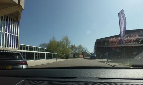
Chichester Festival Theatre
Cinema and theater · 2.7 mi
Theatre building in Chichester, West Sussex, England, UK

Minerva Theatre, Chichester
Cinema and theater · 2.7 mi
Theatre in Chichester, England

Museums and landmarks12

Boxgrove Priory
Monument and historic site · Anglican · 0.7 mi
Priory in Boxgrove, Chichester, West Sussex, England, UK

Chichester Castle
Monument and historic site · 2.7 mi
Castle in Chichester, Chichester, West Sussex, England, UK

Goodwood House
Museum · 1.7 mi
Country house in Westhampnett, West Sussex, England, UK

Novium Museum
Museum · 3.0 mi
Museum in Chichester, Sussex, England, United Kingdom


Pallant House Gallery
Museum · 2.9 mi
Art gallery in Chichester, West Sussex, United Kingdom

Trundle
Monument and historic site · 3.3 mi
Hillfort in West Sussex, England, UK

Tangmere Military Aviation Museum
Museum
Aviation museum in Tangmere, West Sussex, United Kingdom
Gamecock Terrace, Chichester
Feb 01-Nov 30 Mo-Su 10:00-17:00
Goodwood Art Foundation
Museum · 1.9 mi
English non profit art gallery

Noviomagus Reginorum
Monument and historic site · 2.9 mi
Roman settlement in West Sussex, England, United Kingdom
Parks, trails and playgrounds7

Brandy Hole Copse
Park · 3.3 mi
Nature reserve in West Sussex, England, UK

Cass Sculpture Foundation
Park · 1.9 mi
Charitable commissioning body

Oaklands Park
Park · 2.7 mi
Public park in Chichester, West Sussex, England

Goodwood Country Park
Park · 3.0 mi
Country park in West Sussex, England
Litten Gardens
Park · 2.6 mi
Public park in Chichester, West Sussex, England

Restaurants and cafes6


History
The Saxon village lies a mile south of the Roman road of Stane Street, linking Londinium with Noviomagus Reginorum, now known as Chichester. In 677 the controversial Bishop of York Wilfrid (later Saint Wilfrid) came to Selsey and converted the South Saxons to Christianity. In 680 a charter, possibly by the king, states: “I Caedwalla... have granted his brethren serving God at the church of St Andrew... the land of 10 hides which is called Tangmere”. A hide equated to 120 acres (49 hectares).
The Domesday Book of 1086 records that Tangmere had a population of around 120, with the stone church of St Andrew built after the Norman Conquest. Originally built of timber, the Saxon church was replaced in 1100 by a stone and timber building. Difficult to date precisely, the building incorporates scavenged and reused stone, including pre-Christian carved figures and Roman bricks, while the size of the yew tree by the present door suggests an ancient sacred site. The church was added to in both the 12th century and in the Victorian era.
In 1341 King Edward II granted the new Archbishop of Canterbury the right to hold a fair at Tangmere on St Andrew's Day. The event is still held by the church every autumn, resulting in the source of the church's name.
Read more of the history
The Manor of Tangmere was owned by the Archbishop of Canterbury until 1542, when Henry VIII claimed possession. It later passed to Cardinal Archbishop Pole and then to the crown again, being granted by Elizabeth I to Richard Baker and then Sir Richard Sackville, a cousin of her mother Anne Boleyn.
In 1579 the manor became part of the Halnaker estate, which was later acquired by the 3rd Duke of Richmond. When he died in 1806, the Goodwood estate, including Tangmere, totalled 17,000 acres (69 km2). Goodwood maintained ownership of Tangmere land until the 1930s.
From the History section of Tangmere on Wikipedia, under CC BY-SA 4.0.
Where to stay5
The Old School Bed And Breakfast
Motel and hotel · 1.3 mi
Stane Street, Chichester
Churches and places of worship11
Shopping2
Gas and EV charging1
Schools, colleges and libraries5
Map of Tangmere
52 places. The map loads OpenStreetMap tiles when you open it.
Getting there and nearby towns
Goodwood Aerodrome (QUG) is the nearest airport with scheduled flights listed in OpenStreetMap, 2 miles away.
- Chichester 3 mi west, about 5 min by car
- Fontwell 3 mi east, about 5 min by car
- Barnham 4 mi east, about 6 min by car
- Walberton 4 mi east, about 7 min by car
- Bognor Regis 5 mi south, about 8 min by car
- Fishbourne 5 mi west, about 8 min by car
- Birdham 6 mi southwest, about 10 min by car
- Littlehampton 8 mi east, about 13 min by car
- Selsey 9 mi south, about 14 min by car
- Emsworth 10 mi west, about 15 min by car
Drive times are estimates from straight-line distance, not routes.
Towns near Tangmere


Keep exploring
Local news
Headlines from INDB.
Reviews, tips and questions
Loading what members have shared...
Sources and licences
- GeoNames (CC BY 4.0): population, coordinates, regions and time zone
- Mapillary (see each image): photos
- OpenStreetMap contributors (ODbL 1.0): places, airports, map data
- Wikidata (CC0 1.0): elevation, founding date, time zone, website, landmarks and historic places
- Wikimedia Commons (see each image): photos
- Wikipedia (CC BY-SA 4.0): overview and history text
Photo credits
- Tangmere Church (St. Andrew), hugh llewelyn, CC BY-SA 2.0
- Minerva Theatre, Chichester b, A bit iffy, Public domain
- Boxgrove Priory Ruins, Peter I. Vardy, Public domain
- Chichester Castle remains, Simon Carey, CC BY-SA 2.0
- Goodwood House, Colin Smith, CC BY-SA 2.0
- Keith Williams Architects Novium Museum Chichester, ACT124, CC BY-SA 4.0
- Pallant House Gallery h, A bit iffy, Public domain
- The Trundle, earthworks and view north, Michael Coppins, CC BY-SA 4.0
- Chichester Greyfriars, Prior Park, Michael Coppins, CC BY-SA 4.0
- Former St Andrew's Church, Oxmarket, Chichester, The Voice of Hassocks, CC0
- St George's Church, Eastergate (From Southeast), The Voice of Hassocks, CC0
- St John the Evangelist's Church, Chichester, Tim Sheerman-Chase, CC BY 2.0
- St Richard of Chichester's Church, Cawley Road, Chichester (NHLE Code 1392318), The Voice of Hassocks, CC0
- St Andrew's Tangmere 4, Charlesdrakew, CC0
- St Mary the Virgin Church, Aldingbourne (NHLE Code 1027736), The Voice of Hassocks, CC0
- Westhampnet Church, Charlesdrakew, Public domain
- St Andrew's Church, Oving (NHLE Code 1232757), The Voice of Hassocks, CC0
- WestbourneHouseSchoolChichester, LauraKameen, CC BY-SA 4.0
- CSF-Cragg-Declination-bluebells-1, Cass Sculpture Foundation, CC BY 3.0
- Otter Gallery 2018-06 DSC 8290.edm, Rebutia Marsoneri, CC BY-SA 4.0
- Boxgrove Priory Church (St.Mary and St. Blaise) - 49905387472, hugh llewelyn, CC BY-SA 2.0
- Boxgrove Priory Church (St.Mary and St. Blaise), hugh llewelyn, CC BY-SA 2.0
- Brandy Hole Copse World War II defences 07, Simon Burchell, CC BY-SA 4.0
- Theatre Oaklands Park Chichester, Pete Chapman, CC BY-SA 2.0
- Street-level photo, tallguy, CC BY-SA 4.0
- Street-level photo, tallguy, CC BY-SA 4.0
- Street-level photo, chris_debian, CC BY-SA 4.0
- Street-level photo, noid, CC BY-SA 4.0
- Street-level photo, richardc, CC BY-SA 4.0


Page built November 10, 2026. Spotted a mistake? Tell us or suggest a place.