


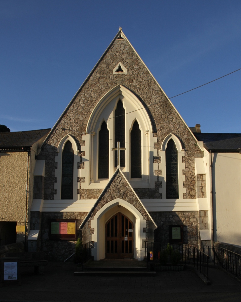

Teignmouth, United Kingdom
Teignmouth is a town of 14,932 people in England, United Kingdom.
Why visit Teignmouth
Townapedia lists 12 museums and landmarks, 18 parks and trails, 53 places to eat, 7 places to stay and 5 attractions in and around town.
Highlights include Teignmouth lighthouse, New Quay, Teign Heritage Centre and The Orangery.
Weather in Teignmouth
Forecast from MET Norway (CC BY 4.0). Full forecast
About Teignmouth
Teignmouth is a seaside town, fishing port and civil parish in the English county of Devon. It lies on the north bank of the estuary mouth of the River Teign, about 12 miles (19 km) south of Exeter. The town had a population of 14,932 at the 2021 census.
From the Wikipedia article Teignmouth (this version), under CC BY-SA 4.0.
Travel tips from other travellers: Teignmouth on Wikivoyage (CC BY-SA 4.0).
Things to do5





Museums and landmarks12
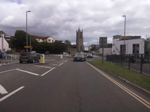


Teign Ferry
Monument and historic site · 0.4 mi
Ferry Shaldon Teignmouth
Apr-Jul Mo-Su,PH 08:00-18:00; Aug Mo-Su,PH 08:00-dusk; Sep-Oct...
Church Rocks Wreck
Monument and historic site · 0.5 mi
Shipwreck near Teignmouth, Devon, England, UK

Martin Gallery
Museum · 1.0 mi
Book library and art gallery in old telephone box.
Parks, trails and playgrounds18





6 more on the map.
Restaurants and cafes53


Teign Bean @ The Beach Teignmouth
Cafe · Coffee Shop
"Opening hours subject to weather – Please check our social media for live updates"
08:00-18:00

Teign Brewery Inn
Bar and pub
20-22 Teign Street, Teignmouth
Mo-Sa 11:00-21:00; Su 11:00-19:00
The Blue Anchor
Bar and pub
Teign Street, Teignmouth
Tu 14:00-21:00, Tu-Sa 14:00-23:00, Su 14:00-21:00



41 more on the map.
History
The first record of Teignmouth, Tengemuða, meaning mouth of the stream, was in 1044. Nonetheless, settlements very close by are attested earlier, with the banks of the Teign estuary having been in Saxon hands since at least 682; a battle between the Ancient Britons and Saxons was recorded on Haldon in 927 and Danish raids having occurred on the Teign estuary in 1001.
There were originally two villages, East and West Teignmouth, separated by a stream called the Tame, which emptied into the Teign through marshland by the current fish quay. Neither village is mentioned in the Domesday Book, but East Teignmouth was granted a market by charter in 1253 and one for West Teignmouth followed a few years later. The Tame now runs under the town in culverts and is visible only higher up the town as Brimley Brook, joined by smaller streams such as the Winterbourne (an intermittent stream, which flows only in winter or after heavy rain).
Documents indicate that Teignmouth was a significant port by the early 14th century, second in Devon only to Dartmouth. It was attacked by the French in 1340 and sent seven ships and 120 men to the expedition against Calais in 1347. Its relative importance waned during the 15th century and it did not figure in an official record of 1577. This may have been due to silting up of the harbour caused by tin mining on Dartmoor.
Read more of the history
During the 17th century, in common with other Channel ports, Teignmouth ships suffered from raids from Dunkirkers, who were privateers from Flemish ports. It is possible that smuggling was the town's most significant trade at this time, though cod fishing in Newfoundland was also of great importance.
In July 1690, after the French Admiral Anne Hilarion de Tourville defeated an Anglo-Dutch fleet at the Battle of Beachy Head, the French fleet was anchored in Torbay and some of the galley fleet travelled the short distance up the coast and attacked Teignmouth. A petition to the Lord Lieutenant from the inhabitants described the incident:
... on the 26th day of this instant July 1690 by Foure of the clocke in the morning, your poor petitioners were invaded (by the French) to the number of 1,000 or thereabouts, who in the space of three hours tyme, burnt down to the ground the dwelling houses of 240 persons of our parish and upwards, plundered and carried away all our goods, defaced our churches, burnt ten of our ships in the harbour, besides fishing boats, netts and other fishing craft ...
After examining 'creditable persons', the Justices of the Peace concluded that:
by the late horrid invasion there were within the space of 12 houres burnt downe and consumed 116 dwelling houses ... and also 172 dwelling houses were rifled and plundered and two parish churches much ruined, plundred and defaced, besides the burning of ten saile of shipps with the furniture thereof, and the goods and merchandise therein ...
As a result, the Crown issued a church brief that authorised the collection of £11,000 for the aid of the town. Churches from as far afield as Yorkshire contributed and the collections enabled the further development of the port. This was the last invasion of England and French Street, with its museum, is named in memory of the occasion.
In the 1600s and 1700s, there are records of a windmill on the Den – an area that was then a large sand dune and is now a grassy public open space near the seafront. By 1759, this windmill was demolished.
A new advantageous Plan of PrivateeringFor a Six Months CruizeAll Gentlemen Seamen and Able Landmen who delight in the Music of Great Guns and distressing the Enemies of Great Britain have now a fine opportunity of making their Fortunes by entering on Board The Dragon Privateer ... now ready to be launch'd in the Harbour of Teignmouth... Any persons capable of beating a Drum or blowing a French horn shall have great encouragement.
In the late 18th century, privateering was common in Teignmouth, as it was in other west country ports. In 1779, the French ship L'Emulation with a cargo of sugar, coffee and cotton was offered for sale at "Rendle's Great Sale Room" in the town. Teignmouth people fitted out two privateers: Dragon with 16 guns and 70 men; and Bellona, described as carrying "16 guns, 4 cohorns and 8 swivels". Bellona set sail on her first voyage in September 1779 and was "oversett in a violent Gust of Wind" off Dawlish, with the loss of 25 crew members.
The Newfoundland fisheries continued to provide the main employment into the early 19th century (e.g. Job Brothers & Co., Limited). With the men in Newfoundland for most of the year, the women did the local fishing and rowed the ferries across the estuary. Early tourists, such as Fanny Burney, referred to the women as the "Amazonians" of Shaldon and Teignmouth, and wrote of their strength, health and tendency to wear trousers or hitch their skirts up to their knees to fish.
As the fisheries declined, tourism increased. A tea house was built on the Den in 1787 amongst the local fishermen's drying nets. By 1803, Teignmouth was called a "fashionable watering place" and the resort continued to develop during the 19th century. Its two churches were rebuilt soon after 1815 and the first bridge across the estuary to Shaldon was built in 1827; George Templer's New Quay opened at the port; and the esplanade, Den Crescent and the central Assembly Rooms (later the cinema) were laid out. The population in the 1841 census was 4,459 inhabitants. The South Devon Railway arrived in 1846 and the pier was built 1865–7.
A version of the legend of the Parson and Clerk, dating to 1900, tells the tale of the Bishop of Exeter visiting Teignmouth and whilst being guided by a local priest, the devil turns them both to stone, which is seen in the form of two stacks.
From the History section of Teignmouth on Wikipedia, under CC BY-SA 4.0.
More about Teignmouth
Geography
The town is located on the north bank of the mouth of the estuary of the River Teign. The red sandstone headland on the south (Shaldon) side, called The Ness, is the most recognisable symbol of the town from the seaward side.
In the harbour area was the Salty; a small flat island created through dredging operations but levelled, supposedly to improve natural scouring of the main channel for shipping, in recent years to leave a large tidal sand bank frequented by seabirds and cockle-collectors. Salmon nets are still employed by locals, especially near Shaldon Bridge.
The estuary seems disproportionately large for the size of the river flowing through it; this is especially apparent at low tide because it is a drowned valley, caused by a relative rise in sea level following the last Ice Age.
Teignmouth is situated on the coast of Devon, a peninsula of South West England. It has a mild maritime climate. Prevailing winds across the south-west of England are from the west. Teignmouth lies to the east of Dartmoor, in a lee / rainshadow, with mean temperatures 3 °C (5 °F) higher and less than 43% of the rainfall of Princetown, which is located on Dartmoor. It receives 133 millimetres (5.2 in) less precipitate per year than nearby Plymouth, which is located on the south-west coast of Devon.
Arts and culture
Although reduced from its heyday, Teignmouth still receives considerable numbers of holidaymakers, especially day-trippers. It is twinned with the French town Perros-Guirec.
The resort has a sea beach and Teignmouth Pier, with amusement arcade and rides. The beach wraps around the spit at the head of the river Teign, providing a river beach commonly known as the Back Beach on the estuary side; this overlooks the harbour with its moorings for many pleasure craft and has views up the estuary to Dartmoor. An 18-mile (29 km) long waymarked route, known as the Templer Way, has been created between Haytor on Dartmoor and Shaldon. It closely follows the route of George Templer's granite tramway, his father James's Stover Canal and finally the estuary to Teignmouth.
Teignmouth Carnival is held during the last week of July, with the procession on the last Thursday. Since 1999, the town has hosted a summer folk festival. In 2005, Fergus O'Byrne and Jim Payne from Newfoundland, were the 'headline' artists at that year's festival which celebrated the town's links with that region.
In 2014, Teignmouth and Dawlish Community Interest Group commissioned a website to promote the town to tourists visiting.
Since 2018, Teignmouth has hosted the annual Teign Shanty Festival; it is a folk music festival with a focus on sea shanties, with over 40 groups performing in 2021.
From the Wikipedia article Teignmouth, under CC BY-SA 4.0.
Notable people from Teignmouth
 Danny ThompsonEnglish double bassist (1939–2025)Photo: David Laws, CC BY-SA 3.0
 Henry Haversham Godwin-AustenEnglish geologist, topographer and surveyor (1834–1923)Photo: produced by Woodbury Company ,..., Public domain
 Elias Parish AlvarsEnglish harpist and composer (1808-1849)Photo: Josef Kriehuber, Public domain
 Thomas Abel Brimage SprattBritish admiral, hydrographer and geologist (1811–1888)Photo: Schembri & Zahra, Malta, Public domain
 William StruttEnglish artist (1825-1915)Photo: William Strutt (died 1915), Public domain
 Sophia Frances Anne CaulfeildwriterPhoto: unknown maybe Caulfeild, S. F. A...., Public domain
 Charles Bennett LawesEnglish rower, athlete and sculptor (1843–1911)Photo: Lonpicman, CC BY-SA 3.0
 William TozerAnglican missionary and bishop (1829–1899)Photo: Anderson-Morshead, A. E. M, Public domain
- John PulmanEnglish snooker player (1923–1998)
- Charles Vanden WouwerBelgian association football player (1916-1989)
- G. S. CarrBritish mathematician (1837-1914)
- Sir John Smyth, 1st BaronetEnglish member of parliament and recipient of the Victoria Cross (1893–1983)
Born in Teignmouth, according to Wikidata (CC0). Each name links to its Wikipedia article.
Where to stay7
Churches and places of worship15
Church of St Michael The Archangel (Parish Church of East Teignmouth)
Church
Shopping8
Gas and EV charging2
Schools, colleges and libraries7
Our Lady and St Patrick's Roman Catholic Primary School
School · Roman Catholic · 0.8 mi
Fourth Avenue, Teignmouth
Healthcare6
Map of Teignmouth
133 places. The map loads OpenStreetMap tiles when you open it.
Getting there and nearby towns
Exeter Airport (EXT) is the nearest airport with scheduled flights listed in OpenStreetMap, 14 miles away.
- Bishopsteignton 2 mi west, about 3 min by car
- Dawlish 3 mi northeast, about 4 min by car
- Kingsteignton 4 mi west, about 6 min by car
- Newton Abbot 5 mi west, about 8 min by car
- Kingskerswell 5 mi southwest, about 8 min by car
- Torquay 6 mi south, about 10 min by car
- Exmouth 6 mi northeast, about 10 min by car
- Exeter 12 mi north, about 20 min by car
- Tiverton 25 mi north, about 40 min by car
- Plymouth 31 mi southwest, about 50 min by car
Drive times are estimates from straight-line distance, not routes.
Towns near Teignmouth


Keep exploring
Local news
Headlines from INDB.
Reviews, tips and questions
Loading what members have shared...
Sources and licences
- GeoNames (CC BY 4.0): population, coordinates, regions and time zone
- Mapillary (see each image): photos
- OpenStreetMap contributors (ODbL 1.0): places, airports, map data
- Wikidata (CC0 1.0): elevation, founding date, time zone, website, landmarks and historic places
- Wikimedia Commons (see each image): photos
- Wikipedia (CC BY-SA 4.0): overview and history text
Photo credits
- 2020-08-13 Teignmouth 50, Simon Cobb, CC0
- 2020-08-13 Teignmouth 49, Simon Cobb, CC0
- City of Plymouth pipe band, 2013 Teignmouth Folk Festival, Barry Lewis, CC BY 2.0
- Teignmouth lighthouse (0044), Nilfanion, CC BY-SA 4.0
- Dawlish MethodistChurch, Motacilla, CC BY-SA 4.0
- Church of St Michael The Archangel (Parish Church of East Teignmouth), Simon Cobb, CC0
- 2020-08-13 Teignmouth 15, Simon Cobb, CC0
- Church of St James (parish Church of West Teignmouth), Simon Cobb, CC0
- 2020-08-13 Teignmouth 04, Simon Cobb, CC0
- New Quay, Simon Cobb, CC0
- 2020-08-13 Teignmouth 46, Simon Cobb, CC0
- Thomas Luny House, Attached Walls And Gateway, Simon Cobb, CC0
- 2020-08-13 Teignmouth 59, Simon Cobb, CC0
- Molloys, Teignmouth 2020-03-08, Simon Cobb, CC0
- The Devon Arms Hotel, Teignmouth, 16 May 2012, Barry Lewis, CC BY 2.0
- Teignmouth Library, Simon Cobb, CC0
- 2020-08-13 Shaldon 65, Simon Cobb, CC0
- Brass Monkey, Simon Cobb, CC0
- 2020-08-13 Teignmouth 57, Simon Cobb, CC0
- King William IV (1), Simon Cobb, CC0
- Jolie Brise (JD Wetherspoon), Sic19, CC BY-SA 3.0
- Cove (1), Simon Cobb, CC0
- Holcombe (2021-07-31) 22, Simon Cobb, CC0
- Bitton House orangery, Teignmouth, 18 May 2013, Barry Lewis, CC BY 2.0
- Street-level photo, southglos, CC BY-SA 4.0
- Street-level photo, WaggyDog, CC BY-SA 4.0
- Street-level photo, WaggyDog, CC BY-SA 4.0
- Street-level photo, WaggyDog, CC BY-SA 4.0
- Street-level photo, southglos, CC BY-SA 4.0
- Street-level photo, southglos, CC BY-SA 4.0
- Street-level photo, WaggyDog, CC BY-SA 4.0
- Street-level photo, WaggyDog, CC BY-SA 4.0
- Street-level photo, WaggyDog, CC BY-SA 4.0
- Street-level photo, WaggyDog, CC BY-SA 4.0
- Street-level photo, WaggyDog, CC BY-SA 4.0
- Street-level photo, WaggyDog, CC BY-SA 4.0
- Street-level photo, WaggyDog, CC BY-SA 4.0
- Street-level photo, WaggyDog, CC BY-SA 4.0
- Street-level photo, WaggyDog, CC BY-SA 4.0
- Street-level photo, southglos, CC BY-SA 4.0
- Street-level photo, WaggyDog, CC BY-SA 4.0
- Street-level photo, WaggyDog, CC BY-SA 4.0


Page built November 10, 2026. Spotted a mistake? Tell us or suggest a place.