


Tiverton, United Kingdom
Tiverton is a town of 22,291 people in England, United Kingdom.
Why visit Tiverton
Townapedia lists 34 museums and landmarks, 13 parks and trails, 42 places to eat, 7 places to stay and 3 attractions in and around town.
Highlights include The Tivoli, Knightshayes Court and Tiverton Castle.
Weather in Tiverton
Forecast from MET Norway (CC BY 4.0). Full forecast
About Tiverton
Tiverton is a market town and civil parish in Devon, England, It is the commercial and administrative centre of the Mid Devon district, and lies on the River Exe, approximately 46 miles (74 km) north-east of Plymouth, 12 miles (19 km) north of Exeter, 18 miles (29 km) west-southwest of Taunton, and 38 miles (61 km) south-southwest of Weston-super-Mare. It had a population of 22,291 at the 2021 census, which was previously estimated at 20,587 in 2019.
From the Wikipedia article Tiverton, Devon (this version), under CC BY-SA 4.0.
Travel tips from other travellers: Tiverton on Wikivoyage (CC BY-SA 4.0).
Photos of Tiverton


Things to do3


Museums and landmarks34
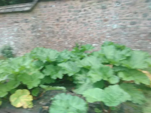
Knightshayes Court
Museum · 1.9 mi
Grade I listed historic house museum in Mid Devon, England, UK

Tiverton Castle
Museum
Grade I listed historic house museum in Mid Devon, England, UK
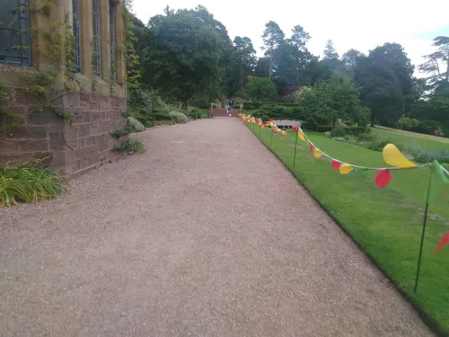



Tiverton Museum of Mid Devon Life
Museum
Local museum in Tiverton, Devon, United Kingdom
Becks Square, Tiverton
Jan 02-Dec 21 Tu-Sa 10:00-16:00

22 more on the map.
Parks, trails and playgrounds13




1 more on the map.
Restaurants and cafes42
The Fisherman's Cot
Bar and pub · 3.2 mi
Exeter Road, Tiverton
Mo-Su 11:30-23:00
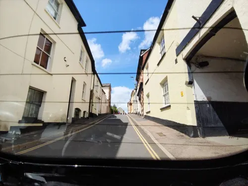
The Flying Pickle Deli
Restaurant · Regional, Burger, Coffee Shop, Sandwich, Cake · 0.4 mi
Tu-Sa 09:00-15:00





30 more on the map.
History
The town's name is conjectured to derive from "Twy-ford-ton" or "Twyverton", meaning "the town on two fords", and was historically referred to as "Twyford". The town stands at the confluence of the rivers Exe and Lowman. Human occupation in the area dates back to the Stone Age, with many flint tools found in the area. An Iron Age hill fort, Cranmore Castle, stands at the top of Exeter Hill above the town, and a Roman fort or marching camp was discovered on the hillside below Knightshayes Court near Bolham, just to the north of the town. In 2026 excavation of a Roman villa was begun in Halberton.
Tiverton formed part of the inheritance of Aethelweard, youngest son of King Alfred. Countess Gytha of Wessex controlled the town in 1066 and the Domesday Book indicates that William the Conqueror was its tenant-in-chief in 1086. Tiverton was also the seat of the court of the hundred of Tiverton. It was the strategic site chosen by Henry I for a Norman castle, Tiverton Castle, first built as a Motte and Bailey in 1106.
Read more of the history
Tiverton has a medieval town leat, built for it by Countess Isabella de Fortibus, who was the eldest daughter of Baldwin de Redvers, 6th Earl of Devon and grew up at Tidcombe Hall, close to Tiverton. Isabella also controlled the Port of Topsham, Devon, through which much of Tiverton's woollen exports were transported, mostly to the Low Countries. Every seven years there is a Perambulation of the Town Leat: a ceremony to clear the path of the leat and ensure it is kept running. The leat can be seen in Castle Street, where it runs down the centre of the road, and at Coggan's Well, in Fore Street.
Tiverton owes its early growth and prosperity to the wool trade, which caused the town to grow rapidly in the 16th and 17th centuries. Many wealthy wool merchants added to the town's heritage. John Greenway (1460–1529), for example, built a chapel and porch onto St Peter's parish church in 1517, and a small chapel and almshouses in Gold Street, which still stand – the Almshouse Trust still houses people today. Peter Blundell, another wealthy merchant, who died in 1601, bequeathed the funds and land for Blundell's School to educate local children. It was founded in Tiverton in 1604 and relocated to its present location on the outskirts of town in 1882, where it functions as an independent school. John Waldron (died 1579) founded Waldron's Almshouses, on Wellbrook Street, and his elaborate chest tomb survives in St Peter's Church.
Around the turn of the 17th century, there were two major fires in the town. The first, allegedly started in a frying pan, was in 1596 and destroyed most of the town. The second, in 1612, was known as the "dog-fight fire" – a dog fight had distracted those meant to be looking after a furnace. The parish registers of Barnstaple reported of the second fire: "In the yere of or Lorde God 1612 in the 5th daye of the month of Auguste was the towne of Teverton burned the second tyme wth fyer to the nomber of 260 dwellynge howses."
During the English Civil War in 1645 Tiverton Castle, held by the Royalists, was the scene of a relatively brief siege by Thomas Fairfax's Parliamentarian forces. The Parliamentarian forces entered Tiverton under Major General Massey on 15 October, the town's defenders fleeing before him towards Exeter. They left a defending force in the castle and church. Fairfax arrived from Cullompton on 17 October, set up his artillery and bombarded the castle for two days, ceasing fire for the sabbath in the afternoon of Saturday 18 October. On Sunday Fairfax had "several great pieces" of artillery brought up, ready for a renewed barrage on Monday, which commenced at 7 a.m. The siege was ended when a lucky shot broke one of the drawbridge chains and an alert squad of Roundheads gained swift entry.
From the early 17th century until the mid-19th century, Tiverton was governed by the Tiverton Corporation, a self-selecting body established by royal charter in 1615 under King James I. The Corporation consisted of a mayor, aldermen, and councillors who exercised control over local justice, taxation, markets, education, and charitable endowments. It played a prominent role in regulating the town's wool trade and public infrastructure. In the late 18th century, the Corporation became closely associated with the political interests of the Ryder family, later the Earls of Harrowby, who dominated parliamentary representation and civic appointments.
The Corporation was reformed and ultimately abolished under the Municipal Corporations Act 1835, after which an elected borough council was established.
The town enjoyed prosperity from the wool trade in the early 18th century. However, a period of decline followed during the early Industrial Revolution. There were occasional riots, and societies of woolcombers and weavers were formed in an effort to protect jobs and wages. By the end of the century, imports of cotton and the expansion of industrialization elsewhere, along with the effect of the Napoleonic Wars on exports, took the town's woollen industry into terminal decline. In June 1731 another fire destroyed 298 houses, causing £58,000 worth of damage. After this, the streets were widened. In May 1738, riots broke out in the town.
From the History section of Tiverton, Devon on Wikipedia, under CC BY-SA 4.0.
More about Tiverton
Geography
Tiverton lies in north-east Devon 13 miles (21 km) north of Exeter, 46 miles (74 km) north-east of Plymouth and 18 miles (29 km) west of Taunton. The villages of Ashley to the south and Bolham to the north have become suburbs of Tiverton. The River Exe flows through the town.
Tiverton has an oceanic climate (Köppen climate classification Cfb).
Education
Blundell's School, an independent coeducational day and boarding school
The Castle Primary School, formerly in the old Grammar School building, but replaced by a new build in 2017, the old building being demolished
Heathcoat Primary School, member of the Federation of Tiverton Schools
Petroc College, formerly East Devon College, a further education college sharing a campus with Tiverton High School
Rackenford Primary School, member of the Federation of Tiverton Schools
Tiverton High School, the local community secondary school and a specialist visual arts college belonging to the Federation of Tiverton Schools
Wilcombe Primary School, once a state school, now part of an academy with 12 other Devon primaries
From the Wikipedia article Tiverton, Devon, under CC BY-SA 4.0.
Notable people from Tiverton
 Richard CoswayBritish artist (1742-1821)Photo: Richard Cosway, Public domain
 Hannah CowleyEnglish writer, dramatist, poet (1743-1809)Photo: Shashankg165, CC BY-SA 4.0
 Frank R. GoodingAmerican politician (1859-1928)Photo: National Photo Company Collection, Public domain
 Craig WoodmanEnglish footballer (born 1982)Photo: Matthew Wilkinson, CC BY 2.0
- Harry Mitchellboxer
- Frederick CumingBritish cricketer (1875-1942)
- Jay StansfieldEnglish association football player
- Derick Heathcoat-Amory, 1st Viscount AmoryBritish politician and government minister (1899–1981)
- Ronald SquireBritish actor (1886-1958)
- Sam StockleyEnglish association football defender (born 1977)
- Adam StansfieldEnglish footballer (1978–2010)
- John Taylor ColeridgeEnglish judge (1790-1876)
Born in Tiverton, according to Wikidata (CC0). Each name links to its Wikipedia article.
Where to stay7
Churches and places of worship32
Shopping12
Gas and EV charging3
Schools, colleges and libraries15
Healthcare5
Tiverton and District Hospital
Hospital · 0.5 mi
Kennedy Way, Tiverton
Map of Tiverton
166 places. The map loads OpenStreetMap tiles when you open it.
Getting there and nearby towns
Exeter Airport (EXT) is the nearest airport with scheduled flights listed in OpenStreetMap, 12 miles away.
- Halberton 4 mi east, about 6 min by car
- Cullompton 5 mi southeast, about 9 min by car
- Exeter 12 mi south, about 20 min by car
- Cardiff 42 mi north, about 1 h 15 min by car
- Wells 42 mi northeast, about 1 h 15 min by car
- Yatton 44 mi northeast, about 1 h 15 min by car
- Plymouth 46 mi southwest, about 1 h 15 min by car
- Newport 52 mi northeast, about 1 h 30 min by car
- Swansea 53 mi north, about 1 h 30 min by car
- Bristol 54 mi northeast, about 1 h 30 min by car
Drive times are estimates from straight-line distance, not routes.
Towns near Tiverton


Keep exploring
Local news
Headlines from INDB.
Reviews, tips and questions
Loading what members have shared...
Sources and licences
- GeoNames (CC BY 4.0): population, coordinates, regions and time zone
- Mapillary (see each image): photos
- OpenStreetMap contributors (ODbL 1.0): places, airports, map data
- Wikidata (CC0 1.0): elevation, founding date, time zone, website, landmarks and historic places
- Wikimedia Commons (see each image): photos
- Wikipedia (CC BY-SA 4.0): overview and history text
Photo credits
- River Exe, en:User:Lew747, CC BY-SA 3.0
- Tiverton St Paul eastward GeoUK 2866232, Lewis Clarke, CC BY-SA 2.0
- Tiverton (2023-06-11) 03, Simon Cobb, CC0
- Tiverton (2023-06-11) 02, Simon Cobb, CC0
- AyshfordChapelBurlescombeDevon, own work, Public domain
- All Saints Church, Huntsham, Devon, Boddah, CC BY-SA 3.0
- StAndrews Cullompton, NHSavage, CC BY-SA 3.0
- ExeEstuaryAtPowderham, Stephen Lea, CC BY-SA 3.0
- Bickleigh castle, Smb1001, CC BY-SA 3.0
- CastleClose1, Trotboy, Public domain
- Rampart of Cranmore Castle from the road, NHSavage, CC BY-SA 4.0
- StBartholomewsCadeleigh, J M Hobson, Public domain
- Halberton Church, Devon, England-5April2010, Jon, CC BY 2.0
- Tiverton (2023-06-11) 08, Simon Cobb, CC0
- Tiverton (2023-06-11) 58, Simon Cobb, CC0
- CranmoreCastle1, User:Trotboy, Public domain
- Vauxhall Astra 27082019 161303 Front, Astra1999, CC BY-SA 4.0
- Tiverton Castle front 2021, Jack1956, CC BY-SA 4.0
- Street-level photo, WaggyDog, CC BY-SA 4.0
- Street-level photo, bhiker, CC BY-SA 4.0
- Street-level photo, WaggyDog, CC BY-SA 4.0
- Street-level photo, southglos, CC BY-SA 4.0
- Street-level photo, WaggyDog, CC BY-SA 4.0
- Street-level photo, WaggyDog, CC BY-SA 4.0
- Street-level photo, WaggyDog, CC BY-SA 4.0
- Street-level photo, bhiker, CC BY-SA 4.0
- Street-level photo, WaggyDog, CC BY-SA 4.0
- Street-level photo, WaggyDog, CC BY-SA 4.0
- Street-level photo, WaggyDog, CC BY-SA 4.0


Page built November 10, 2026. Spotted a mistake? Tell us or suggest a place.