


West Bromwich, United Kingdom
West Bromwich is a city of 103,112 people in England, United Kingdom.
Why visit West Bromwich
Townapedia lists 47 museums and landmarks, 58 parks and trails, 206 places to eat, 8 places to stay and 9 attractions in and around town.
Highlights include Galton Bridge, Summit Bridge, Oldbury Cenotaph and Sandwell Priory.
Weather in West Bromwich
Forecast from MET Norway (CC BY 4.0). Full forecast
About West Bromwich
West Bromwich, commonly known as West Brom, is a market town in the borough of Sandwell, in the county of the West Midlands, England. Historically part of Staffordshire, it is around 6 miles west of Birmingham. West Bromwich is part of the area known as the Black Country, in terms of geography, cultures and dialect. West Bromwich had a population of 103,112 in the 2021 Census.
From the Wikipedia article West Bromwich (this version), under CC BY-SA 4.0.
Travel tips from other travellers: West Bromwich on Wikivoyage (CC BY-SA 4.0).
Photos of West Bromwich


Things to do9

Galton Bridge
Bridge · 1.3 mi
Cast-iron canal bridge in Smethwick, West Midlands, England


The Public
Cinema and theater
Former arts centre in West Bromwich, West Midlands, England




Museums and landmarks47

Oldbury Cenotaph
Monument and historic site · 1.4 mi
The pylon rises from a five-stepped base, rectangular on plan, and at the top dies back to the foot of the empty tomb. The tomb is in...
Birmingham Street

Sandwell Priory
Monument and historic site · 1.3 mi
Medieval Benedictine monastery, near West Bromwich, England


Dartmouth Park War Memorial
Monument and historic site · 0.4 mi
This statue of a winged female figure stands atop an inscribed pedestal decorated with wreaths and swags.

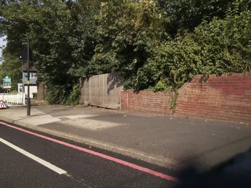
Bishop Asbury Cottage
Museum · 2.4 mi
Cottage in Sandwell, West Midlands, England, UK

Blue Plaque: Chance Brothers Glassworks
Monument and historic site · 1.0 mi


Lions of the Great War
Monument and historic site · 1.9 mi
War memorial in Smethwick, Sandwell, England

Oak House
Museum · 0.5 mi
Historic house museum in Greets Green, West Bromwich, England, UK

35 more on the map.
Parks, trails and playgrounds58


Sot's Hole Local Nature Reserve
Park · 0.9 mi
Nature reserve in West Bromwich, UK


Forge Mill Lake
Park · 1.8 mi
Lake and nature reserve in West Midlands, England, UK


Lightwoods Park
Park · 3.4 mi
Public park in Smethwick in the West Midlands, England

Perry Hall Park
Park · 3.4 mi
Park in Perry Barr, Birmingham, England

Brunswick Park
Park · 2.7 mi
Public park in Wednesbury, West Midlands, England, UK
46 more on the map.
Restaurants and cafes206

The Court of Requests
Bar and pub · Pizza, Burger, Italian, Mexican, Indian, American, Breakfast, Steak House, Fish And Chips, Curry, Wings · 1.3 mi
19 Church Street, Oldbury
Su-Fr 08:00-24:00, Sa 08:00-01:00
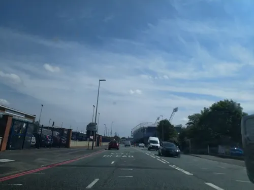
Starbucks
Cafe · Coffee Shop · 1.3 mi
Birmingham Road, West Bromwich
Mo-Fr 06:00-22:00, Sa 06:30-22:00, Su 07:30-22:00
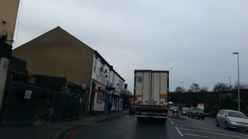
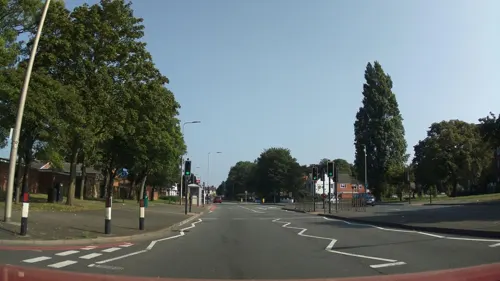


The Jolly Collier
Bar and pub · Sandwich · 1.4 mi
43 Junction Street, Oldbury
Mo-Th 12:00-14:30,17:00-23:00; Fr,Sa 12:00-23:00; Su 12:00-22:30

194 more on the map.
History
West Bromwich was first mentioned as Bromwic ('broom village') in the Domesday Book of 1086. It is believed that it may have originally been part of the Handsworth parish. A Benedictine priory existed in West Bromwich from the 12th century around which the settlement of Broomwich Heath grew. In 1727, the town became a stop on the coaching road between London and Shrewsbury and the beginning of its growth dates from this time. The prefix 'West' serves to distinguish it from the village of Castle Bromwich, around 8 miles (13 km) to the east on the other side of Birmingham.
In the 19th century, coal deposits were discovered, ensuring that the town grew rapidly as an industrial centre, with industries such as spring, gun and nail making developing. Well before the end of the 19th century, West Bromwich had established itself as a prominent area to match older neighbouring towns including Dudley and Walsall.
In 1888, West Bromwich became a county borough, incorporating the village of Great Barr. It was expanded in 1966, acquiring most of the boroughs of Tipton and Wednesbury as well as a small section of Coseley urban district, before joining with the neighbouring county borough of Warley (which contained the towns of Rowley Regis, Oldbury and Smethwick) in 1974 to form the Metropolitan Borough of Sandwell.
Read more of the history
Charlemont Hall, built during the 1750s, stood on the west side of the present Charlemont Crescent, in the Charlemont and Grove Vale district of the town. Charlemont Hall was described c. 1800 as "a lofty neat-looking house of brick, faced with stone, with iron palisades etc. in front." An east wing was added in 1855. The last occupant was the widow of Thomas Jones, town clerk of Wednesbury 1897–1921. The house was demolished in 1948, and is now covered by a number of smaller detached homes. Much of the surrounding area was developed during the 1960s as the Charlemont Farm housing estate, which is a mix of private and council housing.
The population of West Bromwich suffered heavily in the Cholera epidemic of 1831 which spread northwards into the town. A temporary board of health was set up and a hospital opened in the former Revivalist chapel in Spon Lane. The natural gradual slope of the land provided drainage within the soil, however, urbanisation made this increasingly difficult and drainage along the streets was described as inadequate. The West Bromwich Town Improvement Commissioners was established in 1854, and they tackled the drainage problem in the town. They appointed members to new titles and in the 1880s bought land in Friar Park for a sewerage farm.
Under the Reform Act 1832, West Bromwich became part of the new southern division of Staffordshire, and under the Representation of the People Act 1867 it was transferred to the parliamentary borough of Wednesbury. Under the Redistribution of Seats Act 1885, the borough of West Bromwich became a parliamentary borough returning one member. In 1885, it was held by the Liberal Party but from 1886 to 1906 it was held by the Conservative Party before being held by the Liberal Party again until 1910 when the Conservative Party regained the area which they held until 1918 under the representation of Viscount Lewisham. In 1918, it was won by Labour who held it until 2019, when Nicola Richards was elected as MP. Prior to that the constituency was held by Labour except for the period between 1931 and 1935 when it held by the National Unionists.
By the outbreak of World War I in 1914, many of the older houses built to house workers during the Industrial Revolution were becoming unfit for human habitation. Sanitation was inadequate, decay was rife, and the homes were becoming a danger to the health and safety of their inhabitants. After the end of the war, the local council started building new homes to rehouse people from the rundown town centre. However, there are still many late 19th century and early 20th century buildings around the centre of West Bromwich.
The first council housing in West Bromwich was built in 1920 on the Tantany Estate to the north of the town centre. Within 20 years, several thousand council houses had been built by West Bromwich County Borough Council. The largest developments were mostly in the north of the town, including the Charlemont Farm Estate around Walsall Road, and the Friar Park Estate near the border with Wednesbury.
The town suffered significant damage from air raids in World War II, with 58 civilian deaths, most in the raids of 19 November 1940 around Oak Road and Lombard Street to the west of the town centre. There were a few other less severe raids during the war on parts of West Bromwich including Stone Cross and Tantany, with no fatalities. This occurred on the same night as the Birmingham Blitz, which resulted in thousands of casualties, as well as the less severe raids on nearby Dudley and Tipton.
The first major postwar council housing development was the Harvills Hawthorn Estate near Hill Top, which was completed in 1948.
Substantial immigration from the Commonwealth took place in West Bromwich during the 1950s and 1960s, with most of these hailing from the Indian subcontinent, although a significant number of Afro-Caribbean immigrants also settled in West Bromwich. The majority of these immigrants settled in the older parts of the town that were mostly made up of Victorian and Edwardian terraced houses. West Bromwich made national news in 1955 when an Indian man (Bhikabhai Patel) was employed by the town's transport department, and almost all the drivers and conductors went on strike in protest.
From the History section of West Bromwich on Wikipedia, under CC BY-SA 4.0.
More about West Bromwich
Education
The largest educational provider in the town is the Central Campus of Sandwell College. This is housed in a £77 million building opened in February 2012. The college is capable of enrolling over 5,000 students each year across many curriculum areas. Central Sixth delivers the college's A-Level programme covering some thirty different subject areas. Facilities in the Central Campus include a Boeing 737 fuselage used for training air cabin crew and a dental surgery used to train dental nurses. Central Campus also offers a wide variety of apprenticeships and a small number of Higher Education programmes.
The town is served by five secondary schools: George Salter Academy, Health Futures UTC, the Phoenix Collegiate, Q3 Academy Great Barr and Sandwell Academy. A new secondary school, West Bromwich Collegiate Academy, opened in September 2019.
The town has 21 primary schools in total. Some of which are Lodge Primary School, St. John Bosco RC Primary School, Holy Trinity C of E Primary School, Ryders Green Primary School, All Saints' CofE Primary School, St Mary Magdalene, Hateley Heath and Eaton Valley.
From the Wikipedia article West Bromwich, under CC BY-SA 4.0.
Notable people from West Bromwich
 Robert PlantEnglish musician and lead vocalist of Led ZeppelinPhoto: Raph_PH, CC BY 2.0
 K. K. DowningBritish guitaristPhoto: Tilly antoine, CC BY-SA 4.0
 Madeleine CarrollEnglish actress (1906–1987)Photo: Donald Biddle Keyes, Public domain
 Denise LewisBritish athletePhoto: Soccer Aid for UNICEF, CC BY 3.0
 Ian HillBritish bassist, member of Judas PriestPhoto: Birgit Fostervold, CC BY-SA 4.0
 Dean SmithEnglish footballer and manager (born 1971)Photo: Hameltion, CC BY-SA 4.0
 Billy BassettEnglish footballer (1869-1937)Photo: Unknown author Unknown author, Public domain
 Ashleigh NevilleEnglish footballer (born 1993)Photo: Katie Chan, CC BY-SA 4.0
 Frank SkinnerEnglish comedian and television personalityPhoto: Raph_PH, CC BY 2.0
- Raymond CattellBritish-American psychologist (1905–1998)
- Phil LynottIrish rock musician (1949–1986)
- Gerry AshmoreBritish racing driver (1936-2021)
Born in West Bromwich, according to Wikidata (CC0). Each name links to its Wikipedia article.
Where to stay8
Churches and places of worship77
Catholic Church of St Michael and the Holy Angels
Church · Roman Catholic
260 High Street, West Bromwich
Shopping42
Gas and EV charging14
Schools, colleges and libraries37
St Mary Magdalene CofE Voluntary Controlled Primary School
School · Anglican · 1.0 mi
Stanway Road, West Bromwich
Healthcare20
Map of West Bromwich
250 places. The map loads OpenStreetMap tiles when you open it.
Getting there and nearby towns
Birmingham Airport (BHX) is the nearest airport with scheduled flights listed in OpenStreetMap, 11 miles away.
- Oldbury 2 mi southwest, about 3 min by car
- Smethwick 2 mi southeast, about 3 min by car
- Wednesbury 3 mi northwest, about 4 min by car
- Tipton 3 mi west, about 5 min by car
- Rowley Regis 3 mi southwest, about 5 min by car
- Dudley 4 mi west, about 6 min by car
- Birmingham 5 mi southeast, about 8 min by car
- Walsall 5 mi north, about 7 min by car
- Wolverhampton 7 mi northwest, about 11 min by car
- Worcester 25 mi southwest, about 40 min by car
Drive times are estimates from straight-line distance, not routes.
Towns near West Bromwich


Keep exploring
Local news
Headlines from INDB.
Reviews, tips and questions
Loading what members have shared...
Sources and licences
- GeoNames (CC BY 4.0): population, coordinates, regions and time zone
- Mapillary (see each image): photos
- OpenStreetMap contributors (ODbL 1.0): places, airports, map data
- Wikidata (CC0 1.0): elevation, founding date, time zone, website, landmarks and historic places
- Wikimedia Commons (see each image): photos
- Wikipedia (CC BY-SA 4.0): overview and history text
Photo credits
- West Bromwich Town Hall, Tony Hisgett derivative work: MrPanyGoff, CC BY 2.0
- I am the King of the Castle - High Street, West Bromwich (34298626860), Elliott Brown from Birmingham, United Kingdom, CC BY-SA 2.0
- Billiard Hall at St Michael's Street, West Bromwich, Elliott Brown from Birmingham, United Kingdom, CC BY-SA 2.0
- Cross in Hand - High Street, West Bromwich (35461984924), Elliott Brown from Birmingham, United Kingdom, CC BY-SA 2.0
- West Bromwich - The Billiard Hall, Row17, CC BY-SA 2.0
- West Bromwich bus station, West Midlands, 1 April 2011, Elliott Brown from Birmingham, United Kingdom, CC BY 2.0
- West Bromwich Bus Station (5580806324), Elliott Brown from Birmingham, United Kingdom, CC BY 2.0
- Galton Bridge and tunnel, Oosoom at English Wikipedia, CC BY-SA 3.0
- Summit Bridge, Brianboru100, CC BY-SA 3.0
- The Public north, David Waterson ( DWaterson ), CC BY-SA 3.0
- Sandwell - south chapels 02, Sjwells53, CC BY-SA 3.0
- Dartmouth Park, West Bromwich - War Memorial (36184932921), Elliott Brown from Birmingham, United Kingdom, CC BY-SA 2.0
- BlackPatchAug04, Sibadd at English Wikipedia, CC BY-SA 3.0
- Forge Mill Lake, Frombowen, CC BY-SA 4.0
- Handsworth Park, Birmingham, West Midlands Police, CC BY-SA 2.0
- Perry Hall Park, Birmingham - Moat - Andy Mabbett, Andy Mabbett, CC BY-SA 3.0
- Bishop Latimer Church of All Saints Winson Green, Brianboru100, CC BY-SA 3.0
- Oak House rear (3215480435), Tony Hisgett from Birmingham, UK, CC BY 2.0
- Koperenplaat bovenin vuurtoren - Vlieland - 20243185 - RCE, A. J. van der Wal, CC BY-SA 4.0
- Sandwell General Hospital - 2016-08-16 - Andy Mabbett, Andy Mabbett, CC BY-SA 4.0
- War Memorial (5726549793), Tony Hisgett from Birmingham, UK, CC BY 2.0
- Oldbury Library (3681110871), Tony Hisgett from Birmingham, UK, CC BY 2.0
- New Oldbury Library, Tony Hisgett from Birmingham, UK, CC BY 2.0
- WW1 centenary (34) (14841065584), Sandwell Council, CC BY-SA 2.0
- Sandwell - church from east, Sjwells53, CC BY-SA 3.0
- The Big House Oldbury (3323420154), Tony Hisgett from Birmingham, UK, CC BY 2.0
- Chance Monument West Smethwick park (4565999608), Tony Hisgett from Birmingham, UK, CC BY 2.0
- The Oak House, Brianboru100, CC BY-SA 3.0
- Grey plaque at Court of Requests pub, Oldbury, West Midlands, ClaireBustin, CC BY-SA 4.0
- Oldbury Court of Requests, MaryMooney100, CC BY-SA 3.0
- Wesleyan Church Oldbury (3681125499) (2), Tony Hisgett from Birmingham, UK, CC BY 2.0
- Christ Church Oldbury, Tony Hisgett, CC BY 2.0
- Chance Glassworks with canalside buildings, Oosoom at English Wikipedia, CC BY-SA 3.0
- Lightwoods House 01, R J Higginson, CC BY-SA 3.0
- The Lions of the Great War - High Street, Smethwick (45846856412), Elliott Brown from Birmingham, United Kingdom, CC BY-SA 2.0
- Gate (3269748340), Tony Hisgett from Birmingham, UK, CC BY 2.0
- Reflected Mosaic 1 (3619096693), Tony Hisgett from Birmingham, UK, CC BY 2.0
- Spiral sculpture 3 (3619973710), Tony Hisgett from Birmingham, UK, CC BY 2.0
- Sculpture 3 (3619303203), Tony Hisgett from Birmingham, UK, CC BY 2.0
- Spiral sculpture 4 (3619998076), Tony Hisgett from Birmingham, UK, CC BY 2.0
- Sandwell Park Farm pond (3253745128), Tony Hisgett from Birmingham, UK, CC BY 2.0
- Street-level photo, southglos, CC BY-SA 4.0
- Street-level photo, laye, CC BY-SA 4.0
- Street-level photo, adam2, CC BY-SA 4.0
- Street-level photo, southglos, CC BY-SA 4.0
- Street-level photo, laye, CC BY-SA 4.0
- Street-level photo, southglos, CC BY-SA 4.0
- Street-level photo, laye, CC BY-SA 4.0
- Street-level photo, adam2, CC BY-SA 4.0
- Street-level photo, adam2, CC BY-SA 4.0
- Street-level photo, southglos, CC BY-SA 4.0


Page built November 10, 2026. Spotted a mistake? Tell us or suggest a place.