



Why visit Mill Plain
Townapedia lists 31 museums and landmarks, 38 parks and trails, 83 places to eat, 1 place to stay and 10 attractions in and around town.
Highlights include Regina A. Quick Center for the Arts, Black Rock Harbor Light, Ahavath Achim Synagogue and Bassickville Historic District.
July is the warmest month, with average highs of 83°F; January lows average 24°F, and about 34 inches of snow fall in a normal year.
Weather in Mill Plain
Forecast from the National Weather Service. Full forecast
Things to do10

Regina A. Quick Center for the Arts
Cinema and theater · 0.8 mi
University arts center in Fairfield, Connecticut

Black Rock Harbor Light
Lighthouse · 2.9 mi
Lighthouse in Connecticut, United States

Fairfield University
School · 2.1 mi
University located in Fairfield, Connecticut


Museums and landmarks31
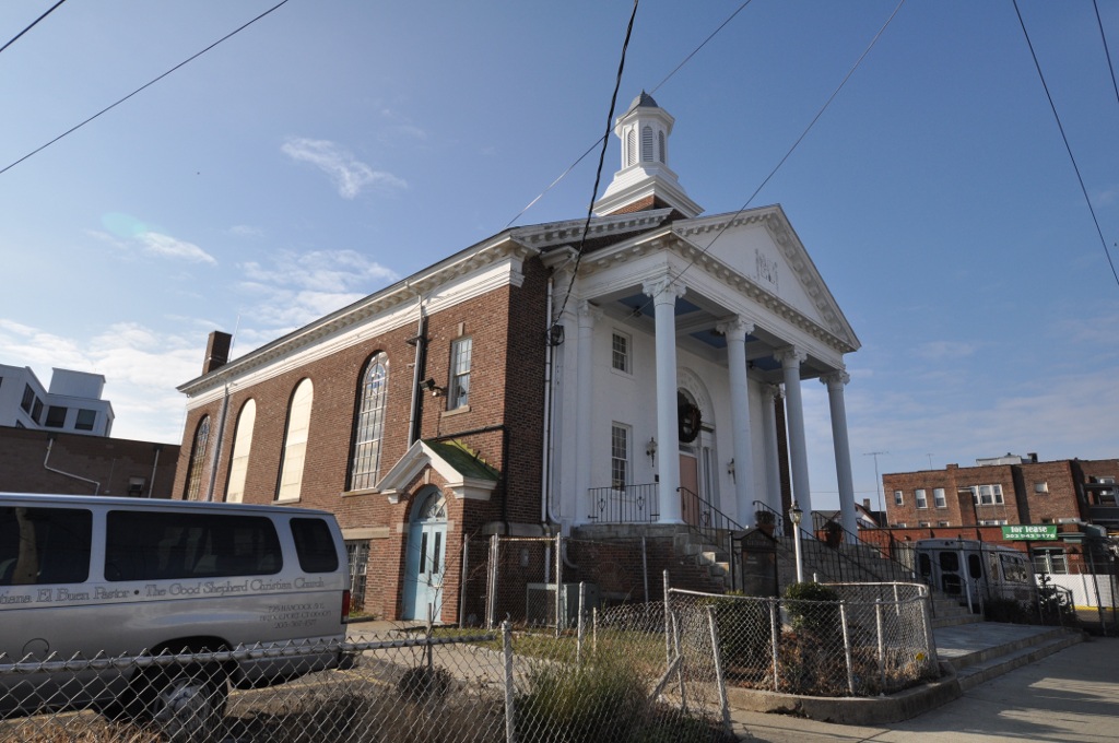
Ahavath Achim Synagogue
Monument and historic site · National Register of Historic Places · 3.1 mi
Synagogue in Bridgeport, Connecticut

Bassickville Historic District
Monument and historic site · National Register of Historic Places · 3.2 mi
Historic district in Connecticut, United States

Black Rock Gardens Historic District
Monument and historic site · National Register of Historic Places · 2.3 mi
Area in Bridgeport, Connecticut, US
Black Rock Historic District
Monument and historic site · National Register of Historic Places · 2.5 mi
Historic district in Bridgeport, Connecticut

Bronson Windmill
Monument and historic site · National Register of Historic Places · 1.7 mi
Windmill in Connecticut, United States of America
Cassidy House
Monument and historic site · National Register of Historic Places · 2.4 mi
Historic house in Connecticut, United States

David Ogden House
Monument and historic site · National Register of Historic Places · 0.5 mi
Historic house in Connecticut, United States

Division Street Historic District
Monument and historic site · National Register of Historic Places · 1.5 mi
Historic district in Connecticut, United States

Fairfield Historic District
Monument and historic site · National Register of Historic Places · 1.3 mi
Listed on the NRHP in Connecticut

Fairfield station
Monument and historic site · National Register of Historic Places · 1.1 mi
Railway station in Fairfield, Connecticut, United States


Greenfield Hill Grange No. 133
Monument and historic site · National Register of Historic Places · 2.3 mi
Building in Connecticut, United States of America
Greenfield Hill Historic District
Monument and historic site · National Register of Historic Places · 1.8 mi
Historic district in Connecticut, United States
19 more on the map.
Parks, trails and playgrounds38


26 more on the map.
Restaurants and cafes83


Archie Moore's
Restaurant · Burger · 1.1 mi
48 Sanford Street, Fairfield
Mo-Su 11:30-24:00; Sa-Su 00:00-01:00
Circle Diner
Restaurant · Diner · 1.4 mi
441 Post Road, Fairfield
Mo-Th 06:00-13:00; Fr 06:00-24:00; Sa 00:00-02:00,06:00-24:00; Su...
Planet Pizza
Restaurant · Pizza · 1.3 mi
733 Post Road, Fairfield
Mo-Su 10:00-23:00; Fr,Sa 10:00-24:00

Craft 260
Bar and pub · Steak House · 1.5 mi
260 Post Road, Fairfield
Mo-Th 15:30-21:30, Fr-Sa 12:00-22:30, Su 12:00-21:30
Kiraku Japanese Asian Grill
Restaurant · Japanese · 1.1 mi
Mo-Th 11:30-22:00; Fr 11:30-23:00; Sa 12:00-23:00; Su 12:30-22:00


71 more on the map.
Where to stay1
Churches and places of worship14
Shopping15
Gas and EV charging10
Schools, colleges and libraries52
Achievement First Bridgeport Academy
School · 5.5 mi
655 Stillman St., Bridgeport
Healthcare9
Passport Health Fairfield Travel Clinic
Clinic and pharmacy · 1.2 mi
140 Sherman Street, Fairfield
Map of Mill Plain
250 places. The map loads OpenStreetMap tiles when you open it.
Climate by month
Monthly table
| Month | High | Low | Rain | Snow |
|---|---|---|---|---|
| Jan | 38°F | 24°F | 3.2 in | 8.5 in |
| Feb | 40°F | 26°F | 3.1 in | 10.7 in |
| Mar | 47°F | 32°F | 4.1 in | 7.0 in |
| Apr | 58°F | 42°F | 4.2 in | 0.9 in |
| May | 68°F | 52°F | 3.6 in | 0.0 in |
| Jun | 78°F | 62°F | 3.8 in | 0.0 in |
| Jul | 83°F | 68°F | 3.3 in | 0.0 in |
| Aug | 82°F | 67°F | 4.0 in | 0.0 in |
| Sep | 75°F | 60°F | 4.0 in | 0.0 in |
| Oct | 64°F | 48°F | 3.8 in | 0.1 in |
| Nov | 54°F | 38°F | 3.1 in | 0.9 in |
| Dec | 44°F | 30°F | 4.0 in | 5.5 in |
U.S. Climate Normals 1991-2020 for Bridgeport Sikorsky Mem Ap 72504 (7 mi away), NOAA NCEI.
People and cost of living
American Community Survey 5-year estimates, 2020-2024, U.S. Census Bureau. Estimates have margins of error, larger for small towns.
Disaster history
The county has had 25 federal disaster declarations since 2000, most often for hurricanes.
- 2024-09-20: Severe Storm, Flooding, Landslides, And Mudslides (Severe Storm)
- 2024-08-21: Severe Storms, Flooding, Landslides, And Mudslides (Severe Storm)
- 2021-10-30: Remnants Of Hurricane Ida (Hurricane)
- 2021-08-22: Hurricane Henri (Hurricane)
- 2021-01-12: Tropical Storm Isaias (Hurricane)
- 2020-08-06: Tropical Storm Isaias (Hurricane)
OpenFEMA disaster declarations summaries.
Getting there and nearby towns
Igor I. Sikorsky Memorial Airport (BDR) is the nearest airport with scheduled flights listed in OpenStreetMap, 7 miles away.
- Fairfield University 1 mi east, about 1 min by car
- Southport 2 mi southwest, about 3 min by car
- Bridgeport 4 mi northeast, about 7 min by car
- Greens Farms 4 mi southwest, about 6 min by car
- Coleytown 4 mi west, about 7 min by car
- Compo 5 mi southwest, about 8 min by car
- Sacred Heart University 5 mi north, about 8 min by car
- Poplar Plains 6 mi west, about 9 min by car
- Trumbull Center 7 mi northeast, about 12 min by car
- Norwalk 9 mi southwest, about 14 min by car
Drive times are estimates from straight-line distance, not routes.
Local news
Headlines from INDB, the NEMICO news database.
Reviews, tips and questions
Loading what members have shared...
Sources and licences
- NCES EDGE (Public domain): public schools
- NOAA NCEI U.S. Climate Normals 1991-2020 (Public domain): climate by month
- OpenFEMA (Public domain): disaster declarations
- OpenStreetMap contributors (ODbL 1.0): places, airports, map data
- U.S. Census Bureau (Public domain): population, income, housing, education, commute
- Wikidata (CC0 1.0): landmarks and historic places
- Wikimedia Commons (see each image): photos
Photo credits
- BridgeportCT FormerAchavathAchimSynagogue, User:Magicpiano, CC BY-SA 4.0
- BridgeportCT BlackRockHD JohnWheelerHouse, User:Magicpiano, CC BY-SA 4.0
- Pine creek park bridge, Wahrnehmer, CC BY-SA 4.0
- BridgeportCT CassidyHouse, User:Magicpiano, CC BY-SA 4.0
- Southport Congregational Church, 1966, Jack Boucher, Public domain
- GREENFIELD HILL GRANGE NO. 133 FAIRFIELD COUNTY, JERRYE & ROY KLOTZ, M.D., CC BY-SA 4.0
- David Ogden House HABS 1938, Everett H. Keeler, Public domain
- FairfieldCT WestboundSouthportRRStation2, Magicpiano, CC BY-SA 4.0
- BridgeportCT BlackRockGardensHD, User:Magicpiano, CC BY-SA 4.0
- BridgeportCT DivisionStreetHD CottageStreet, User:Magicpiano, CC BY-SA 4.0
- BridgeportCT BassickvilleHD BassickAve, User:Magicpiano, CC BY-SA 4.0
- RESTMORE, FAIRFIELD COUNTY, CT, JERRYE & ROY KLOTZ, M.D., CC BY-SA 4.0
- Fairfield station from southbound train (2), July 2019, Pi.1415926535, CC BY-SA 3.0
- JOHN OSBORNE HOUSE, FAIRFIELD COUNTY, CT, JERRYE & ROY KLOTZ, M.D., CC BY-SA 4.0
- Frederic Bronson Windmill, 3015 Bronson Road, Fairfield (Fairfield County, Connecticut), Jack Boucher, Public domain
- BridgeportCT StratfieldHD WestParishChurch, User:Magicpiano, CC BY-SA 4.0
- Connecticut Audubon Birdcraft Museum Exterior, Jllm06, Public domain
- WestportCT GreenFarmsSchool, Magicpiano, CC BY-SA 3.0
- Fairfield Museum Front Exterior, Jllm06, Public domain
- Quick Center for the Arts, Stagophile, CC BY-SA 3.0
- Our Lady of the Assumption Church, Westport, Connecticut, WestportWiki, CC BY-SA 3.0
- Fairfield Entrance, Stagophile ( talk ), CC BY-SA 3.0
- StPeterBridgeport1, Lukascb, CC BY-SA 3.0
- Brcc1976, BRCC, Public domain
- FairfieldCT DavidOgdenHouse, Magicpiano, CC BY-SA 4.0
- Bellarmine Hall entrance, Fairfield University, Jllm06, CC BY-SA 4.0
- Bust of Cardinal Roberto Bellarmine by Bernini on display at Fairfield University Art Museum, Zeete, Public domain
- Bellarmine Hall, Fairfield University, alumni lounge, Jllm06, CC BY-SA 4.0
- Bellarmine Museum of Art 3 - brass dish, Jllm06, CC BY-SA 4.0
- Bellarmine Museum of Art 8 - Historic plaster casts, Jllm06, CC BY-SA 4.0
- Bellarmine Museum of Art 1 - brass items, Jllm06, CC BY-SA 4.0
- Bellarmine Museum of Art 2, Jllm06, CC BY-SA 4.0
- Bellarmine Museum of Art 6 - Ancient Mexican ceramics, Jllm06, CC BY-SA 4.0
- Bellarmine Museum of Art 7, Jllm06, CC BY-SA 4.0
- Bellarmine Hall at Fairfield University, CT, Zeete, CC BY-SA 4.0
- Jonathan Sturges House 074, Pedro Xing, CC0
- Connecticut Turnpike - Fairfield Service Plaza, Kenneth C. Zirkel, CC BY-SA 4.0
- Birdcraft Sanctuary (Unedited), Spencer Georgiades, CC BY-SA 4.0
- Rest stop in Connecticut, en route to Washington DC - panoramio, Arnab Majumdar, CC BY-SA 3.0
- 06824-main-train-station-house, Paul Luciano, CC BY-SA 3.0


Page built October 30, 2026. Spotted a mistake? Tell us or suggest a place.