


Robbinsdale, Minnesota
Robbinsdale is a city of 14,234 people in Hennepin County, Minnesota, founded in 1893.
Why visit Robbinsdale
Townapedia lists 21 museums and landmarks, 51 parks and trails, 29 places to eat and 7 attractions in and around town.
Highlights include Broadway Avenue Bridge, Camden Bridge, Lawrence A. and Mary Fournier House and Fredrika Bremer Intermediate School.
July is the warmest month, with average highs of 82°F; January lows average 7°F, and about 54 inches of snow fall in a normal year.
Weather in Robbinsdale
Forecast from the National Weather Service. Full forecast
About Robbinsdale
Robbinsdale is a city in Hennepin County, Minnesota, United States. Its population was 14,646 at the 2020 census. The city is in the Minneapolis–Saint Paul metropolitan area and is adjacent to the northwest portion of Minneapolis.
From the Wikipedia article Robbinsdale, Minnesota (this version), under CC BY-SA 4.0.
Things to do7

Broadway Avenue Bridge
Bridge · 3.2 mi
Bridge in Minneapolis, Minnesota

Camden Bridge
Bridge · 2.4 mi
Bridge in Minneapolis, Minnesota, United States
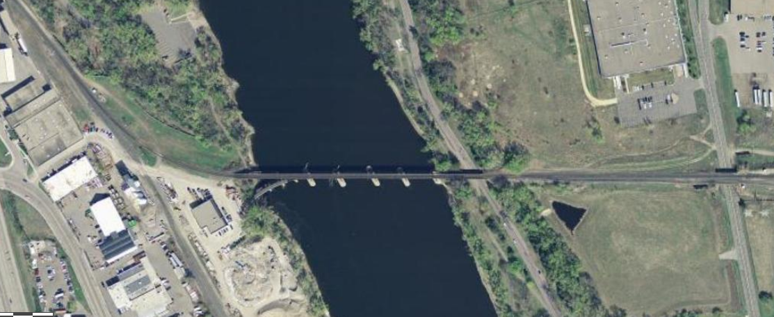
Canadian Pacific Camden Place Rail Bridge
Bridge · 2.4 mi
Bridge in Minneapolis, Minnesota

Lowry Avenue Bridge
Bridge · 2.9 mi
Tied-arch bridge that crosses the Mississippi River in Minneapolis, Minnesota, United States

Northern Pacific-BNSF Minneapolis Rail Bridge
Bridge · 3.1 mi
Bridge in Minneapolis, Minnesota

Plymouth Avenue Bridge
Bridge · 3.6 mi
Bridge in Minneapolis, Minnesota

Museums and landmarks21

Lawrence A. and Mary Fournier House
Monument and historic site · National Register of Historic Places · 1.0 mi
House in Minneapolis, United States of America
3505 North Sheridan Avenue, Minneapolis

Fredrika Bremer Intermediate School
Monument and historic site · National Register of Historic Places · 1.9 mi
Building in Minneapolis, Minnesota, United States

John Lohmar House
Monument and historic site · National Register of Historic Places · 2.8 mi
Historic house in Minnesota, United States

Little Sisters of the Poor Home for the Aged
Monument and historic site · National Register of Historic Places · 3.7 mi
Building in Minneapolis, Minnesota, United States

Minneapolis Brewing Company Building
Monument and historic site · National Register of Historic Places · 3.4 mi
Brewery building in Minneapolis, Minnesota, United States

Minneapolis Public Library, North Branch
Monument and historic site · National Register of Historic Places · 2.6 mi
Former library building in Minneapolis, Minnesota, United States

North East Neighborhood House
Monument and historic site · National Register of Historic Places · 3.4 mi
Building in Minneapolis, Minnesota, United States

North Loop
Monument and historic site · National Register of Historic Places · 3.7 mi
Neighborhood of Minneapolis, Minnesota, United States

Northwestern Knitting Company Factory building
Monument and historic site · National Register of Historic Places · 3.7 mi
Building in Minneapolis, Minnesota, United States

Ripley Memorial Hospital
Monument and historic site · National Register of Historic Places · 3.2 mi
Former maternity hospital in Minneapolis, Minnesota
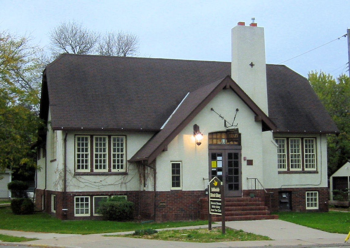
Robbinsdale Library
Monument and historic site · National Register of Historic Places · 0.7 mi
Branch library of the Hennepin County Library system in Robbinsdale, Minnesota

Sumner Library
Monument and historic site · National Register of Historic Places · 3.3 mi
Public library in Minneapolis, Minnesota, USA
9 more on the map.
Parks, trails and playgrounds51


Graeser Park
Park · 1.1 mi
Park in Robbinsdale, Hennepin County, United States of America

Bohanon Park
Park · 2.3 mi
City park in Minneapolis, Minnesota, United States
North Mississippi Regional Park
Park · 2.7 mi
Park in Hennepin County, Minnesota, United States of America
Theodore Wirth Park
Park · 3.2 mi
Park in Hennepin County, Minnesota, United States
39 more on the map.
Restaurants and cafes29

Broadway Pizza (Eagles Nest Lounge)
Restaurant · Pizza · 0.5 mi
4106 Lakeland Avenue North, Robbinsdale
Mo-Su 11:00-23:00
The Lowry Cafe
Restaurant · Breakfast · 1.3 mi
2207 North Lowry Avenue, Minneapolis
Mo-Sa 08:00-15:00; Su 07:00-03:00

Olympic Cafe Plus
Restaurant · 1.8 mi
2117 West Broadway Avenue, Minneapolis
Su-Th 10:00-22:00; Fr,Sa 10:00-23:00

The Thirsty Whale
Bakery · 1.8 mi
4149 North Fremont Avenue
We-Fr 06:30-18:00; Sa 07:00-15:00; Su 07:00-13:00

Mai Thai
Restaurant · Thai
3839 Lakeland Avenue North, Robbinsdale
Tu-Fr 11:30-21:00; Mo 16:00-21:00; Sa,Su 12:00-21:00

17 more on the map.
History
Shortly after the Minnesota Territorial Legislature created Hennepin County in 1852, John C. Bohanon filed the first claim in the Township of Crystal Lake. Railroads reached the area in 1880. A flag station was established near the farm of Alfred Parker, and six years later he donated land for a depot. The community that grew around it came to be known as Parker's Station. In 1887 Minneapolis made an effort to secure more taxable property by annexing neighboring townships. In response, Crystal Lake farmers incorporated the Village of Crystal.
Later that year, entrepreneur, civil war veteran, and real estate developer Andrew Bonney Robbins came to Parker's Station on behalf of an Illinois business interest. Robbins was a former state senator and the brother-in-law of lumber baron Thomas Barlow Walker. Robbins purchased 90 acres (360,000 m2) to the west of Lower Twin Lake to incorporate into the Robbinsdale Park subdivision.
From the History section of Robbinsdale, Minnesota on Wikipedia, under CC BY-SA 4.0.
Churches and places of worship25
The Church of Jesus Christ of Latter-day Saints
Church · Mormon · 1.9 mi
2801 Douglas Drive North, Crystal
The Church of St. Margaret Mary
Church · Roman Catholic · 1.7 mi
2323 Zenith Avenue North, Golden Valley
Brookdale Covenant Church
Church · Covenant · 1.7 mi
5139 Brooklyn Boulevard, Brooklyn Center
Cambodian Nazarene Church
Church · Nazarene · 1.7 mi
6421 45th Avenue North, Crystal
Church of Saint Austin
Church · Catholic · 0.9 mi
4047 North Thomas Avenue, Minneapolis
Elim Lutheran Church ELCA
Church · Lutheran
3978 West Broadway Avenue, Robbinsdale
Luther Memorial Lutheran Church
Church · Lutheran · 0.9 mi
3751 North Sheridan Avenue, Minneapolis
Peace Lutheran Church
Church · Lutheran · 0.9 mi
4512 France Avenue North, Robbinsdale
Redeemer Evangelical Lutheran Church
Church · Evangelical · 0.9 mi
4201 Regent Avenue North, Robbinsdale
Shopping13
Northside Oriental Market & Deli
Grocery · 0.6 mi
4165 Hubbard Avenue North, Robbinsdale
Gas and EV charging10
Schools, colleges and libraries52
283 St Louis Pk Independent Study
School · 5.8 mi
6425 W 33Rd St, Saint Louis Park
283-Ind Stdy 15 And Under - I.S.
School · 5.8 mi
6425 W 33Rd St, Saint Louis Park
4126 - Prairie Seeds Academy - Is
School · 3.6 mi
6200 W Broadway Ave, Brooklyn Park
Healthcare6
North Memorial Health – Robbinsdale Hospital
Hospital · 0.8 mi
3300 Oakdale Avenue North, Robbinsdale
Robbinsdale Clinic P.A.
Clinic and pharmacy
3819 West Broadway Avenue, Robbinsdale
Map of Robbinsdale
214 places. The map loads OpenStreetMap tiles when you open it.
Climate by month
Monthly table
| Month | High | Low | Rain | Snow |
|---|---|---|---|---|
| Jan | 24°F | 7°F | 0.9 in | 10.1 in |
| Feb | 29°F | 11°F | 1.0 in | 10.1 in |
| Mar | 42°F | 23°F | 1.9 in | 9.0 in |
| Apr | 57°F | 35°F | 3.3 in | 5.1 in |
| May | 69°F | 48°F | 4.5 in | 0.0 in |
| Jun | 78°F | 58°F | 4.6 in | 0.0 in |
| Jul | 82°F | 63°F | 4.5 in | 0.0 in |
| Aug | 80°F | 61°F | 4.2 in | 0.0 in |
| Sep | 72°F | 52°F | 3.5 in | 0.0 in |
| Oct | 57°F | 39°F | 3.0 in | 0.8 in |
| Nov | 41°F | 26°F | 1.9 in | 6.9 in |
| Dec | 28°F | 14°F | 1.4 in | 12.3 in |
U.S. Climate Normals 1991-2020 for New Hope (3 mi away), NOAA NCEI.
People and cost of living
American Community Survey 5-year estimates, 2020-2024, U.S. Census Bureau. Estimates have margins of error, larger for small towns.
Disaster history
Hennepin County has had 10 federal disaster declarations since 2000, most often for floods.
- 2020-04-07: Covid-19 Pandemic (Biological)
- 2020-03-13: Covid-19 (Biological)
- 2016-11-02: Severe Storms And Flooding (Flood)
- 2014-07-21: Severe Storms, Straight-Line Winds, Flooding, Landslides, And Mudslides (Flood)
- 2013-07-25: Severe Storms, Straight-Line Winds, And Flooding (Severe Storm)
- 2011-06-07: Severe Storms And Tornadoes (Severe Storm)
OpenFEMA disaster declarations summaries.
Getting there and nearby towns
Crystal Airport (MIC) is the nearest airport with scheduled flights listed in OpenStreetMap, 3 miles away.
- Crystal 2 mi northwest, about 3 min by car
- Golden Valley 3 mi southwest, about 4 min by car
- New Hope 3 mi west, about 5 min by car
- Brooklyn Center 3 mi north, about 5 min by car
- Columbia Heights 4 mi northeast, about 7 min by car
- Minneapolis 5 mi southeast, about 8 min by car
- Fridley 5 mi northeast, about 9 min by car
- Brooklyn Park 6 mi north, about 10 min by car
- Plymouth 6 mi west, about 10 min by car
- New Brighton 7 mi northeast, about 11 min by car
Drive times are estimates from straight-line distance, not routes.
Local news
Headlines from INDB, the NEMICO news database.
Reviews, tips and questions
Loading what members have shared...
Sources and licences
- NCES EDGE (Public domain): public schools
- NOAA NCEI U.S. Climate Normals 1991-2020 (Public domain): climate by month
- OpenFEMA (Public domain): disaster declarations
- OpenStreetMap contributors (ODbL 1.0): places, airports, map data
- U.S. Census Bureau (Public domain): population, income, housing, education, commute
- Wikidata (CC0 1.0): elevation, founding date, time zone, website, landmarks and historic places
- Wikimedia Commons (see each image): photos
- Wikipedia (CC BY-SA 4.0): overview and history text
Photo credits
- Snowy Winter Night, City of Robbinsdale, Minnesota (25291020434), Tony Webster from San Francisco, California, CC BY-SA 2.0
- Terrace Theater - Robbinsdale (7207081360), m01229 from USA, CC BY 2.0
- Terrace robbinsdale (7207079166), m01229 from USA, CC BY 2.0
- Snowy Robbinsdale Trees (24763103526), Tony Webster from Minneapolis, Minnesota, United States, CC BY-SA 2.0
- Snow-Covered Trees at Copperfield Hill Senior Living - Robbinsdale, Minnesota (24161157294), Tony Webster from Minneapolis, Minnesota, United States, CC BY-SA 2.0
- Terrace Mall - Robbinsdale, Minnesota (24161207984), Tony Webster from Minneapolis, Minnesota, United States, CC BY-SA 2.0
- Terrace Theatre, Robbinsdale, Minnesota. 9-27-16, KIRTIS, CC BY-SA 4.0
- Fournier House 1, Elkman, CC BY-SA 4.0
- Ripley Memorial Hospital 1, McGhiever, CC BY-SA 4.0
- Northwestern Knitting Company Factory, McGhiever, CC BY-SA 3.0
- Robbinsdale Library 002, Elkman, CC BY-SA 4.0
- Sumner Branch Library, McGhiever, CC BY-SA 3.0
- North East NHood House 1, Elkman, CC BY-SA 4.0
- Minneapolis Brewing Company, McGhiever, CC BY-SA 3.0
- Fredrika Bremer Intermediate School, McGhiever, CC BY-SA 4.0
- John Lohmar House, McGhiever, CC BY-SA 4.0
- Minneapolis Warehouse District, User:Mulad, Public domain
- Little Sisters of the Poor Home for the Aged, McGhiever, CC BY-SA 4.0
- North Branch Library, McGhiever, CC BY-SA 3.0
- Graeser Park Beehive Grill Spring, Elkman, CC BY 4.0
- Camden Bridge Mpls, McGhiever, CC BY-SA 4.0
- St Mary's Orthodox Cathedral Mpls, McGhiever, CC BY-SA 4.0
- Northern Pacific-BNSF Minneapolis Rail Bridge, Cadwaladr, CC BY-SA 3.0
- BroadwayBridgeMinneapolis, Todd Murray, CC BY-SA 3.0
- Golden Valley Historical Society, Side View (cropped), MidwestMoss, CC0
- New Lowry Avenue Bridge, Cadwaladr, CC BY-SA 3.0
- Canadian Pacific Camden Place Rail Bridge USGS, USGS, Public domain
- Plymouth Ave Bridge, McGhiever, CC BY-SA 4.0
- Black Lives Matter march for Tania Harris (17184022805), Fibonacci Blue from Minnesota, USA, CC BY 2.0
- Black Lives Matter march for Tania Harris (16976576597), Fibonacci Blue from Minnesota, USA, CC BY 2.0
- Black Lives Matter march for Tania Harris (17182366062), Fibonacci Blue from Minnesota, USA, CC BY 2.0
- Black Lives Matter march for Tania Harris (16563793403), Fibonacci Blue from Minnesota, USA, CC BY 2.0
- Black Lives Matter march for Tania Harris (17183410351), Fibonacci Blue from Minnesota, USA, CC BY 2.0
- Crystal Lake (1), Gobonobo, CC BY-SA 3.0
- The old Terrace Theater (7207060418), m01229 from USA, CC BY 2.0
- Old Terrace Theater (7207073374), m01229 from USA, CC BY 2.0
- Terrace Theater (7207062954), m01229 from USA, CC BY 2.0
- Terrace Theater (7207076604), m01229 from USA, CC BY 2.0
- Stairs at Terrace Theater (7207066432), m01229 from USA, CC BY 2.0
- Terrace Theater (7207090250), m01229 from USA, CC BY 2.0


Page built October 30, 2026. Spotted a mistake? Tell us or suggest a place.