


Why visit Chengalpattu
Townapedia lists 2 attractions in and around town.
Weather in Chengalpattu
Forecast from MET Norway (CC BY 4.0). Full forecast
About Chengalpattu
Chengalpattu, previously known as Chingleput or Chengalpet, is a town in Chennai metropolitan area and the headquarters of Chengalpattu district of the state Tamil Nadu, India. The town is located near the industrial and IT hub. It is the headquarters of the district and is 56 kilometres (35 mi) away from the state capital, Chennai on the National Highway 45.
From the Wikipedia article Chengalpattu (this version), under CC BY-SA 4.0.
Travel tips from other travellers: Chengalpattu on Wikivoyage (CC BY-SA 4.0).
Things to do2

Churches and places of worship16

4 more on the map.
Gas and EV charging5

Schools, colleges and libraries7


History
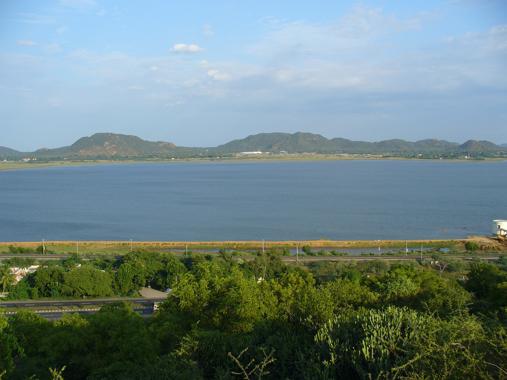
Chengalpattu dates from the early Chola dynasty of the 2nd century BCE. Chengalpattu was formerly a capital of the kings of Vijayanagara, after their defeat by the Deccan sultanates at Battle of Talikota in 1565. The fortress at Chengalpattu, built by the Vijayanagara kings in the 16th century, was of strategic importance, owing to its swampy surroundings and the lake that flanked its side.
In 1639 a local governor or nayak, subject to these kings, granted a piece of coastal land to the British East India Company where Fort St George now stands, which became the nucleus of the city of Madras. Chengalpattu was taken by the French in 1751 and was retaken in 1752 by Robert Clive, after which it proved of great strategic advantage to the British, especially when Lally failed to capture the fortress in his advance on Madras.
During the wars of the British with Hyder Ali of Mysore, it withstood his assault and afforded a refuge to the nearby residents. In 1780, after the defeat of Colonel W Baillie, the army of Sir Hector Munro took refuge there. By 1900 the town was noted for its manufacture of pottery and was a local market center, especially of the rice trade. The surrounding district was home to cotton and silk weaving, indigo dyeing, tanneries, and a cigar factory, and extensive salt manufacturing took place along the coast.
From the History section of Chengalpattu on Wikipedia, under CC BY-SA 4.0.
Healthcare38
Map of Chengalpattu
68 places. The map loads OpenStreetMap tiles when you open it.
Getting there and nearby towns
Chennai International Airport (MAA) is the nearest airport with scheduled flights listed in OpenStreetMap, 39 km away.
- Mahabalipuram 25 km east, about 25 min by car
- Vandalūr 25 km northeast, about 25 min by car
- Tambaram 31 km northeast, about 31 min by car
- Kanchipuram 34 km northwest, about 34 min by car
- Pallāvaram 36 km northeast, about 36 min by car
- Poonamalle 42 km north, about 42 min by car
- Saint Thomas Mount 42 km northeast, about 42 min by car
- Ambattur 49 km northeast, about 49 min by car
- Avadi 49 km north, about 49 min by car
- Chennai 55 km northeast, about 55 min by car
Drive times are estimates from straight-line distance, not routes.
Local news
Headlines from INDB.
Reviews, tips and questions
Loading what members have shared...
Sources and licences
- GeoNames (CC BY 4.0): population, coordinates, regions and time zone
- OpenStreetMap contributors (ODbL 1.0): places, airports, map data
- Wikidata (CC0 1.0): elevation, founding date, time zone, website
- Wikimedia Commons (see each image): photos
- Wikipedia (CC BY-SA 4.0): overview and history text
Photo credits
- Chengalpat lake, satpoorani, CC BY 2.0
- Chengalpattu (5404833798), Ashwin Kumar from Bangalore, India, CC BY-SA 2.0
- Kolavai Eri Chengalpattu, Ashwin Kumar, CC BY-SA 2.0
- Chengalpattu hill view, Jayaramprabha, CC BY-SA 4.0
- Chengalpet Railway Station, Gowtham Sampath, CC BY-SA 4.0
- THANE CYCLONE MOMENT @ KOLAVAI LAKE VIEW - panoramio (1), RAJUKHAN SR RAJESH, CC BY-SA 3.0
- THANE CYCLONE MOMENT @ KOLAVAI LAKE VIEW - panoramio, RAJUKHAN SR RAJESH, CC BY-SA 3.0
- Chengalpet Railway Station 1, Gowtham Sampath, CC BY-SA 4.0
- Ananthapuri Express a WAP-4, Ashok Prabhakaran, CC BY-SA 2.0
- My Pppis, Naveen Kumar, CC BY 3.0
- Farmer, Ramkumar Radhakrishnan, CC0
- Farming India, Ramkumar Radhakrishnan, CC0
- Place Pn Kalathur, Ramkumar Radhakrishnan, CC0
- Lemon Lady!!! (5686597068), Vinoth Chandar from Chennai, India, CC BY 2.0
- What a look! (Explored - Frontpage) (5602765430), Vinoth Chandar from Chennai, India, CC BY 2.0
- A Hindu man with Tripundra Tilaka forehead markings, Vinoth Chandar from Chennai, India, CC BY 2.0
- Premier Roadmaster Fargo 2016 Chennai Rear View, SnapMeUp, CC BY-SA 4.0
- Premier Roadmaster Fargo 2016 Chennai Side View, SnapMeUp, CC BY-SA 4.0
- Premier Roadmaster Fargo 2016 Chennai, SnapMeUp, CC BY-SA 4.0
- Imageimporter, Neechalkaran, CC0
- Karivaridha Perumal Pallava temple (14), Ssriram mt, CC BY-SA 4.0


Page built November 3, 2026. Spotted a mistake? Tell us or suggest a place.