




Why visit Elayavur
Townapedia lists 2 museums and landmarks, 4 parks and trails, 8 places to eat, 4 places to stay and 3 attractions in and around town.
Highlights include Kannur Lighthouse, Kannur University and Arakkal Museum.
Weather in Elayavur
Forecast from MET Norway (CC BY 4.0). Full forecast
Things to do3
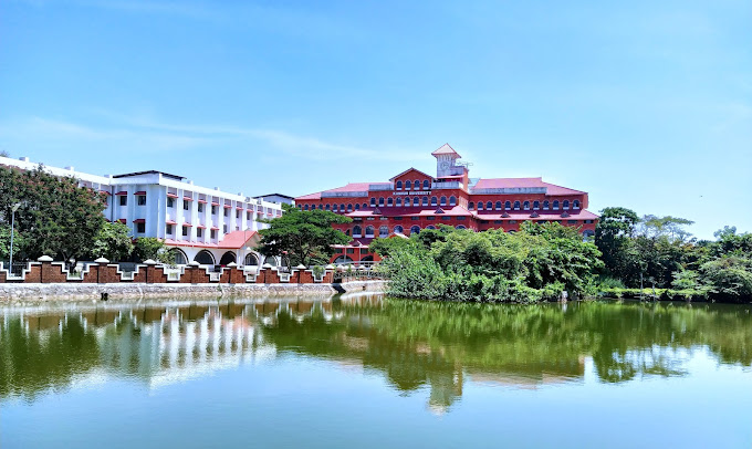
Kannur University
School · 4.8 km
State public university in Kannur, Kerala, India

Museums and landmarks2

Arakkal Museum
Museum · 5.0 km
Museum in Kannur district, Keralam, India

Parks, trails and playgrounds4




Restaurants and cafes8



Where to stay4
Churches and places of worship33
Shopping7
Gas and EV charging3
Schools, colleges and libraries24
Chelora Higher Secondary School Ground
School · 1.9 km
Varam Chelora Road, KANNUR
Healthcare10
Chelora Primary Health Centre
Clinic and pharmacy · 2.4 km
Kannur - Mattannur Road
Map of Elayavur
98 places. The map loads OpenStreetMap tiles when you open it.
Getting there and nearby towns
Kannur International Airport (CNN) is the nearest airport with scheduled flights listed in OpenStreetMap, 15 km away.
- Thottada 6 km south, about 6 min by car
- Kannur 6 km west, about 6 min by car
- Pāppinisshēri 11 km northwest, about 11 min by car
- Muluppilagadu 11 km southeast, about 11 min by car
- Dharmadam 14 km southeast, about 14 min by car
- Tellicherry 18 km southeast, about 18 min by car
- Taliparamba 18 km north, about 18 min by car
- Mattanur 18 km east, about 18 min by car
- Irikkūr 18 km northeast, about 18 min by car
- Panoor 23 km southeast, about 23 min by car
Drive times are estimates from straight-line distance, not routes.
Local news
Headlines from INDB.
Reviews, tips and questions
Loading what members have shared...
Sources and licences
- GeoNames (CC BY 4.0): population, coordinates, regions and time zone
- OpenStreetMap contributors (ODbL 1.0): places, airports, map data
- Wikidata (CC0 1.0): elevation, founding date, time zone, website, landmarks and historic places
- Wikimedia Commons (see each image): photos
Photo credits
- Click on 15-03-2013, Akuaku123, CC BY-SA 3.0
- Arakkal Kettu museum- kannur, നിരക്ഷരൻ, CC BY-SA 3.0
- Kannur Univerisity Thavakkara Campus, Rahul B Ashok, CC0
- കൊങ്ങിണി (Lantana camara) (20866), George Muttathil Pulikurumba, CC BY-SA 4.0
- ISS022-E-69436 - View of Earth, Earth Science and Remote Sensing Unit , Lyndon B. Johnson Space Center, Public domain
- ISS022-E-69437 - View of Earth, Earth Science and Remote Sensing Unit , Lyndon B. Johnson Space Center, Public domain
- Forest in Edachovva, Kerala, India, Shareef Taliparamba, CC BY-SA 2.0
- Melechovva water tank vrvbaan042k24 (2), Vinayaraj, CC BY-SA 4.0
- Melechovva water tank vrvbaan042k24 (4), Vinayaraj, CC BY-SA 4.0
- Melechovva water tank vrvbaan042k24 (6), Vinayaraj, CC BY-SA 4.0
- Melechovva water tank vrvbaan042k24 (5), Vinayaraj, CC BY-SA 4.0
- Melechovva water tank vrvbaan042k24 (1), Vinayaraj, CC BY-SA 4.0
- Melechovva water tank vrvbaan042k24 (3), Vinayaraj, CC BY-SA 4.0
- Mele Chovva (4329647899), Shareef Taliparamba, CC BY-SA 2.0
- Mundayad indoor stadium vrvbaan042k24, Vinayaraj, CC BY-SA 4.0


Page built November 3, 2026. Spotted a mistake? Tell us or suggest a place.