
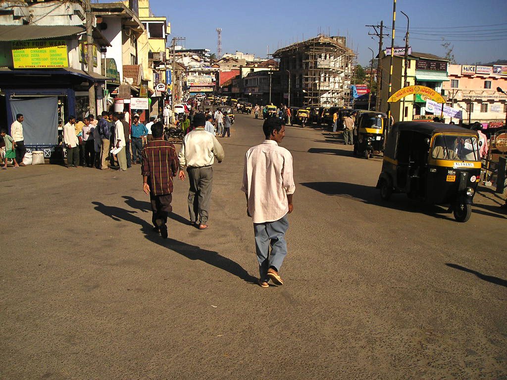


Why visit Madikeri
Townapedia lists 3 museums and landmarks, 4 parks and trails, 24 places to eat, 27 places to stay and 2 attractions in and around town.
Highlights include Abbey Falls and Madikeri Fort.
Weather in Madikeri
Forecast from MET Norway (CC BY 4.0). Full forecast
About Madikeri
Madikeri (Kodava: [mɐɖikeːri]), earlier called as Mercara is city and headquarters of Kodagu district in the Karnataka state of India. It is recognised as one of the world's eight "hottest hotspots" of biological diversity and is also a UNESCO World Heritage Site. The city is ranked 1st in India for clean air and air quality index in 2024.
From the Wikipedia article Madikeri (this version), under CC BY-SA 4.0.
Travel tips from other travellers: Madikeri on Wikivoyage (CC BY-SA 4.0).
Things to do2

Abbey Falls
Waterfall · 4.3 km
Waterfall in Kodagu District of the Indian state of Karnataka

Museums and landmarks3



Parks, trails and playgrounds4




Restaurants and cafes24


12 more on the map.
History
The history of Madikeri is related to the history of Kodagu. From the 2nd to the 6th century AD, the northern part of Kodagu was ruled by Kadambas. The southern part of Kodagu was ruled by Gangas from the 4th to the 11th century. After defeating the Gangas in the 11th century, Cholas became the rulers of Kodagu. In the 12th century, the Cholas lost Kodagu to the Hoysalas. Kodagu fell to the Vijayanagar kings in the 14th century.
After their fall, the local chieftains from Kodava community (Palegars) started ruling their areas directly. They appointed Haleri Dynasty founder Veeraraju, (Nephew of Ikkeri Sadashiva Nayaka who were descendants of Talakadu Ganga Dynasty) as ruler. In the year 1700 AD Ikkeri Somashekara Nayaka gifted Puttur and Amara Sullia Magnes of Tulunadu to Haleri Kings.
Descendants of Veeraraju who are known as "Haleri Dynasty" ruled Kodagu from 1600 to 1834 AD. Haleri king Mudduraja built the Fort in Madikeri and made it as their capital. Mudduraja, the third Haleri king started levelling the land around Madikeri and built a fort in the year 1681. Madikeri Fort which was original built of mud and was replaced by Tipu Sultan. Kodagu became a part of British India after 1834 AD.
From the History section of Madikeri on Wikipedia, under CC BY-SA 4.0.
Where to stay27
Churches and places of worship8
Shopping9
Gas and EV charging3
Schools, colleges and libraries4
Healthcare24
Map of Madikeri
108 places. The map loads OpenStreetMap tiles when you open it.
Getting there and nearby towns
Kannur International Airport (CNN) is the nearest airport with scheduled flights listed in OpenStreetMap, 60 km away.
- Irikkūr 53 km southwest, about 53 min by car
- Mattanur 58 km south, about 58 min by car
- Taliparamba 59 km southwest, about 59 min by car
- Pāppinisshēri 68 km southwest, about 1 h 15 min by car
- Nīlēshwar 68 km west, about 1 h 15 min by car
- Kanhangad 70 km west, about 1 h 15 min by car
- Kannur 75 km southwest, about 1 h 15 min by car
- Thottada 74 km southwest, about 1 h 15 min by car
- Hassan 75 km northeast, about 1 h 15 min by car
- Tellicherry 80 km south, about 1 h 15 min by car
Drive times are estimates from straight-line distance, not routes.
Local news
Headlines from INDB.
Reviews, tips and questions
Loading what members have shared...
Sources and licences
- GeoNames (CC BY 4.0): population, coordinates, regions and time zone
- OpenStreetMap contributors (ODbL 1.0): places, airports, map data
- Wikidata (CC0 1.0): elevation, founding date, time zone, website, landmarks and historic places
- Wikimedia Commons (see each image): photos
- Wikipedia (CC BY-SA 4.0): overview and history text
Photo credits
- Streets of Madikeri, Dasprevailz, Public domain
- Madikeri fort2, Prof tpms, CC BY-SA 4.0
- Elephant Statue - Madikeri Fort Coorg, Ankit, CC BY-SA 4.0
- Madikeri fort, Kodagu, Prof tpms, CC BY-SA 4.0
- Walls of the Madikeri fort, AlvaKedak, CC BY 4.0
- Stained Glass window, Madikeri Fort Museum, AlvaKedak, CC BY 4.0
- Cannon in the Madikeri Fort Museum, AlvaKedak, CC BY 4.0
- Abbey falls 2010, User: (WT-shared) Rohithrajjc at wts wikivoyage, Public domain
- Government museum, Madikeri, Vaishak Kallore ( Vaishak Kallore ), CC BY 3.0
- Wotti with kesa curry and mushroom fry . 01, Chargedparticlesrish, CC BY-SA 4.0
- Well Take My Picture, Shreeram Kushwaha, CC BY 3.0
- Better Get Beaten Than Be Headed, Vincent Paul, CC BY-SA 3.0
- Uropeltis by Manoj P, Manoj P, CC BY 3.0
- Moon rise @Pushpagiri Wildlife Sanctuary, Manamohana Holla K, CC BY-SA 4.0
- Its not Day time @Pushpagiri Wildlife Sanctuary, Manamohana Holla K, CC BY-SA 4.0
- Inside Forest @Pushpagiri Wildlife Sanctuary, Manamohana Holla K, CC BY-SA 4.0
- Rising Moon @Pushpagiri Wildlife Sanctuary, Manamohana Holla K, CC BY-SA 4.0
- The Milk of Mountains @Pushpagiri Wildlife Sanctuary, Manamohana Holla K, CC BY-SA 4.0
- Morning breez@Pushpagiri Wildlife Sanctuary, Manamohana Holla K, CC BY-SA 4.0
- Milky Way @Pushpagiri Wildlife Sanctuary, Manamohana Holla K, CC BY-SA 4.0
- Bus stand in Coorg, Testmaskara, CC BY-SA 3.0
- Tetrapanax papyrifer 6, George Muttathil Pulikurumba, CC BY-SA 4.0
- Tetrapanax papyrifer 7, George Muttathil Pulikurumba, CC BY-SA 4.0
- Tetrapanax papyrifer 8, George Muttathil Pulikurumba, CC BY-SA 4.0
- Plant 158, Nativeplants garden, CC BY-SA 4.0
- Tetrapanax papyrifer, Nativeplants garden, CC BY-SA 4.0
- Tetrapanax papyrifer 2, Nativeplants garden, CC BY-SA 4.0
- Biophytam sensitivum 4, Nativeplants garden, CC BY-SA 4.0
- Ficus racemosa 318048993, Sindhu Haridas, CC BY 4.0
- Ficus racemosa 318049003, Sindhu Haridas, CC BY 4.0
- Yellow-flowered waterhyssop, Nativeplants garden, CC BY-SA 4.0
- Flower at Thadiyandamol 20230831 145055 18, Deepa Chandran2014, CC BY-SA 4.0
- Flower at Thadiyandamol 20230831 145055 17, Deepa Chandran2014, CC BY-SA 4.0
- Flower at Thadiyandamol 20230831 145055 16, Deepa Chandran2014, CC BY-SA 4.0
- A female Great Eggfly butterfly- Mimic (48892277187), Hari K Patibanda, CC BY 2.0
- Kodava Men singing the "Balo Paat", Jagath Ponnanna PM, CC BY-SA 4.0
- The "Bolak Aat" being performed by a group of Kodava men, Jagath Ponnanna PM, CC BY-SA 4.0
- Kodava Women Performing "Ummathaat", Jagath Ponnanna PM, CC BY-SA 4.0
- Former Palace - now government buildings, Jvl1083, CC BY-SA 3.0
- Kodava Men Prepping to sing The "Balo Paat", Jagath Ponnanna PM, CC BY-SA 4.0
- Taxidermized Leopard in Madikeri Museum, AlvaKedak, CC BY 4.0
- Raja seat, Madikeri - panoramio, Likhith N.P, CC BY-SA 3.0


Page built November 3, 2026. Spotted a mistake? Tell us or suggest a place.