


Ipswich, Massachusetts
Ipswich is a community of 4,924 people in Essex County, Massachusetts.
Why visit Ipswich
Townapedia lists 38 museums and landmarks, 35 parks and trails, 12 places to eat, 1 place to stay and 6 attractions in and around town.
Highlights include Crane Beach, Ipswich Range Lights, Greenwood Farm and Austin Brown House.
July is the warmest month, with average highs of 80°F; January lows average 18°F, and about 51 inches of snow fall in a normal year.
Weather in Ipswich
Forecast from the National Weather Service. Full forecast
About Ipswich
Ipswich is a census-designated place (CDP) located in the town of Ipswich in Essex County, Massachusetts, United States. The population was 4,222 at the 2010 census.
From the Wikipedia article Ipswich (CDP), Massachusetts (this version), under CC BY-SA 4.0.
Things to do6

Crane Beach
Beach · 2.8 mi
Conservation and recreation property located in Ipswich, Massachusetts

Ipswich Range Lights
Lighthouse · 2.9 mi
Range lights in Massachusetts, United States



Museums and landmarks38

Greenwood Farm
Monument and historic site · National Register of Historic Places · 1.2 mi
Building in Massachusetts, United States

Austin Brown House
Monument and historic site · National Register of Historic Places · 2.8 mi
Historic house in Massachusetts, United States
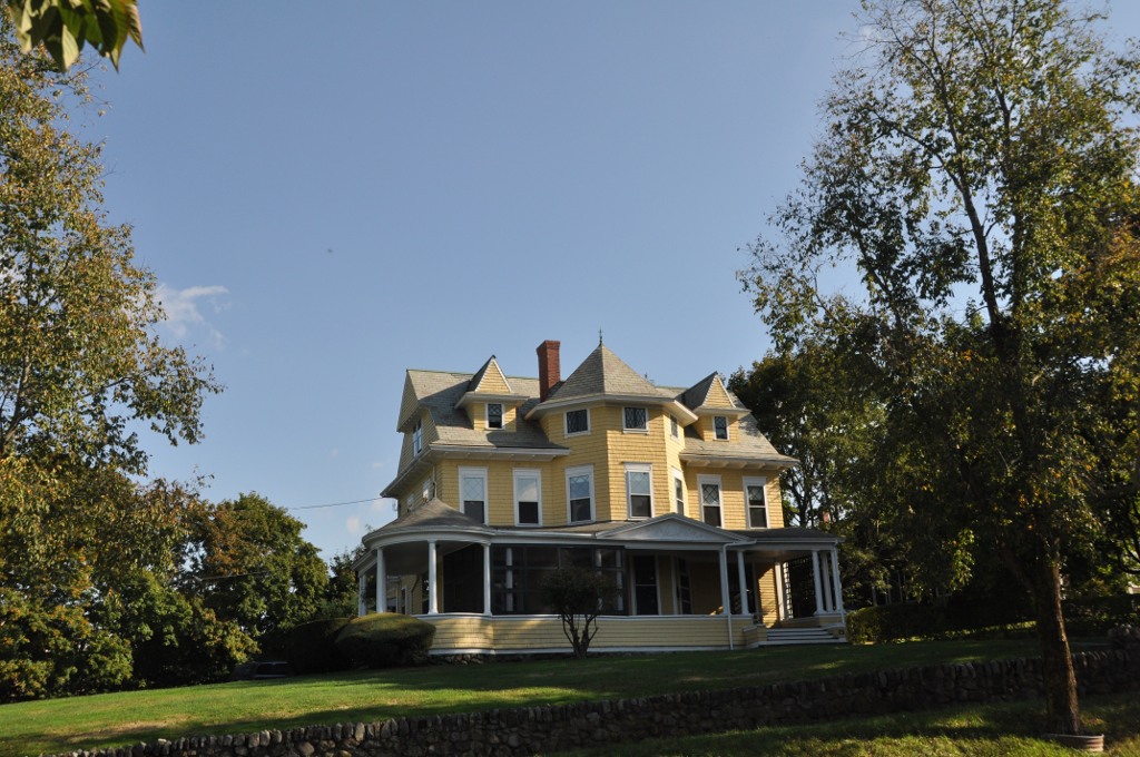
Bailey House
Monument and historic site · National Register of Historic Places · 0.9 mi
Historic house in Massachusetts, United States
Benaiah Titcomb House
Monument and historic site · National Register of Historic Places · 2.1 mi
Historic house in Massachusetts, United States
Benjamin Grant House
Monument and historic site · National Register of Historic Places · 0.7 mi
Historic house in Massachusetts, United States
Benjamin Stickney Cable Memorial Hospital
Monument and historic site · National Register of Historic Places · 1.0 mi
Former hospital in Massachusetts, United States
Brown Stocking Mill Historic District
Monument and historic site · National Register of Historic Places · 1.3 mi
Historic district in Massachusetts, United States

Brown's Manor
Monument and historic site · National Register of Historic Places · 1.7 mi
Building in Massachusetts, United States
Burnham-Patch House
Monument and historic site · National Register of Historic Places · 0.6 mi
Historic house in Massachusetts, United States

Caldwell Block
Monument and historic site · National Register of Historic Places · 0.9 mi
Commercial building in Ipswitch, Massachusetts, United States


Castle Hill
Monument and historic site · National Register of Historic Places · 2.3 mi
Drumlin with mansion in Ipswich, Massachusetts, USA
Dr. John Calef House
Monument and historic site · National Register of Historic Places · 0.6 mi
Historic house in Massachusetts, United States
26 more on the map.
Parks, trails and playgrounds35

Crane Wildlife Refuge
Park · 3.2 mi
Wildlife refuge in Ipswich and Essex, Massachusetts, USA

23 more on the map.
Restaurants and cafes12

Choate Bridge Pub
Bar and pub · American, Pizza, Seafood · 0.8 mi
3 South Main Street, Ipswich
Mo-Su 11:30-21:00


The Brown Dog
Restaurant · 0.9 mi
14 Central Street
Mo off; Tu,Th-Sa 11:30-21:00; We 16:00-21:00; Su 11:30-20:30

Zumi’s Espresso & Coffeehouse
Cafe · 0.9 mi
40 Market Street, Ipswich
Mo-Fr 06:00-18:00; Sa 07:00-18:00; Su 07:00-16:00
Ipswich Ale Brewer's Table
Restaurant · 1.0 mi
2 Soffron Lane, Ipswich
We-Sa 11:30-20:00; Su 11:30-19:00
ippy’s bagels & donuts
Bakery · 1.0 mi
5 Depot Square
Mo,Th-Sa 07:00-14:00; Tu-We off; Su 07:00-12:00


Where to stay1
Churches and places of worship4
Assumption of the Virgin Mary Greek Orthodox Church
Church · Greek Orthodox · 1.0 mi
8 Lafayette Road, Ipswich
The Orthodox Church of Saint John the Russian
Church · Russian Orthodox · 1.1 mi
16 Mount Pleasant Avenue, Ipswich
Shopping3
Gas and EV charging2
Schools, colleges and libraries14
Healthcare1
Map of Ipswich
116 places. The map loads OpenStreetMap tiles when you open it.
Climate by month
Monthly table
| Month | High | Low | Rain | Snow |
|---|---|---|---|---|
| Jan | 37°F | 18°F | 3.7 in | 16.0 in |
| Feb | 39°F | 18°F | 3.6 in | 16.4 in |
| Mar | 45°F | 25°F | 4.6 in | 7.6 in |
| Apr | 57°F | 34°F | 4.2 in | 1.4 in |
| May | 66°F | 44°F | 3.5 in | 0.0 in |
| Jun | 75°F | 54°F | 4.0 in | 0.0 in |
| Jul | 80°F | 60°F | 3.4 in | 0.0 in |
| Aug | 79°F | 58°F | 3.4 in | 0.0 in |
| Sep | 72°F | 51°F | 3.8 in | 0.0 in |
| Oct | 61°F | 40°F | 5.0 in | 0.3 in |
| Nov | 51°F | 31°F | 4.0 in | 0.9 in |
| Dec | 42°F | 24°F | 4.8 in | 8.8 in |
U.S. Climate Normals 1991-2020 for Beverly (6 mi away), NOAA NCEI.
People and cost of living
American Community Survey 5-year estimates, 2020-2024, U.S. Census Bureau. Estimates have margins of error, larger for small towns.
Disaster history
Essex County has had 26 federal disaster declarations since 2000, most often for severe storms.
- 2023-09-15: Hurricane Lee (Hurricane)
- 2020-03-27: Covid-19 Pandemic (Biological)
- 2020-03-13: Covid-19 (Biological)
- 2018-07-19: Severe Winter Storm And Snowstorm (Snowstorm)
- 2018-06-25: Severe Winter Storm And Flooding (Severe Storm)
- 2015-04-13: Severe Winter Storm, Snowstorm, And Flooding (Severe Storm)
OpenFEMA disaster declarations summaries.
Getting there and nearby towns
Beverly Municipal Airport (BVY) is the nearest airport with scheduled flights listed in OpenStreetMap, 8 miles away.
- Essex 4 mi southeast, about 6 min by car
- Rowley 4 mi northwest, about 6 min by car
- Topsfield 7 mi west, about 12 min by car
- Gloucester 8 mi southeast, about 12 min by car
- Beverly 8 mi south, about 13 min by car
- Boxford 8 mi west, about 13 min by car
- Danvers 10 mi southwest, about 15 min by car
- Newburyport 10 mi north, about 16 min by car
- Peabody 12 mi southwest, about 20 min by car
- Salem 13 mi south, about 21 min by car
Drive times are estimates from straight-line distance, not routes.
Local news
Headlines from INDB, the NEMICO news database.
Reviews, tips and questions
Loading what members have shared...
Sources and licences
- NCES EDGE (Public domain): public schools
- NOAA NCEI U.S. Climate Normals 1991-2020 (Public domain): climate by month
- OpenFEMA (Public domain): disaster declarations
- OpenStreetMap contributors (ODbL 1.0): places, airports, map data
- U.S. Census Bureau (Public domain): population, income, housing, education, commute
- Wikidata (CC0 1.0): elevation, founding date, time zone, website, landmarks and historic places
- Wikimedia Commons (see each image): photos
- Wikipedia (CC BY-SA 4.0): overview and history text
Photo credits
- Choate Bridge, Ipswich MA, John Phelan, CC BY-SA 3.0
- Ipswich, Massachusetts (2745563273), yeowatzup, CC BY 2.0
- Ipswich, Massachusetts (2746399064), yeowatzup, CC BY 2.0
- Door at Whipple House Ipswich MA USA, Swampyank, CC BY 4.0
- Whipple House front Ipswich MA USA, Swampyank, CC BY 4.0
- 2007 Ipswich Massachusetts USA 392004119, Brian Kelley from Auggen, Germany, CC BY-SA 2.0
- 2007 Ipswich Massachusetts USA 392004258, Brian Kelley from Auggen, Germany, CC BY-SA 2.0
- Ipswich, Massachusetts, Quintin Soloviev, CC BY 4.0
- Ipswich (Mass.) Public Library, Elizabeth Thomsen, CC BY-SA 4.0
- Shoreborne Wilson House, Ipswich MA, John Phelan, CC BY-SA 3.0
- Ipswich Public Library, Elizabeth B. Thomsen, CC BY-SA 3.0
- Choate Bridge (Ipswich), Elizabeth Thomsen, CC BY-SA 4.0
- IpswichMA LaborInVainHouse, Magicpiano, Public domain
- Treadwell Inn Ipswich Mass, Caseyleebrown, CC BY-SA 4.0
- 12 North Main St Ipswich Mass, Caseyleebrown, CC BY-SA 4.0
- IpswichMA JamesBurnhamHouse, Magicpiano, CC BY-SA 3.0
- EBSCO Publishing, Ipswich MA, John Phelan, CC BY-SA 3.0
- Platform shelter at Ipswich station, May 2017, Pi.1415926535, CC BY-SA 3.0
- Mini-high platform at Ipswich station, May 2017, Pi.1415926535, CC BY-SA 3.0
- Train at Ipswich station, November 19, 1986, David Matt, The Salem News, CC BY 2.0
- North part of Ipswich station platform, May 2017, Pi.1415926535, CC BY-SA 3.0
- Ipswich station platform facing north, May 2017, Pi.1415926535, CC BY-SA 3.0
- Former layover tracks in Ipswich, May 2017, Pi.1415926535, CC BY-SA 3.0
- 39 Brownville, Ipswich MA, John Phelan, CC BY-SA 3.0
- Ipswich, MA, USA - panoramio (1), bynyalcin, CC BY 3.0
- Ipswich, MA, USA - panoramio (3), bynyalcin, CC BY 3.0
- Ipswich, MA, USA - panoramio, bynyalcin, CC BY 3.0
- Paine House, Greenwood Farm, Ipswich MA, John Phelan, CC BY 3.0
- IpswichMA GIddingsBurnhamHouse, User:Magicpiano, CC BY-SA 4.0
- HamiltonMA EmelinePatchHouse, User:Magicpiano, CC BY-SA 4.0
- Crane estate (5), Djmcrenn, CC BY 3.0
- Heard-Lakeman House, Ipswich MA, John Phelan, CC BY 3.0
- IpswichMA CaldwellBlock, User:Magicpiano, CC BY-SA 4.0
- EssexMA GeorgeGiddingsHouseAndBarn, User:Magicpiano, CC BY-SA 4.0
- IpswichMA BaileyHouse, User:Magicpiano, CC BY-SA 4.0
- Odd Fellows Hall and United Methodist Church, Ipswich MA, John Phelan, CC BY 3.0
- Browns Manor, Ipswich MA, John Phelan, CC BY-SA 3.0
- IpswichMA WadeHouse, User:Magicpiano, CC BY-SA 4.0
- IpswichMA TurnerHill 02, User:Magicpiano, CC BY-SA 4.0
- IpswichMA ThomasLowHouse, User:Magicpiano, CC BY-SA 4.0


Page built October 30, 2026. Spotted a mistake? Tell us or suggest a place.