


Why visit Khalāzīr
Townapedia lists 19 parks and trails, 10 places to eat, 2 places to stay and 1 attraction in and around town.
Weather in Khalāzīr
Forecast from MET Norway (CC BY 4.0). Full forecast
About Khalāzīr
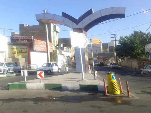
Khalazir (Persian: خلازير) is a village in, and the capital of, Khalazir Rural District in Aftab District of Tehran County, Tehran province, Iran.
From the Wikipedia article Khalazir (this version), under CC BY-SA 4.0.
Things to do1

Parks, trails and playgrounds19

7 more on the map.
Restaurants and cafes10

کافه ویتامینه ایکو
Cafe · 1.4 km
مرتضی گرد خیابان پیروزی بلوار فرهمند کافه آیکو, tehran
Mo-Su 07:00-24:00




Where to stay2


Churches and places of worship17
Shopping10
عمده فروشی زیتون ترشیجات و ترشک لواشک ناصری
Grocery · 2.2 km
کنارگذر آزادگان, تهران
Gas and EV charging10
Schools, colleges and libraries10
Healthcare4
Map of Khalāzīr
83 places. The map loads OpenStreetMap tiles when you open it.
Getting there and nearby towns
Mehrabad International Airport (THR) is the nearest airport with scheduled flights listed in OpenStreetMap, 11 km away.
- Bāqershahr 9 km southeast, about 9 min by car
- Tehran 11 km northeast, about 11 min by car
- Eslamshahr 13 km southwest, about 13 min by car
- Golestān 19 km southwest, about 19 min by car
- Ṣāleḥīeh 19 km southwest, about 19 min by car
- Tajrīsh 23 km north, about 23 min by car
- Qods 26 km northwest, about 26 min by car
- Shahrīār 28 km west, about 28 min by car
- Robāţ Karīm 29 km southwest, about 29 min by car
- Ḩasanābād 29 km southwest, about 29 min by car
Drive times are estimates from straight-line distance, not routes.
Local news
Headlines from INDB.
Reviews, tips and questions
Loading what members have shared...
Sources and licences
- GeoNames (CC BY 4.0): population, coordinates, regions and time zone
- Mapillary (see each image): photos
- OpenStreetMap contributors (ODbL 1.0): places, airports, map data
- Wikidata (CC0 1.0): elevation, founding date, time zone, website, landmarks and historic places
- Wikimedia Commons (see each image): photos
- Wikipedia (CC BY-SA 4.0): overview and history text
Photo credits
- Khalazir2021-12-06 18, Naser Jafari, CC BY 4.0
- 20170418 Along the road - 33864751760, somiz, CC BY-SA 2.0
- Sorinet Stadium (Rah-Ahan F.C.) - panoramio, philoperse, CC BY 3.0
- دنده پنج کمک - panoramio, matin fattahi, CC BY 3.0
- دودکش کوره آجر پزی - panoramio, matin fattahi, CC BY 3.0
- مرتضي گرد - panoramio, Mojtaba zali, CC BY 3.0
- ورزشگاه تراکتورسازی - panoramio (1), Mojtaba zali, CC BY 3.0
- Street-level photo, dhl63, CC BY-SA 4.0
- Street-level photo, dhl63, CC BY-SA 4.0
- Street-level photo, dhl63, CC BY-SA 4.0
- Street-level photo, mohammadjavad72, CC BY-SA 4.0
- Street-level photo, dhl63, CC BY-SA 4.0

Page built November 8, 2026. Spotted a mistake? Tell us or suggest a place.