


Why visit Tajrīsh
Townapedia lists 50 museums and landmarks, 32 parks and trails, 223 places to eat, 9 places to stay and 5 attractions in and around town.
Highlights include Shahr-e Bazi, پردیس سینمایی ارگ, Cinema Museum of Iran and Iranian Art Museum Garden.
Weather in Tajrīsh
Forecast from MET Norway (CC BY 4.0). Full forecast
About Tajrīsh
Tajrish (Persian: تجريش, pronounced [tædʒˈɾiːʃ]) refers both to a neighbourhood of Tehran, capital of Iran, and to a broader administrative city historically known as Shemiran. The city of Tajrish is synonymous with District 1 of Tehran along with adjacent parts of District 2 (such as Evin and Darakeh), and serves as the capital of Shemiranat County, Tehran province. At one time a village, it was later absorbed into the city of Tehran.
From the Wikipedia article Tajrish (this version), under CC BY-SA 4.0.
Things to do5

Shahr-e Bazi
Monument and historic site · 3.4 km
Former amusement park in Tehran, Iran



Museums and landmarks50


Time Museum
Museum · 0.6 km
ولیالله فلاحی
Sa-Th 10:00-23:00; Fr 11:00-23:00

Dr. Hesabi Museum
Museum · 0.6 km
دکتر محمود حسابی, تهران

Imamzadeh Saleh
Monument and historic site
Imamzadeh in Tajrish, Iranian national heritage site



نگارخانه نقش جهان
Museum · 1.7 km
9 محمودی دوم, تهران
Su-Fr 16:00-19:00
38 more on the map.
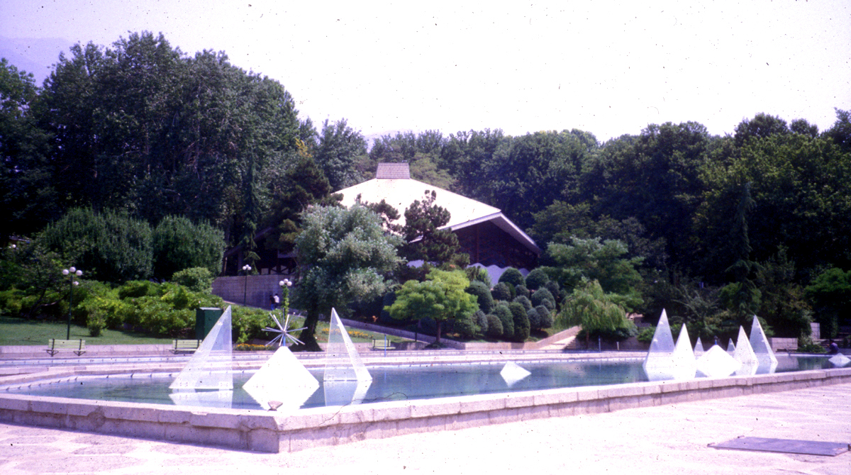
Parks, trails and playgrounds32






20 more on the map.
Restaurants and cafes223

Ghassab Restaurant
Restaurant · Turkish, Steak House · 1.6 km
104 مرتضی فیاضی, Tehran
Mo-Su 12:00-23:30
Leen Cafe
Cafe · Coffee Shop, Breakfast, Pastry · 1.9 km
1 کونیکو یامامورا, شهر تهران
Sat-Fri 8:00 - 23:00

Roshanan Mansion
Cafe · Pizza, Coffee Shop, Italian, Burger, Regional, Kebab, Sandwich · 1.7 km
نوری, tehran
9:00-23:00
cafe jibaji کافه جیباجی
Cafe · Coffee Shop, Pizza, Burger, Noodle, Pasta, Cake, Hot Dog, Juice · 0.6 km
72 برادران فناخسرو, تهران پاساژ تندیس
08:00-22:00
مطبخ وزیری
Restaurant · Kebab, جگرکی, ایرانی, کباب مطبخ وزیری · 1.8 km
خیابان اندرزگو - ابتدای بلوار صبا-نبش کوچه مهدیه-مطبخ وزیری مهدیه, تهران
Sa-We 011:00-24:00


کافه باقلوای ترکی تک سین
Cafe · Regional, Coffee Shop · 0.8 km
خیابان شريعتي، ميدان قدس، ابتداي خيابان دربند، پلاك ١٩ دربند, تهران
Mo-Su 10:00-22:00
211 more on the map.
History
The location of the neighbourhood was once an ancient village, and in 1788, the Qajar dynasty chose this as their capital. It is known for its mountainous landscape. The area was often used as a summer retreat by city residents.
Until the 1920s, Tajrish and neighbouring Shemiranat were a collection of small villages along Tehran's city border. The area was relatively disconnected from Tehran's urban area with the exception of Old Shemiran Road, currently known as Shariati Avenue. During the Pahlavi era, with the construction of Pahlavi Street (now named Valiasr Street) in the 1930s and Modarres Highway, then known as Shahanshahi Boulevard, the Northern suburbs became accessible from downtown and extension became possible.
From the History section of Tajrish on Wikipedia, under CC BY-SA 4.0.
Where to stay9
Churches and places of worship23
امامزاده قاسم
Place of worship · Shia · 1.6 km
میدان امامزاده قاسم, تهران
Shopping81
Gas and EV charging1
Schools, colleges and libraries57
Dehkhoda Lexicon Institute & International Center for Persian Studies
School
3011 خیابان ولیعصر (عج)، بالاتر از پارک وی ، نرسیده به میدان تجریش ، ایستگاه پسیان ، موقوفات دکتر محمود افشار, تهران
University of Social Welfare and Rehabilitation Sciences
School · 2.3 km
Healthcare122
داروخانه شبانه روزی دکتر امیر محمدخان
Clinic and pharmacy · 0.7 km
41 خیابان شهرداری, تهران
Map of Tajrīsh
250 places. The map loads OpenStreetMap tiles when you open it.
Getting there and nearby towns
Mehrabad International Airport (THR) is the nearest airport with scheduled flights listed in OpenStreetMap, 17 km away.
- Tehran 12 km south, about 12 min by car
- Lavāsān 20 km east, about 20 min by car
- Qods 30 km west, about 30 min by car
- Eslamshahr 33 km southwest, about 33 min by car
- Pardīs 35 km east, about 35 min by car
- Shahrīār 37 km southwest, about 37 min by car
- Karaj 39 km west, about 39 min by car
- Golestān 39 km southwest, about 39 min by car
- Shahre Jadide Andisheh 39 km west, about 39 min by car
- Ṣāleḥīeh 39 km southwest, about 39 min by car
Drive times are estimates from straight-line distance, not routes.
Local news
Headlines from INDB.
Reviews, tips and questions
Loading what members have shared...
Sources and licences
- GeoNames (CC BY 4.0): population, coordinates, regions and time zone
- Mapillary (see each image): photos
- OpenStreetMap contributors (ODbL 1.0): places, airports, map data
- Wikidata (CC0 1.0): elevation, founding date, time zone, website, landmarks and historic places
- Wikimedia Commons (see each image): photos
- Wikipedia (CC BY-SA 4.0): overview and history text
Photo credits
- 139609181015105612728334 تجریش, M. Mahdi Dorani, CC BY 4.0
- Iranian Art Museum Garden main building, M.samei, CC BY-SA 4.0
- موزه حشرهشناسی هایک میرزایانس, Unknown author Unknown author, CC BY-SA 4.0
- امامزاده صالح, AliAKHA, CC BY-SA 4.0
- Niavaran Palace, Tehran, David Stanley, CC BY 2.0
- AmingholamaliJamshidie Tehran1, Amingholamali, CC BY-SA 3.0
- منظره توچال از پارک ملت(Ms) - panoramio, Mehrdad Sarhangi, CC BY 3.0
- Park niavaran, Zereshk at English Wikipedia, CC BY-SA 3.0
- Saint Minas church, Tehran, Լևոն Հարությունյան, CC BY-SA 4.0
- 1397020812401033113977764 سعادت آباد, Sajjad Naseri, CC BY 4.0
- Sahid Beheshti University, Xpander1, CC BY 4.0
- SBMU School of Medicine, Mehdi.samei, Public domain
- دانشگاه-صدا-و-سیما-تهران-, Soundengirib, CC BY-SA 4.0
- Sadabad9, Ahura21, CC BY-SA 3.0
- Bagh-e Ferdows Tajrish, https://www.flickr.com/photos/kamshots/, CC BY 2.0
- Mosque - panoramio - franek2, franek2, CC BY-SA 3.0
- Hossein Khodadad's House in Tehran prior to Islamic Revoloution, Fr1340, CC BY-SA 3.0
- TekkiyeTajrish, No machine-readable author provided. Mani1~commonswiki assumed (based on copyright claims)., Public domain
- Mahmoud Hessaby house 1, GTVM92, CC BY-SA 4.0
- Tajrish Bazaar entrance, Arian Ar, CC BY-SA 4.0
- Cinema Arg, Kasir, CC BY-SA 4.0
- 295A1291, Morteza Aminoroayayi, CC BY-SA 4.0
- Ferdows garden 2, Transe-gomnam, CC BY-SA 4.0
- Mellat Palace Museum 02, Bernard Gagnon, CC BY-SA 4.0
- Old yet standing trees in SaadAbad, Ali Dehghan, CC BY-SA 4.0
- Do not miss the sky, Ali Dehghan, CC BY-SA 4.0
- 2011 Alleyway near Tajrish Tehran by Kamyar Adl 5866583015, kamshots, CC BY 2.0
- White IKCO Samand, Kamyar Adl, CC BY 2.0
- Samand white rear, kamshots ; cropped and adjusted by uploader Mr.choppers, CC BY 2.0
- پارک قلمستان - panoramio, Mehrad Afkham, CC BY-SA 3.0
- Ghalamestan Park 6371, GTVM92, CC BY-SA 4.0
- Fresh green ^ Red - panoramio, Behrooz Rezvani, CC BY 3.0
- New Life on X Pahlavi Ave.Trees, 2011 Spring - panoramio (1), Behrooz Rezvani, CC BY 3.0
- New Life on X Pahlavi Ave.Trees, 2011 Spring - panoramio (9), Behrooz Rezvani, CC BY 3.0
- Tehran Snapshot 01130, Nevit Dilmen, CC BY-SA 3.0
- Asad Abad, Tehran, Tehran Province, Iran - panoramio, saeed.asadi.koroliya, CC BY 3.0
- Ghalamestan Park 6365, GTVM92, CC BY-SA 4.0
- New Life on X Pahlavi Ave.Trees, 2011 Spring - panoramio (4), Behrooz Rezvani, CC BY 3.0
- منظره ای از پارک حاشیه رودخانه تجریش - panoramio, sima.b.hashemi, CC BY 3.0
- Parkway Cross to Tajrish, Tehran - panoramio, Behrooz Rezvani, CC BY 3.0
- Ghalamestan Park 6361, GTVM92, CC BY-SA 4.0
- Street-level photo, saeideh1234, CC BY-SA 4.0
- Street-level photo, saeideh1234, CC BY-SA 4.0
- Street-level photo, bigbang001, CC BY-SA 4.0
- Street-level photo, mohammadjavad72, CC BY-SA 4.0
- Street-level photo, mohammadjavad72, CC BY-SA 4.0
- Street-level photo, saeideh1234, CC BY-SA 4.0


Page built November 8, 2026. Spotted a mistake? Tell us or suggest a place.