




Hannō, Japan
飯能市
Hannō is a town of 80,361 people in Saitama, Japan, founded in April 1, 1889.
Why visit Hannō
Townapedia lists 44 museums and landmarks, 132 parks and trails, 124 places to eat, 12 places to stay and 45 attractions in and around town.
Highlights include Bunri University of Hospitality, Kagawa Nutrition University, Hanno City Museum and Koma Village Stone Age Dwelling Site.
Weather in Hannō
Forecast from MET Norway (CC BY 4.0). Full forecast
About Hannō
Hannō (飯能市, Hannō-shi) is a city located in Saitama Prefecture, Japan. As of 1 January 2021, the city had an estimated population of 79,123 in 35,440 households and a population density of 410 persons per km2. The total area of the city is 193.05 square kilometres (74.54 sq mi).
From the Wikipedia article Hannō (this version), under CC BY-SA 4.0.
Things to do45

Bunri University of Hospitality
School · 12.3 km
Higher education institution in Saitama Prefecture, Japan

Kagawa Nutrition University
School · 14.0 km
Private university in Japan with campuses in Saitama Prefecture and Tokyo
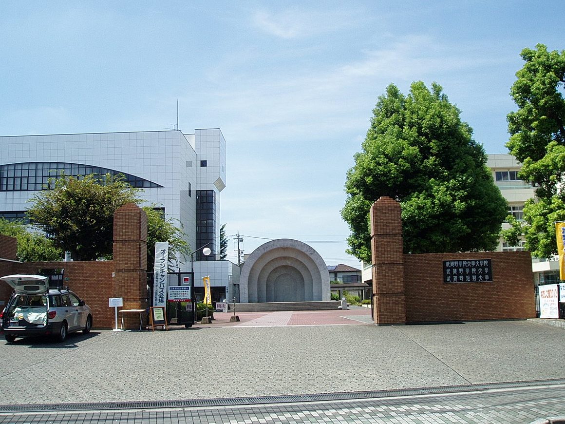
Musashino Gakuin University
School · 6.4 km
Higher education institution in Saitama Prefecture, Japan

Nihon Institute of Medical Science
School · 9.2 km
Higher education institution in Saitama Prefecture, Japan

Saitama Medical University
School · 9.8 km
Higher education institution in Saitama Prefecture, Japan

Saitama Medical University College
School · 9.7 km
Higher education institution in Saitama Prefecture, Japan

Tokyo International University
School · 13.6 km
Private university in Tokyo, Japan


33 more on the map.
Museums and landmarks44


Koma Village Stone Age Dwelling Site
Monument and historic site · 3.7 km
Archaeological site in Hidaka, Japan



32 more on the map.
Parks, trails and playgrounds132



Noyamakita-Rokudōyama Park
Park · 11.1 km
Public park in Tokyo, Japan






120 more on the map.
Restaurants and cafes124

Chuka soba ohsaki
Restaurant · Ramen · 3.5 km
6, 入間市
11:00-15:00, 17:00-20:00; Sa-Su 11:00-20:00; Mo off

Cafe Crock
Cafe · Coffee, Curry
Book cafe featuring a gallery and music events.
10-28, 飯能市
Mo,Th,Su 11:00-17:00; Fr-Sa 11:00-19:30; Tu-We off
HANNO DIPPING NOODLES
Restaurant · Ramen · 0.7 km
12, 飯能市
Mo-Su 11:00-14:00,18:00-22:00

CROSS SIDE
Bar and pub
6, 飯能市
We,Th,Su 22:00-02:00; Fr,Sa 22:00-05:00
Cafe Y's Garden
Cafe · Coffee Shop, International · 4.5 km
Mo-We 11:00-16:00; Fr-Su 11:00-16:00
Tea Break .m
Cafe · 3.1 km
We-Fr 11:00-15:30; Sa-Su 11:00-16:00
112 more on the map.
History
Hannō was traditionally noted for its lumber industry, which developed during the Edo period to supply Edo with timber needed for rebuilding after its frequent fires. The town of Hannō was established within Koma District, Saitama with the establishment of the modern municipalities system on April 1, 1889. Koma District was abolished in 1896, becoming part of Iruma District.
Hannō annexed the neighboring villages of Seimei, Minami-Koma, Kaji and Moto-Kaji on April 1, 1943. It was elevated to city status on January 1, 1954. Hannō annexed the neighboring villages of Agano, Gigshi-Agano, Haraichiba on September 30, 1956. On January 1, 2005, the village of Naguri was merged into Hannō.
From the History section of Hannō on Wikipedia, under CC BY-SA 4.0.
Where to stay12
Churches and places of worship98
Shopping30
Gas and EV charging13
Schools, colleges and libraries43
Saitama Prefectural Hanno High School (South Building)
School · 2.0 km
Healthcare46
Map of Hannō
250 places. The map loads OpenStreetMap tiles when you open it.
Getting there and nearby towns
Yokota Air Base (OKO) is the nearest airport with scheduled flights listed in OpenStreetMap, 12 km away.
- Iruma 6 km southeast, about 6 min by car
- Sayama 8 km east, about 8 min by car
- Ōme 10 km southwest, about 10 min by car
- Ogose 12 km north, about 12 min by car
- Tokorozawa 15 km southeast, about 15 min by car
- Kawagoe 16 km northeast, about 16 min by car
- Akishima 16 km south, about 16 min by car
- Itsukaichi 17 km southwest, about 17 min by car
- Higashimurayama 17 km southeast, about 17 min by car
- Tachikawa 18 km southeast, about 18 min by car
Drive times are estimates from straight-line distance, not routes.
Local news
Headlines from INDB.
Reviews, tips and questions
Loading what members have shared...
Sources and licences
- GeoNames (CC BY 4.0): population, coordinates, regions and time zone
- OpenStreetMap contributors (ODbL 1.0): places, airports, map data
- Wikidata (CC0 1.0): elevation, founding date, time zone, website, landmarks and historic places
- Wikimedia Commons (see each image): photos
- Wikipedia (CC BY-SA 4.0): overview and history text
Photo credits
- Hannou city from Mt.tenran, クリオネサラダ, CC BY-SA 4.0
- Bunri University of Hospitality, Abasaa, Public domain
- Kagawa Nutrition University (Joshi Eiyō Daigaku), Mj-bird, CC BY-SA 4.0
- Musashino-Gakuin-Univ-MainGate01, Hasec, CC0
- Nihon Institute of Medical Science, Nyao148, CC BY-SA 4.0
- Shobi-Univ-20120901, Hasec, CC0
- Tokyo International University campus1, TIU kouhou, CC BY-SA 3.0
- Hidaka Saitama Koma Vill Stone Age Dwelling Site 2, 京浜にけ, CC BY-SA 3.0
- Satoyamaminkah, four horsemen, CC BY-SA 3.0
- Ume park 梅 公園, Arashiyama, CC BY-SA 3.0
- OmeRailwayPark-c, Unknown author, CC BY-SA 3.0
- Sankichi Inari Jinja (Hanno), Abasaa, Public domain
- Kuge Inari Jinja, Abasaa, Public domain
- Hanno Minami High School 2 Tx-re, Tx-re, CC BY-SA 3.0
- Hanno High School 2 Tx-re, Tx-re, CC BY-SA 3.0
- Anrakuji Temple ome 2025, 基準点なアセスメント, CC BY 4.0
- Mt. Hiwada in early autumn, Excl-zoo ( talk ), Public domain
- Hanno Mt.Tenran 1, 京浜にけ at Japanese Wikipedia, CC BY-SA 3.0
- Hidaka Saitama Komago Old Folk House 1, 京浜にけ, CC BY-SA 3.0
- Moominvalley Park 2019e, 江戸村のとくぞう, CC BY-SA 4.0
- 多峯主山の頂上1 - panoramio, Hyakutaro, CC BY-SA 3.0
- Hanno Museum 20191102a, 江戸村のとくぞう, CC BY-SA 4.0
- メッツァ (47983684533), chinnian from Singapore, CC BY-SA 2.0
- 入間市上谷ヶ貫八幡神社正面②, I-kaneko-viax, CC BY-SA 4.0
- Saitama-medical-center 1, Ebiebi2, CC0
- Saitama Prefectural Hanno Minami High School 1, Ebiebi2, CC BY-SA 4.0
- Hanno High School Tx-re, Tx-re, CC BY-SA 3.0
- 飯能市民球場, 千葉の番人, CC BY-SA 4.0
- 阿須運動公園全景, 千葉の番人, CC BY-SA 4.0
- メッツァ (47983738511), chinnian from Singapore, CC BY-SA 2.0
- Sep 06 2020 11-50AM Hanno City Kaji Junior High School, Nesnad, CC BY 4.0
- Seibu 001 series Tc001-G1 entrance Moomin 20251026-DSC 7062, SEMISAYAMASHI, CC BY-SA 4.0
- Seibu 4000 series tc4019 back of the driver's cab, SEMISAYAMASHI, CC BY-SA 4.0
- Seibu 4000 series inside free space Tc4003 20241121-DSC 9874, SEMISAYAMASHI, CC BY-SA 4.0
- Seibu 4000 series nameplate inside a train M4103 No2 L 20241121-DSC 9882, SEMISAYAMASHI, CC BY-SA 4.0
- Seibu 4000 series inside end-No2 Tc4003 20241121-DSC 9873, SEMISAYAMASHI, CC BY-SA 4.0
- Seibu 4000 series doors and surroundings Tc4007 No1 20250212-DSC 2324, SEMISAYAMASHI, CC BY-SA 4.0
- Seibu 4000 series inside frontend Tc4003 20241121-DSC 9872-2, SEMISAYAMASHI, CC BY-SA 4.0
- Seibu 4000 series tc4011 driver's seat 20231207, SEMISAYAMASHI, CC BY-SA 4.0
- Hanno Station - Feb 2 2021 various 23 24 30 221000, Nesnad, CC BY 4.0


Page built November 5, 2026. Spotted a mistake? Tell us or suggest a place.